Between our trip to central Utah in mid-October and our Thanksgiving break at the end of November, life was hectic. Zach was exceptionally busy with rehearsals, recitals, and classes; I was struggling to bridge the gap between my increasingly busy job and keeping the home fires burning one might say. It was kind of a dark month without much time for outdoor therapy.
Since our future in Salt Lake is up in the air as Zach completes his doctorate and hunts for a permanent job, I’ve been feeling fatalistic in a “what-if-this-is-our-last-year-in-Utah” kind of way. I’ve compiled a list of all the places I think we can visit in the next several months, and I’ve been mentally plotting small excursions for the spring already. It was in that frame of mind that I planned our Thanksgiving trip.
We decided to return to southern Utah. It was such a pleasant trip last year and gave us access to places which are just out of reach for a regular three-day weekend. We made a large loop from Salt Lake, staying in Kanab for three nights, then Bluff for the next, before ending up in Salt Lake again. An extra night would have been ideal, but it didn’t work out for us this time. So we crammed as much into five days as we could.
We left Salt Lake mid-morning on Wednesday. We often leave early in the morning or immediately after work/school, but since we couldn’t check into our Airbnb until 4pm, we weren’t in a hurry. We took the opportunity to stop in Fillmore, Utah’s first capital, and check out the state’s oldest government building. A year after the Utah Territory was created in 1850, Brigham Young, the first territorial governor, chose a central location for the capital. He named the county Millard and the city Fillmore after President Millard Fillmore possibly in an attempt to appeal for statehood. The building which stands in Fillmore now was used only once for a legislative session in 1855. The Territory population was concentrated in and around the Salt Lake Valley, so legislators ultimately decided to move the capital to Salt Lake City. There they constructed the Capitol on a hill where it would overlook the valley. Statehood eluded Utah until 1896 when it became the 45th state.
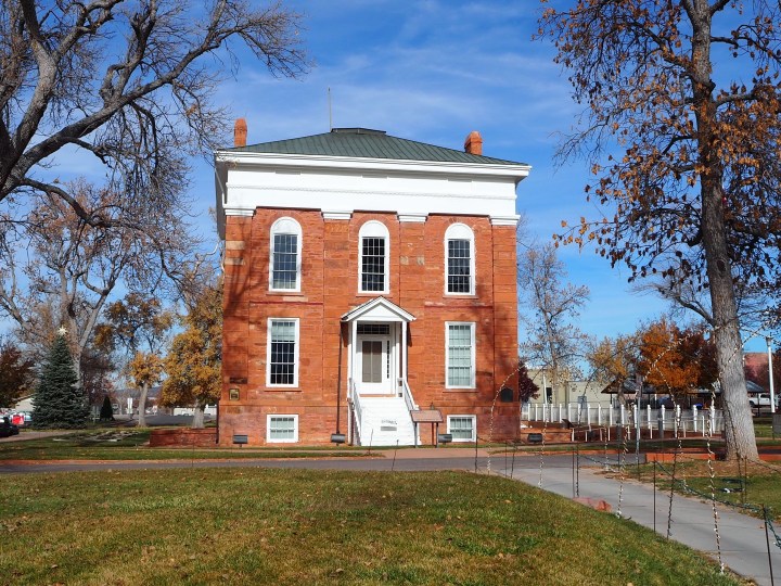
One wing of what would have been a larger Capitol 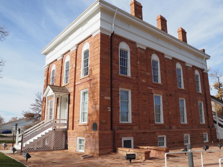
After Fillmore, we drove straight to Cedar City where we stopped for lunch. We were starving and many of the fast food joints off I-15 had been absolutely packed. We grabbed sandwiches at a Great Harvest and continued toward our first stop, a detour to Cedar Breaks National Monument. Though the park closes for the winter, UT Highway 148 will remain open until snow makes it impassable. We were fortunate; although there has been decent early season snow, 148 was still open.
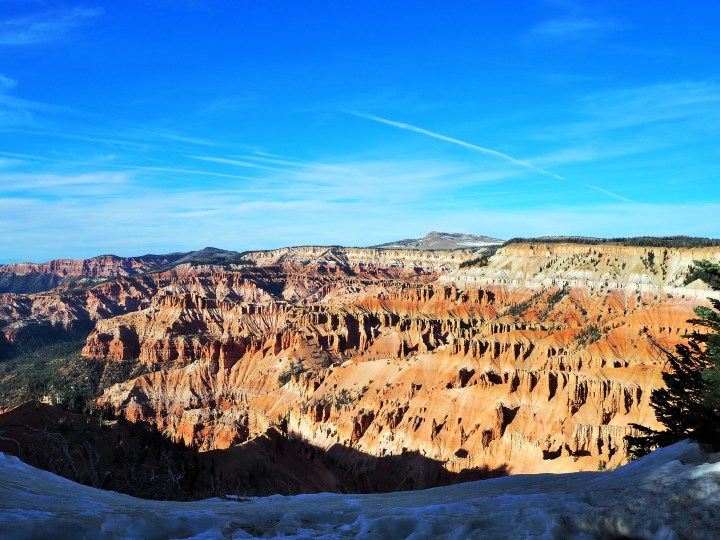
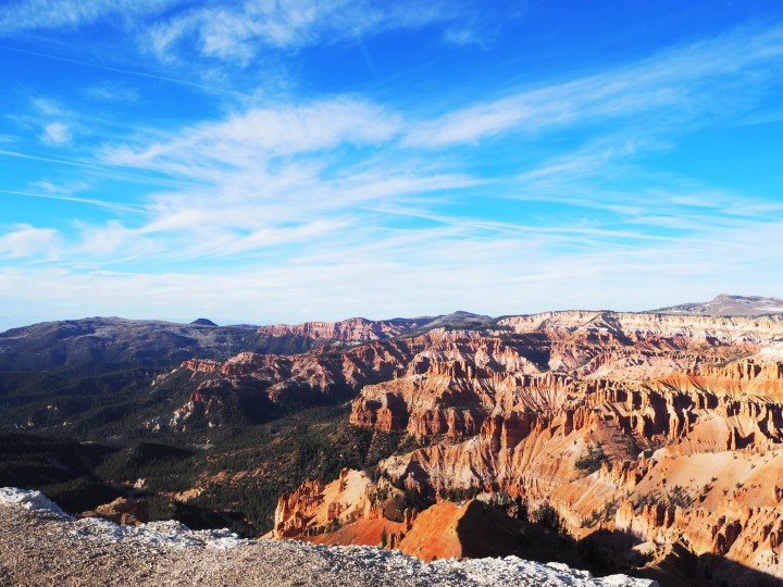
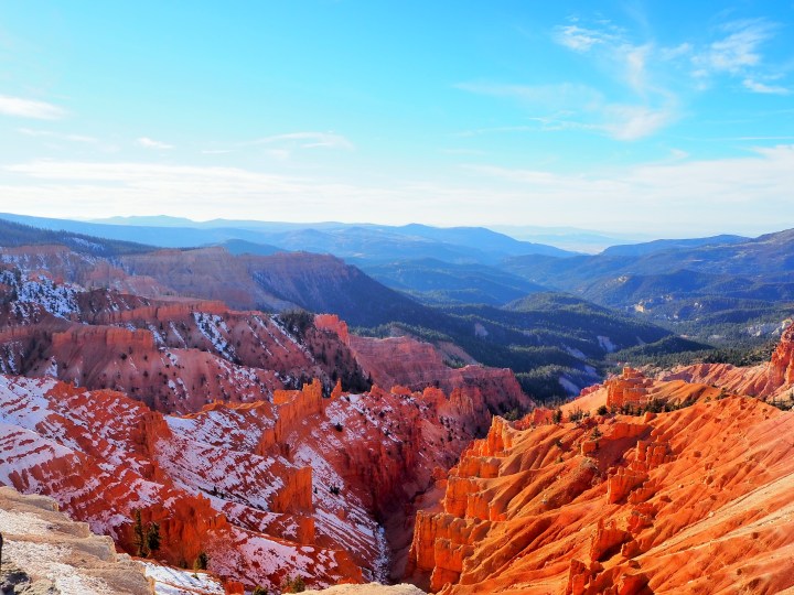
Cedar Breaks NM sits above 10,000 ft and offers expansive views from several overlooks of a three-mile wide amphitheater of limestone hoodoos, fins, arches, and canyons vividly colored in hues of orange, red, yellow, and purple. Mistakenly named Cedar Breaks by Anglo settlers (they incorrectly identified the juniper trees as cedar), it was protected as a National Monument in 1933. There isn’t much hiking to be done in the Monument itself, but it’s a tranquil place to visit and relax.

We stopped first at the Point Supreme Overlook. Dogs are allowed at all of the overlooks and on the Sunset Trail which is a paved path between Point Supreme and Sunset Overlook. I let Truman out so he could stretch his legs. We opted not to walk the entire Sunset Trail, but did a small portion. There was still a decent amount of snow/ice covering the paved walkway in the shade of the trees, and it was significantly colder than Cedar City had been.


From Point Supreme we drove to Sunset Overlook. On a slightly warmer day it would have been pleasant to walk along the paved path. It was just cold enough that I didn’t think Tru would want to make the return journey. We crossed the road in the direction of the overlook and decided to turn back and drive.
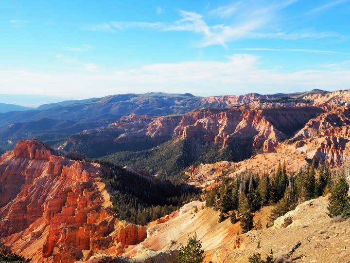
Sunset Overlook offered a better view of the south side of the amphitheater from the east. Here we could distinctly see the way each ridge is separated from the next.
There was a group of girls from the nearby university at Sunset Overlook, but we had the remaining two overlooks completely to ourselves. I’m not sure how busy Cedar Breaks is in the summer, but it felt entirely off the beaten path at the end of November.
We proceeded to North View Overlook. Slightly higher than the other two overlooks, it’s almost dead opposite Point Supreme providing sweeping views of the amphitheater to the south. We were there at the wrong time of day for decent photographs, but it was still spectacular.


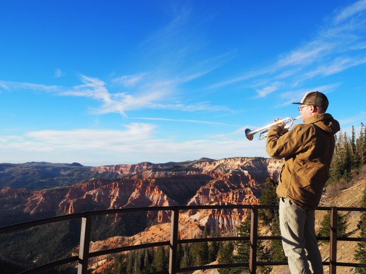
Our final stop was the Chessmen Ridge Overlook which roughly separates the amphitheater into two sections, north and south. Surprisingly this was my favorite. We had a much better view of the snowy north faces of the breaks along with Chessmen Ridge. Zach used the opportunity and isolation to play his trumpet (although it wasn’t the highest elevation at which he’s ever played).
And with that we saw most of what Cedar Breaks NM has to offer. The Ramparts Trail would be fun to snowshoe in the winter, but I don’t think we’ll be nearby anytime soon. It was definitely worth the detour on this trip!

Categories: North America, USA, Utah
