April was a busy month for us. Zach had commitments most weekends and the end of the semester (and his degree) loomed over him. I wanted to get out of town at least once, so Zach proposed a quick weekend trip. We thought this would be our last chance to visit Moab for a while (except plans changed and we’ll be there this weekend…), so we planned a farewell getaway.
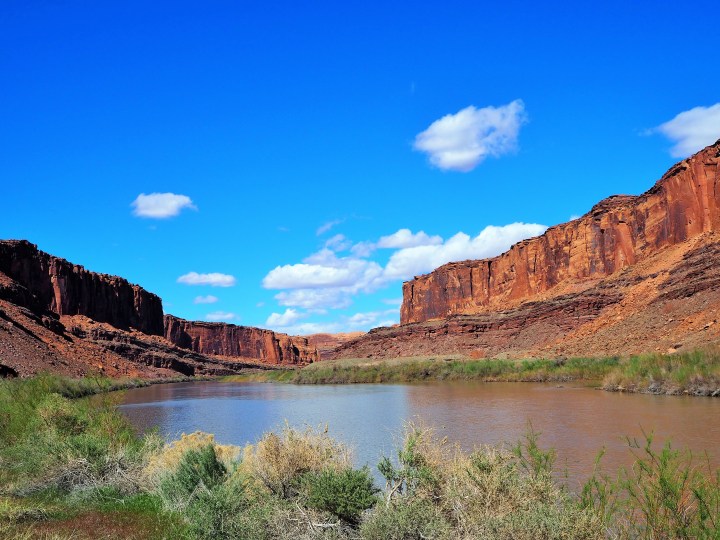
We left Salt Lake at 7am hoping to arrive by 11 to find a campsite. All of the BLM campgrounds around Moab are first-come, first-served. I wasn’t terribly worried about finding a campsite, but it sucks when you have to drive around searching for one. We made great time and were pulling into the outskirts of Moab around 10:30am. I wanted to check the campgrounds on Hwy. 279 first with the belief that they wouldn’t be as crowded as the ones on the other end of the Colorado River. My hunch wasn’t entirely correct. As we passed the first two campgrounds – both full – I worried that we’d lost valuable time. We drove past the third campground – Gold Bar – utterly defeated. As we circled back around to leave, we noticed an empty campsite at the very end. Detached from the other sites, we had almost missed it. Zach made a quick U-turn, and we snagged what appeared to be the last available site.
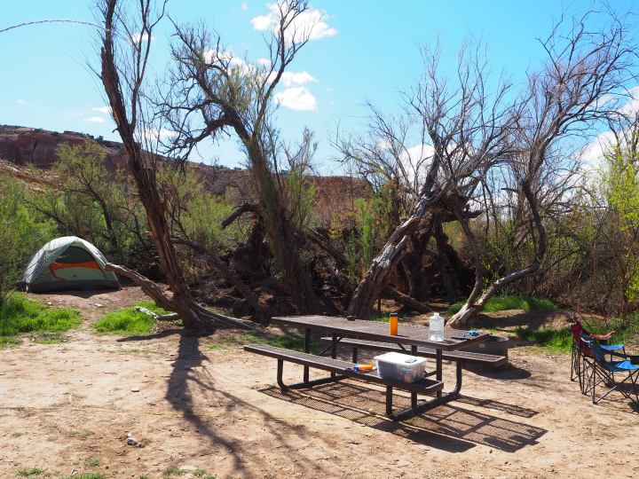
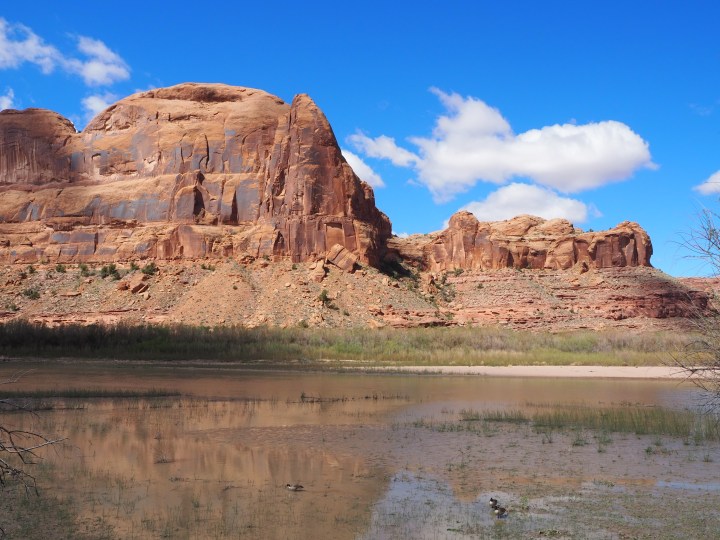
Since we lucked out and didn’t need to search for a site, we had a few hours to kill before I wanted to do our hike to Corona Arch. We could see the trailhead from the end of our site, and it was very crowded when we pulled up around 11. We took our time unloading and setting up, then we relaxed and read by the river. Our site didn’t really have river access – the bank was steep and fragile – but we had a nice view. Since we were separated from the main channel of the river, we had geese and ducks as company much to Truman’s delight.
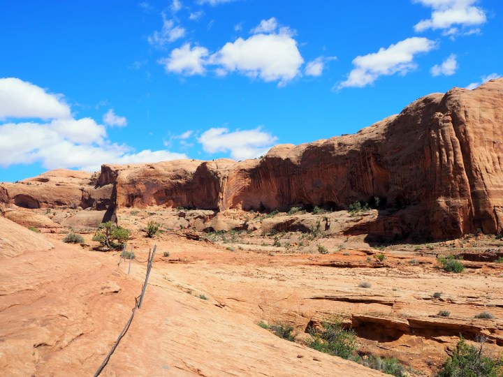
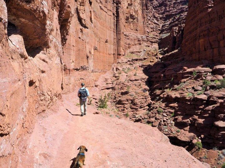
We made lunch and decided to go for our hike around 2pm. The crowds had declined significantly, and it seemed like a good time to get started. Most of the hike was full sun exposure although we were able to find shade in shadows cast by the canyon walls. Truman was raring to go, but it was evident that the sun quickly depleted his energy. He stubbornly pressed on.
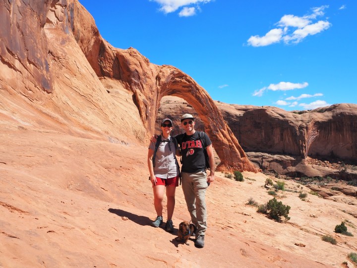
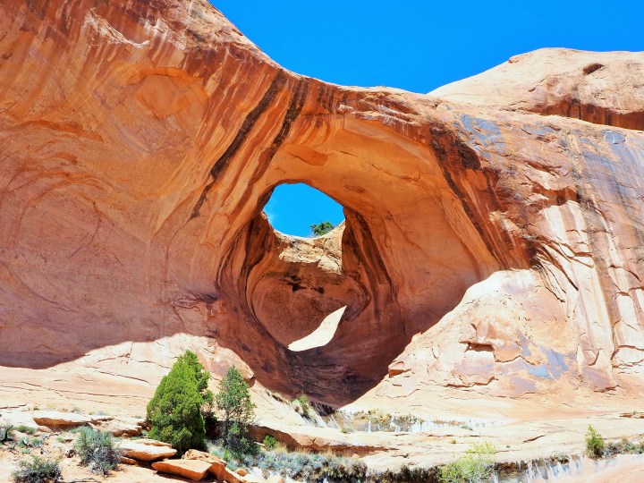
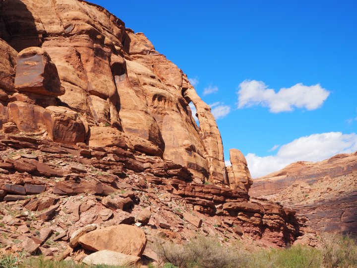
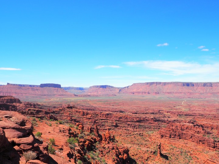
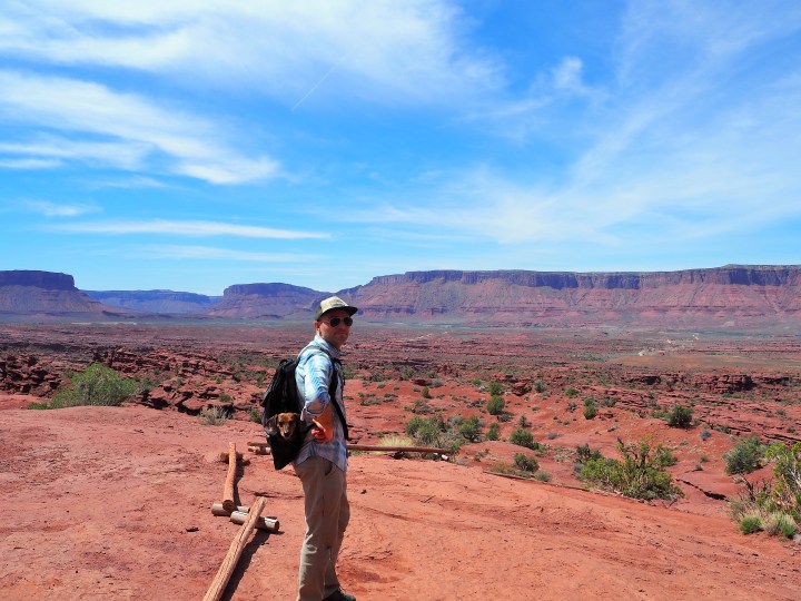
The trail is easy to follow, especially since it’s heavily trafficked, and soon we were following cairns over slickrock around a long, slightly steep curve. At the end, in addition to a heaping pile of cairns, we could see our destination. We had an expansive view of the entire canyon and both Corona and Bowtie Arches shimmered in the sun.
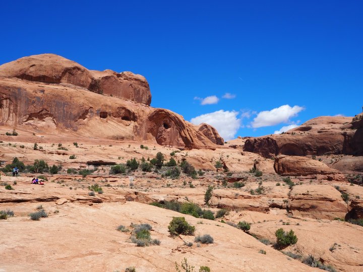
The next part of the trail is the most physical: climbing a set of Moqui steps (with the aid of a rope) and a short ladder. Neither is terribly difficult, but if you couldn’t overcome these obstacles, the view from this point is still worth it. (We put Tru in his pack for this part.) From the top of the ladder it’s an easy walk to both arches.
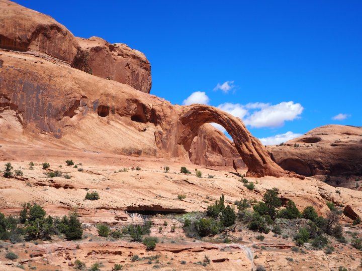
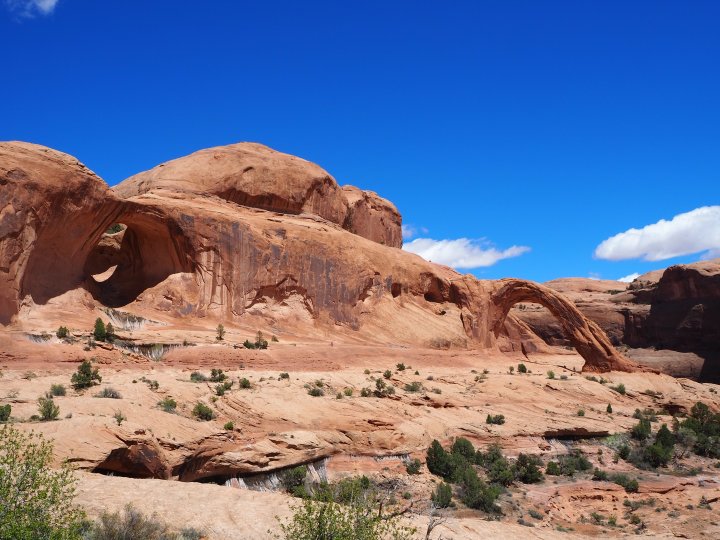
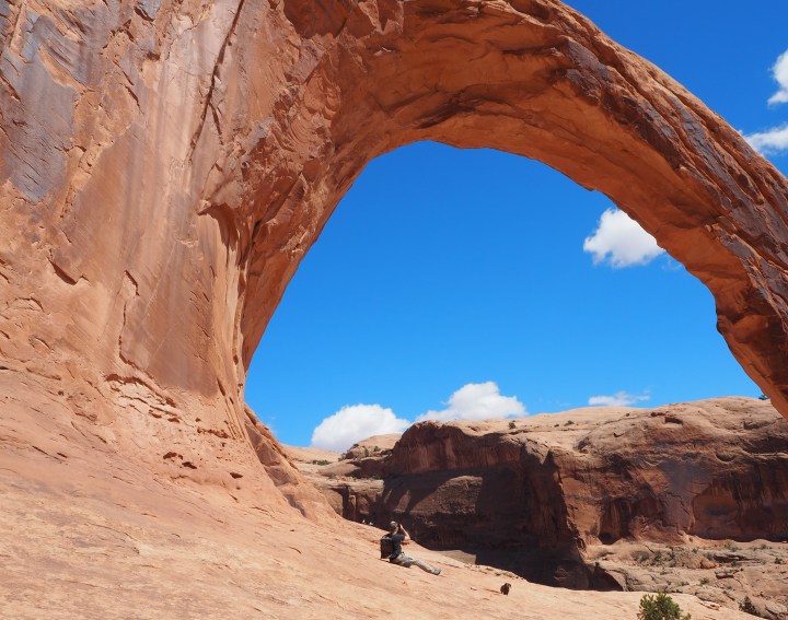
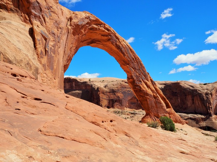
We were fortunate to hit a lull and found the opportunity to photograph and explore Corona Arch without people. It’s incredible. The opening is large enough for small plane to fly through – 140ft. wide by 105ft. high. I imagine Bowtie Arch is often overlooked, but it could be an attraction on its own.
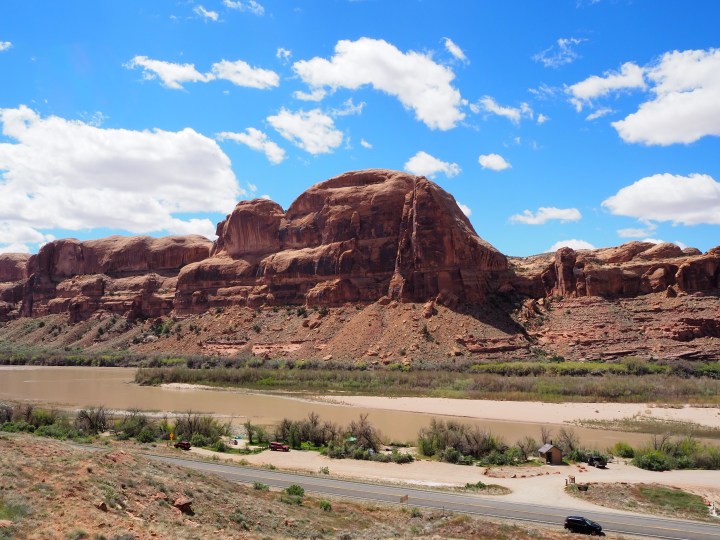
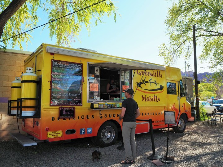
We returned to our campsite to grab the car and explore the rest of 279. From our campground the paved road follows a large bend in the river, passes Jughandle Arch, and ends at the Potash plant. We briefly stopped at Jughandle Arch, then decided to go poke around town and get quesadillas for dinner.
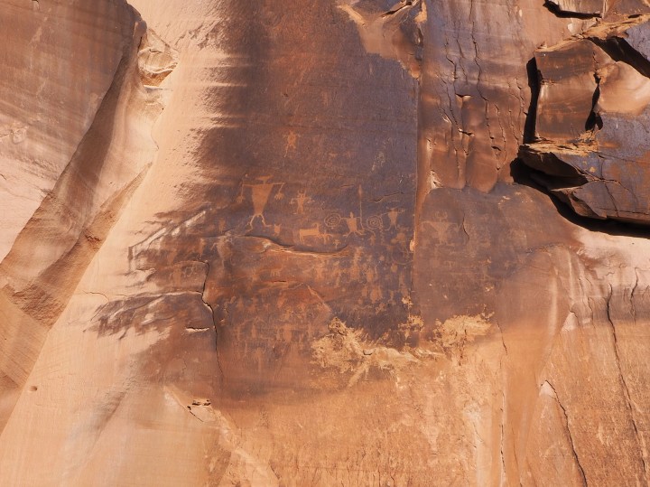
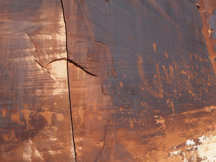
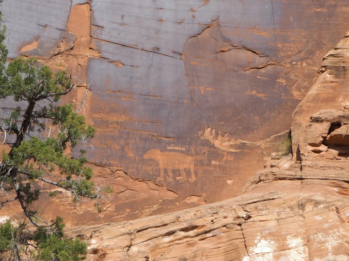
The next morning we slept in as much as we could with the geese honking nearby. We packed our site and went into town for a leisurely breakfast and coffee at our standard joint, Red Rock Bakery & Cafe. On the way we stopped at the petroglyphs along Hwy. 279 which are nestled between slabs of sandstone cliffs popular with climbers.
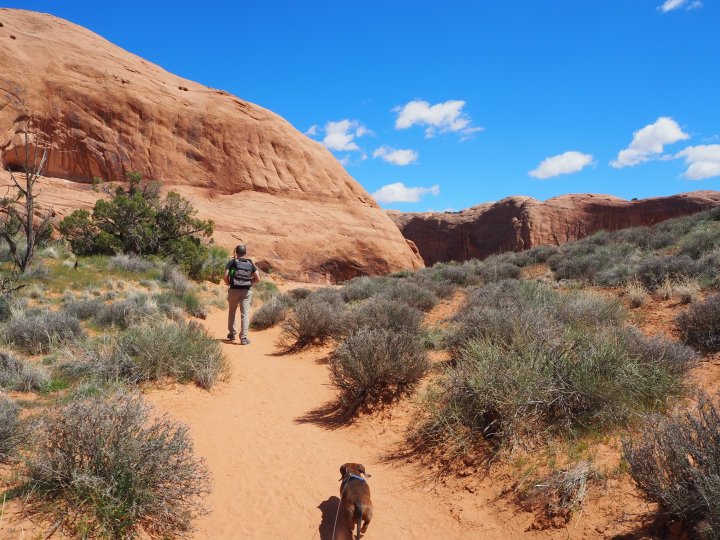
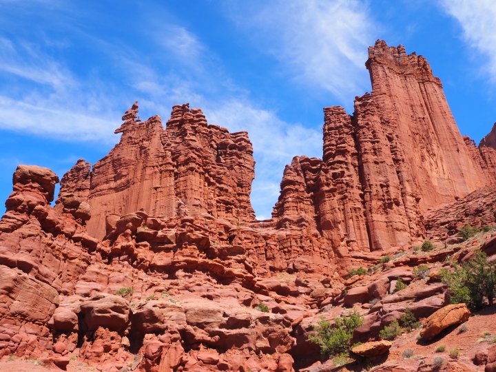
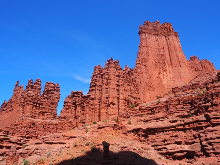
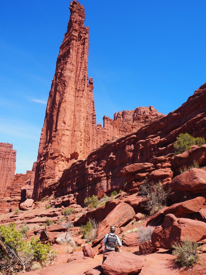
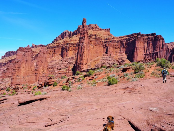
I like to mix up our hikes when we’re in Moab, so it’s not arch, arch, arch. With that in mind, I chose Fisher Towers for our Sunday hike. I had seen photos from friends of ours, but the beauty of the hike and the towers surprised me. We weren’t sure we’d have time to reach the end, but planned to go as far as we could before turning back.
The view from the parking lot is already spectacular, but it’s worth the journey to the viewpoint at the end. The trail immediately drops down and skirts sandstone goblins before leading you to the base of the towers. From there, the trail simply traces the base of the towers. It’s a splendid perspective and succeeds in making you feel your size.
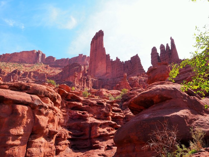
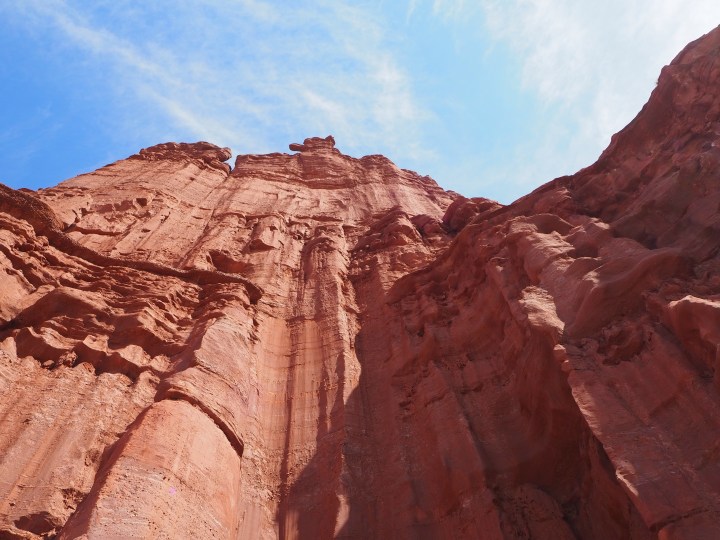
Fisher Towers is also a popular spot for climbers. We caught sight of a group at the top of Ancient Art, a 400 ft. tower near the beginning. One person had just reached the pinnacle as we watched. It looked amazingly terrifying.
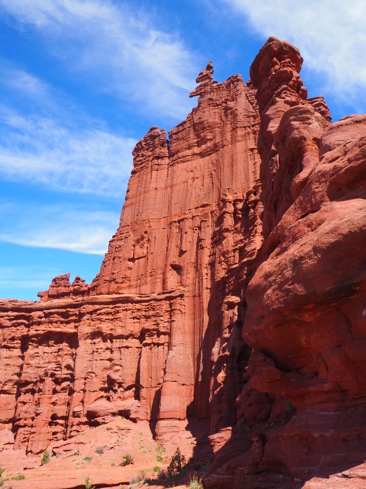
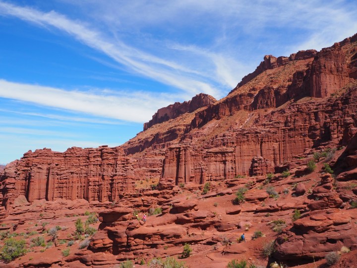
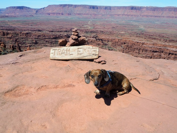
There is one obstacle between the viewpoint for the Titan, a 900 ft. tower, and the trail’s conclusion: a ladder to bridge a small gap in the trail. Only requiring a few steps, it was easy for us to put Tru in his pack. Others with larger dogs either turned around or had a more difficult time of it.
We made great time to the base of the Titan and decided to finish the hike. Tru was clearly exhausted, but wasn’t willing to admit defeat. He managed to reach the viewpoint which provided a panoramic view of the towers – a perspective you can’t quite get from the trail – along with 360 views of the landscape.
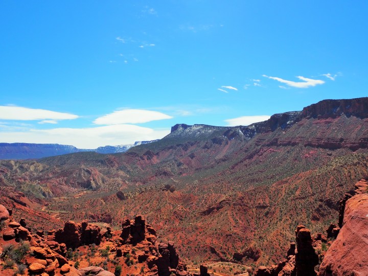
We had the viewpoint to ourselves and enjoyed the opportunity to rest in solitude. Just as we began to turn back, we heard the crack of a rockfall, but couldn’t identify its location. It was the first time I’d thought about such a hazard.

Tru gave up shortly after we started back which meant we were able to quicken our pace on the return. As with the day before, we’d managed to time our hike well. There were more people flooding in as we hiked out, including a small tour group. It’s definitely a trail better enjoyed in relative peace.

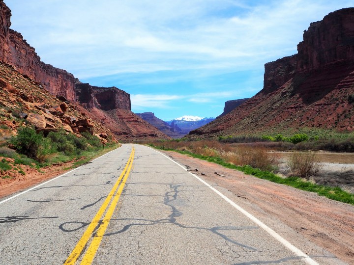
We made it back to the car before Zach’s goal of 2pm and set off down Hwy. 128 to reach the Interstate and begin our trek home.
Categories: North America, USA, Utah
