Kootenay National Park is the least visited of the four Rocky Mountain parks. It was a by-product of the creation of the Banff-Windermere Highway. The need for a road connecting the Columbia Valley with Banff and Calgary was evident, but after WWI the provincial government didn’t have enough money to finish the construction it had begun before the war. The federal government agreed to pay for the road, but stipulated that five miles on each side would be designated as national park land. The park opened in 1920 – three years before the road was finished – and the boundaries have expanded a few times to its present size.

There are three campgrounds in the park, all situated at varying distances along the highway. Our campground, Marble Canyon, was the farthest from Radium Hot Springs at the top of the park near the Alberta border. The highway is 58 (ish) miles from park entrance to exit, with significant changes in elevation gain and loss. For that reason, we chose to stop at overlooks along the way to avoid back-tracking later in our stay.
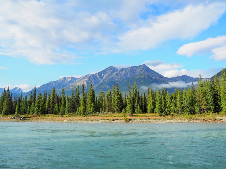
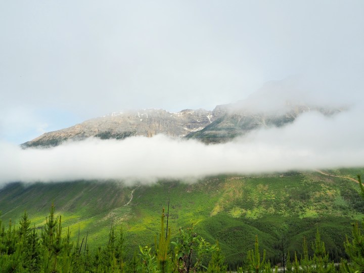
It was early in the evening when we entered the park – about 6pm or so. We drove through Sinclair Canyon before we realized what it was and shortly thereafter passed the hot springs pool. We bypassed a couple short trails because the trail report listed them as closed (bear in area), so our first stop was the Kootenay Valley viewpoint.


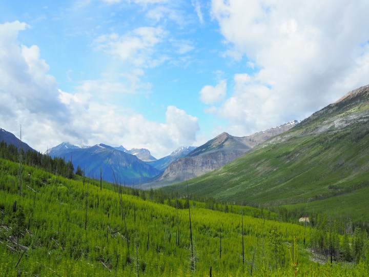
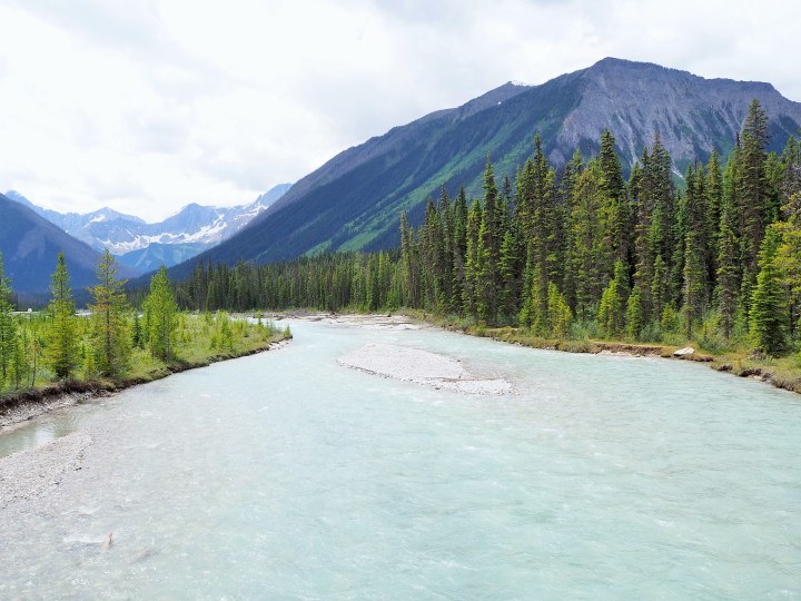
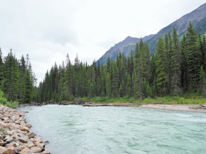
We later stopped at a picnic area along the Kootenay River with lots of Columbian ground squirrels and great riverside views, a pullout without a clear view, and another spot with a picturesque vista. When we reached the upper portions of the park, we saved the stops for the next day.
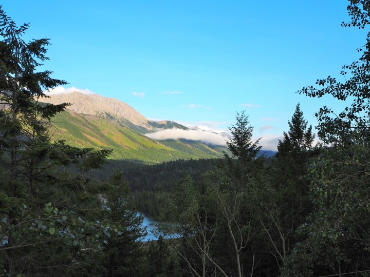
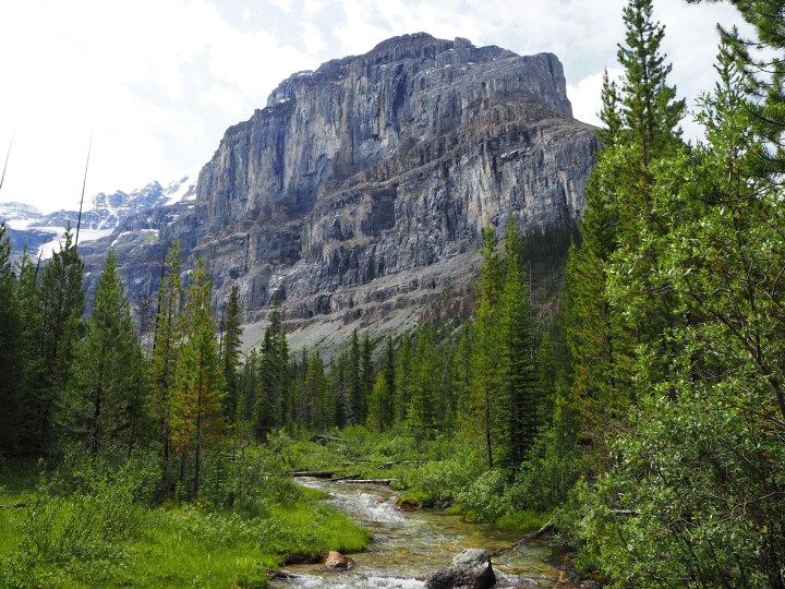
Because of its origin, cruising through Kootenay NP is slightly different from the other parks. There truly are drivers using it as a highway! There were fewer overlooks and pullouts than I expected, and sometimes we felt rushed by faster drivers. However, it was an immensely scenic drive!
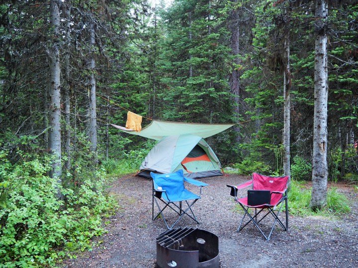
When we reached our campground everything was wet from a recent rain shower and our things were still damp from the morning. The campground was divided into small loops of six or so sites. Bathrooms with flush toilets and sinks (disappointingly unheated) were shared by several loops. It wasn’t the best campground at a Canadian national park and it wasn’t the worst – looking at you, Lake Louise! Our site had ample shade and privacy from those next to and behind us, and it was rather spacious. We set up, sat through a brief rain shower, and enjoyed a cold but clear evening.
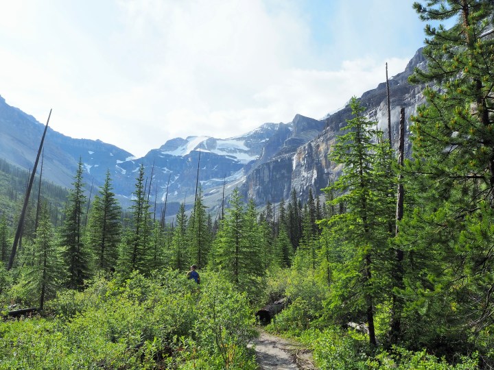
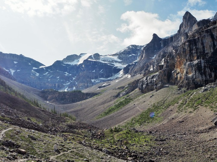
In the morning I was up early to prepare for our hike to Stanley Glacier. The weather was supposed to be fine in the morning, but there was a chance of afternoon showers. It seemed overcast when we woke up, but I quickly realized we were just trapped under a layer of clouds which looked like they would clear out. I was hopeful.

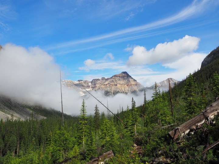
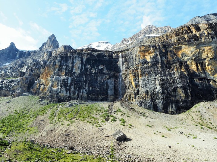
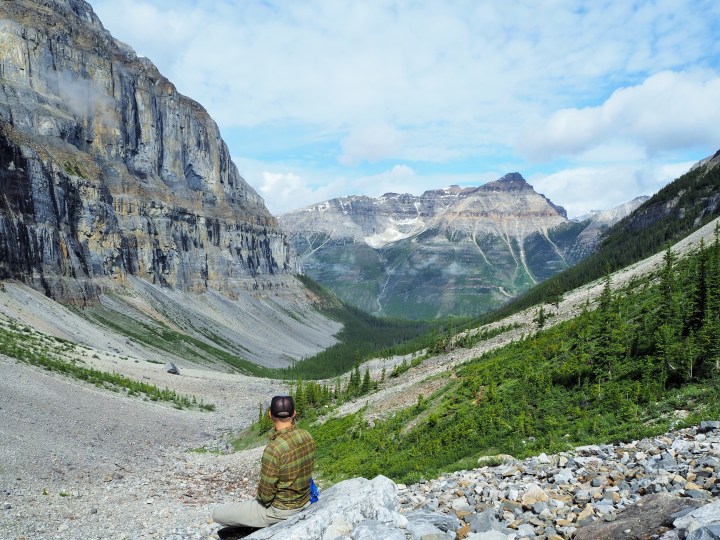
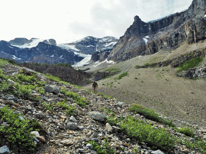
We arrived at the trailhead parking lot early enough to secure an actual parking spot and got started just before 9am. Our entire ascent felt eerie as we remained under the clouds. We could see improvement behind us, but continued to hike into a basin we couldn’t see. As we neared the end of the trail, the clouds began to dissipate and we began to realize we were surrounded by beautiful scenery. As we continued to climb, the view kept improving. It was spectacular!


Many people go beyond the trail’s official end to a tree-studded plateau. We went slightly farther – I wanted a wider view of the basin – but decided not to go to the plateau. It looked like a grueling climb via switchbacks through the shale. I hoped to squeeze a few more stops into our afternoon, so we turned back after a snack.
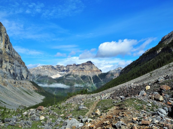


As we hiked down, more and more people were headed up. It affirmed our early start time. On our descent we could also see what wasn’t visible on our way up – lovely vistas peeking above the virgin forest regrowth (from a 1968 wildfire).


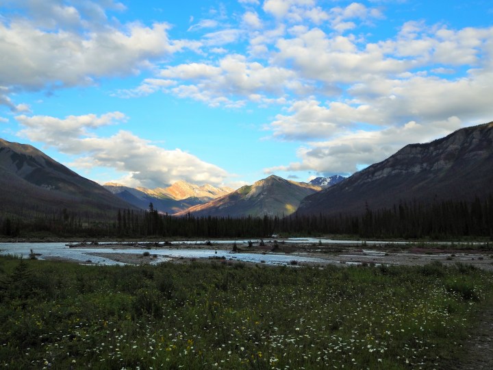
We returned to the parking lot and plotted our next move. I wanted to check out the Paint Pots, Marble Canyon, Numa Falls, and the Continental Divide. Thinking we would spend the day in the park, we drove up to the Continental Divide first. There wasn’t much to see, but it was marked with a nice monument. It was there we realized how much closer we were to Banff than Radium Hot Springs – roughly 30 miles.

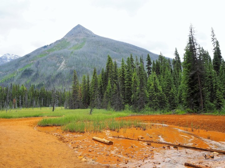
We turned back into the park to check out the Paint Pots, one of the more popular stops in the park. I didn’t know what to expect of the trail. The beginning led us to a bridge spanning the Vermilion River. It was a little more overcast by this point, but several families were enjoying the chance to wade into the river and rest on the rocky shores. We continued over the river and alongside it for a bit before diverging toward an ochre-filled meadow.

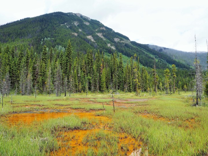
The First Nations peoples used the ochre clay found in this area as a dye for ceremonies and trade. Unfortunately for us, the recent rain had flooded the trail making it immensely messy, and though some boardwalks were provided, difficult to avoid stepping in the clay dirt which temporarily stained our shoes. We continued along the trail as it ascended gently from the meadow to reach the pots themselves, colorful pools fed by spring water. These pools were much more picturesque, but ultimately the trail wasn’t one of my favorites.
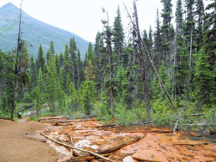


I had ulterior motives for doing the Paint Pots trail. While the Marble Canyon parking lot and trailhead were closed for construction, I thought we could take the scenic route and hike from the Paint Pots to Marble Canyon. But when we arrived at the trailhead, a sign listed it as closed. Plan dashed. We drove a little farther to Numa Falls and discovered it was also closed. Growing increasingly frustrated, I decided that Zach’s idea to go to Banff for the afternoon was a good one.
We left Kootenay NP behind for the rest of the day, and although we camped there another night, it concluded our time in the park. I’m interested in returning to the park, and now that we know how spread out it is, we’ll be able to plan our time there better.
Categories: Canada, North America

Great pictures. We love the Kootenays. Too bad you didn’t get to Marble Canyon. Why was it closed? Bears?
They had the entire parking lot torn up, so I think the trail closure was construction related. Now it’s open per their website. I guess we just hit it at the wrong time!
Too bad, it’s a reason for another trip!
Wow. Just Wow. And what about that sweet campsite?