With a three-day weekend for the July 4 holiday, we decided to take a little trip to another area of Idaho we are interested in exploring: the Frank Church – River of No Return Wilderness, mercifully shortened by locals to The Frank. We learned the hard way returning from our Copper Basin trip, that on Sundays there is a bit of a traffic jam on the route that is closest to our house. (Whether this is pandemic-related or the summer norm, we can’t say.) So, we decided to make this trip a two-nighter, leaving on Thursday after my work day ended and returning on Saturday evening, leaving us an entire day to relax at home before the next work week commenced.
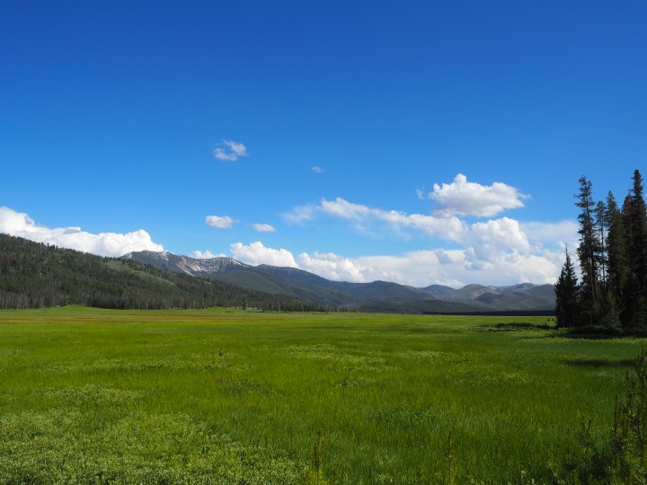
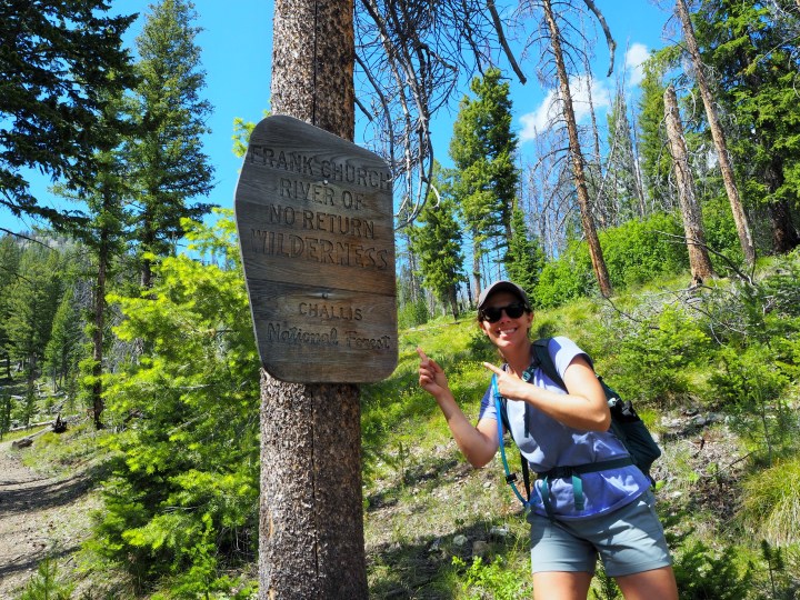
For this first foray to The Frank, we decided to camp in the Bear Valley area of the Boise National Forest. Here, we would be at the border of The Frank, making a couple of day hikes completely doable. As you may recall from our previous trips to Wilderness areas, it is the highest level of federal protection. Once a wilderness designation has been declared, no other improvements can be made. It also means that there is no motorized traffic within the region – no OHVs or dirt bikes blasting dust in your face! The Frank is the largest, roadless area in the Lower 48 making a lot of the hikes much longer, backpacking hikes. We’ll get around to those too, but wanted an introduction first.
On Thursday afternoon, we drove up hoping to secure a campsite at Fir Creek Campground, which would put us within walking distance of a trailhead for the next morning. We knew it was a gamble – there are only six sites! – but gave it an effort anyway. As expected, it was full. We knew we would be able to find a dispersed site somewhere, so we drove toward Elk Creek and examined possible sites as we went along. We ended up at a nice site, all by ourselves, with access to Elk Creek. Early the next morning, we felt the earth rumble beneath us. We turned to one another and muttered ‘earthquake.’ I momentarily thought about the skinny lodgepole pines encircling our site, but decided they could withstand such a small tremor and returned to sleep. By the time we’d gotten up, I had already forgotten it, like a hazy early-morning dream. (A 6.5 magnitude earthquake struck near Ruffneck Peak northwest of Stanley on March 31 and aftershocks have been rumbling the state ever since.)


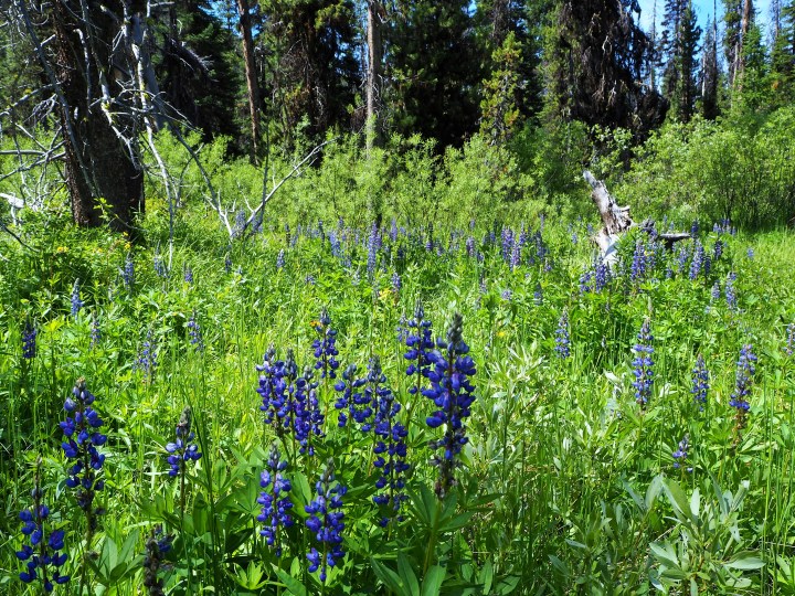
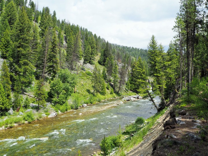
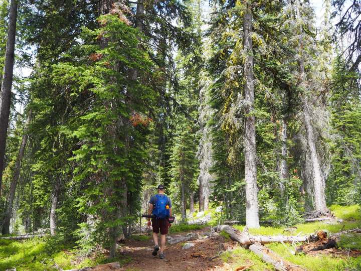
That day, we planned to enter The Frank for the first time to hike along Bear Valley Creek. The trail had a few creek crossings, so we strapped our Chacos to our backpacks and set out. The first section was literally along the creek, the rocky trail keeping us nearly on the shoreline. Then we cut through dense greenery as the creek made a large bend. To my delight, the grasses were also thick with lupine, tall and scrawny, towering over Truman. We arrived at what we thought was the first crossing, changed into our Chacos, and made the short trek through the frigid waters. Then we realized we were on a little island and had only crossed a small vein of the creek; we still needed to cross the creek. We found our way through the thick vegetation to the creek and paused. This wasn’t a little ol’ creek crossing. The current was swift, and the water was going to be much higher than thigh-high. There was NO WAY Truman would be convinced to swim across on his own. Zach carried my shoes; I carried Truman. We realized very quickly that the current was stronger than we anticipated. The round river rocks smooth and slippery under our feet made it difficult to find traction.
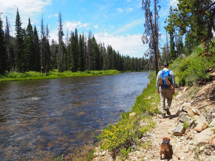
Zach could have gone the whole way, but I knew I wasn’t going to make it. I began to turn around, Truman started to squirm, and that was it. I lost my footing, yelped, and plunged into the creek. Zach later told me he was impressed with my ability to keep Truman dry – this was not a conscious effort. Somehow, I managed to find my feet and climb onto the sandy beach. Zach thought I was a goner, soon to be down-creek. I felt pretty embarrassed, but turning around was definitely the right decision. Out of breath, I sat down to compose myself while Zach began his return. Around the corner a group of kayakers appeared and politely asked if we were okay. I hadn’t realized my legs were bleeding – I had scraped up both knees – and it made things look worse than they were. Feeling defeated, we hung out on the beach for a while, soaking in the sun and enjoying our solitude. Later, I read in another hiking book of ours that creek crossings shouldn’t be attempted when the water is higher than mid-thigh… why hadn’t I read that advice sooner?! We turned around and made it back to the trailhead as dark clouds rolled in the distance. We thought about doing another trail in the opposite direction, but after a tenth of a mile or so of downed trees barricading the path, we decided it wasn’t worth the effort that day. Thunder rumbled in the distance, and we thought it might be prudent to return to our car and come up with a Plan B.
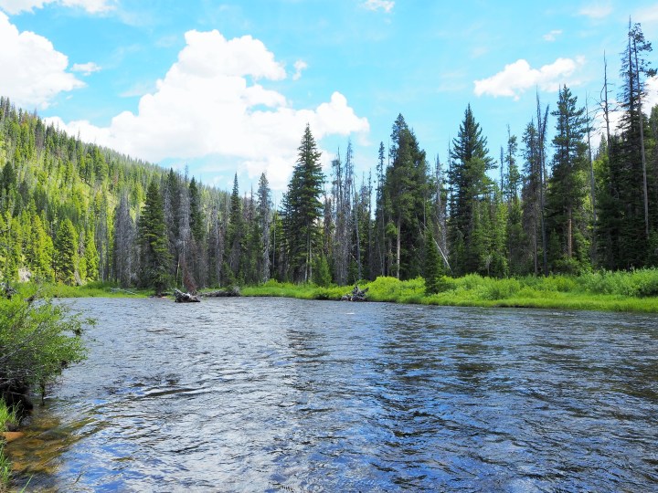


We decided to drive up to the put-in for the Middle Fork of the Salmon River. The Middle Fork is storied for its 100 miles of whitewater, and rafting trips here are often the object of a lifetime. We certainly want to go! But that day, we were mostly curious. We had the time, why not drive up and check it out, maybe there would be a path along the river, or a place for Zach to fish. When we arrived, we first parked in a lot instead of driving to the boat launch. Realizing our error, we drove down to the launch, and there discovered a footpath along the river and down to a rocky shore. We decided to hang out for a while. Zach fished from the shore, though it was less than ideal, and we watched.


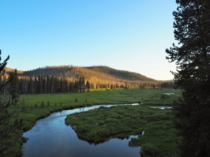
We drove back down to Bear Valley and returned to our site. Zach attempted to fish behind our site in Elk Creek, but it was a mosquito haven, and he gave up after 20 minutes or so. We had our dinner, but found it difficult to sit out and relax with the mosquitoes swarming us, so we opted to go for a drive instead. This time we ventured farther west from our site, following the serpentine curves of Elk Creek as the sun sank lower.
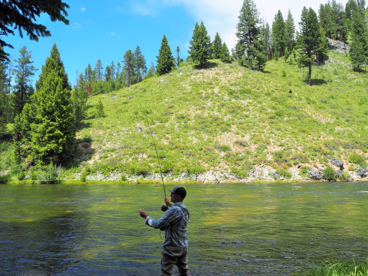
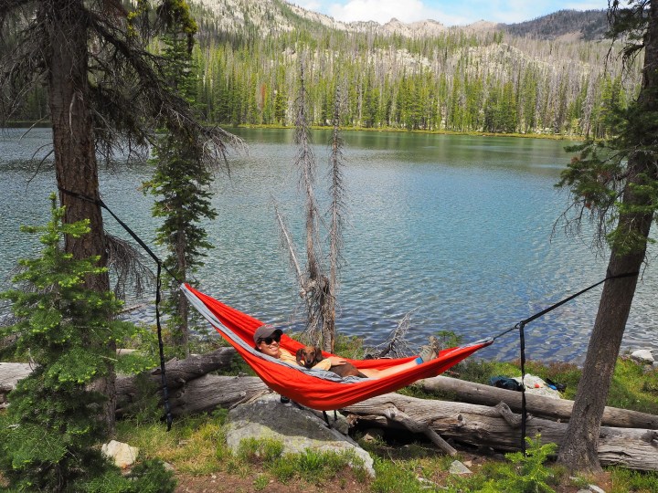
In the morning, we packed up our site and readied for our next hike in The Frank. There were no creek crossings, so I was fairly confident I would be redeemed from the previous day’s debacle. I was a little worried about Truman though. In the first 0.7 miles of the hike we would gain 700 ft. of elevation in a relatively unshaded part of the forest – a burn scar from a fire in 1998. Truman does better when he has decent shade and consistent water sources to cool himself off, and the beginning of the hike only had one of those. But, he’s a stubborn dog, so he bore it in true dachshund style, doing the entire climb with his tongue nearly on the ground. Once we entered the forested section of the trail (and stopped climbing), his energy rebounded. We arrived at Langer Lake surprised that there weren’t more people. It was July 4th after all. Though there were some backpacking sites in use, two groups had passed us on their way down, leaving space to spread out at the lake. We claimed a spot near the trail where I could string up the hammock and Zach could fish and settled in for the afternoon.


It was a beautiful afternoon. We lingered for several hours, and then hiked back down to return to Boise. Grateful to be showered and in our own bed, we were unprepared for the barrage of fireworks nearby. Apparently the lack of large firework shows prompted everyone to set off their own displays causing pets and owners alike to cringe under the blankets. Maybe next year, we’ll backpack on the 4th to really get away from all the noise.


Categories: Idaho, North America, USA
