We arrived at the park just before 10 and found the lot nearly full. As we later came to realize, most people were there to climb not hike. Single-day admission was only $5 which seemed shockingly low when compared to some of the rates we paid at Utah State Parks… I was prepared with cash for the fee machine but had to double back after realizing it only took cards. So, we were off to a slow start! But after paying for our admission, loading up our packs with snacks and water, and slathering on the sunscreen, we were ready to get started. Misery Ridge is the park’s most popular trail but I wanted a) a longer hike and b) to see different areas of the park. When researching the park, Visit Bend’s website suggested a 4-mile loop hike by connecting 3 different trails. We started by taking in the views of the park from the ridge above, enjoying the early morning glow’s partial illumination of the canyon below.
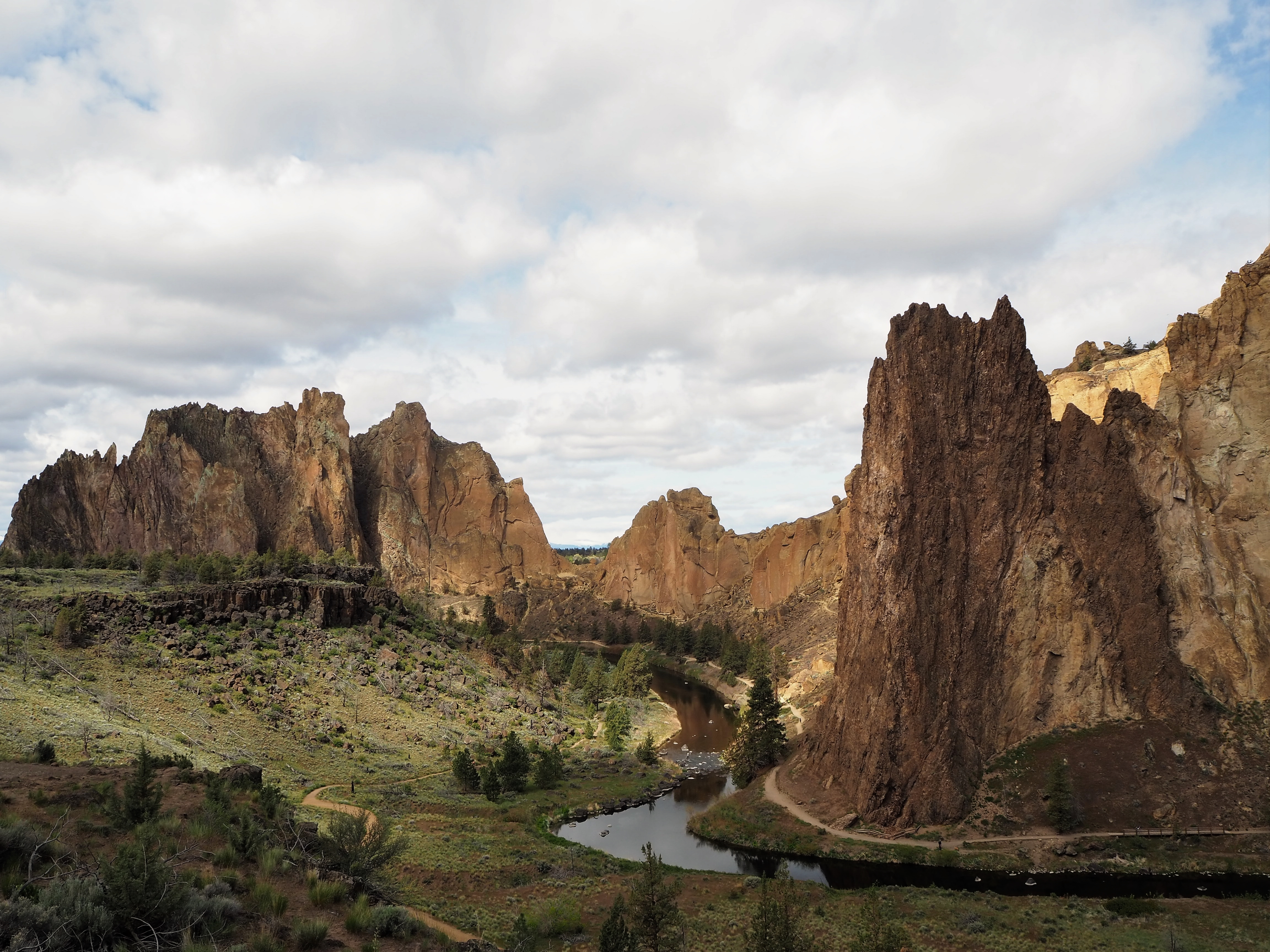
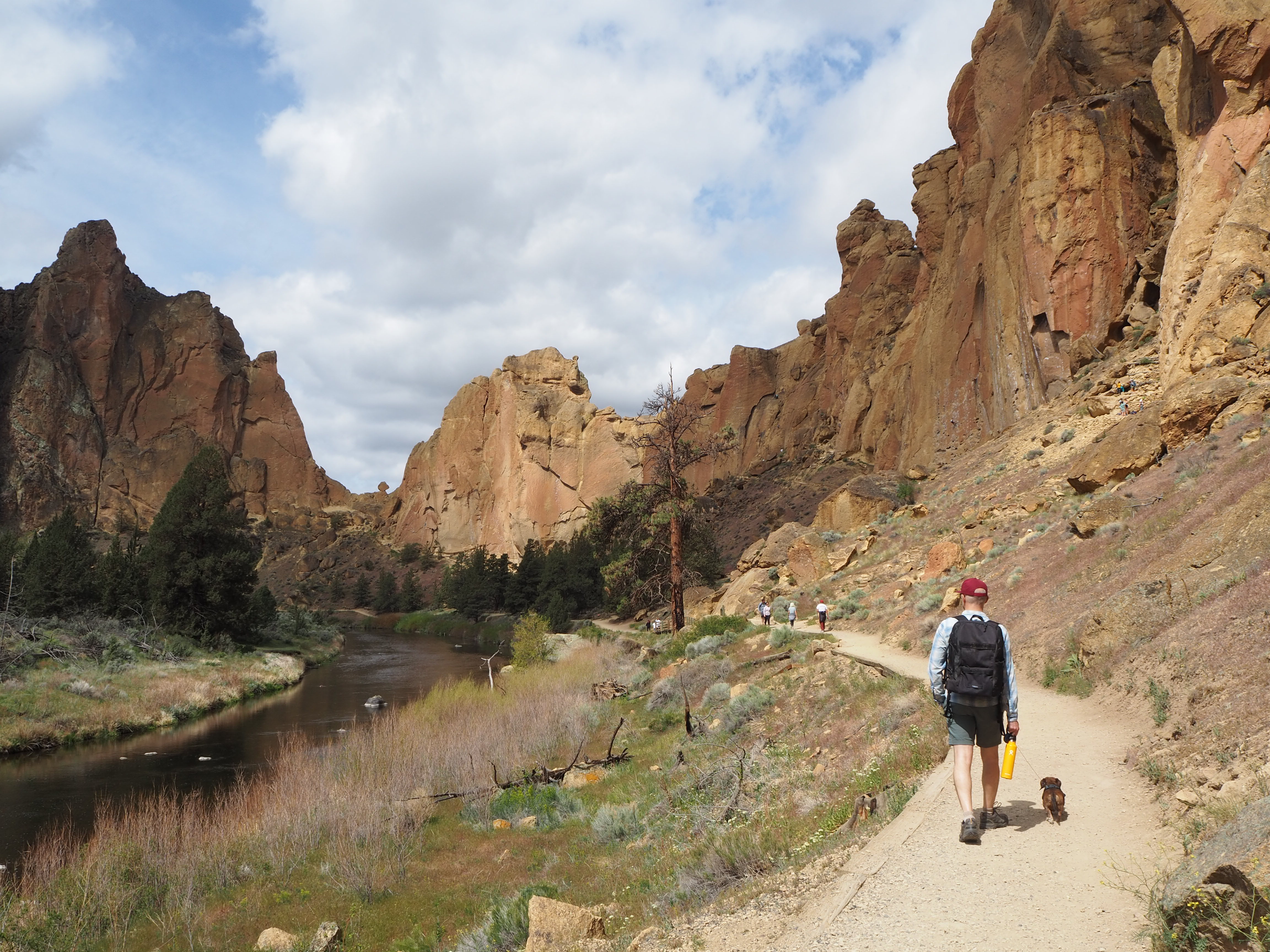
The trek down to the Crooked River was quite steep, and I was grateful for the graded concrete at the start of it. We probably shouldn’t have allowed Tru to do the descent but he was excited and he resists the backpack until he’s legitimately tired. At the bottom, we crossed the river to begin our hike on the River Trail. The first two miles of the loop were relatively flat as the trail threaded the land between the river and the sheer rock walls dotted with climbers. It was a beautiful way to begin our tour of the park. We were able to enjoy the scenery, listen to the various geese honk, and spot birds of prey overhead. The farther we went, the fewer people we encountered.


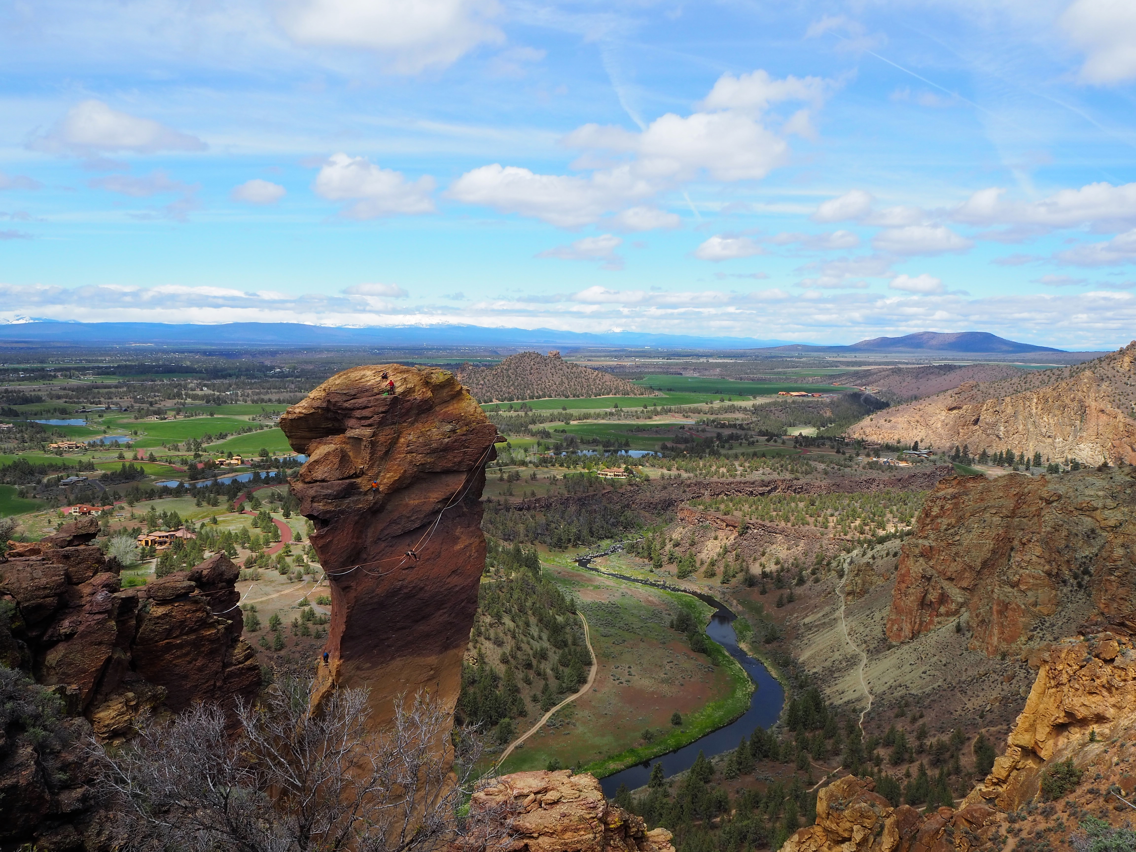
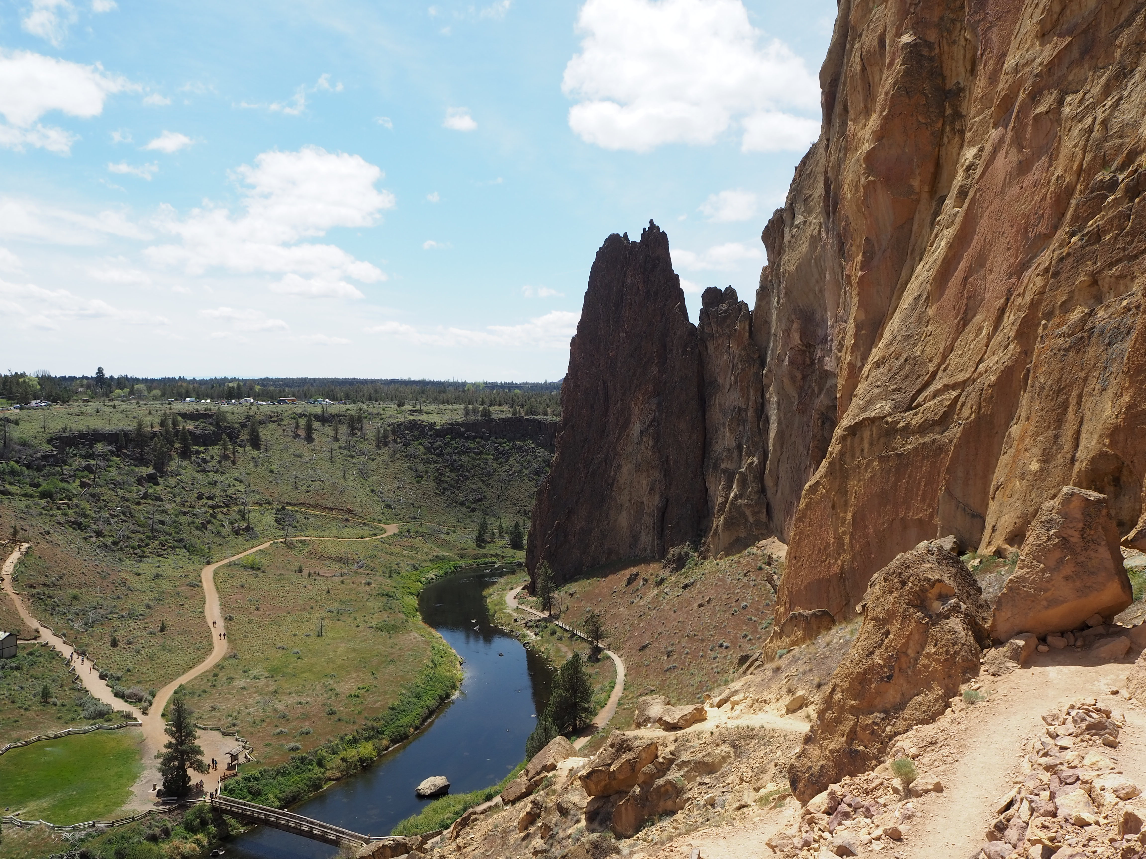
Of course, fewer people can also mean more wildlife. Sure enough, we ran across a three-foot bull snake and later, a small rattler, much to Zach’s dismay. As we rounded the bend to continue on the backside of the rock wall, we had a lovely, verdant vista of the Crooked River, the orange glow of the cliffs, and the rock formation called Monkey Face. As we drew closer to Monkey Face, we exited the River Trail to begin an ascent of the Mesa Verde Trail. Knowing that it would get steep as we climbed toward Misery Ridge, we put Tru in his backpack. As we neared Monkey Face, we could spot climbers on the side of the head and inside the mouth. It looked terrifying.


Little did we know that as we passed Monkey Face to begin the Misery Ridge switchbacks we would find a slack-liner balancing between Misery Ridge and Monkey Face. As we ascended one switchback, we had a full view of him above our heads, and as we turned to the next switchback, we had a gorgeous view of the river and greenery contrasted with the rock walls. It was equal parts fascinating and anxiety-inducing. He fell several times and easily popped back up onto the line to continue the journey across.
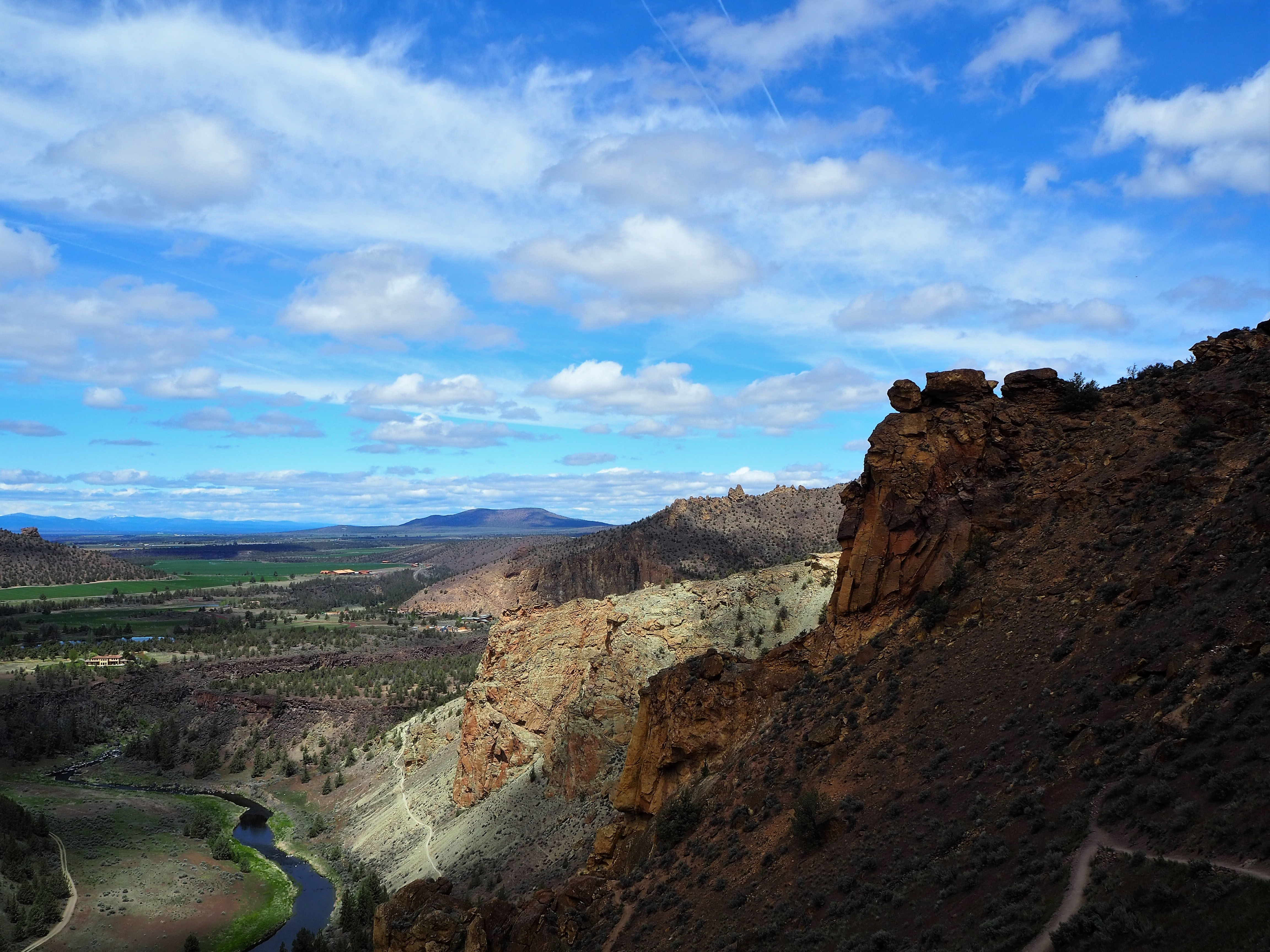

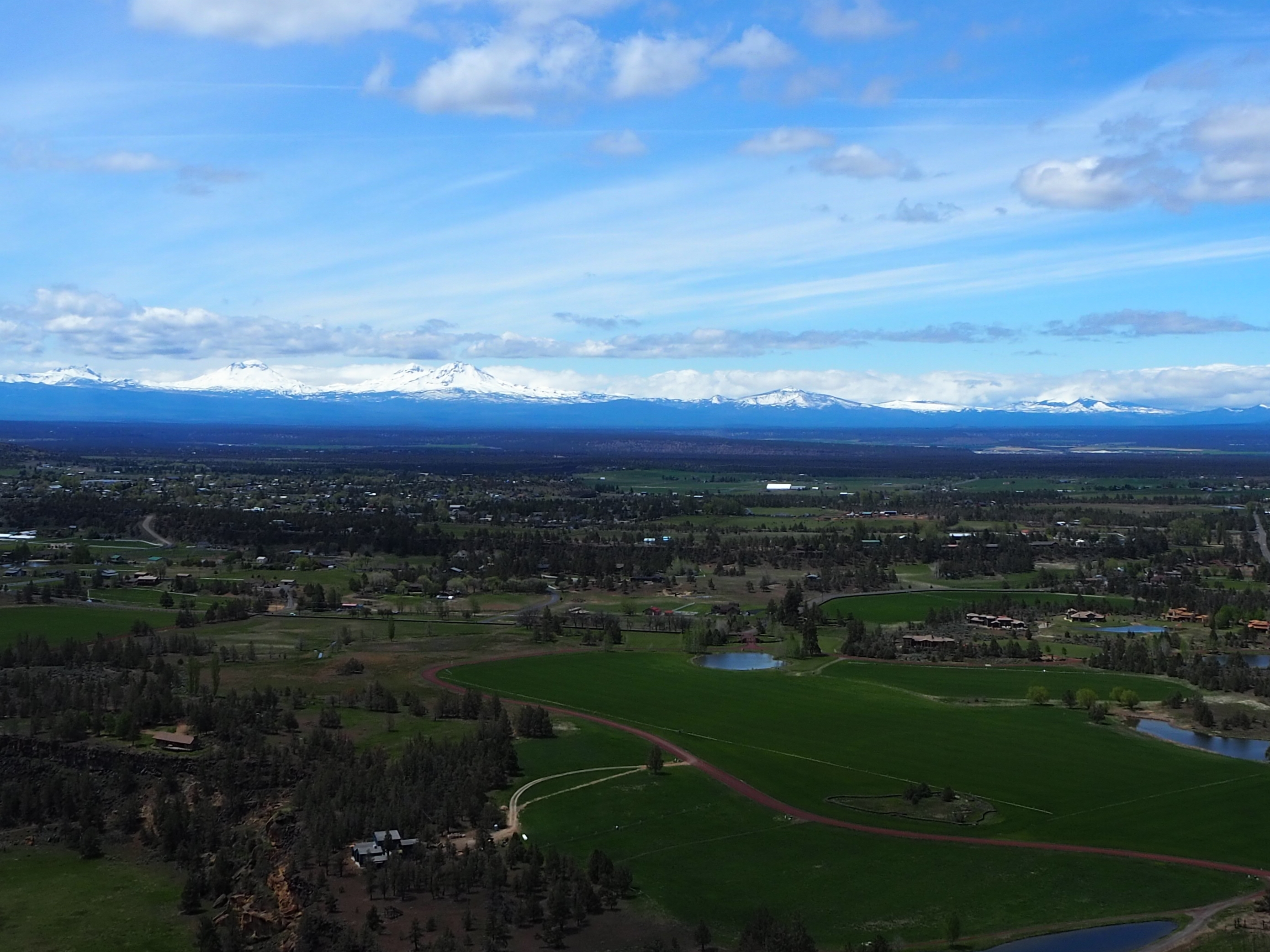
When we reached the top of the ridge, we commandeered the only bench and enjoyed both the athletic feats and scenery. Three climbers reached the top of the Monkey Face and did a jump pose in unison for the photographers on the ridge. The slack-liner finally reached Monkey Face and then began his return journey. It was a beautiful day, not too hot, and we could see several Cascade peaks still blanketed in snow to the west.

We made a slight detour as we started for the descent and managed to find a willing photographer for a photo of the two of us. Then we began the rather tedious trek down Misery Ridge. I was grateful we had completed the ascent from the Mesa Verde Trail and only had to endure the multitude of steps one time. The loop we did – clockwise – seemed to be the best way to ascend and descend Misery Ridge. Our ascent was more scenic and less grueling – I’ll take a steep switchback over stairs any day – and the descent offered a quick (yet painful for my right knee), fairly direct route down. The steps helped mitigate sliding on loose gravel and offered a reprieve from the slope when needed.


At the bottom, we gleefully crossed the Crooked River and began the steep ascent to the parking area. At the top, we let Tru out of his pack and followed the pathway back to our car, stopping once more to capture the park in a sunnier haze.

Categories: North America, Oregon, USA

1 reply »