Last summer, we had grand plans for a summer road trip. Initially, we conceptualized an epic Washington and Oregon trip but eventually realized it would be better to stay away from the popular tourist sites. It sounded like everyone else in America was excited about the first vaccinated summer, and with international travel still more difficult, road trips weren’t going to be an anomaly. Instead, we pivoted to western Montana, choosing some areas we hadn’t yet visited along with others we had stopped in briefly. We planned the entire thing at the beginning of July and then… the smoke started to blow in. Already inundated in Boise, we weren’t keen on sleeping and hiking in poor (or unhealthy) air quality. We monitored the air quality and it remained in the orange, red, and even purple levels. So, we scrapped the entire trip.
Instead, we noticed that northeastern Oregon and northern Idaho somehow remained outside of the wind patterns blowing smoke from the various fires in Oregon. Zach secured a campsite at Priest Lake State Park north of Sandpoint and we planned the rest of the trip around those dates. The Wallowa (pronounced with a WOW sound) Mountains in northeastern Oregon were our first stop. Of course, by the time we left Boise, the wind had shifted once more. The Wallowas would be mostly clear during our stay, but the remainder of our itinerary had begun to shift into orange and red categories.
We left on a Wednesday morning, excited to see a clear blue sky as we drove west. Only a four (ish) hour drive, we felt laid back and joyful. We stopped in Baker City for coffee and admired the historic buildings they have neatly maintained. It’s a small city – probably prime for an influx of Oregonians looking for the next Bend – set against the dramatic backdrop of the Elkhorn Mountains. We left the interstate at La Grande and entered rolling farmland. Eventually, we descended into a beautiful valley and the road followed the Wallowa River as thick forest began to scale the hillside opposite.

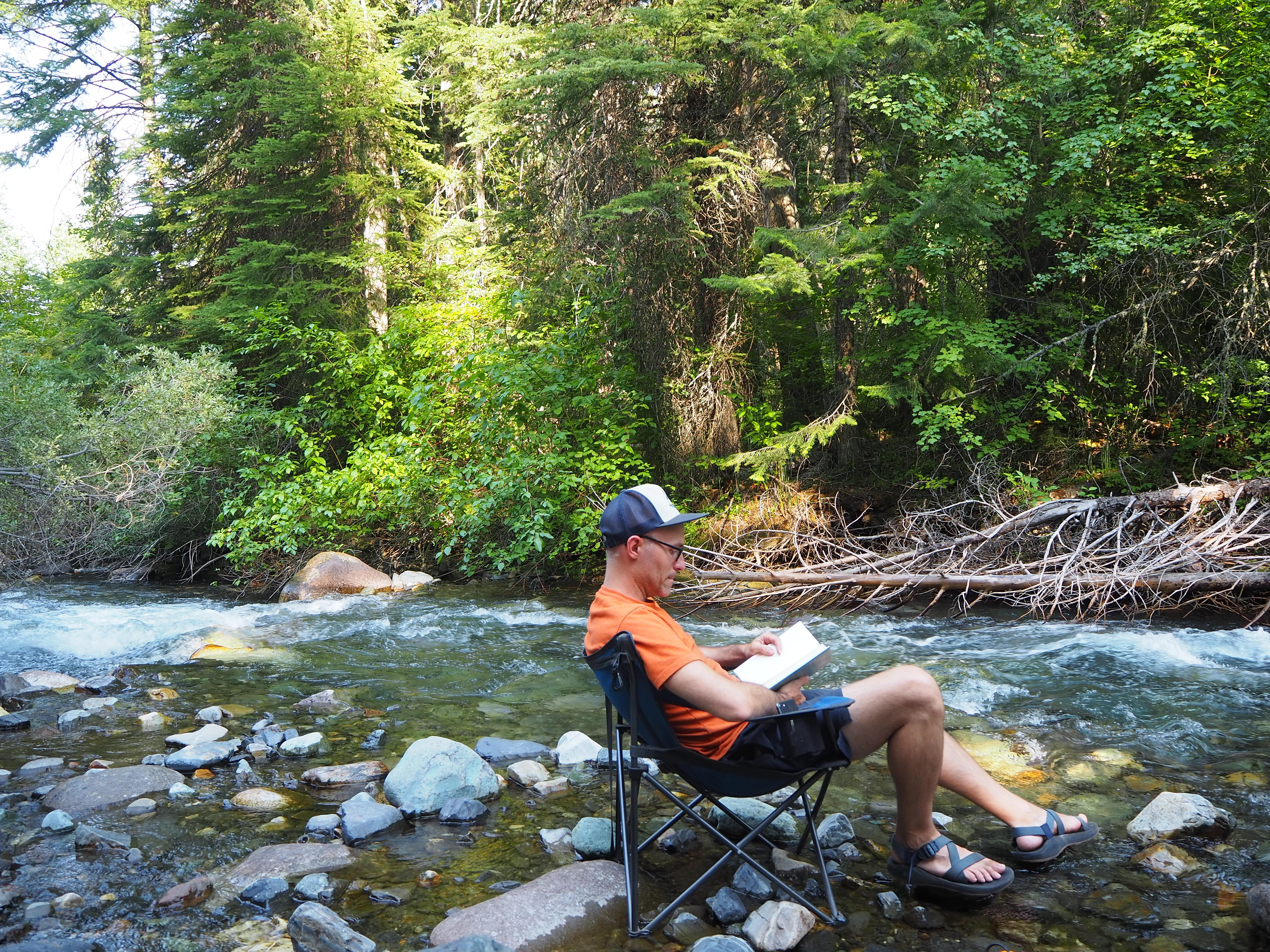
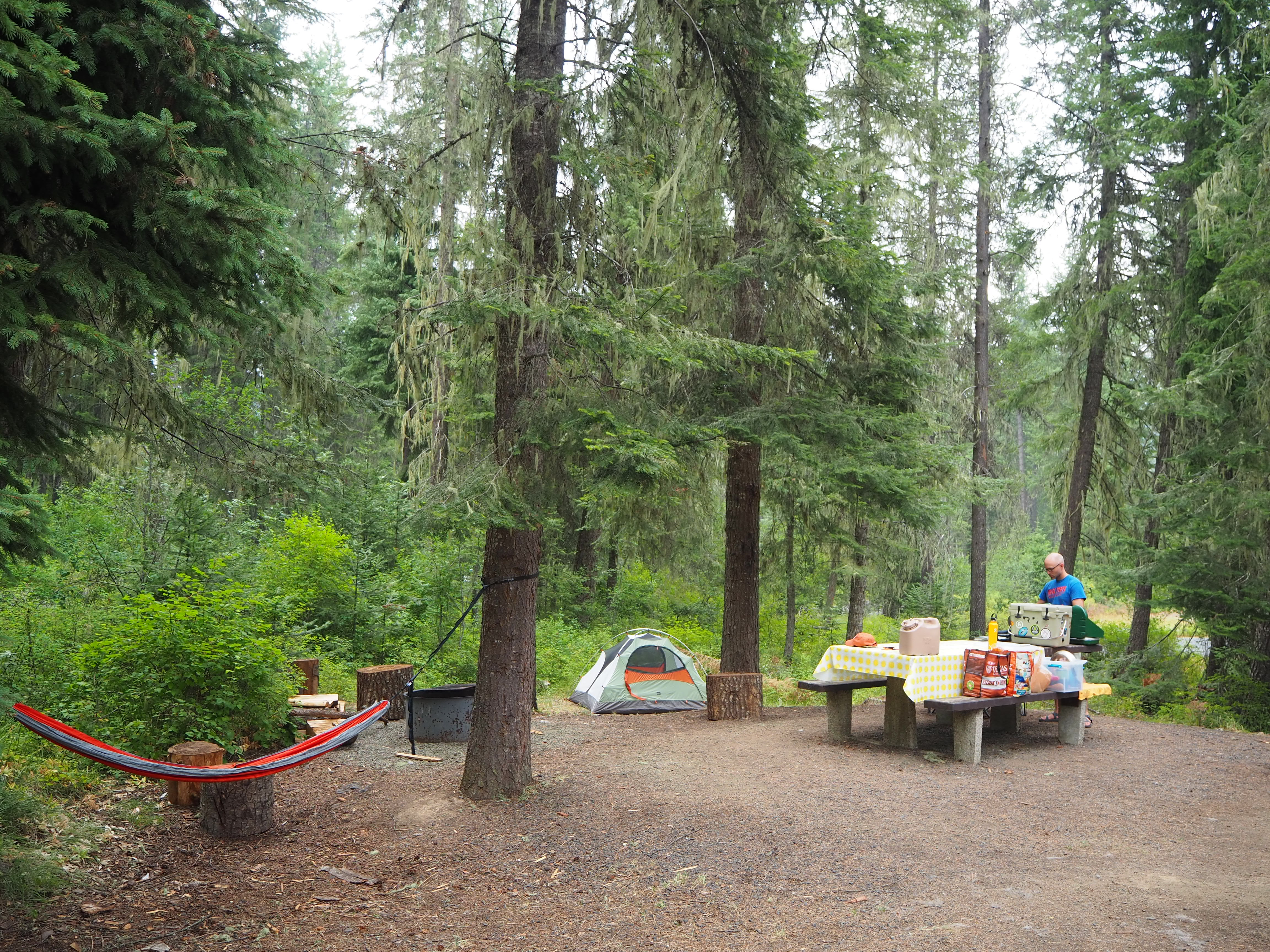
While you can see the Wallowas from the interstate, we wound around to the north side where two larger towns – Enterprise and Joseph – are situated at the foot of the range. In Enterprise we split from the highway to follow the road into the national forest south of town. We hoped we could easily find a spot at Hurricane Creek Campground since it would offer the flexibility of being close to both towns and Wallowa Lake. Luck was on our side and we nearly had our pick of the place. We chose a nicely shaded site alongside Hurricane Creek. We set up, had lunch, and popped back into Joseph to buy a forest permit, check out the lake, and get our bearings. It just so happened that we were in town during their annual festival and rodeo – Chief Joseph Days – so it seemed town might be livelier than usual.


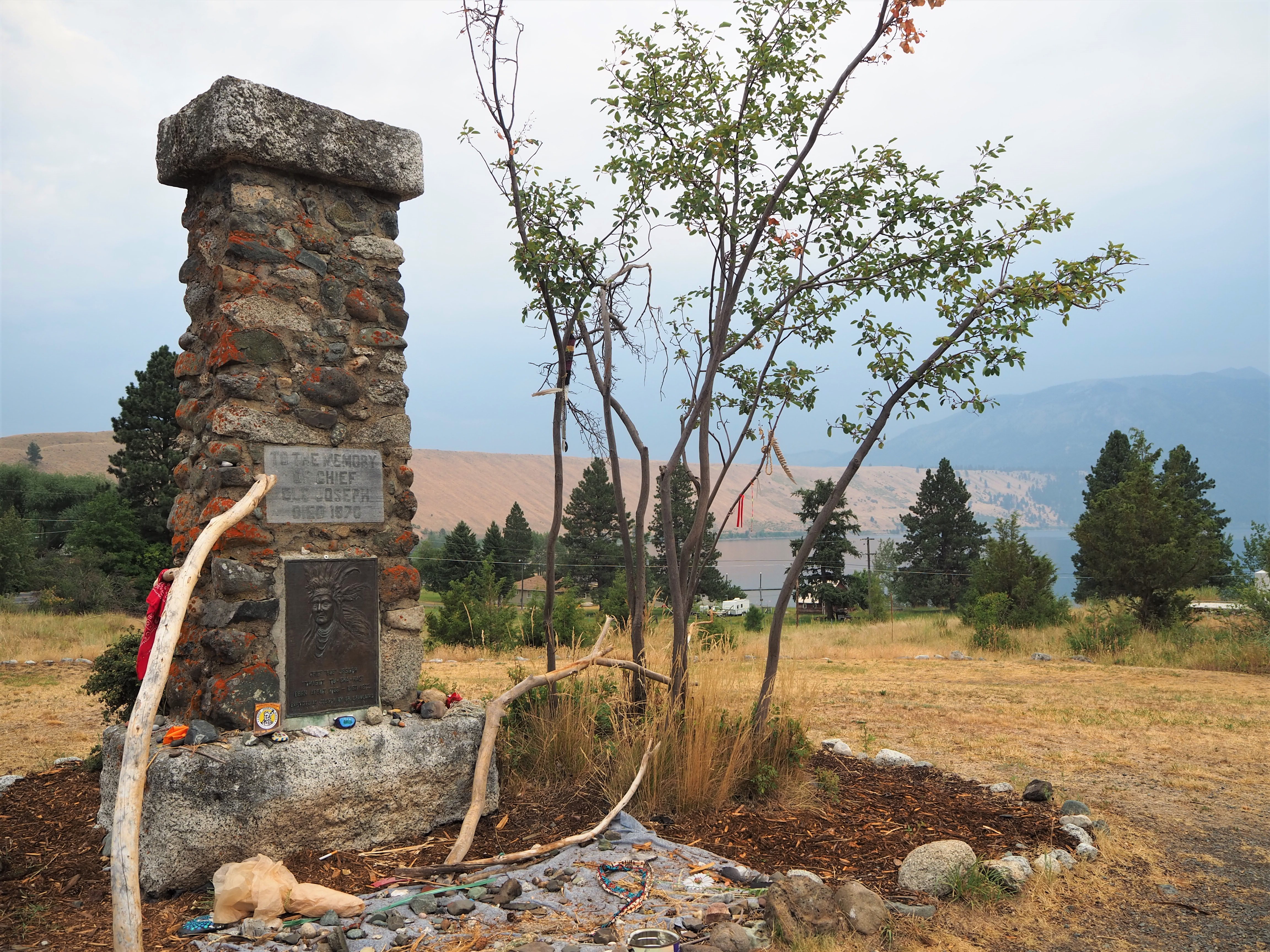
The town of Joseph is named for Chief Joseph of the Nez Perce (Nimíipuu) Tribe. You may recall our visit to Big Hole Battlefield in Montana where we learned extensively about the US government’s treatment of the Nez Perce people and the Nez Perce War. Chief Joseph was the leader of a band of the Nez Perce in 1877 when the US government intended to forcibly remove them from their lands. He led his people in a retreat across four states as they attempted to reach Canada. It was Chief Joseph who surrendered in the Bear Paw Mountains just shy of the Canadian border. The Wallowa Mountains were the summer home to his band of the Nez Perce and the Eagle Cap Wilderness was where they hunted bighorn sheep and deer. His father, Old Chief Joseph, is buried near Wallowa Lake. (For more information about Chief Joseph.)

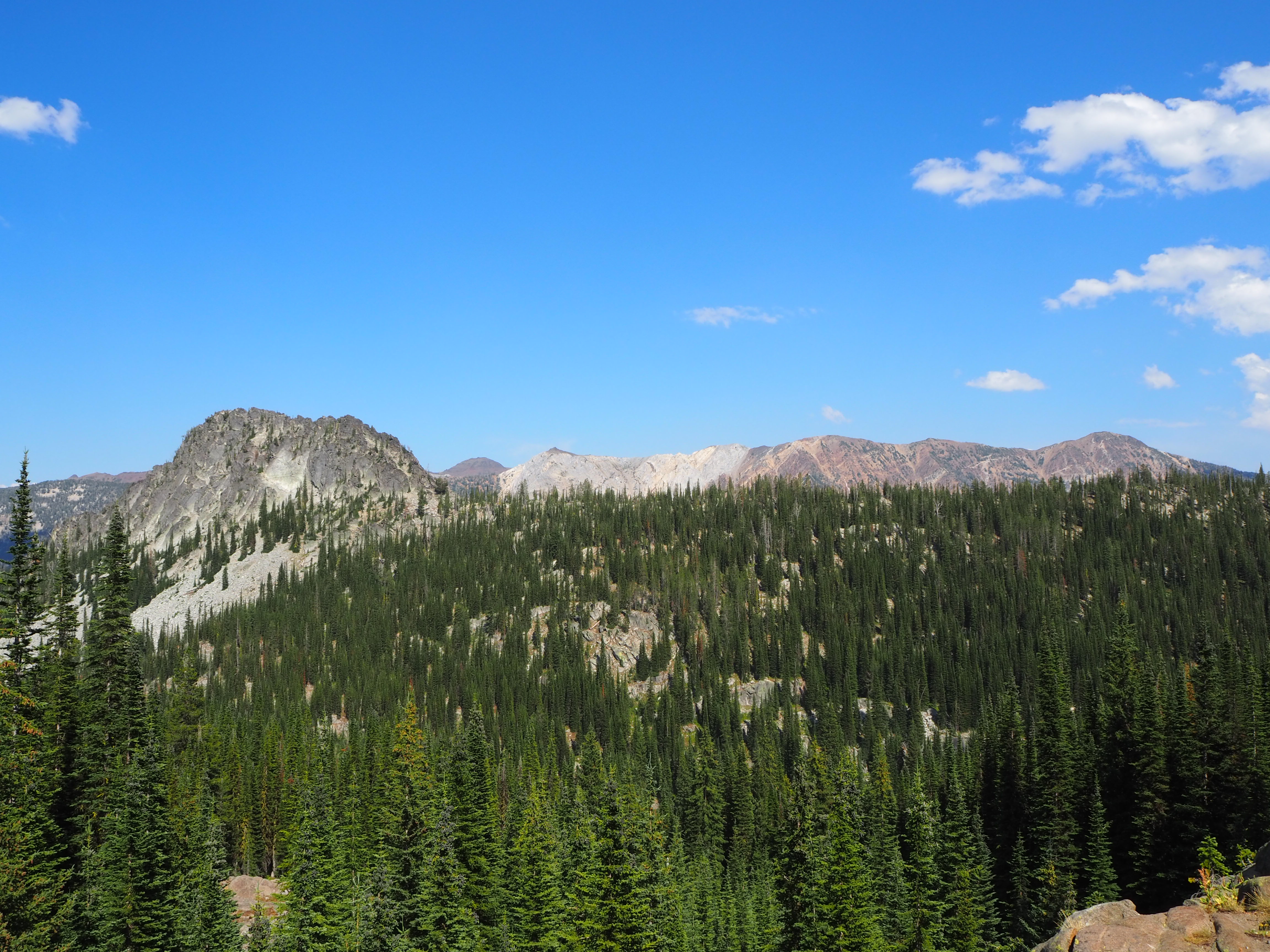
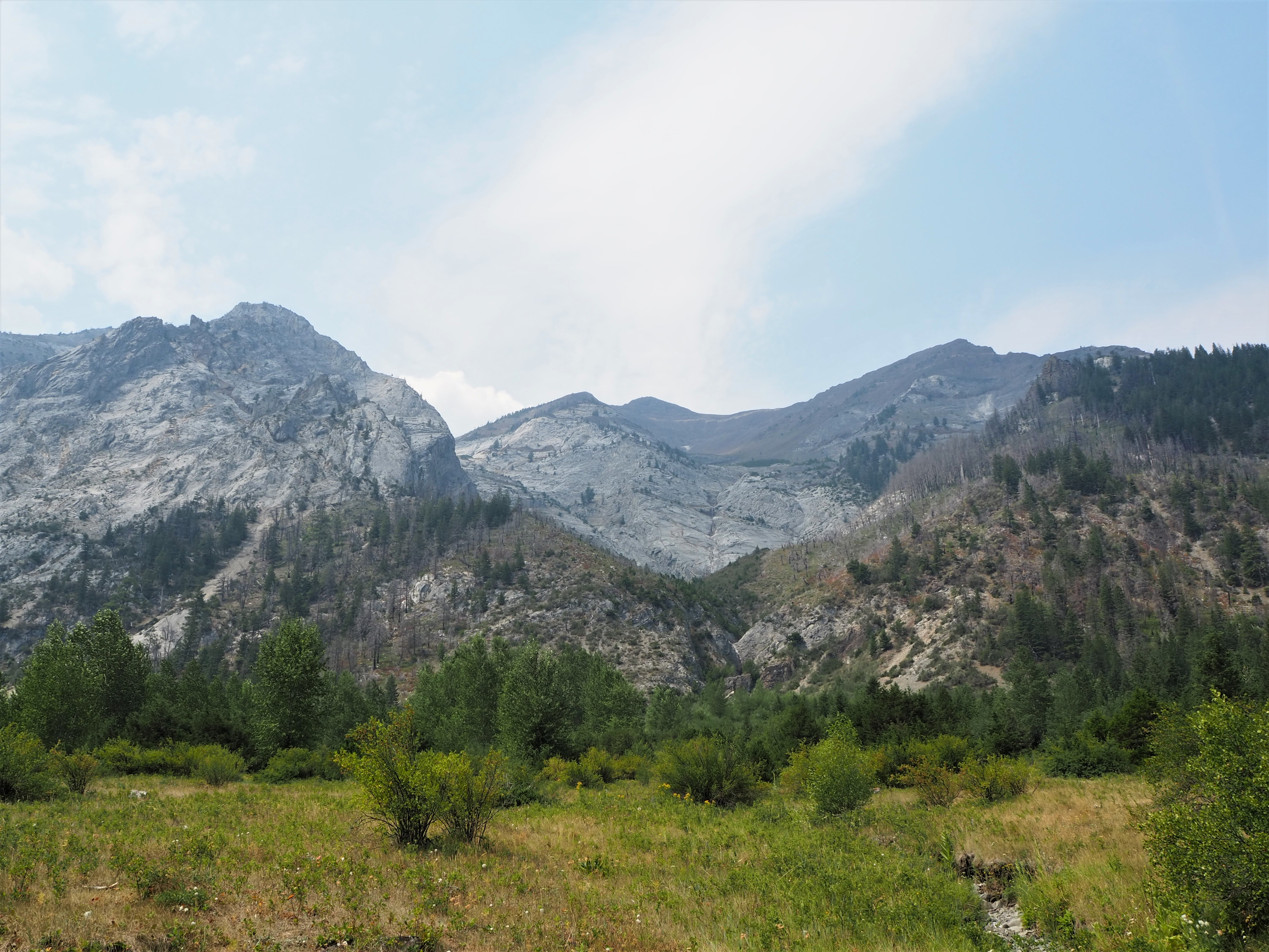
The Wallowas are home to the Eagle Cap Wilderness within the Wallowa-Whitman National Forest. It has been a designated wilderness since 1940 and currently encompasses 359,991 acres. There are approximately 535 miles of trails for hikers and horseback riders to discover solitude, picturesque alpine lakes, and exposed granite peaks. Although many of the trails are long enough to require an overnight backpacking trip, there are some that cater to the day hiker. I was set on hiking to an alpine lake, so while I picked out a few different trails, my top choice was Chimney Lake, a rather grueling 10-mile round-trip hike that climbed 2,300 feet.

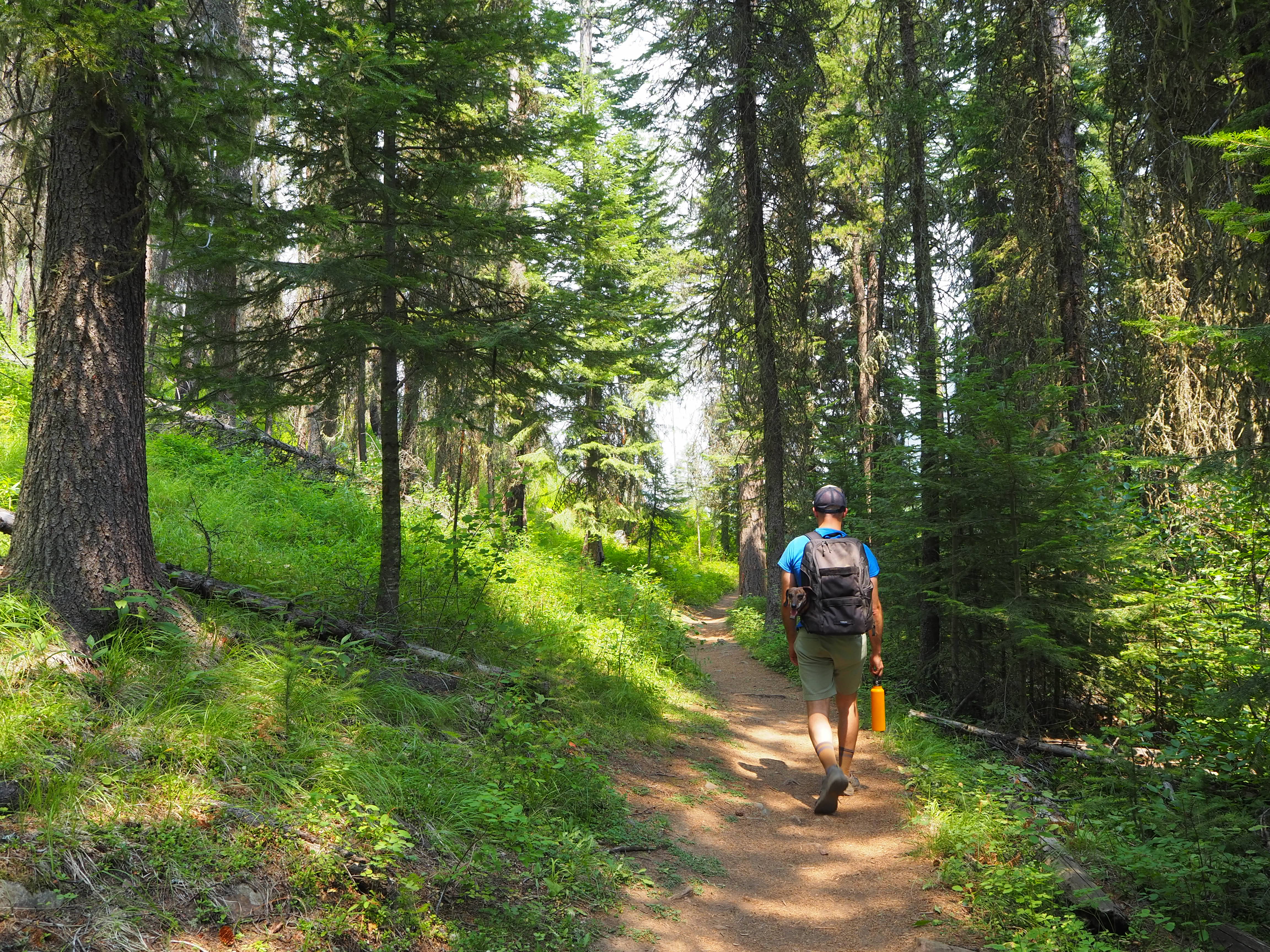
We intended to get an early start, so we were up shortly after 7 on Thursday. The trailhead was located off of FR 8210 which meant we needed to drive through Enterprise to Lostine and then into the forest. I did not anticipate that it would take quite so long though! We didn’t arrive at the trailhead until 9:30! So much for an early start. Thankfully, much of the trail was in the trees which offered up some relief.
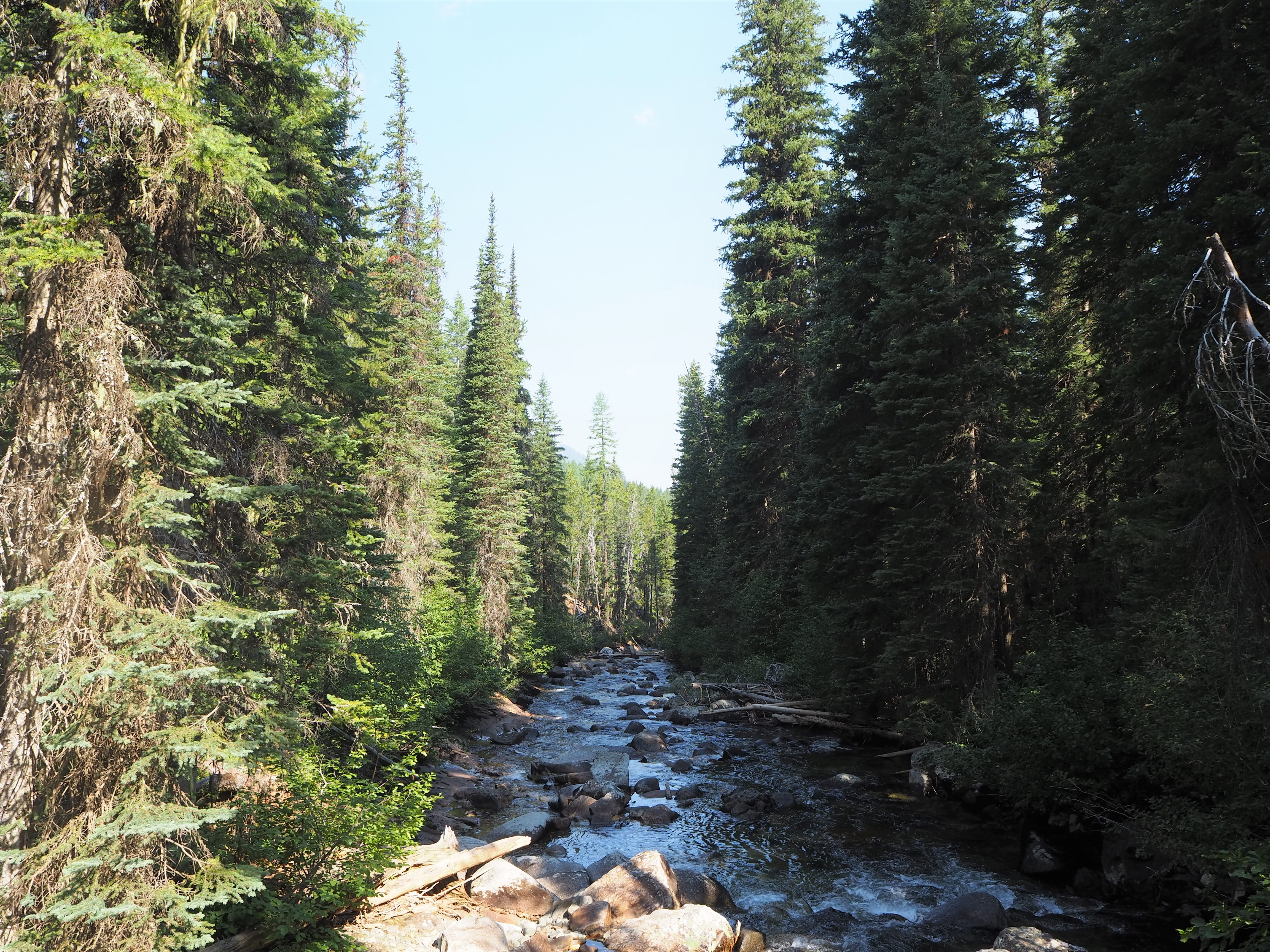
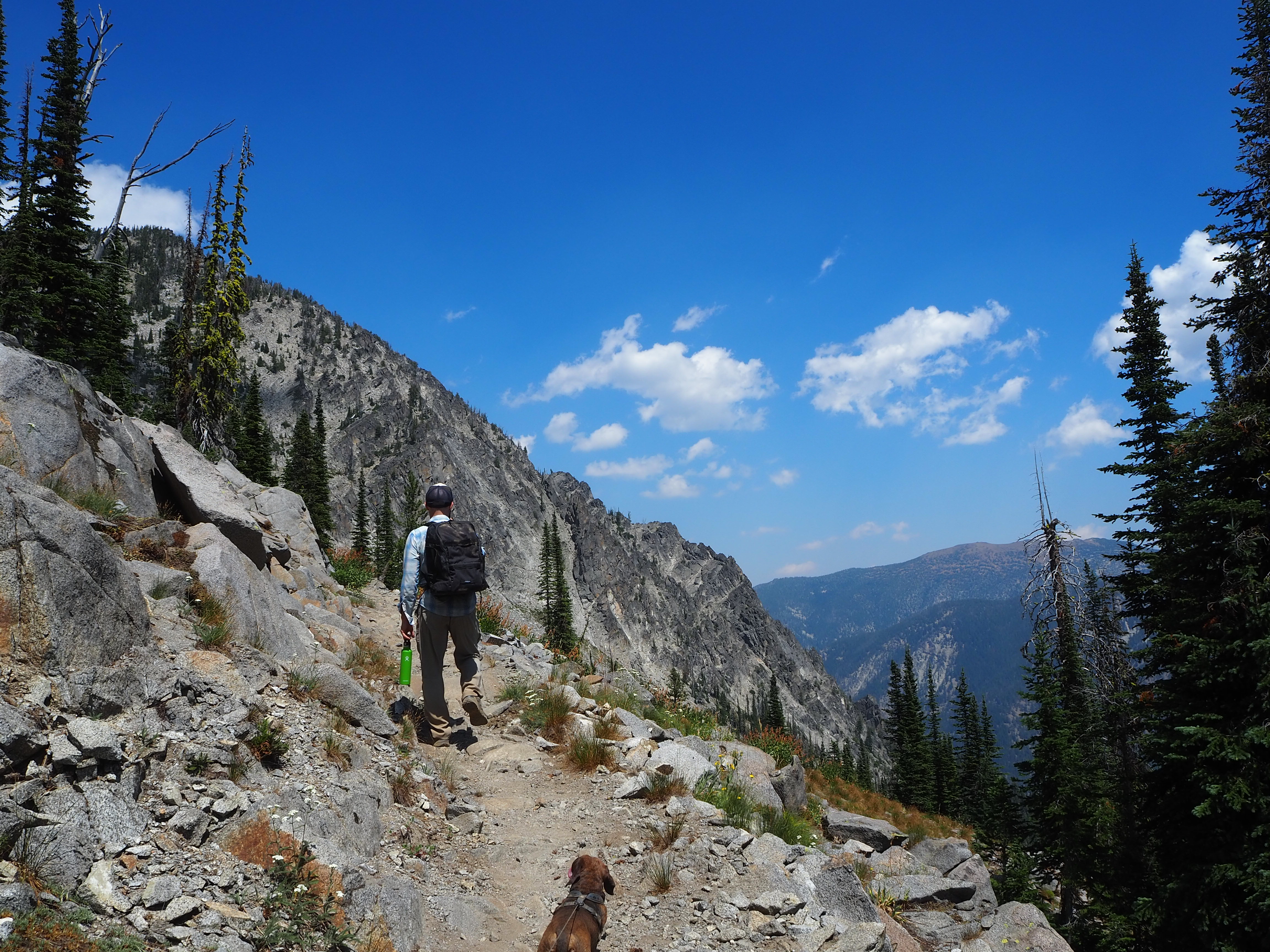
The trail crosses the Lostine River and immediately begins to climb up several long switchbacks. We gained just shy of 1,000 feet in the first mile and a half which was how far Tru made it before we tucked him in the pack. We continued our climb, surprised to see few other humans. Despite the steady ascent, the trail was already quite scenic with vistas popping up now and then as we wove through the forest.

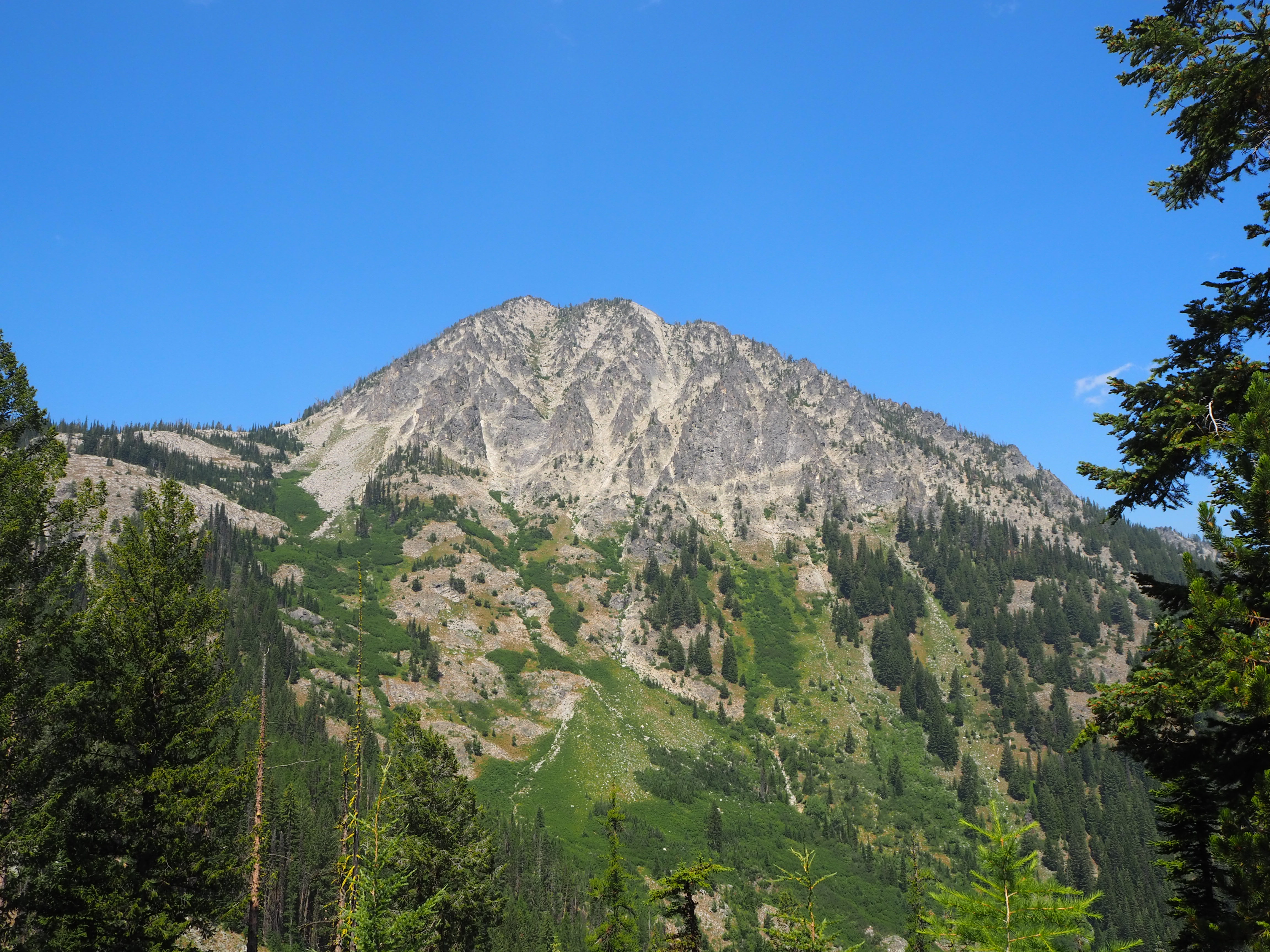
Once we reached 2,000 feet of climbing, the trail split for Chimney Lake. At that point, we had nearly reached the alpine zone. We were starting to emerge above the tree line and alpine flowers dotted the trailside. We encountered a few gorgeous vistas before reaching Laverty Lake, a pretty kidney-shaped pool backed by a towering granite wall. We were briefly tempted to stay there and scratch Chimney Lake – we were feeling the ascent and length of the trail.
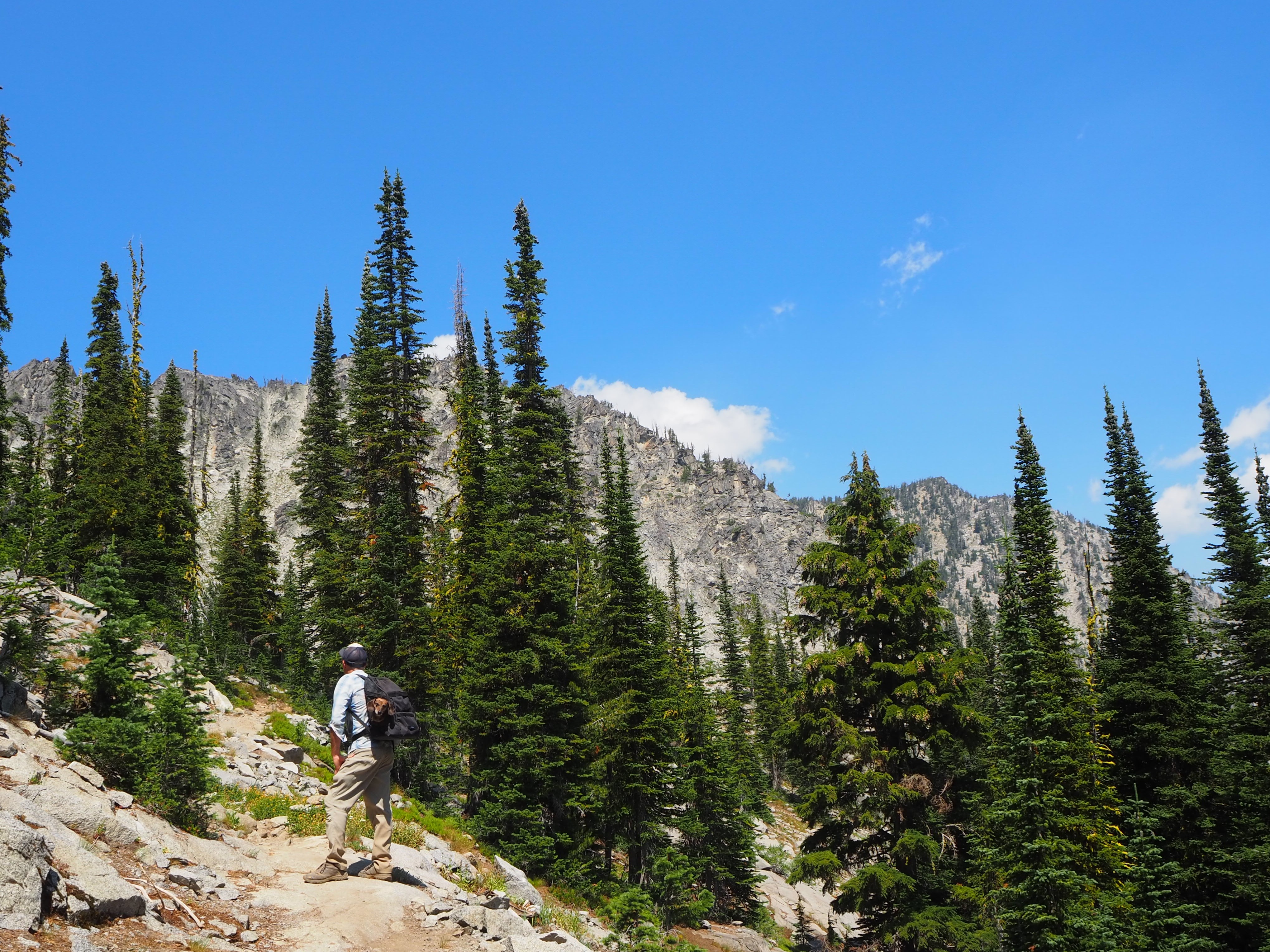
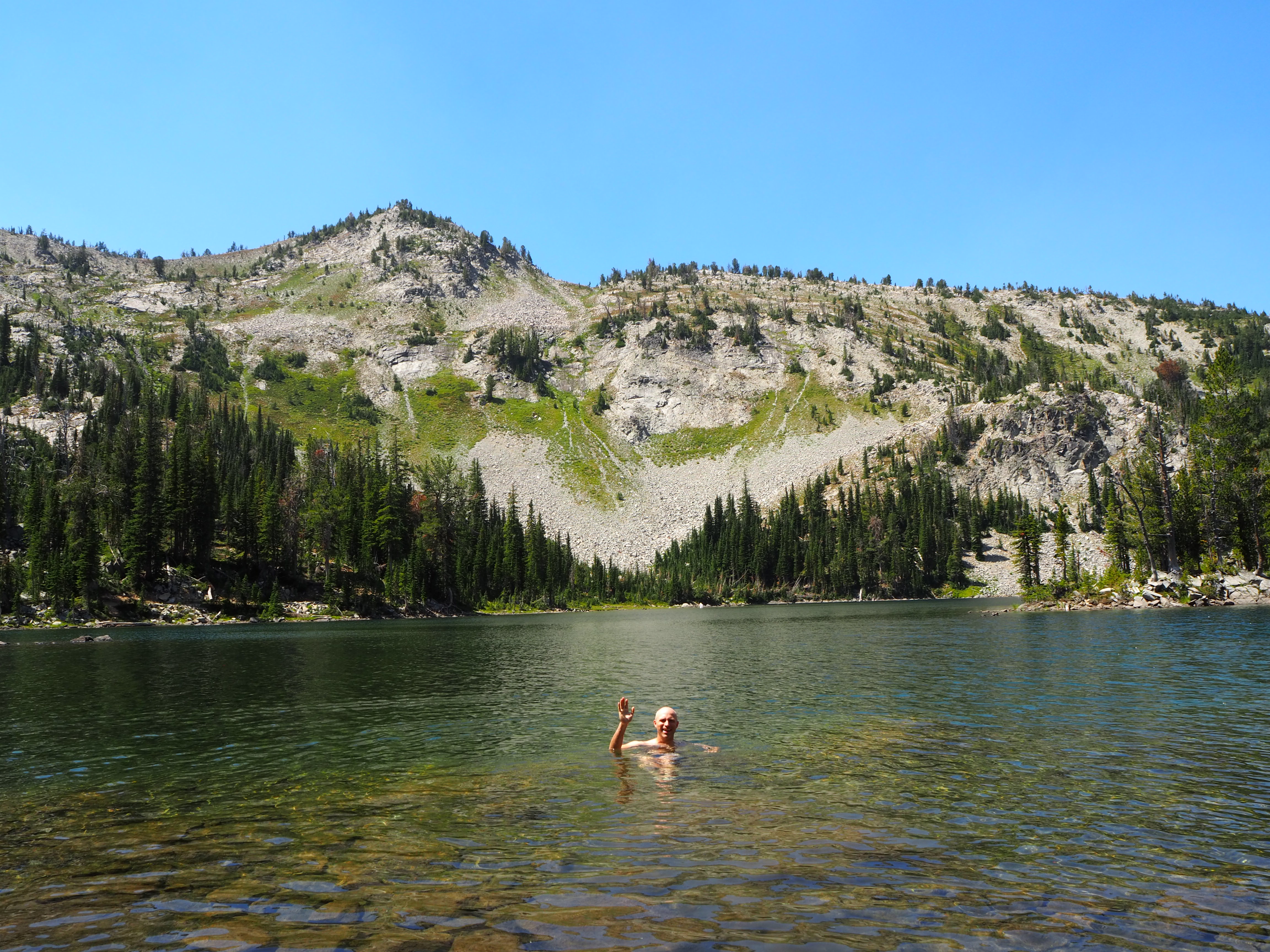
But with little more than half of a mile to go, we pressed on. We let Tru out of his pack and continued toward what looked to be a dead-end – the same granite wall that dammed the lake. As we skirted around the wall, we popped out onto a ridge and finally, to the neighboring basin which held Chimney Lake. Ecstatic and exhausted, we settled in for the next two hours.

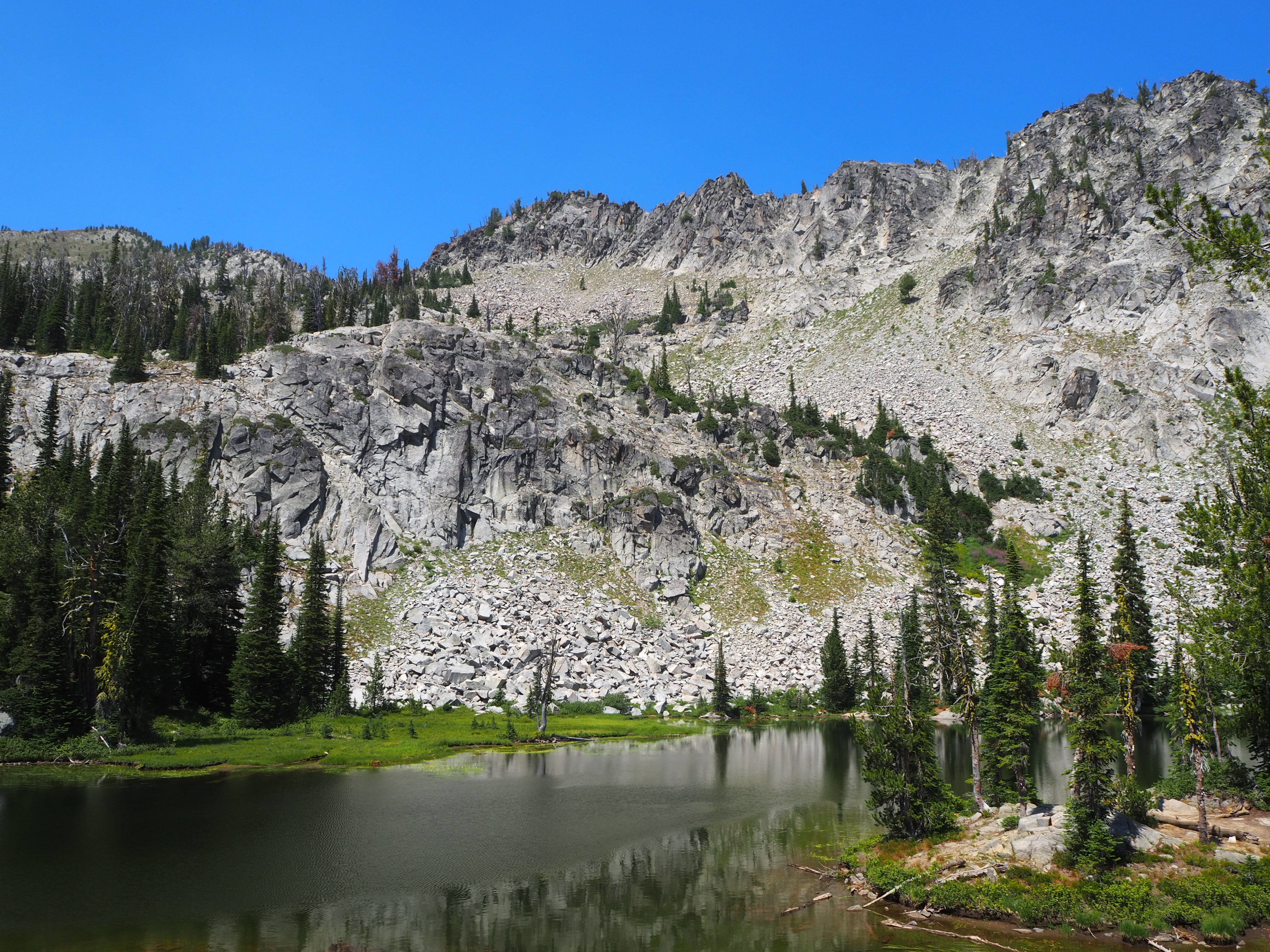
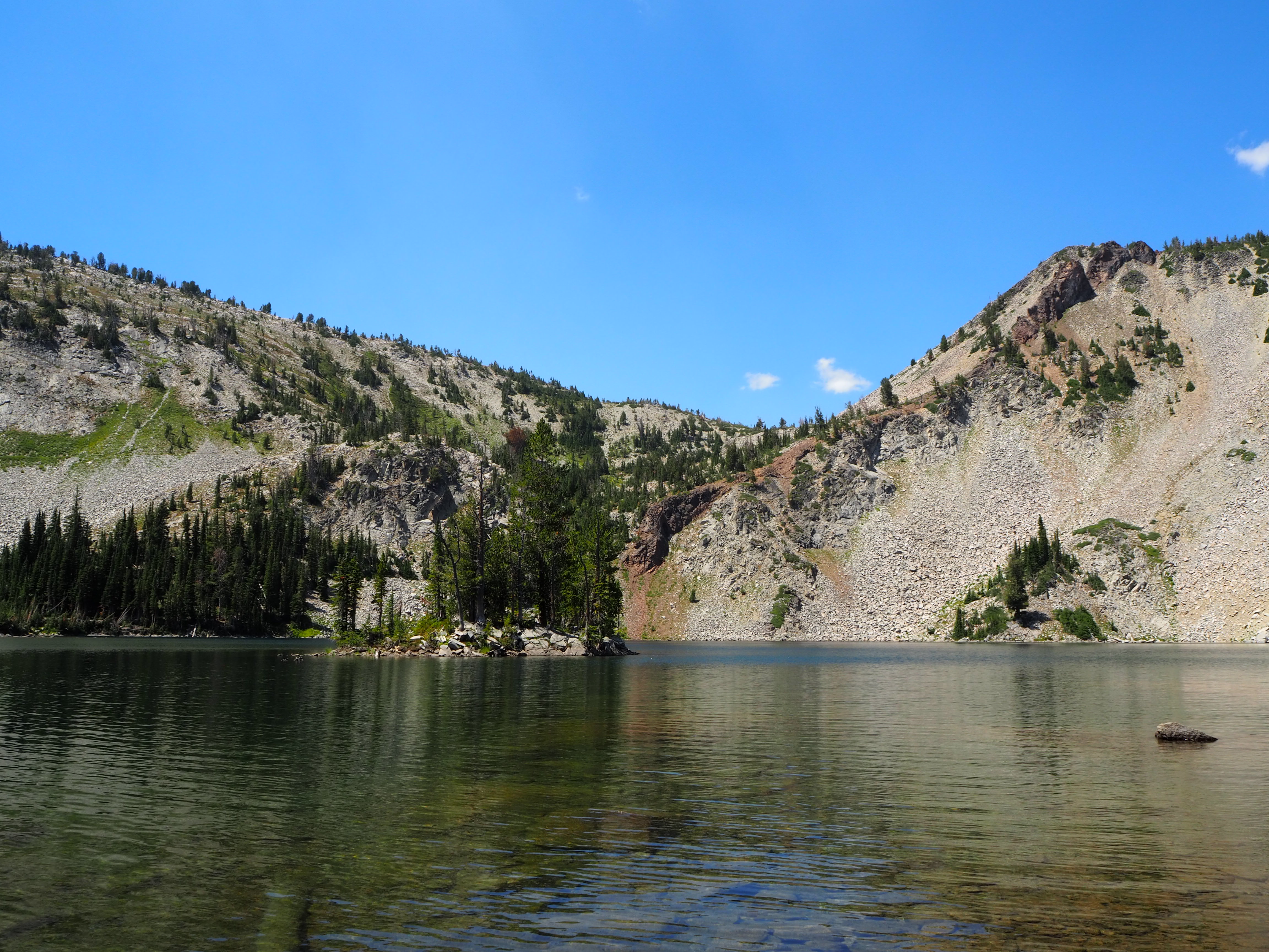
Chimney Lake rests at the bottom of a large bowl; chalk-white walls rise on three sides, enveloping the lake. The trail continues around the lake and up to a third and final lake. Zach had a swim, we ate lunch, and Truman traipsed along the shore. It was a wonderfully relaxing time and shockingly, we were all alone. Those are the moments that give me the most pause – when you can fully feel how small you are in the world and be at peace with it.
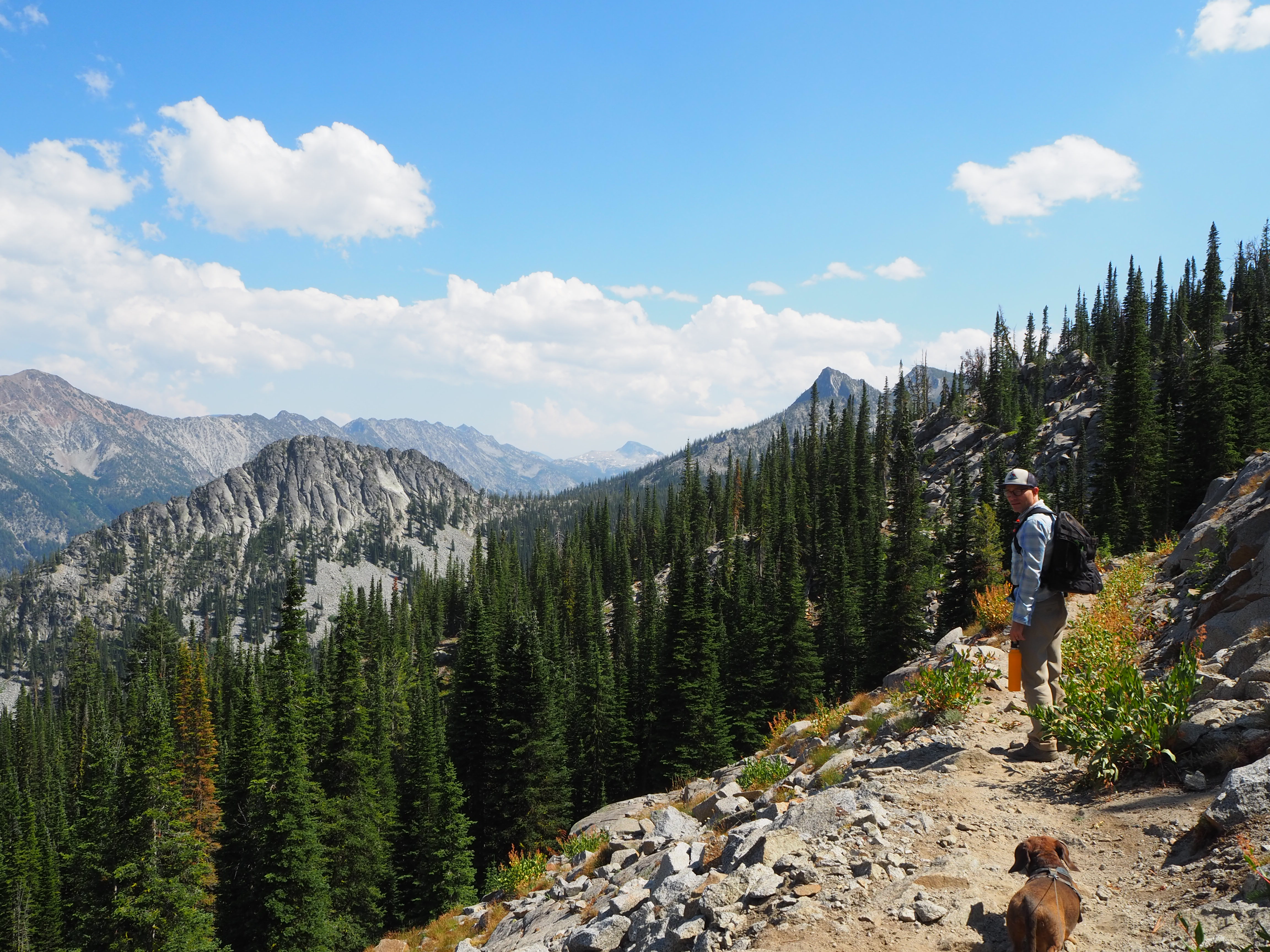
I felt a bit melancholy when we packed up to go. As usual, the hike down was much less grueling than the ascent. Truman hiked to the same spot where he first got in the pack, avoiding the final switchbacks but completing the entire trail, at least one way stitched together. When we began our hike, there was a slight haze in the sky but on our return from the lake, it had been blown clear, revealing crisp views of the valley below, the ridge opposite, and the Hurricane Divide in the distance. It was quite stunning and made for an exceptional descent!


One of the most important parts of any road trip is knowing where to find good beer and good coffee. I feel more lenient with the coffee bit – I can make do with tea – but not with poor beer. And after a long day hike, having a cold beer and a satisfying meal is essential. In Enterprise, Terminal Gravity Brewing is recognized as one of Oregon’s best breweries – which is saying something in a state like Oregon. As we logged those miles up to Chimney Lake and back down, capping off the day with a beer at Terminal Gravity was a big motivating factor. Since we hadn’t made reservations, there was a bit of wait, but that was easily conquered with an ice-cold pint from their walk-up window. I’m not sure what it was like pre-Covid, but the lawn is brimming with tables of varying sizes, shaded by umbrellas, creating a festive, communal atmosphere. Dogs and kids abound, giving the place a real casual feel. Once the sun set – so much earlier than in Boise! – it felt even more convivial.

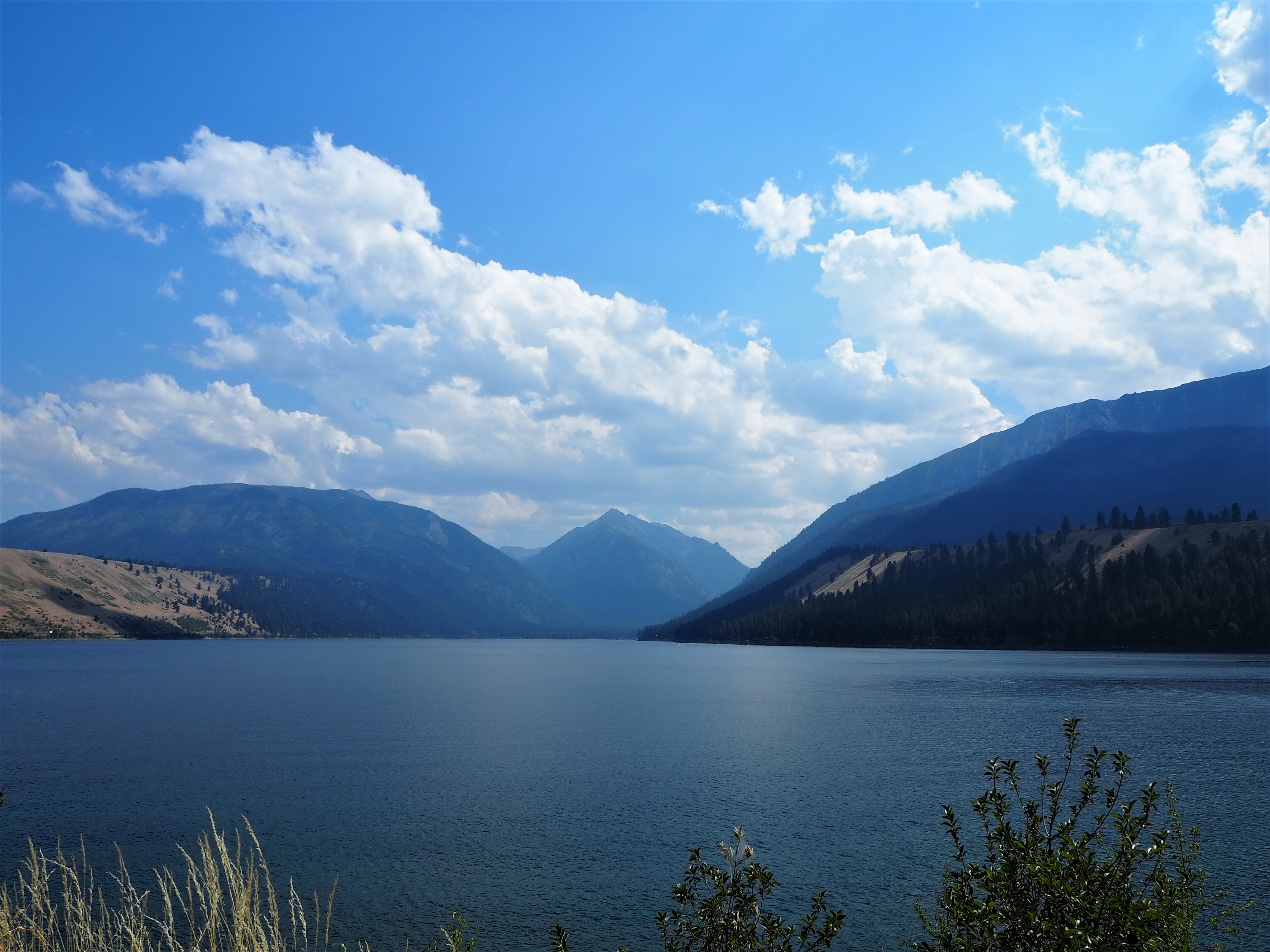
Friday was declared lake day! It was going to be fairly warm and we wanted to enjoy the splendor of Wallowa Lake. We took our time in the morning and made a nice potato and egg hash for breakfast tacos to fuel us. Wallowa Lake is a natural, glacially-carved lake. The moraines still border the lakebed. We felt fortunate to find a parking spot at the northern head of the lake. It was hard to tell if it was always so lively or if Chief Joseph Days made the difference. We heard from several people that the lake was lower than usual, so a rocky beach appeared beside the boat ramp and dock.

We launched our kayaks from the beach and paddled around the perimeter of the western side of the lake in an effort to avoid the boat traffic. There are several lake homes on that side and the water was relatively calm. We “docked” for a bit in the shade to ride the waves from passing boats and cool off. Truman mostly enjoyed his role as a passenger, switching kayak cockpits occasionally. When we returned to the day-use area, a picnic table had opened up. We claimed it for our lunch and took turns swimming in the lake. (Tru is not into swimming anymore.) In the early afternoon, we retreated back to our campsite to relax creekside where it was at least 10 degrees cooler than in town.


In the evening, we went back to Joseph to explore the town. Largely empty since the rodeo started, we enjoyed a warm but leisurely stroll down the main street. We decided to have dinner, choosing pizza at The Gold Room where there was a nicely shaded patio to the side. We splurged a bit and had cocktails (a refreshing watermelon mezcal margarita for me!) and fried shishito peppers and cauliflower, along with our Margherita pizza. Everything was divine, including the occupants of the table behind us who indulged Truman’s occasional outbursts and doted on him.


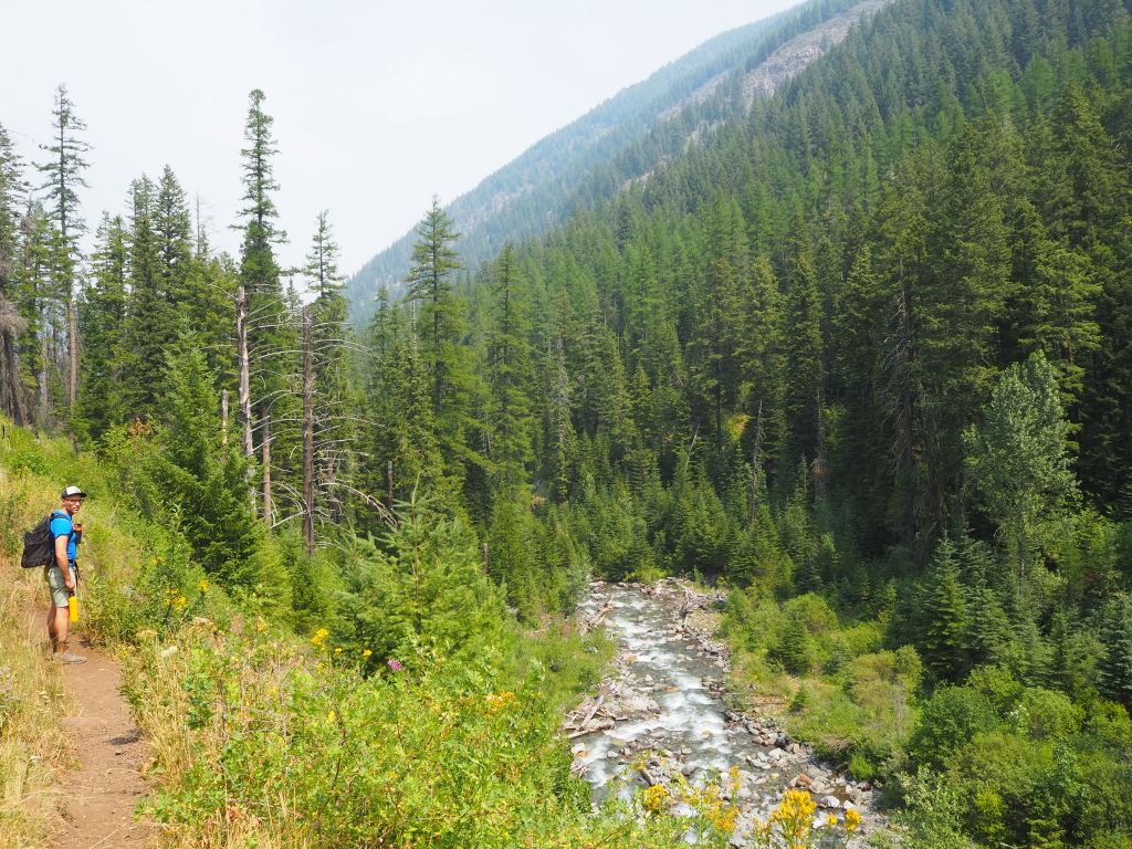
The next morning we ate leftover pizza and made our way to the Hurricane Creek trailhead, located down the road from our campsite. The forecast predicted rain later in the day and we hoped to avoid getting caught in a thunderstorm by hiking early. Instead of the other full-day hike I had planned, we opted to do two miles up the Hurricane Creek Trail.
The hike was lovely. The first part of the trail invited us into a lush, verdant forest with abundant shade and wildflowers. We passed through a burn scar and then into an open clearing. On a less hazy day, it would offer stellar views of Sacajawea Peak. All of the moisture in the air made it a hot and sticky hike, even with all of the shade. We stopped at two miles, as the trail was going to climb more intensely, and had a snack in the shade before heading back. Tru did a mile each way; we wouldn’t let him do the whole stretch for fear he would overheat. I would love to return and do more of this hike. It’s one of the main thoroughfares into the Eagle Cap Wilderness and we definitely saw more people than on our previous hike.


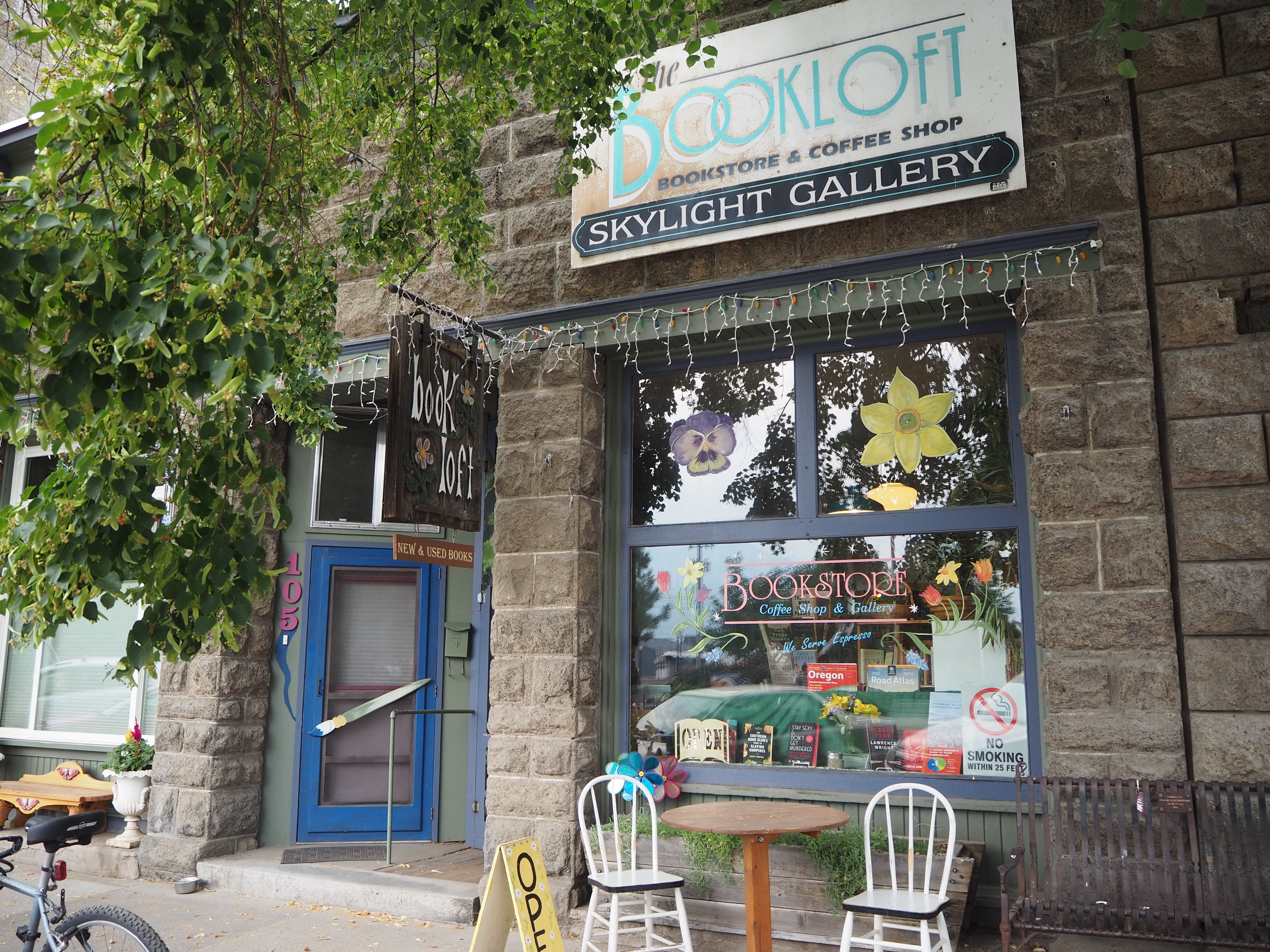
We returned to our campsite for lunch and then drove into Enterprise. I wanted to visit their bookstore – The Book Loft – and we planned to return to Terminal Gravity once more. The Book Loft was small, cozy, and immensely charming. I really enjoy visiting local bookstores when we travel because I like examining their curated selections. You can tell a lot about a place based on the selection of authors and novels. Plus, I like to see what kind of regional selections there are. The Book Loft had an excellent inventory which is why I walked out with two books instead of one.
We were surprised to find Terminal Gravity busy even at an off-peak time. Although maybe others had also cut their adventuring short in anticipation of the rain. This time we were able to forgo the wait and order beers with chips and salsa from the walk-up window. We passed an hour or two there, even as the rain began to prick the umbrella above our heads. As we returned to our campsite, the rain began in earnest. We pulled down our drying items and took refuge under the leafy canopy which kept us dry enough to make dinner.

When the rain began to soften, Zach suggested driving into Joseph for ice cream. After our cones, we paid a visit to Old Chief Joseph’s gravesite near the lake. Moved to its current location in 1926 after repeated robberies, he was originally buried between the forks of the Wallowa and Lostine rivers after his death in 1871. During his tenure as leader, he refused to sell the Wallowa valley or sign the 1863 Treaty with the US government.
We had expected thunderstorms overnight and into the morning but were spared. Light rain pattered against the tent in the early morning but had mostly subsided by the time we got up. I was grateful that our things remained fairly dry – there’s nothing worse than packing up a drenched tent. We cleared our site and drove into Joseph once more. The rain had brought the temperatures down enough that we could leave Tru in the car while we enjoyed breakfast at the Old Town Cafe.

Full and caffeinated, we set off for what we thought would be our next stop – the Umatilla (pronounced YOU-ma-tilla) National Forest, only a two-hour drive from Joseph. Yet, when we arrived at the turn that would lead to a campground, we were met by a volunteer who told us not just the road but the ENTIRE national forest was closed. (There were several fires in the Umatilla NF and the entire northern section of the Blue Mountains ended up closing to the public.) Scrambling, we realized we were fairly close to Walla Walla, Washington so we decided to head there. Eventually, since we had reservations in northern Idaho later in the week, we decided to camp in a national forest outside of Moscow, Idaho. As we drove through Washington and back into Idaho, the smoke-infested skies were depressing, flattening the light and casting a dull sheen on the landscape.
When we arrived at Little Boulder Campground, we basically had our run of the place. There were two other campers and a camp host. On the map, the Potlatch River ran by the campground. Although true, it was a little spit of a river and didn’t look very appealing. The campground was rather nice though with spacious sites and an atmosphere perfect for my current read – Rebecca. However, my spirit was already in the process of breaking. When we drove into Moscow to check the weather and smoke outlook, it wasn’t great. Already in the orange category, red was predicted moving forward, even up in Sandpoint and the Priest Lake area (our next destinations). It didn’t seem worth continuing the trip in such poor and unhealthy air quality, so we called it. We left the next morning and drove back to Boise, culminating our attempt at a summer vacation.

Categories: North America, Oregon, USA
