A couple weekends ago we made our first foray down I-15 to central southern Utah. It seems kind of absurd that we hadn’t gone to that part of Utah yet, but Zion and Bryce Canyon National Parks are just far enough from Salt Lake to warrant a three or four-day weekend to get in a decent trip, and we’ve been busy jetting around to other places. Plus, I’m not interested in going south during the summer. So we decided to make the trip to Capitol Reef National Park, the least well-known of Utah’s “Mighty 5” national parks, while the weather was still pleasant.
We left Salt Lake at 6:30am on a Sunday morning and arrived in Torrey, the town on the park’s edge, around 10:15am – not bad! It may seem crazy to visit the park as a day trip, but we grew so accustomed to long drives in Texas, especially West Texas, that it felt like nothing, and it was completely worth it to spend a day in the park.
We rolled into Torrey without any plan or provisions, so we stopped at the Chuckwagon General Store to buy some snacks for the day, and then drove into the park. Six miles from the entrance, we stopped at the Visitor’s Center to obtain maps and postcards – a necessity of any trip. I overheard a ranger give a couple hiking recommendations – Capitol Gorge and Hickman Bridge – and we tucked those in the back of our minds. We had no real objective for the day. We just wanted to do a couple hikes and see a decent portion of the park – simple!
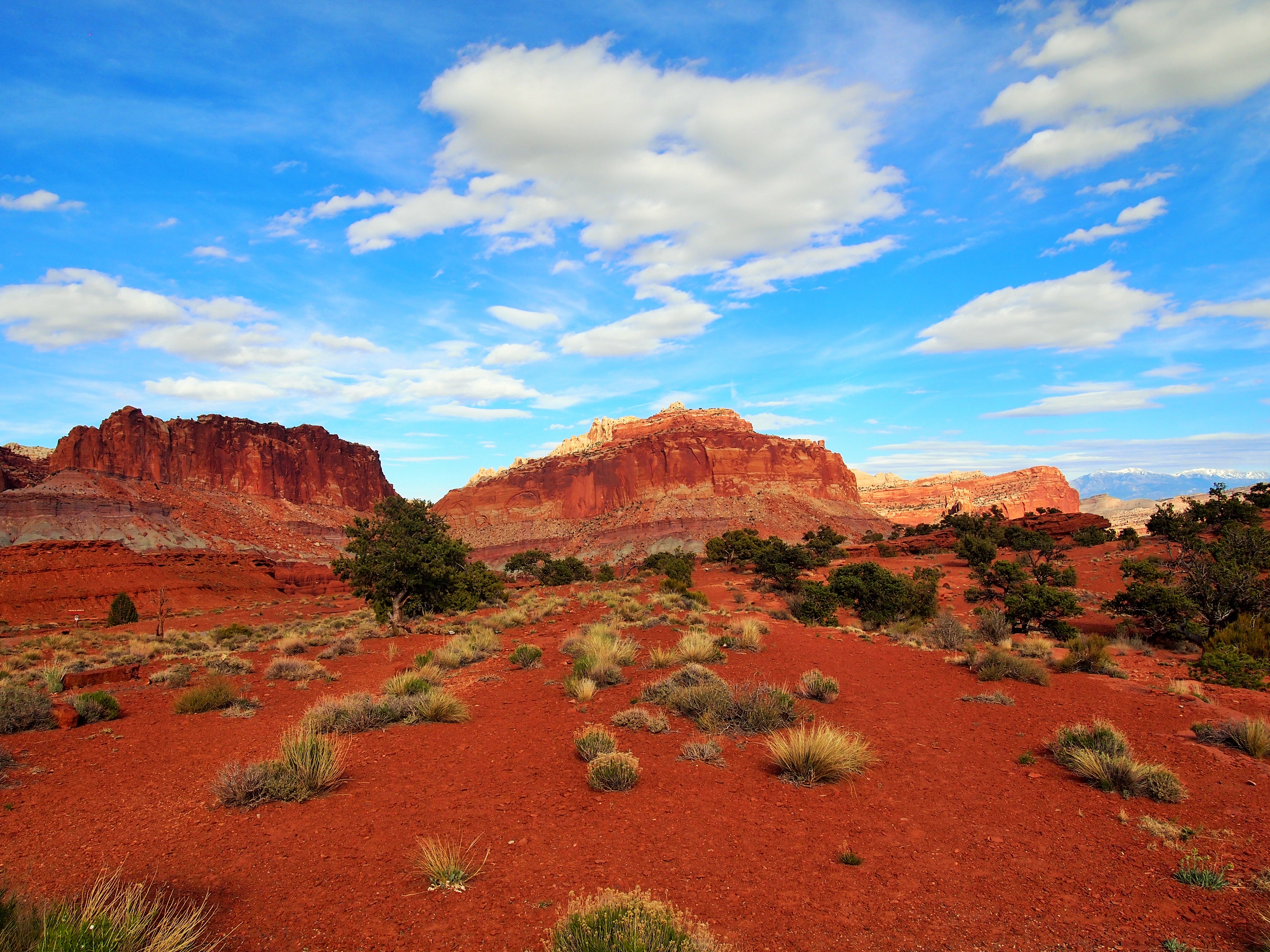
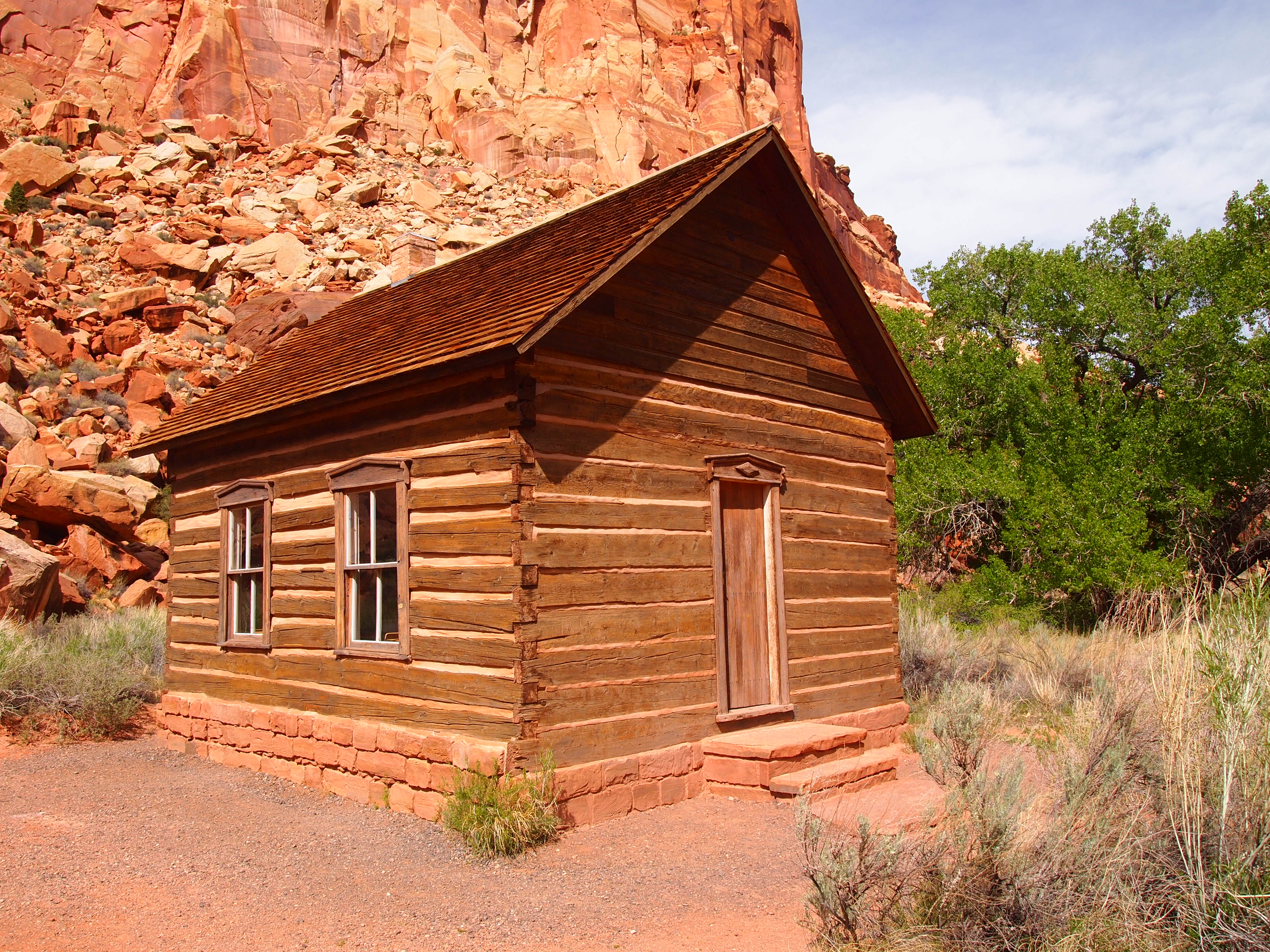
Capitol Reef is larger and more spread out than I realized, and there are sections of the park that aren’t as easily accessible from Highway 24. We concentrated our efforts on Fruita, the historic heart of the park. Although many have left their mark on the region – Fremont Culture and pioneers travelling west – the Mormon pioneers settled Fruita in the 1880s creating a self-sustaining community. Along the banks of the Fremont River, they planted orchards and cleared pastures for grazing. Originally named Junction, the community changed its name to Fruita after the prosperity of their fruit orchards gained them regional renown. The community remained small and isolated. The distance between Torrey and Fruita, 10 easily traveled miles via a smooth paved road today, took an hour and half at the turn of the century. Today, the Fruita orchards are considered part of the historical landscape of Capitol Reef and are maintained by the park service.

Fruita


Fruita is a breathtaking area. The bright spring green of the orchards contrasts so sharply with the red rock of the canyon walls that it produces an astounding sight. Although many of the residential buildings in Fruita were demolished, the Gifford House, a barn, and a schoolhouse still stand on the property. We stopped at the Gifford House after our first two hikes and bought some delicious homemade ice cream along with some apple butter, my favorite. We later stopped by the old schoolhouse which has been restored and staged as it would have been in the 1930s.
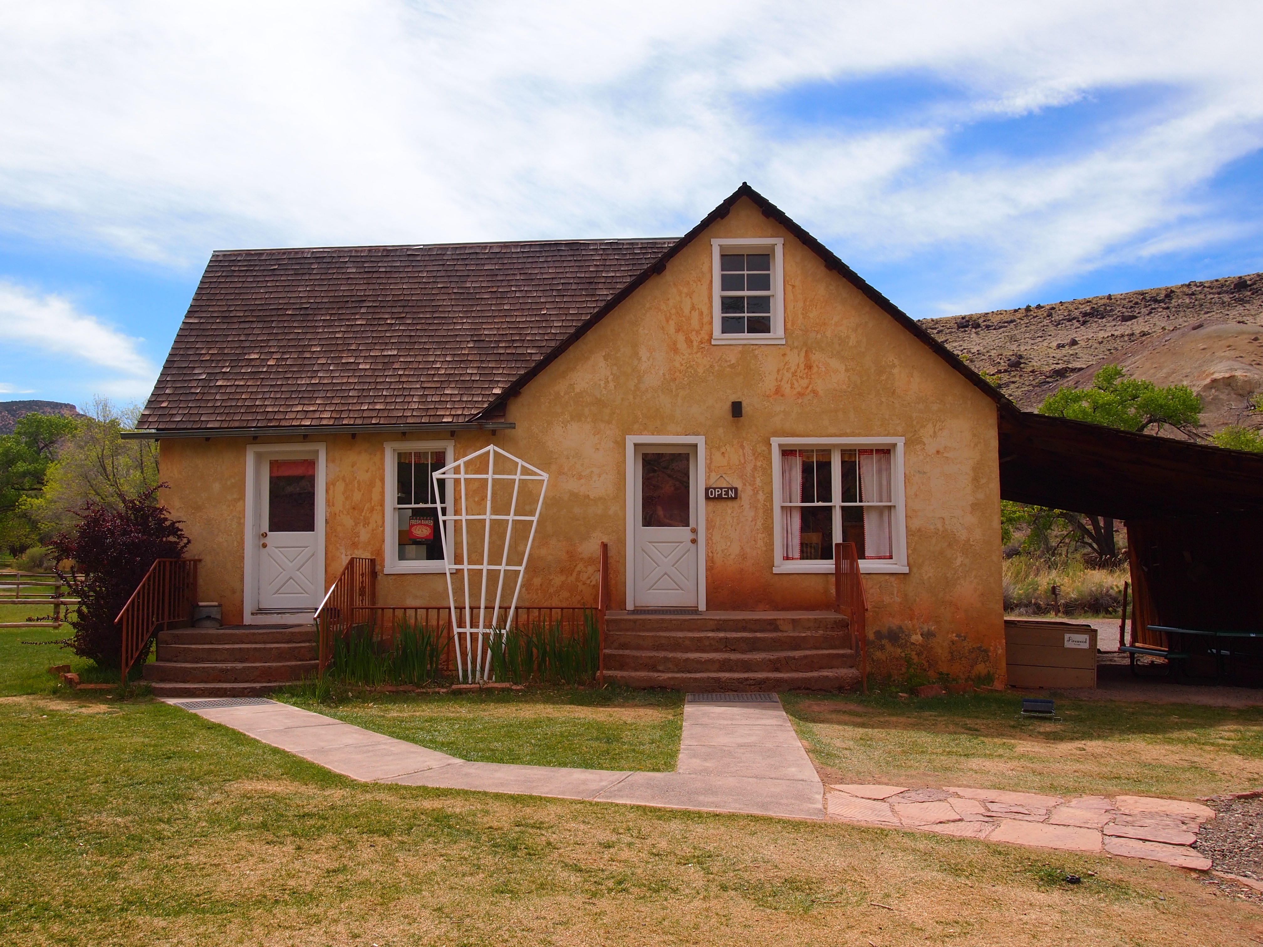
Gifford House

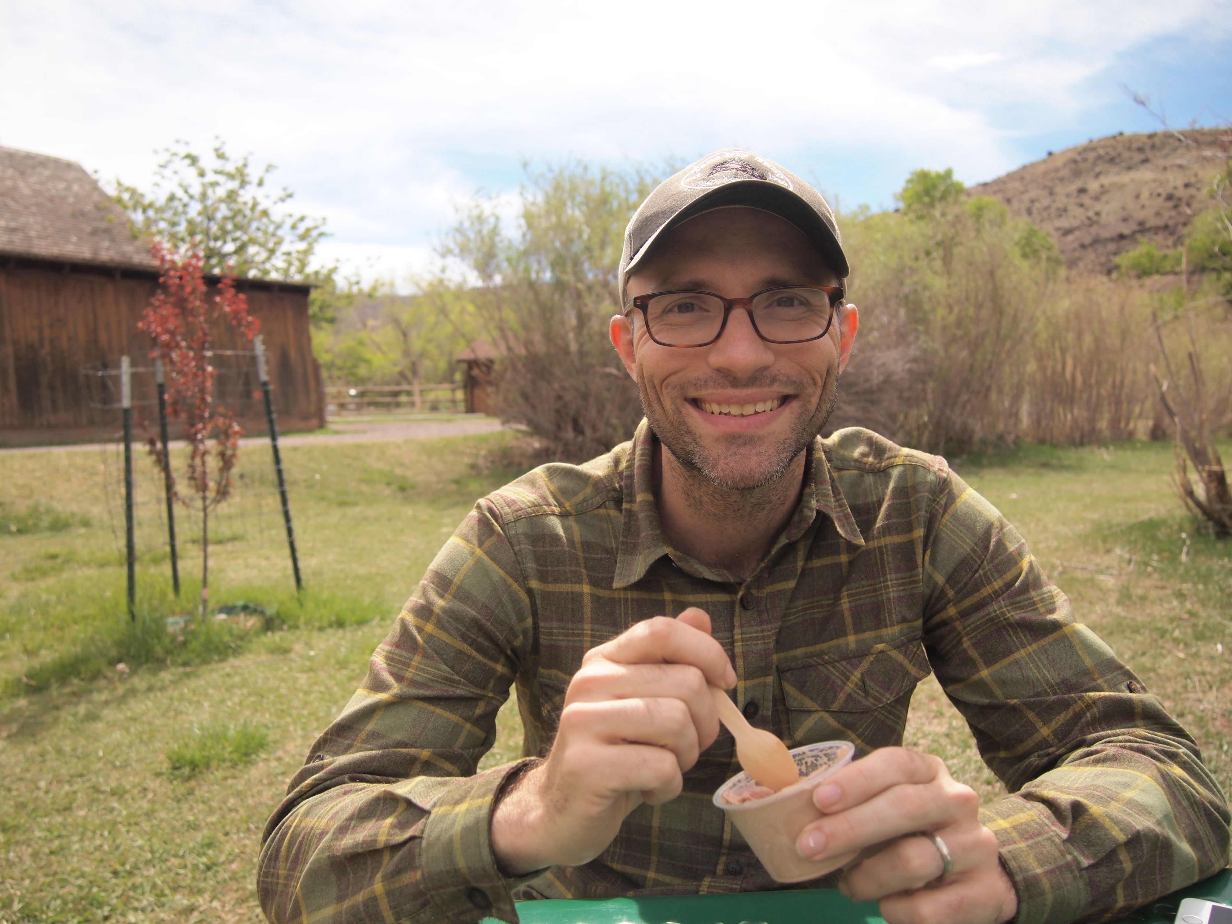
Enjoying ice cream
Schoolhouse
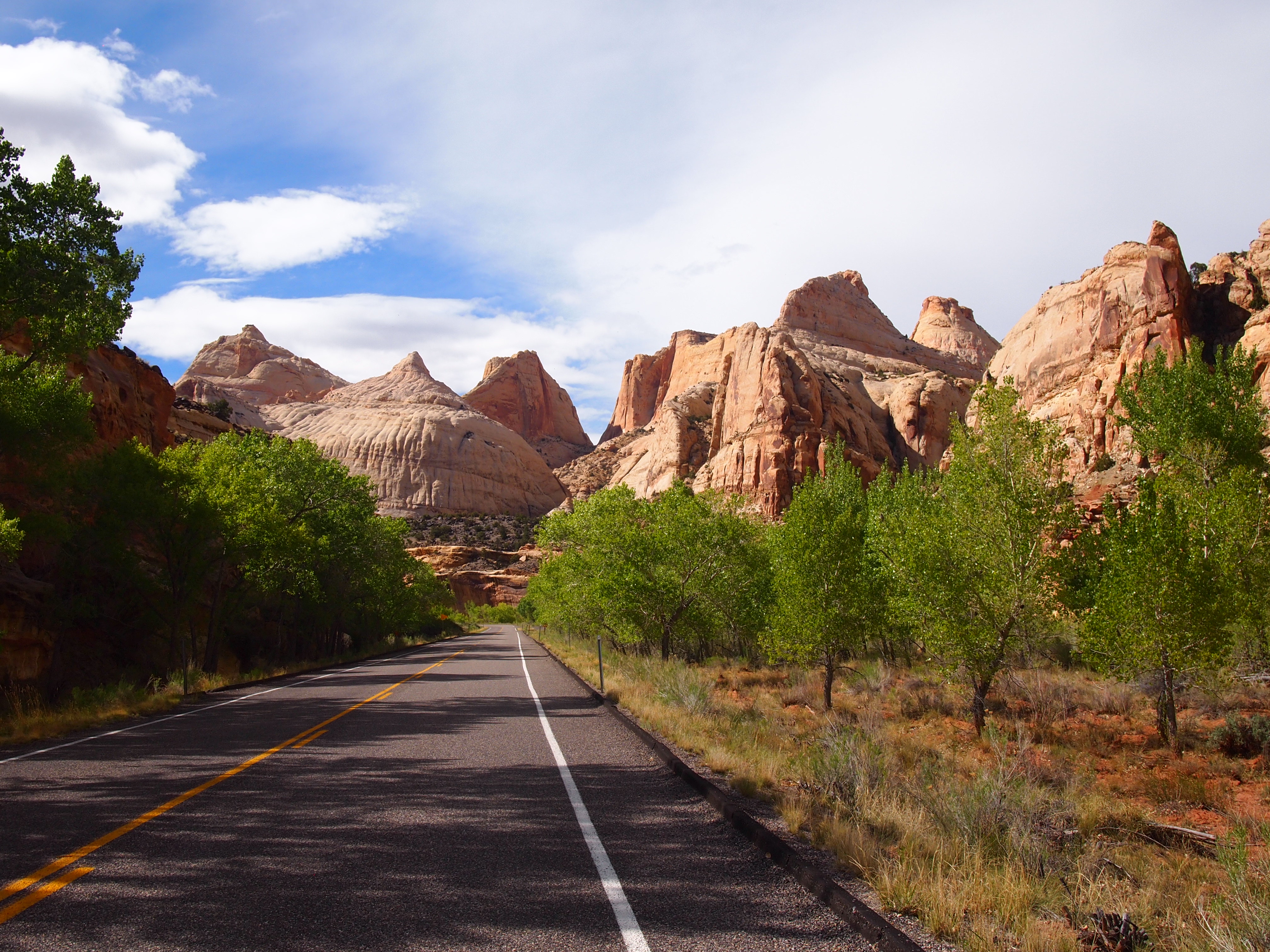
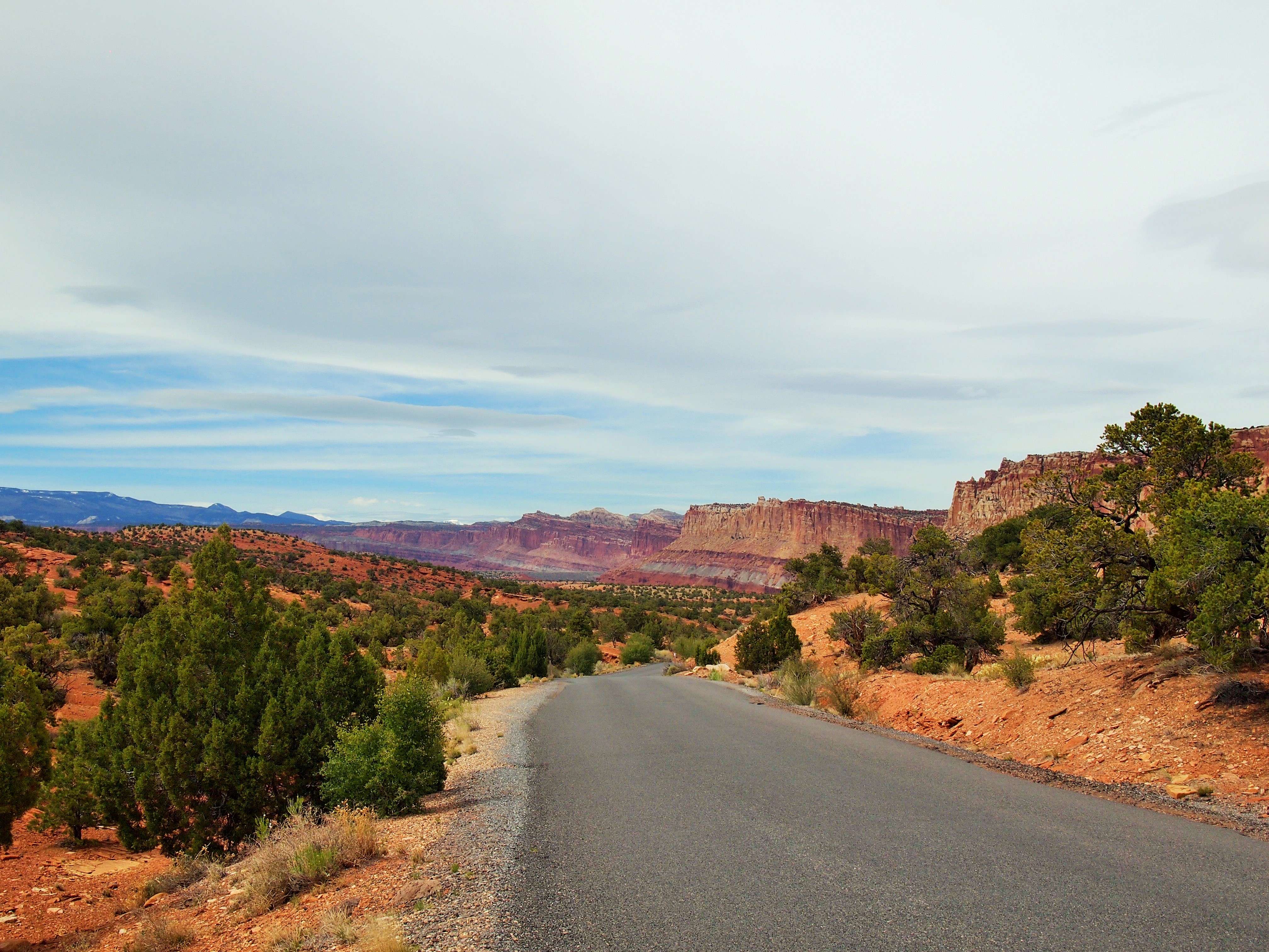
After leaving the Visitor’s Center, we decided to drive southeast along the 8 mile Scenic Drive which follows part of the park’s most distinctive feature, the Waterpocket Fold. The Fold is a monocline which the park brochure describes as a wrinkle in the Earth’s crust. It is nearly 100 miles long and the basis for the ‘reef’ part in the park’s name. From a distance, the Waterpocket Fold appears as an intimidating barrier, much like a reef in the sea.

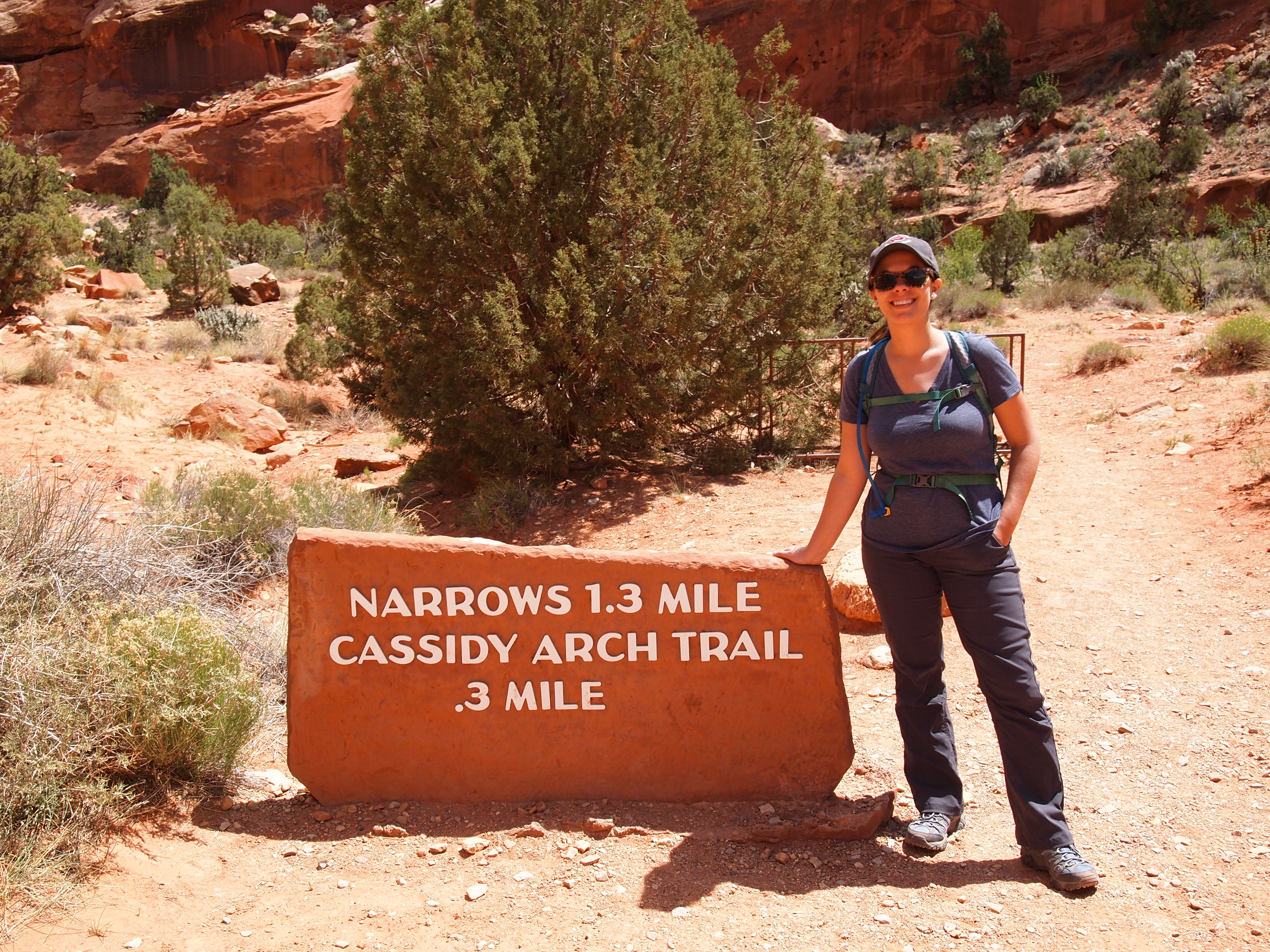
After 3.5 miles we pulled off the drive and onto Grand Wash Road, an unpaved road which leads to two trailheads, Cassidy Arch and Grand Wash. We decided to do Cassidy Arch as our first hike of the day, a pleasant 3.4 mile trek. The arch is named for Butch Cassidy who is rumored to have used Grand Wash as a hide out from time to time. The trail has an elevation gain of 670 ft. which is mostly at the beginning; then it levels out and follows the rim around to the arch. The trail becomes all slickrock at the end and following the cairns becomes essential to make it to the arch. When we arrived there was only one other couple at the arch – that would never be the case at Arches NP!

Grand Wash Road

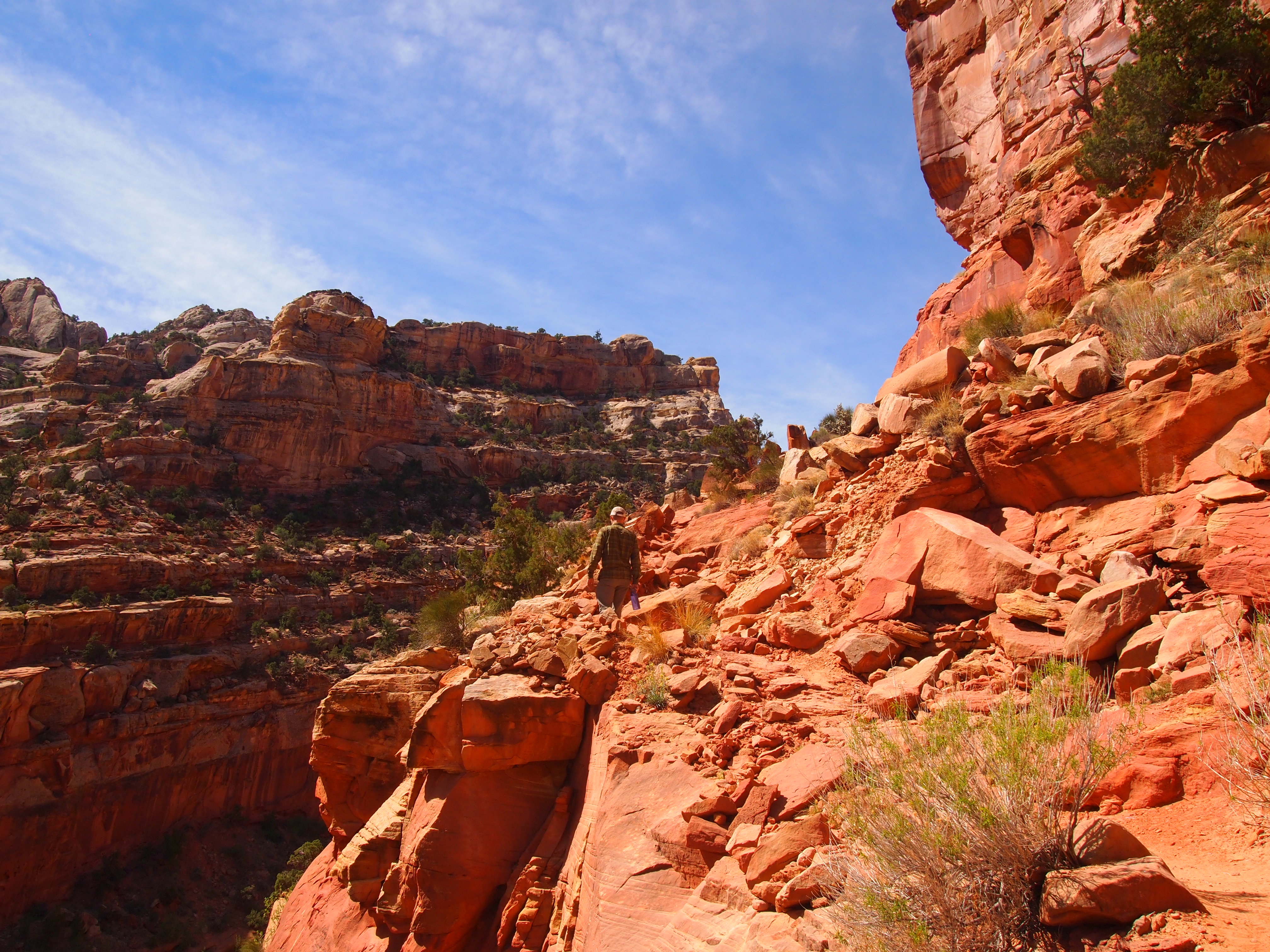
Follow the rim
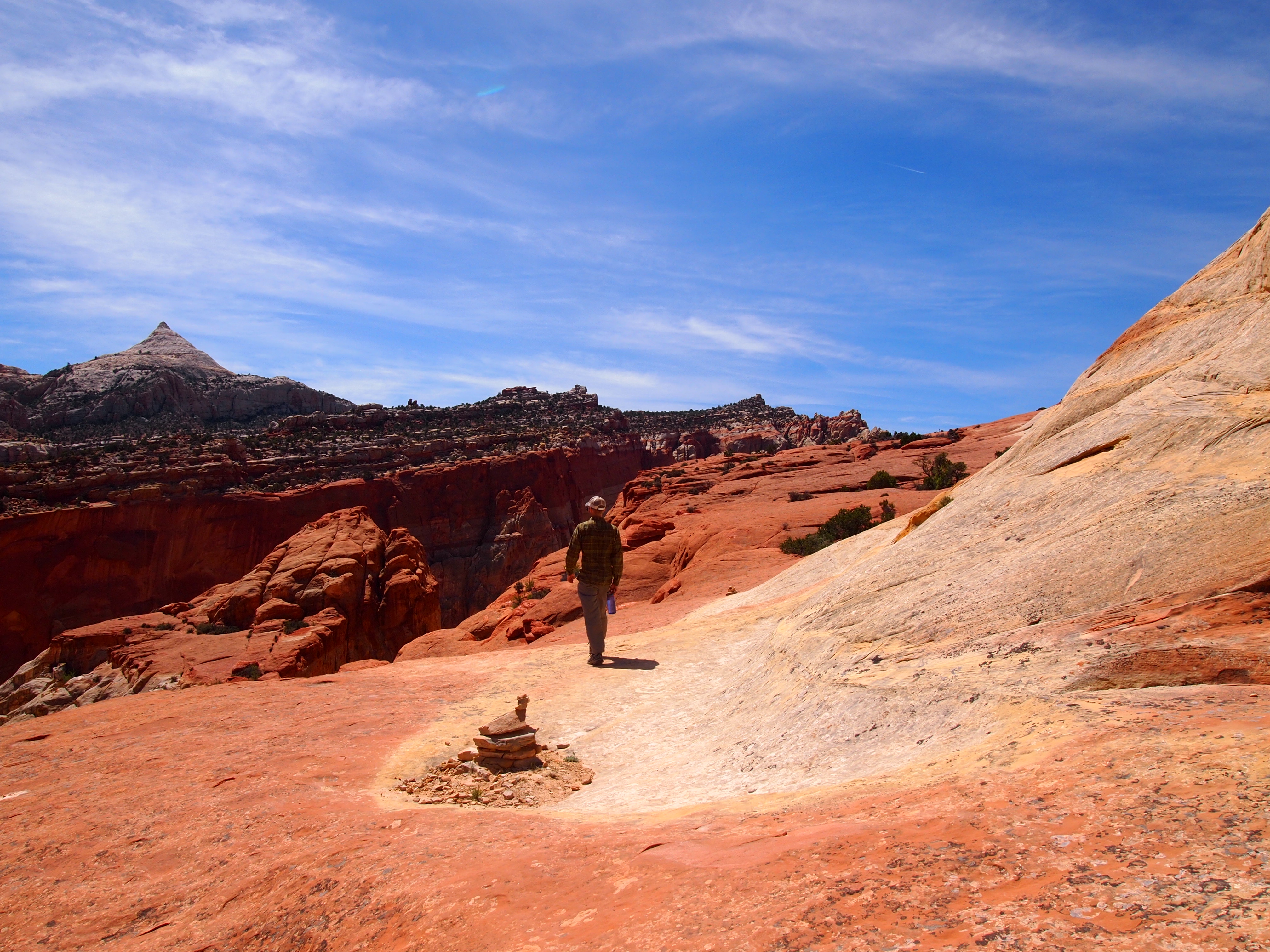
Follow the cairns
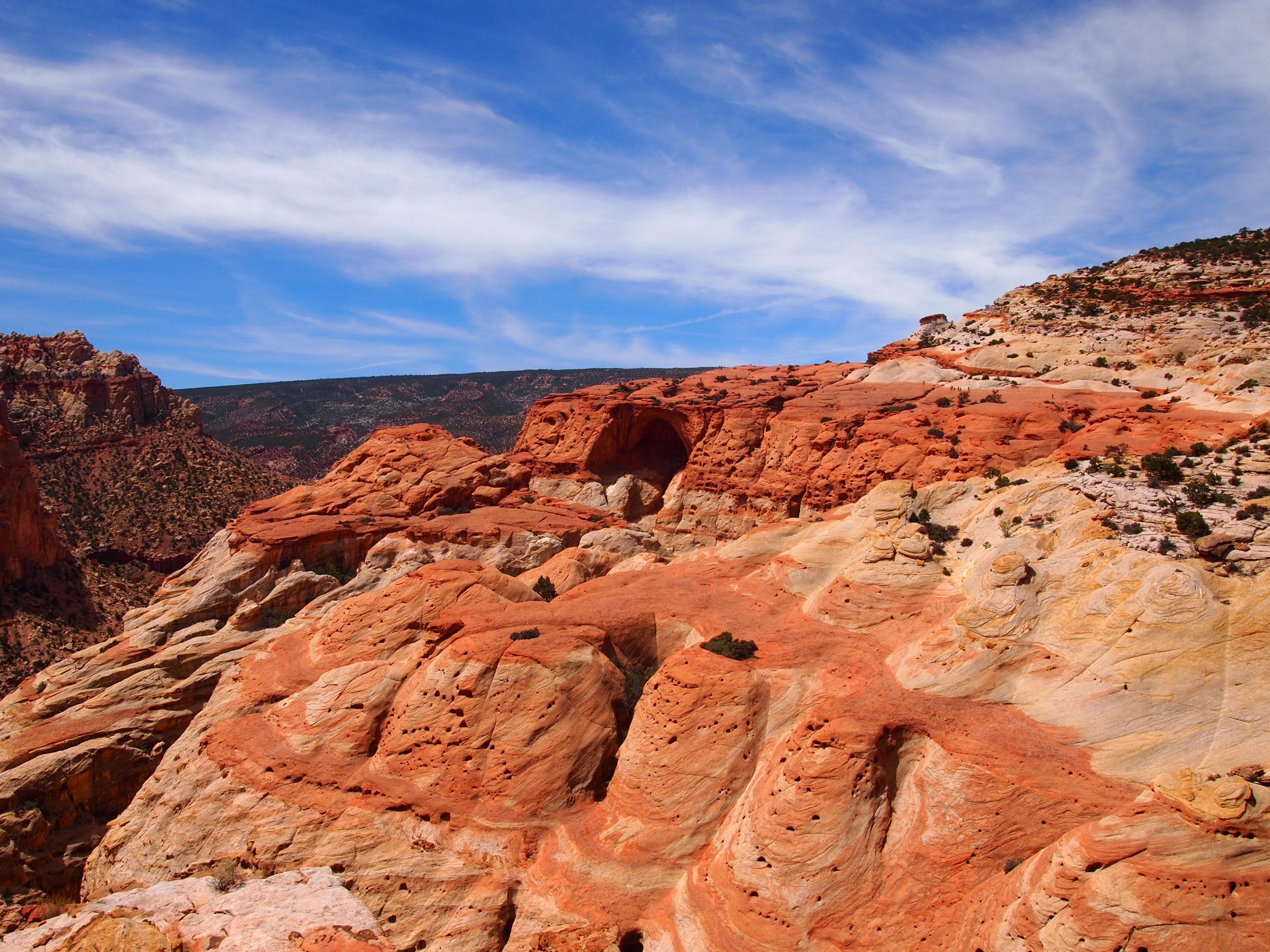
There she is
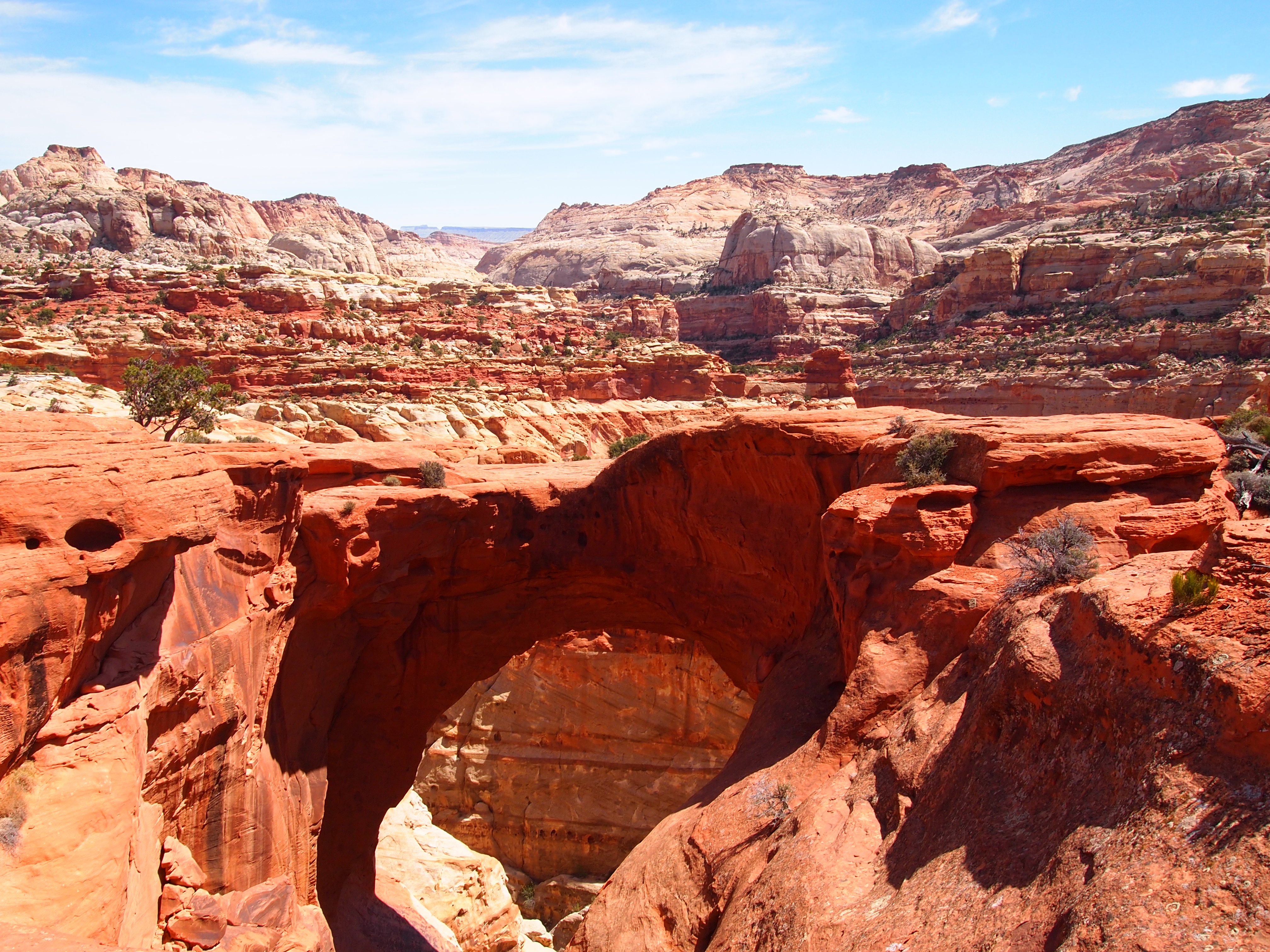
Cassidy Arch


Grand Wash Road meeting Scenic Drive below

Cliffs tower above us in the Grand Wash
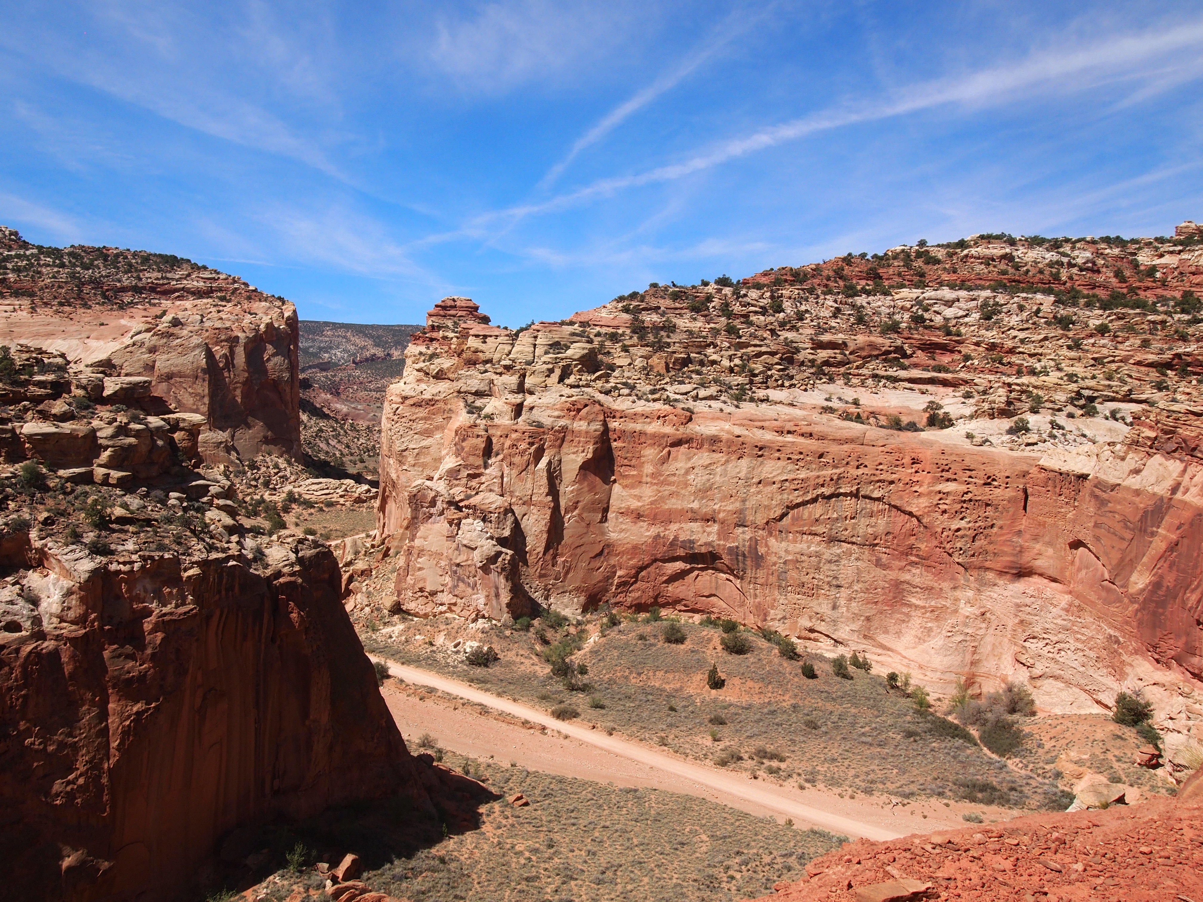
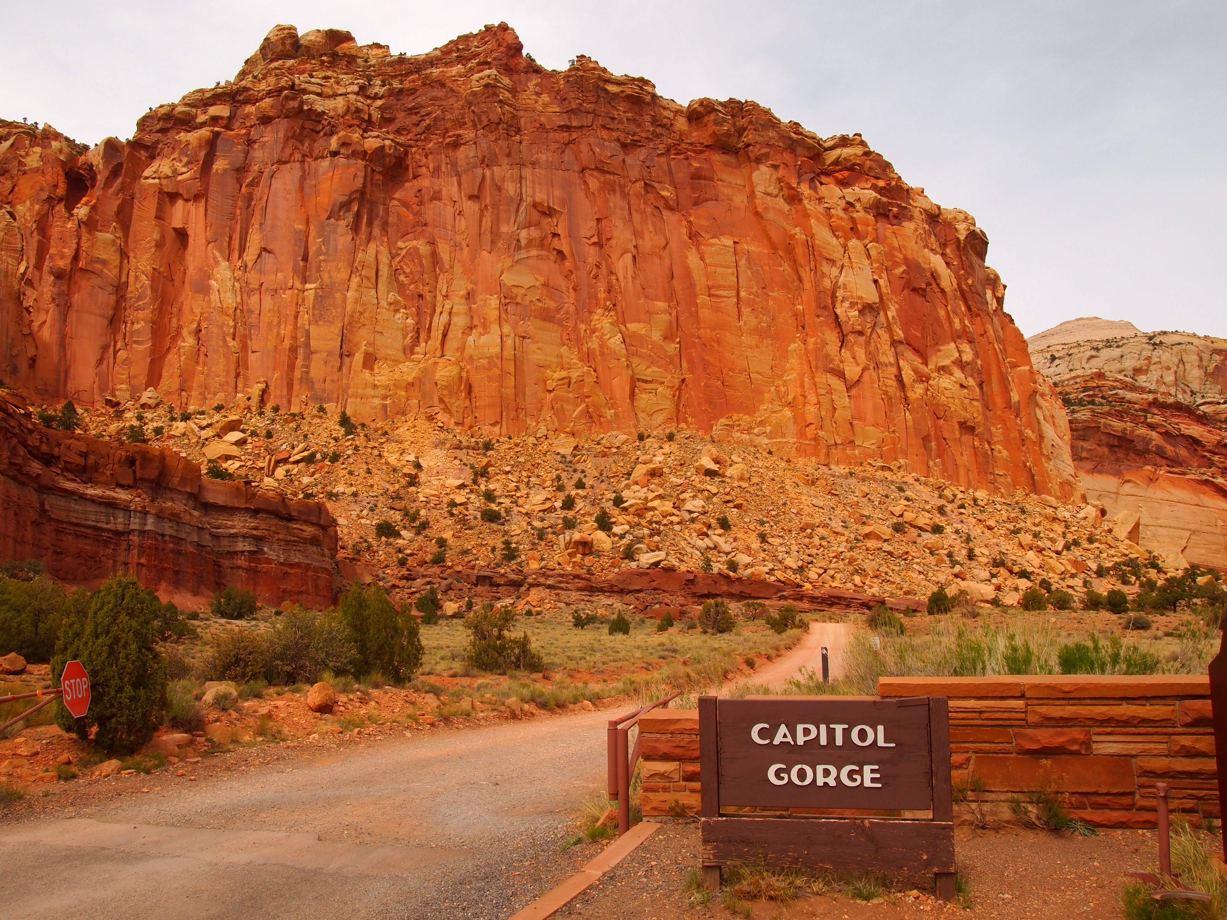
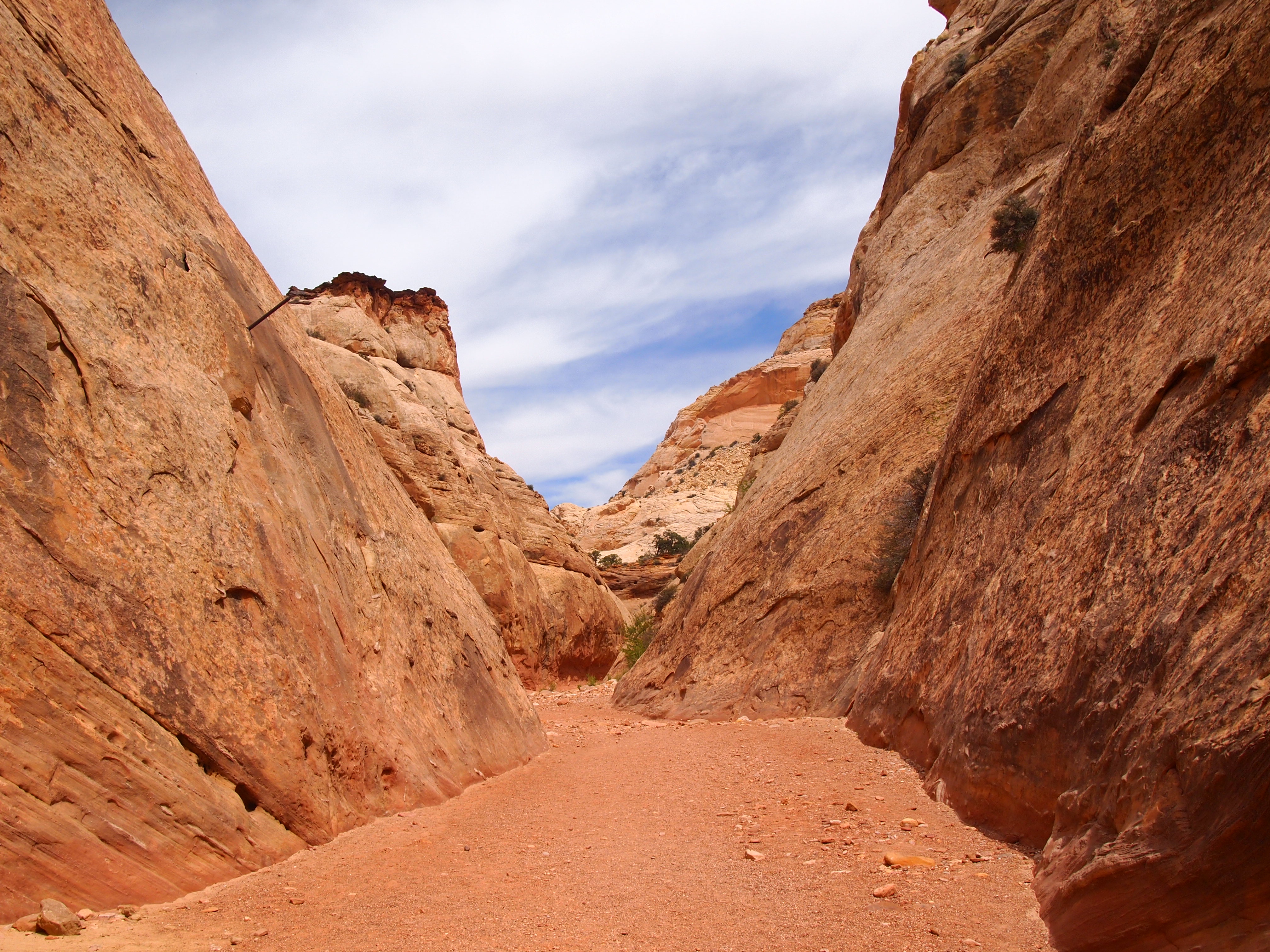
After a great hike to Cassidy Arch, we continued along the Scenic Drive to its end at Capitol Gorge Road. Capitol Gorge, the most prominent opening in the Waterpocket Fold, has served as a passageway for many travelers. The road, a winding dirt track, was an actual through road from 1884 until 1962 when the last piece of Highway 24 was finally completed. Today, the road ends after 2.4 miles at the trailhead for Capitol Gorge and Golden Throne.
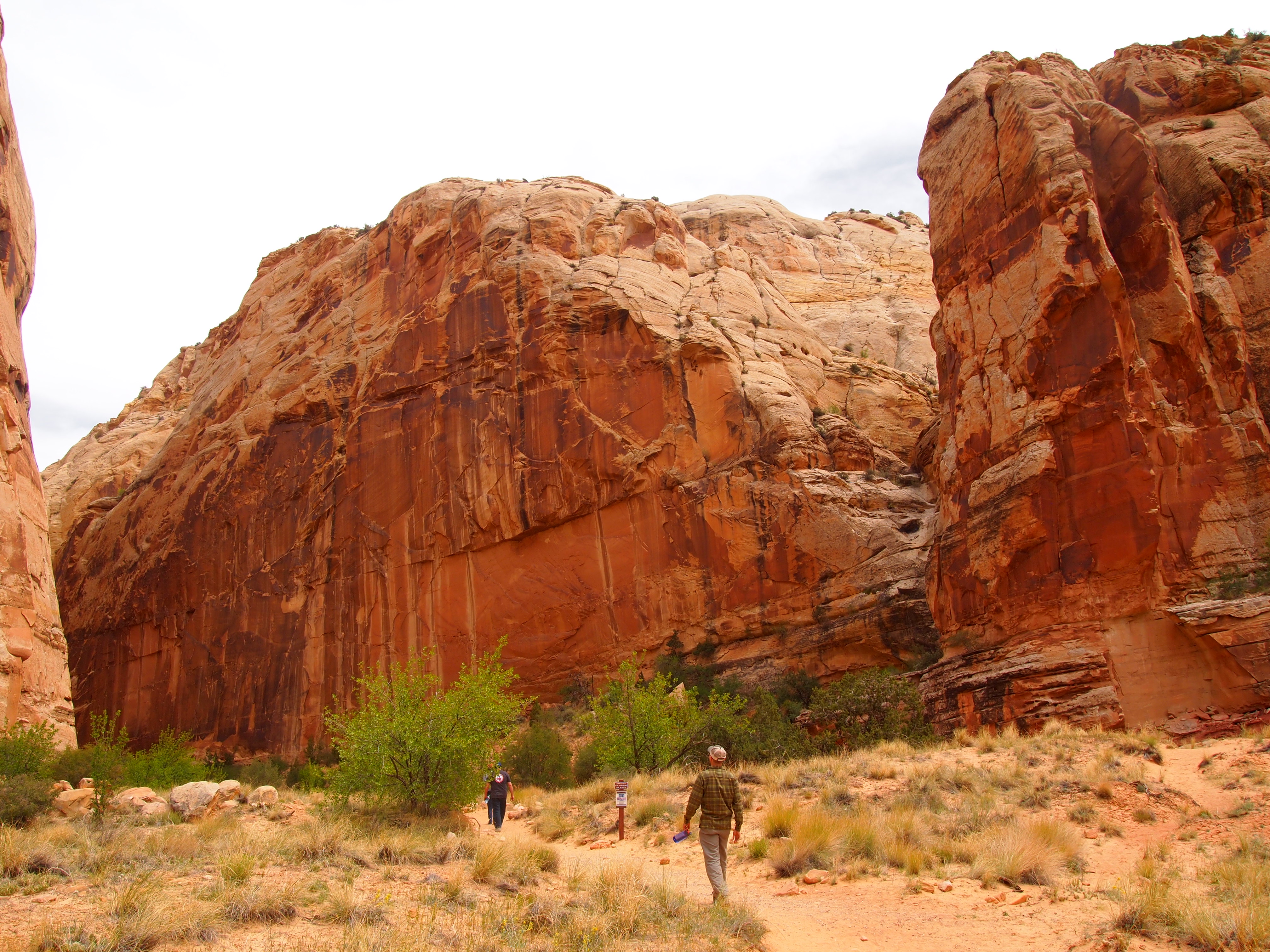
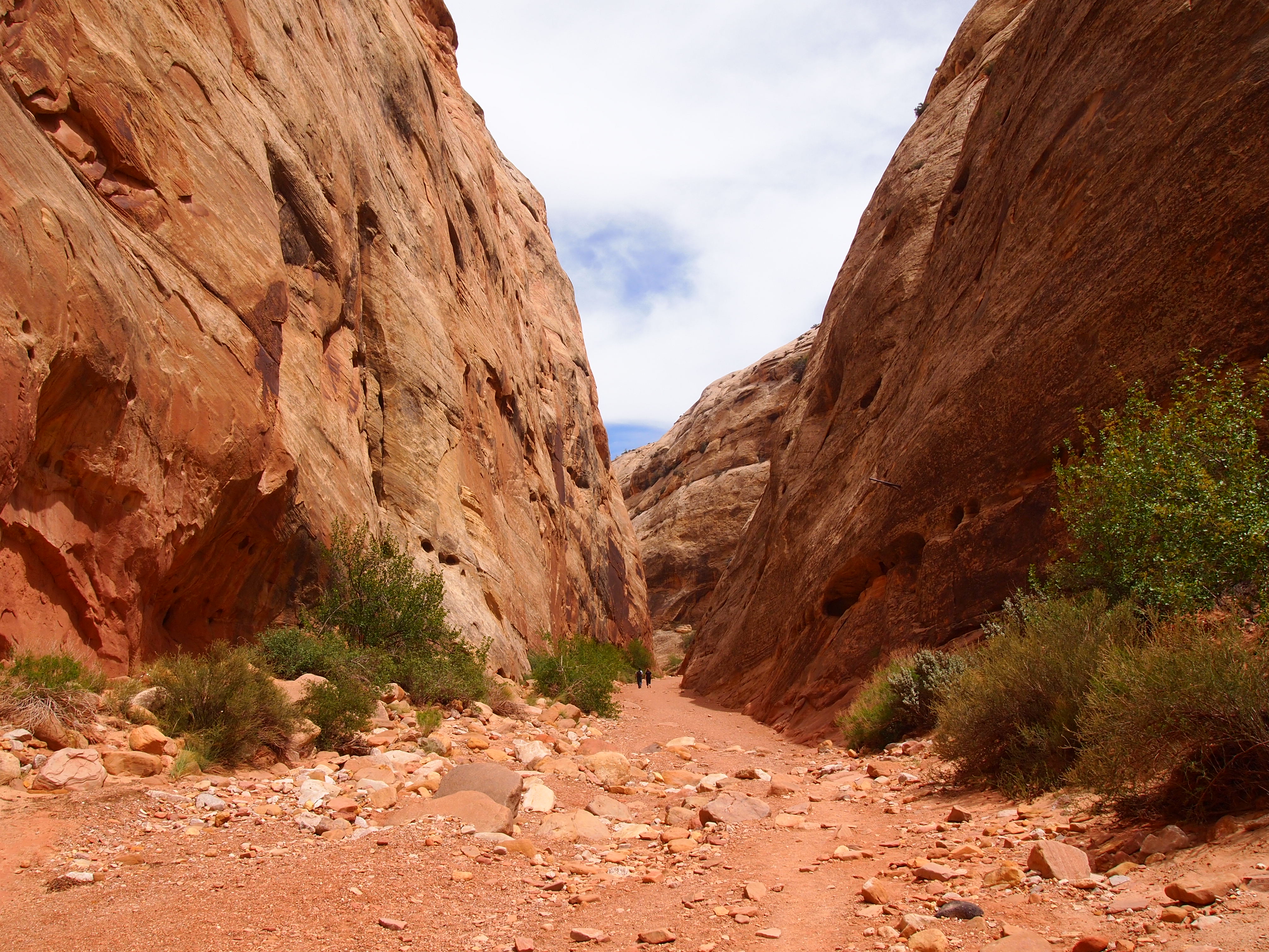
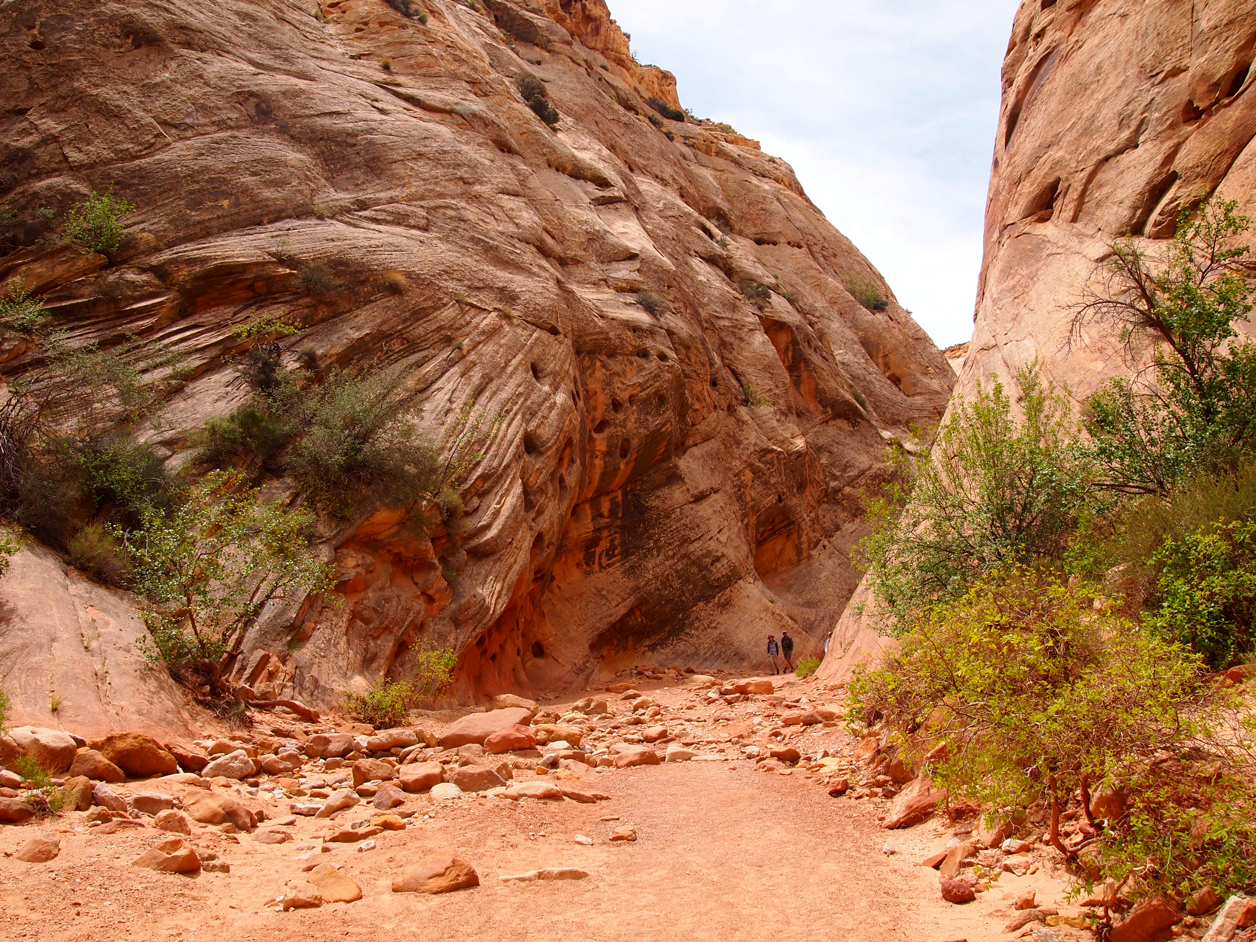
The trail through Capitol Gorge is a dry creek bed. It remains fairly level the entire time though visitors do have the option to hike up to the tanks, or tinajas as we’d say in Texas. The trail ends at the park boundary after a mile so it’s a pretty basic hike that anyone can do, young or old. Although it’s not a strenuous hike in the least, it’s a great way to feel the scale of the Fold and how formidable the journey must have been for anyone traversing this section of Utah. We chose to hike up to the tanks, and as is often the case, we were disappointed to find all but one empty. However, it was nice to get a higher perspective of the area surrounding the Gorge.
Where the Scenic Drive ends

Getting started
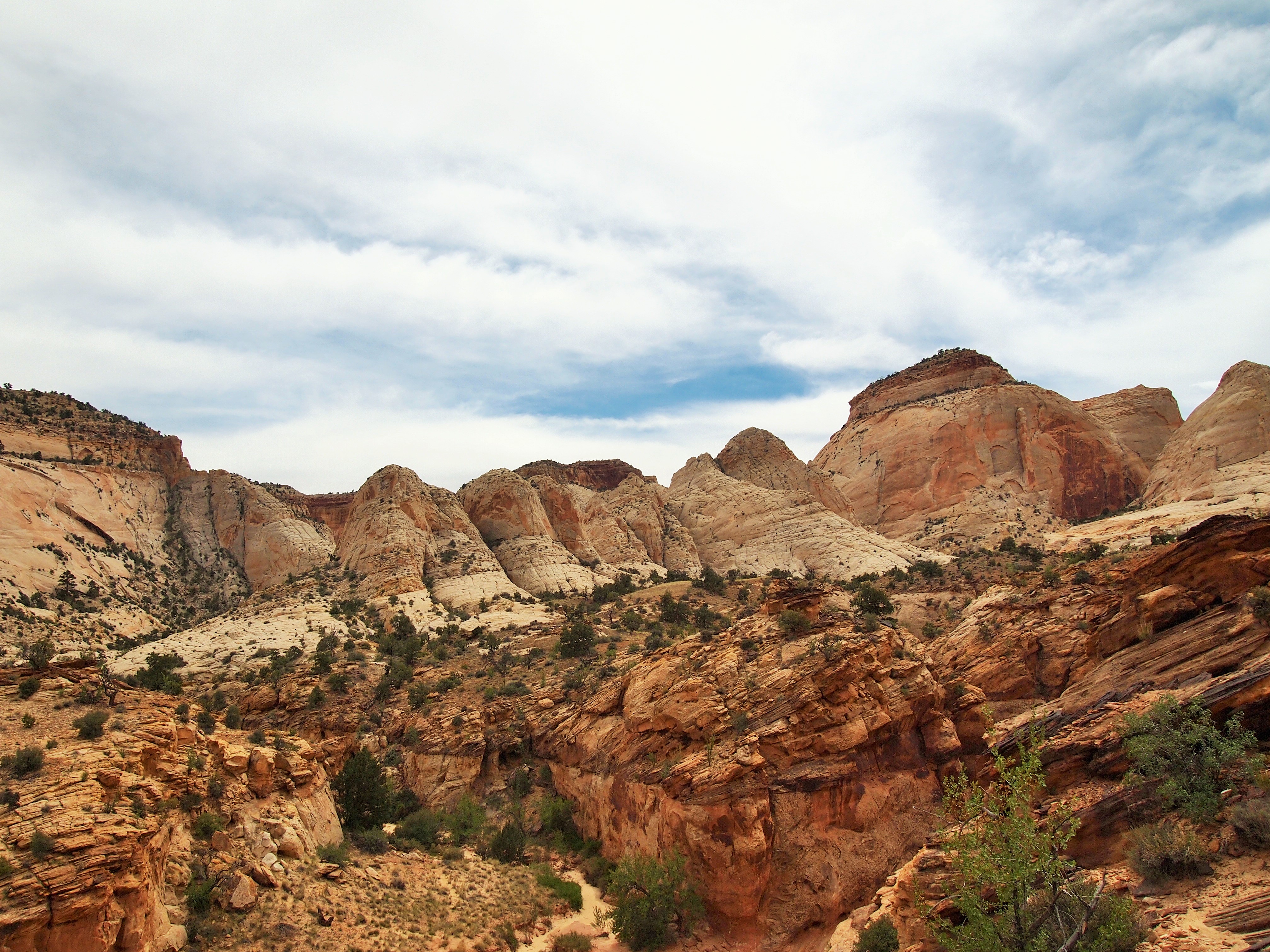
The white stone is called Navajo Sandstone

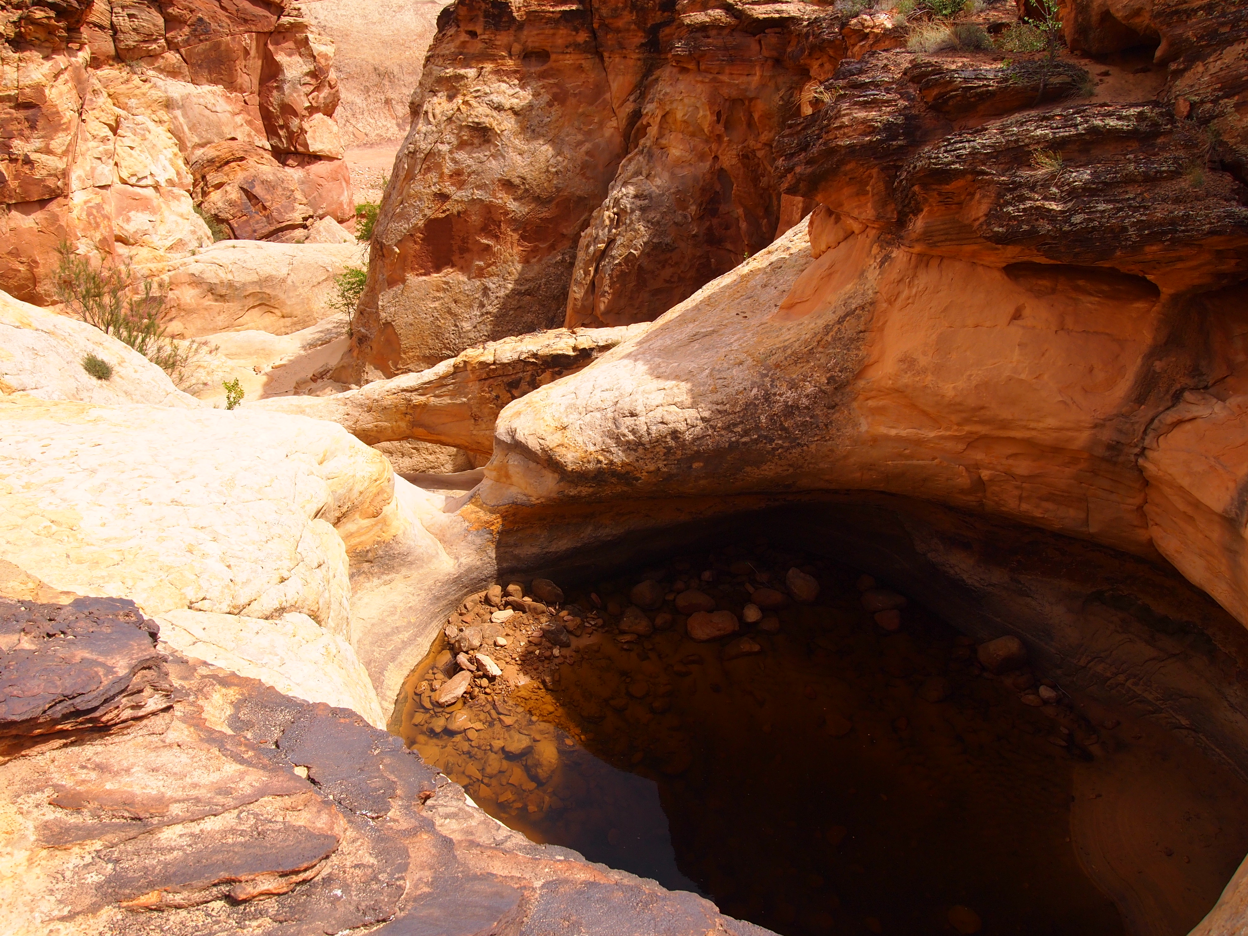
Water!

The road can be quite narrow at times
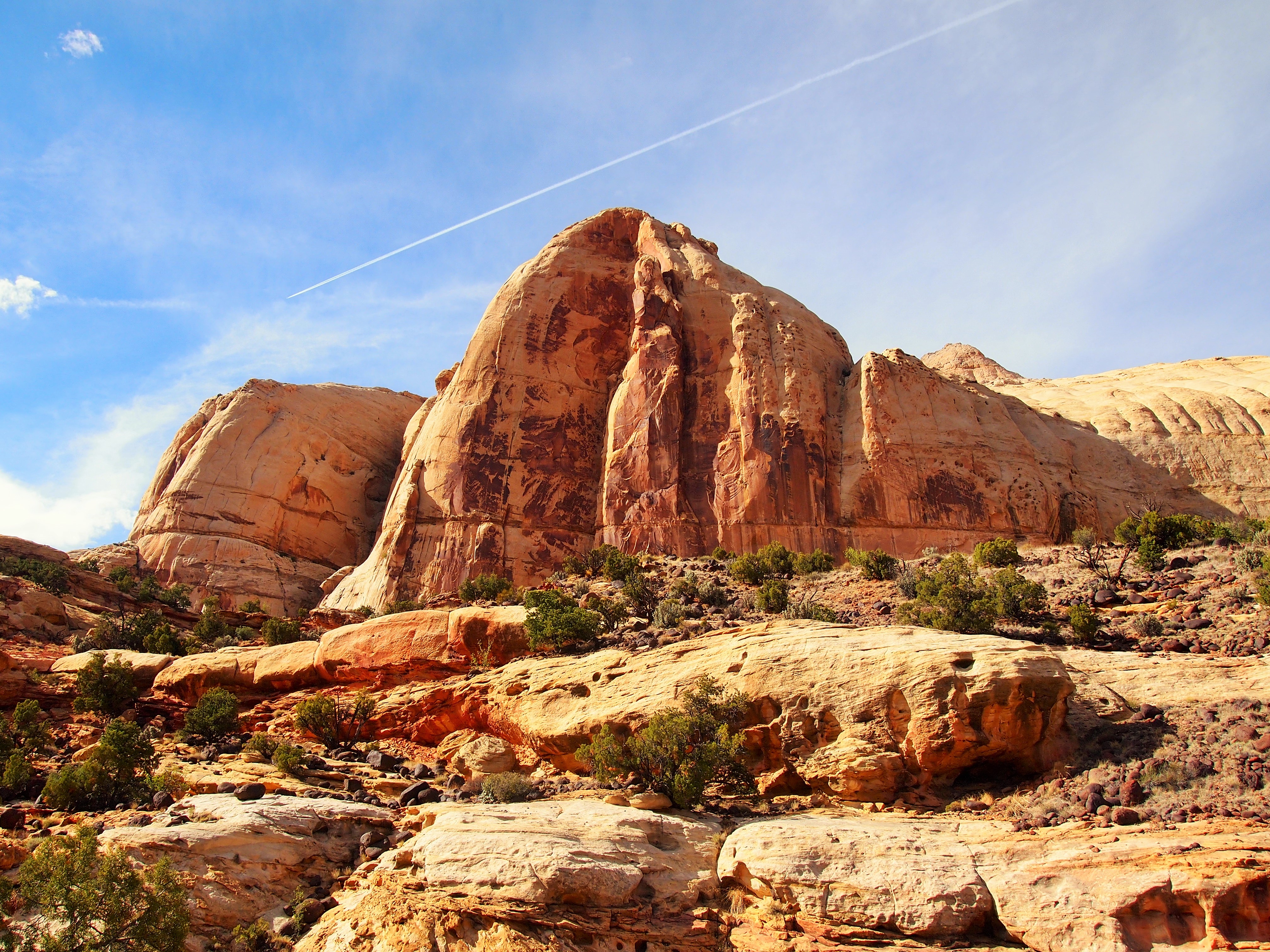
For our final hike of the day, we left the Scenic Drive behind and got back on Highway 24 going east to the trailhead for Hickman Bridge. At just under 2 miles round-trip, it was the perfect hike to end our day in the park. The trail begins alongside the Fremont River and climbs up 400 ft. to the top of the sandstone cliffs, through a side-canyon, and underneath the 133 ft. natural bridge. At the beginning of the trail we also had a fantastic view of Capitol Dome, the reason for the other half of the park’s name, and Pectols Pyramid, a towering structure on the opposite cliff-side.
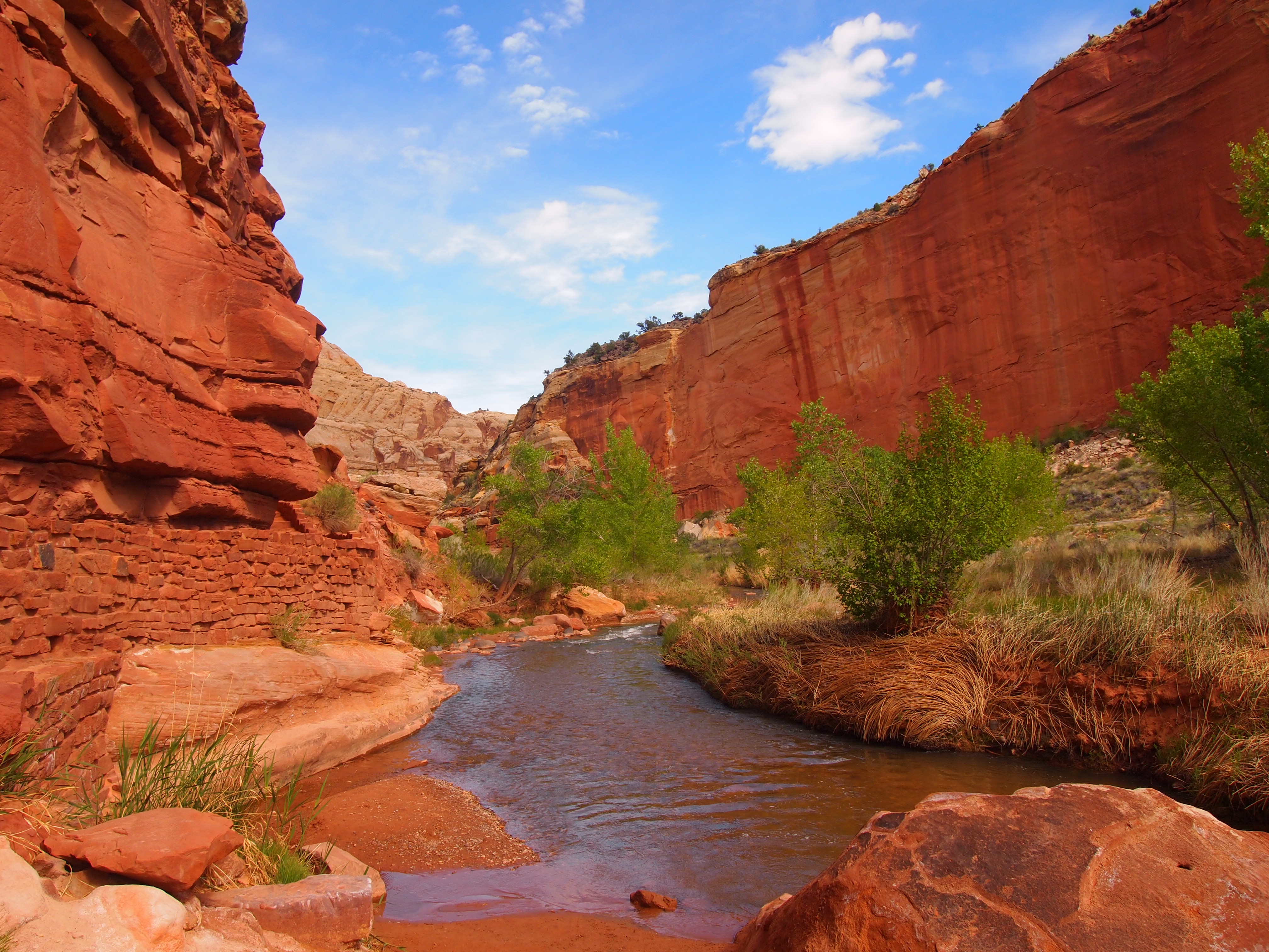
Beginning by the river
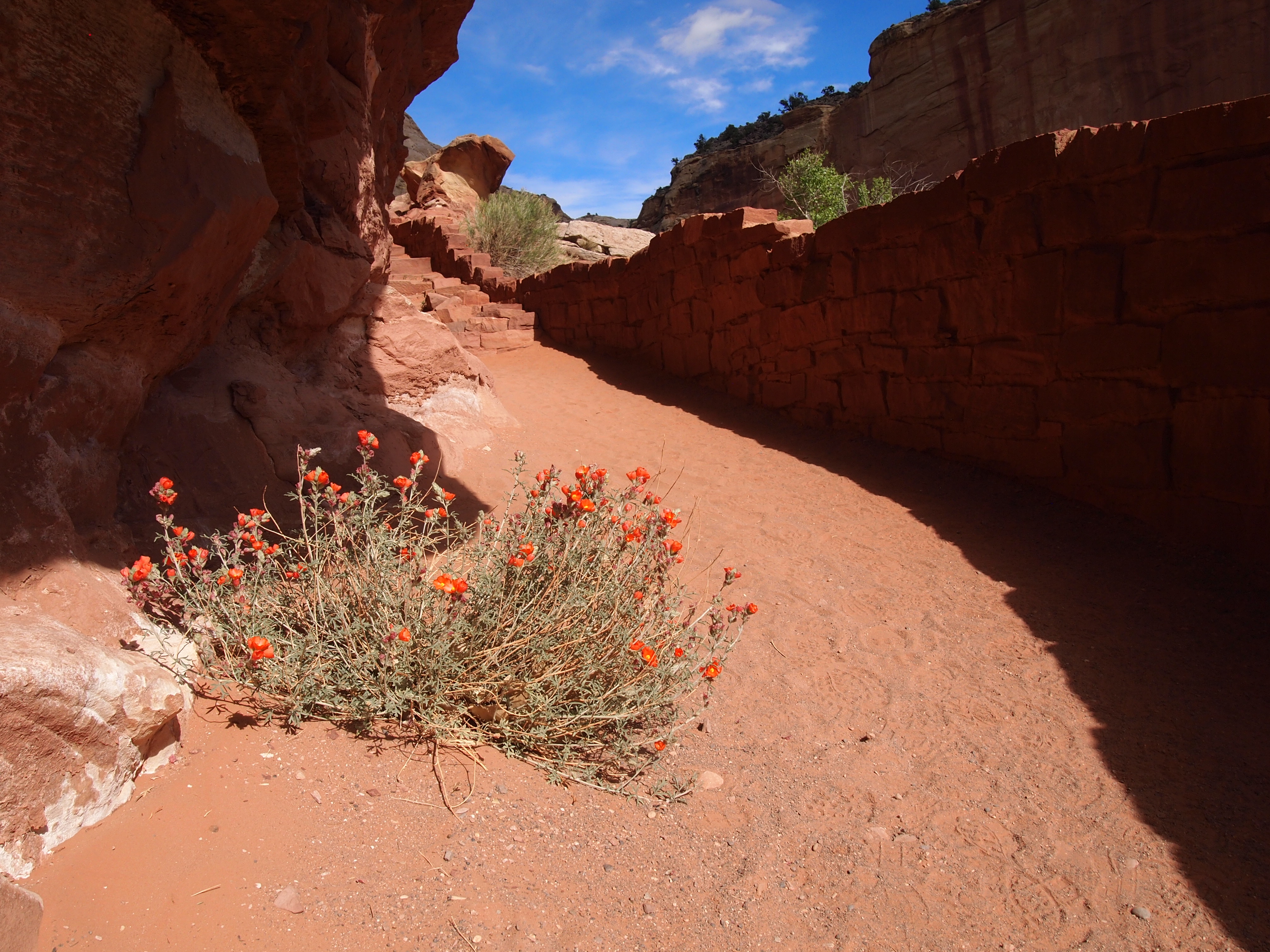
Common Globemallow

Capitol Dome


Hickman Bridge

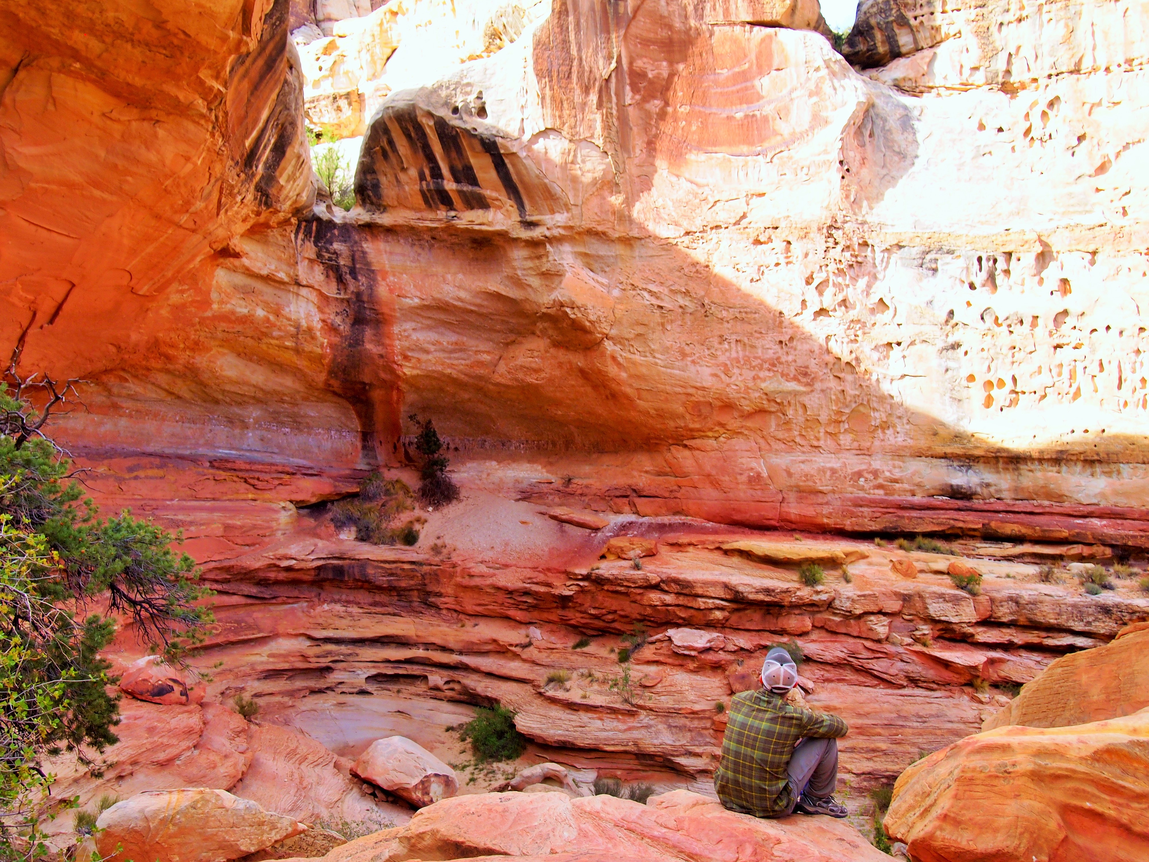
Resting under the bridge


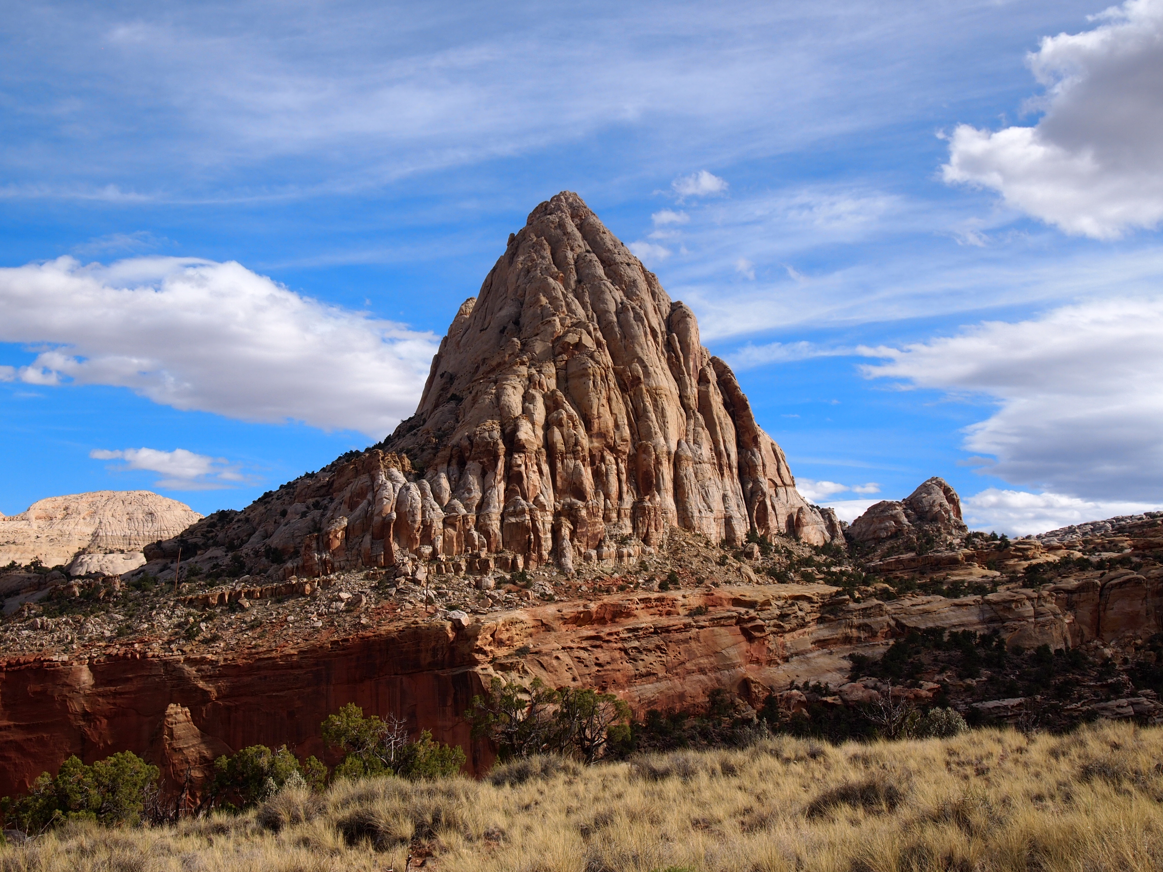
Pectols Pyramid
We left the park shortly after finishing our hike to Hickman Bridge. We covered a lot of ground, saw the core of the park, and did three very different hikes. But we’ll be back; there’s always more to do and see.

Categories: North America, USA, Utah

Wow! It’s so beautiful! I really enjoyed this post. Thanks for all of the information about the area. It was very interesting. Great photos too! That water hole looks really deep. What a great way to spend the day.
Is that a wooden spoon for that ice cream? Took me back to eating those little Blue Bell cups.
Yes!