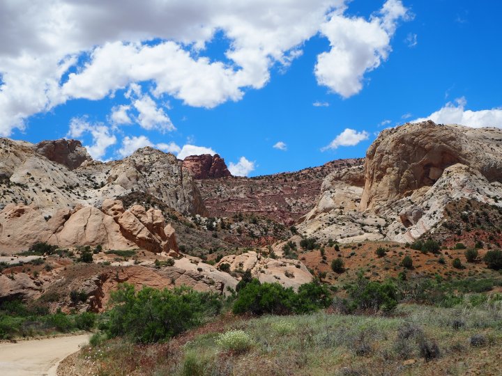
We began our trip at Capitol Reef National Park. Last October during our first tour of the Waterpocket District, Zach and I spotted some camping areas we thought would be great on the BLM land off the Notom-Bullfrog Rd. I thought this trip would be a great opportunity to try to snag one of those spots and use it as a base from which to explore both Cathedral Valley and the Waterpocket District.
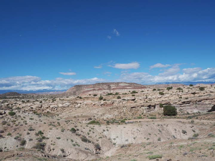
Our pals, Ryan and Lisa, joined us for the first part of our trip. They were about half an hour behind us, so we found a spot, pitched our tent, and Zach went to signal them from the road. We set up on a bluff overlooking the road, the Waterpocket Fold, the Henry Mountains, and badlands in between. It was incredible. We set up, made dinner, and sat around the campfire. It became fiercely windy for a while as we watched a dark cloud move over us. Ultimately, the sky cleared up, and we were greeted with an array of constellations.


In the morning we made breakfast and enjoyed the quiet morning before setting off for Cathedral Valley. When I checked the road conditions during our drive down on Friday, the report was from Thursday. The conditions for the Cathedral Valley loop were unknown, the unpaved portion of the Notom-Bullfrog Rd. was inadvisable, and The Burr Trail (another route I was interested in) was muddy on the switchbacks. It was definitely discouraging. However, the dirt roads where we were camping were fine which seemed promising.

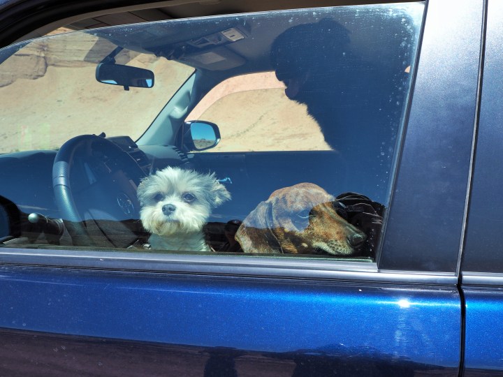
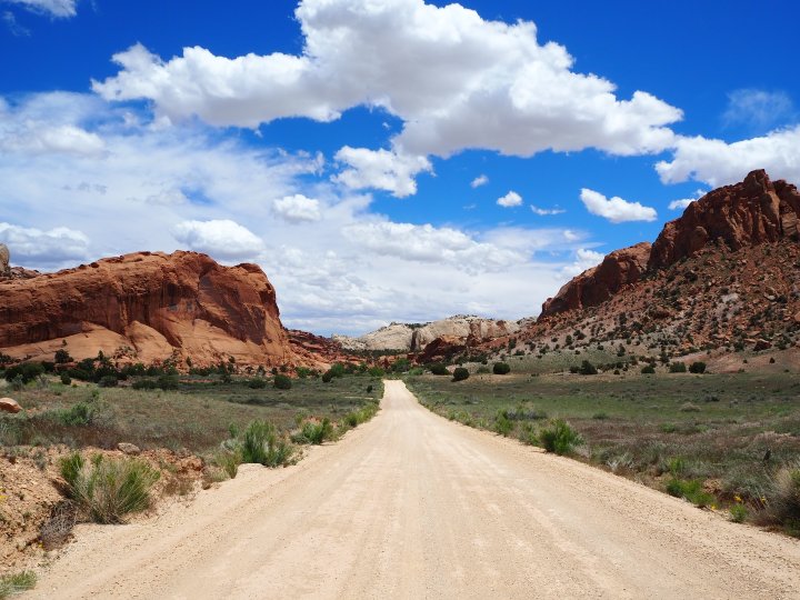
We piled into Ryan’s 4Runner – four humans, three dogs – and set off. Ryan wanted to check the river crossing before starting the loop counterclockwise on Cathedral Road. En route to the Fremont River, we encountered a park ranger. He flagged us down and told us that seven miles beyond the river ford, the Hartnet Road was impassable. It was disappointing news, but we felt fortunate to have run across him. He was headed for Cathedral Road, and we followed suit soon thereafter. We decided we would go as far as we could – hopefully to the Temples of the Sun and Moon.
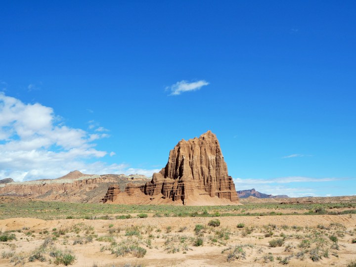
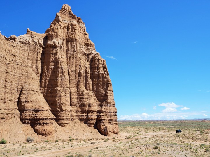
Cathedral Road was ultimately fine. We knew the ranger was somewhere ahead of us, so that eased my anxiety. I have an unusual amount of anxiety about getting lost/stuck/things not going according to plan. It’s something I’m trying to work on… Anyhow, the 17 miles to the Temples travelled through picturesque badlands until we reached a straightaway with a view of the Temples far in the distance. There were few people out, so when we arrived at the Temples we had them to ourselves. I was ecstatic.


I’ve wanted to visit the Temples of the Sun and Moon since our first visit to Capitol Reef two years ago. Last October, I chose to wait to visit in the hopes that we could do the entire loop. But this time, all I wanted was to visit the Temples if we could.
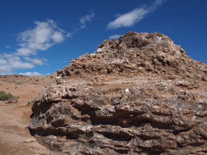
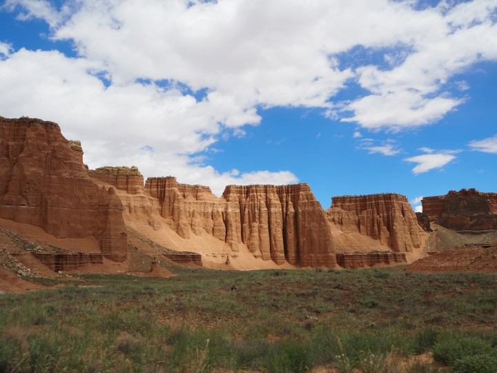
We drove to nearby Glass Mountain first. Created by water carrying dissolved gypsum through the sandstone, this giant “mountain” of crystallized gypsum is a plug which is increasingly exposed as the sandstone coating it erodes. It was fascinating. Sparkling pieces of gypsum were scattered all over the ground. From Glass Mountain, we also had a great view of both Temples. They glittered in the morning sun, imposing and resolute.


We drove to the base of both Temples. We had Temple of the Sun to ourselves and shared Temple of the Moon with another couple. I spent a lot of time soaking in the moment, internalizing how it felt to stand before both giant monoliths. While the others drove to Temple of the Moon, I decided to walk and savor the moment. It was such a beautiful morning, and it was quiet and serene. I thoroughly enjoyed every second.


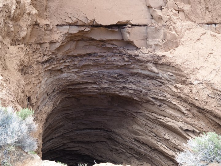
After the Temples, Ryan wanted to go slightly farther to the Gypsum Sinkhole. The road was still more or less fine, but there were several wash crossings which were muddy with flowing water. The scenery remained open and stunning. The sinkhole was in a side canyon, off of the main road, and there wasn’t a sign (that I noticed), so it wasn’t surprising that we were alone. The sinkhole is the result of the dissolution of a gypsum plug, like Glass Mountain. Except in this spot, groundwater is dissolving the plug underneath layers of rock which has resulted in a collapse of those layers above it. It was massive and deep enough (50ft. wide, 200ft. deep) that I didn’t feel comfortable leaning far over the side to find the bottom.
We probably could have continued and truly gone until we had to turn back, but we were all getting hungry and the dogs were antsy from being cooped up in the car. We decided to turn back, leave the rest of the loop for the future, and grab pies at the Gifford House in Fruita.

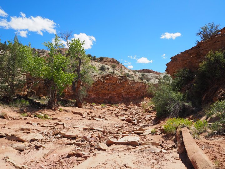
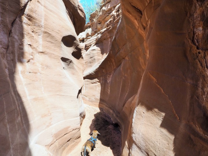
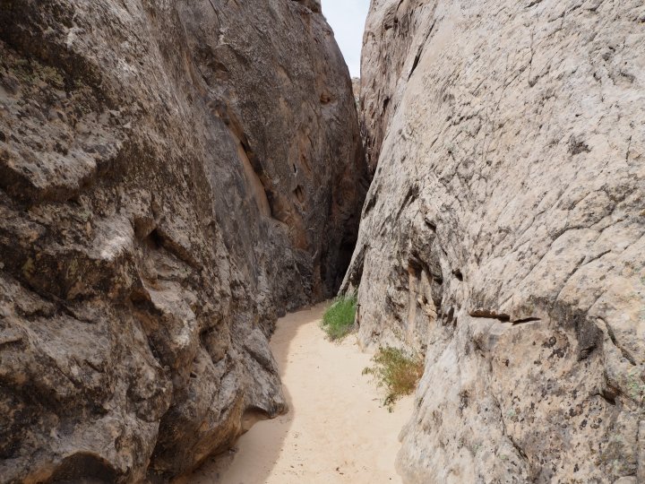
After our pies, we decided to head back toward our camp and do a hike off the Notom-Bullfrog Rd. There are a few hikes which begin off the road on BLM land and then cross into the National Park. I thought we could do a portion of Sheets Gulch with the dogs and turn around at the park boundary for a short four mile hike. (I had my Gaia GPS and map of the area downloaded so I’d know when we were nearing the park boundary.) It was a hot hike through the wash. After roughly a mile we entered the first narrows section. The narrows slimmed into a slot fairly quickly. Sadly, with another 0.5 mile or so to go, we encountered a deep pool of water. Even though we all knew it had rained the past several days, none of us had thought to bring our Chacos. Since Zach and I had four more days of camping and hiking ahead of us, we didn’t want to get our (waterproof) shoes wet. I was bummed that we weren’t going farther, but we’ll just have to go back without the dogs next time and do the whole thing.


The hike was good for one thing though – it sufficiently wore out the pups. We were all happy to go rest back at our camp. It had become gusty up on our bluff, so we took shelter behind Ryan’s 4Runner and had a little happy hour. The wind died down, and the evening was beautiful. We all ended up turning in early, as the first stars were beginning to show.
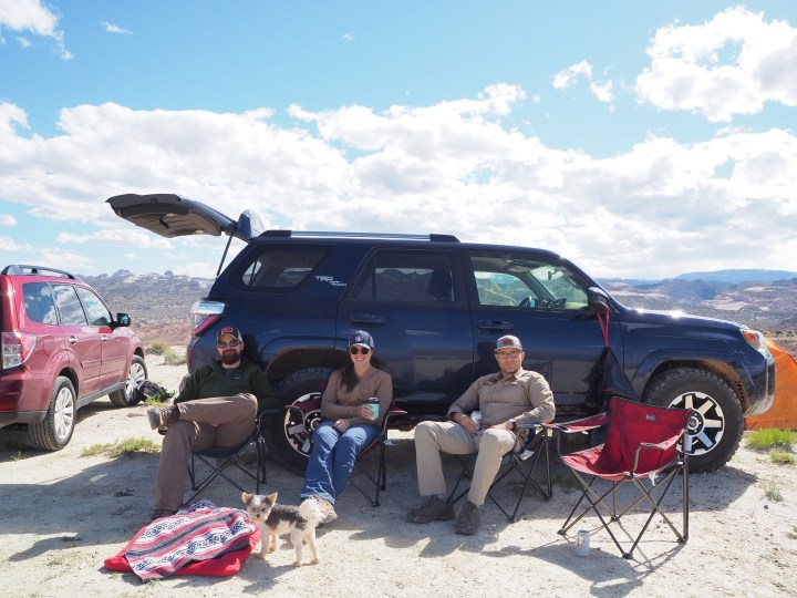

On Sunday we whiled away the morning on our bluff, enjoying the stillness and beauty. Lisa and Ryan were going back to Salt Lake, and we were headed to our next base, Escalante.

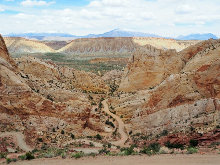
After packing up our camp, we stopped at the Visitor Center in Fruita to check on road conditions and buy a few postcards. I hoped we could go to Boulder via the Notom-Bullfrog Rd and the Burr Trail instead of Hwy. 12. Thankfully, as I suspected, the roads had fully dried out, and we were clear to follow my original plan. And for the second time on our trip, I was ecstatic.

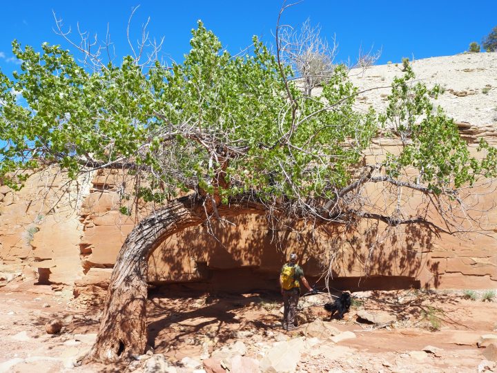
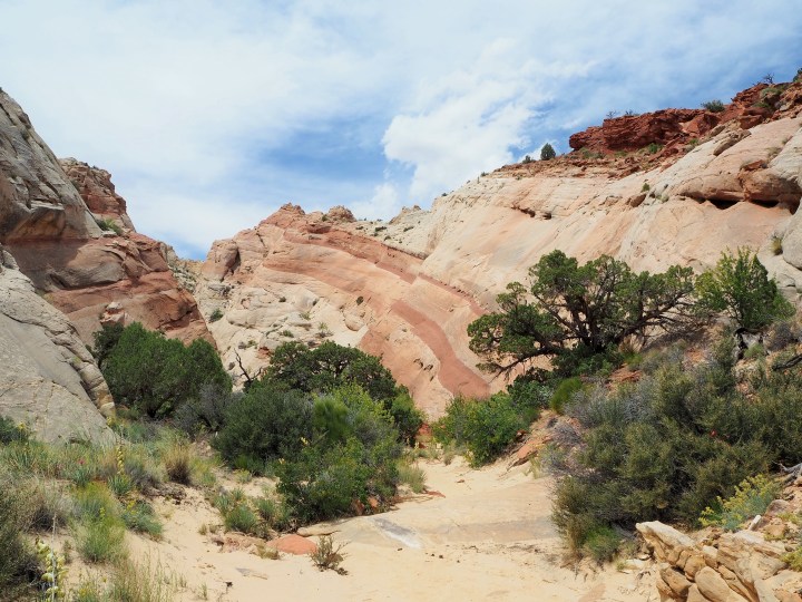
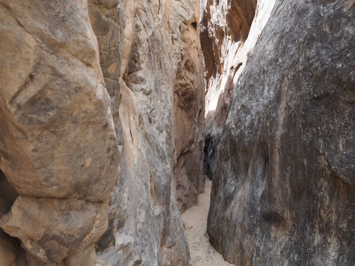
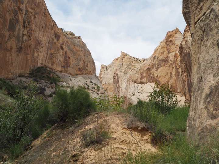
Back in October, we did the short hike to Surprise Canyon. This time I wanted to do the slightly longer hike to Headquarters Canyon, the more popular of the two. The trail to the canyon was prettier and provided stunning views of the Waterpocket Fold. Shortly after the trail entered the wash and turned a bend, we reached the canyon entrance. The canyon walls narrowed quickly, and we entered a brief but lovely slot section. Not quite as pretty as the section of Sheets Gulch we did the day before, but tall and thin. After that the canyon remained open, and the trail twisted through scrub oak and other, rather lush, vegetation. We followed the canyon to its end and turned back the way we’d come.


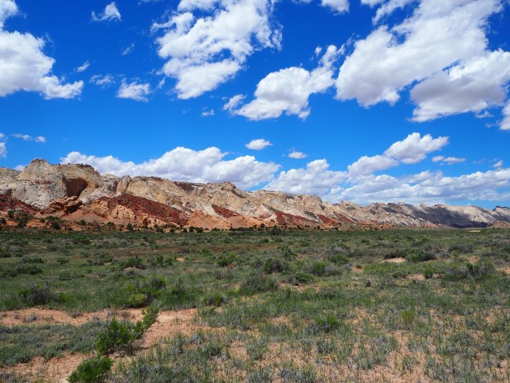
After our hike, we went back to The Burr Trail junction and began our journey to Boulder. The Burr Trail cuts through the Waterpocket Fold at a natural opening and climbs steeply to the top via a series of switchbacks. We were travelling up which gave us incredible views of the road and canyon as we climbed higher and higher. It was yet another X on my Utah bucket list!
Categories: North America, USA, Utah

What an awesome visit, enjoyed your photos and being along for the (virtual) journey! Each time I leave Capitol Reef, I start a new list of parts of the park I want to see the next trip. Timing can be tricky with the backcountry roads though, for sure!
Thanks! Capitol Reef is easily our favorite park in Utah. You’re right though, every time we go, I learn about somewhere else I want to go the next time.