It certainly feels like spring in Boise. With the exception of a few outliers here and there, the temperatures are prompting a lot of enthusiasm for the emergence of hiking season. In the spring, we like to enjoy the high desert while it’s still pleasant. Last year, between the beginning of the abrupt pandemic lockdown and buying a house and moving, we didn’t get to venture around as much. Now, feeling seasoned in the art of avoiding people outside (and getting vaccinated!), we are very hopeful regarding spring excursions.
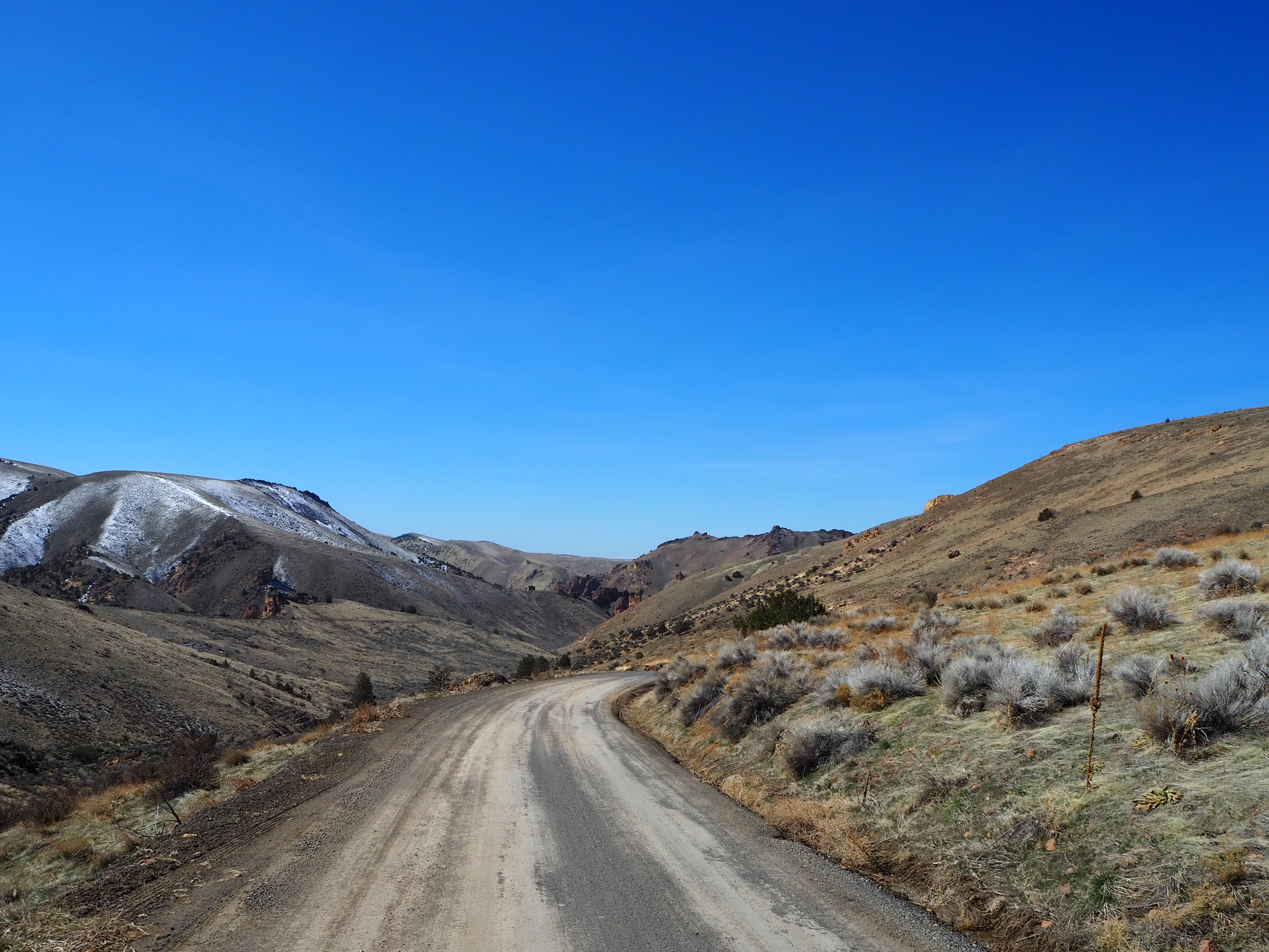
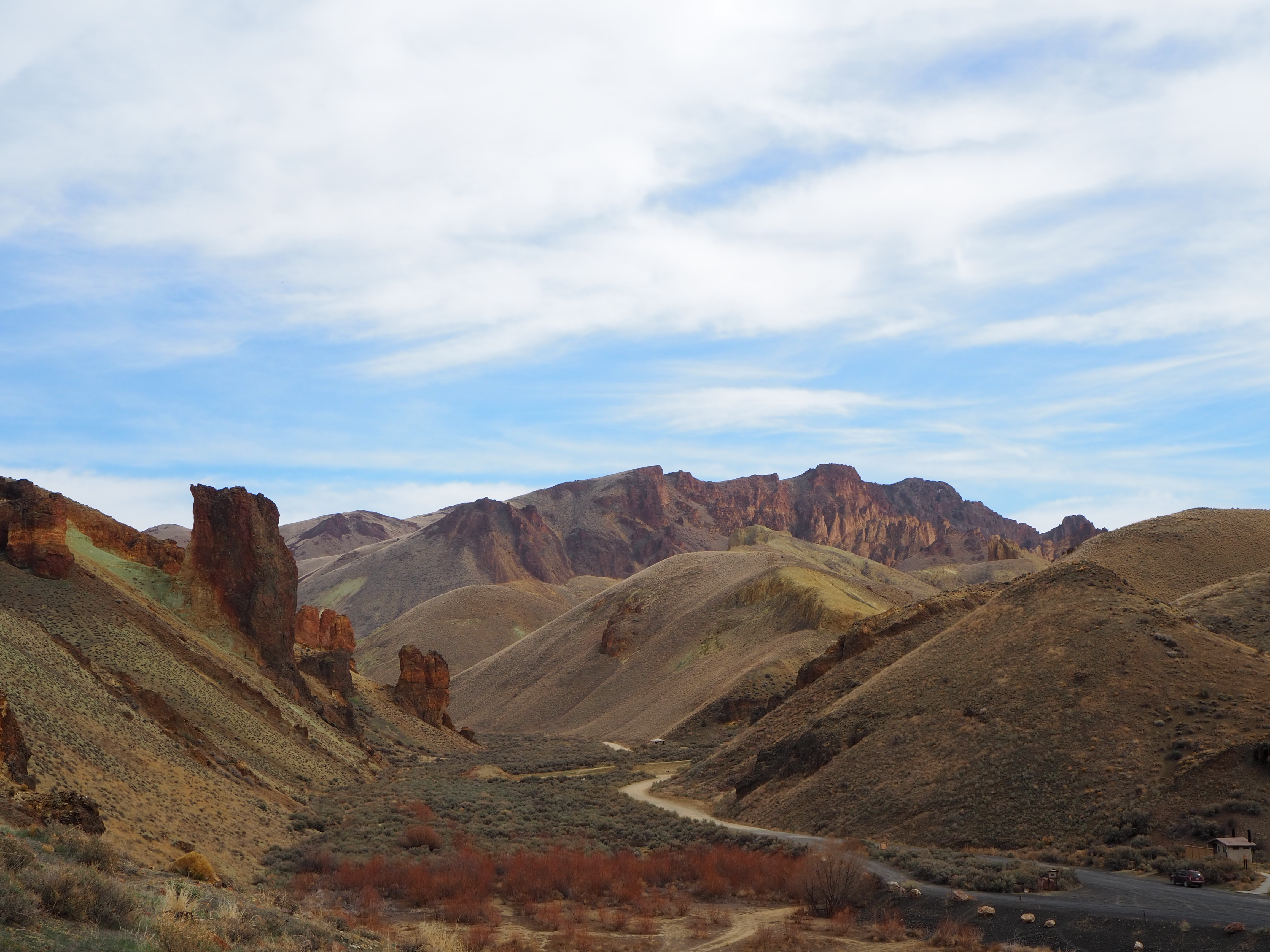
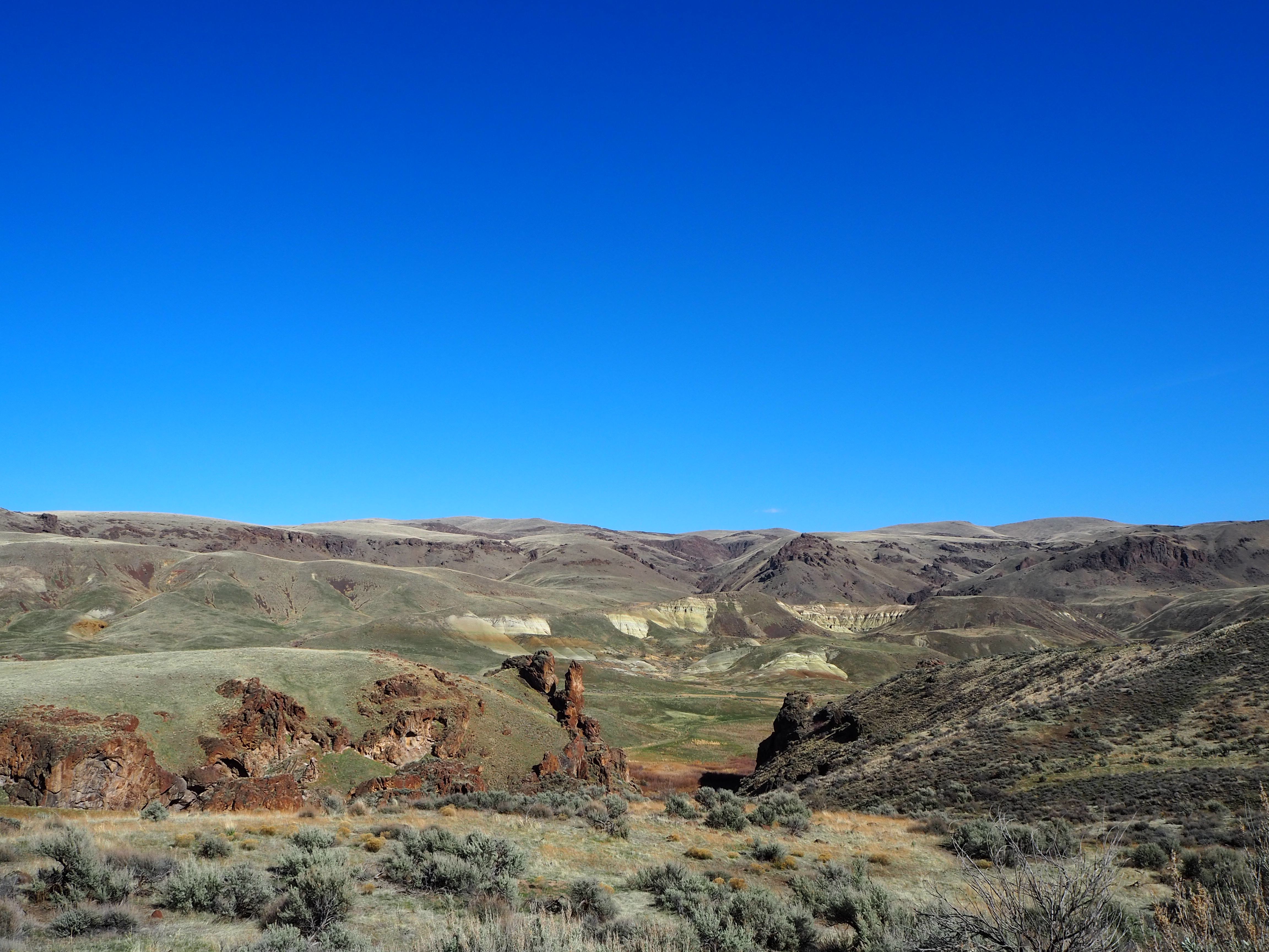
Over two weekends this month, we made the trip out to Leslie Gulch to take advantage of the spring weather. Only 70 miles from Boise and a hop across the Oregon border, Leslie Gulch feels much farther away. It’s tucked among rolling, sagebrush strewn hills, typical of the Owyhee Canyonlands. Suddenly though, a vein opens up and descends down to Owyhee Lake (a dammed portion of the Owyhee River). Standing atop the crest, you can hardly tell what wonders await in the heart of the gulch.
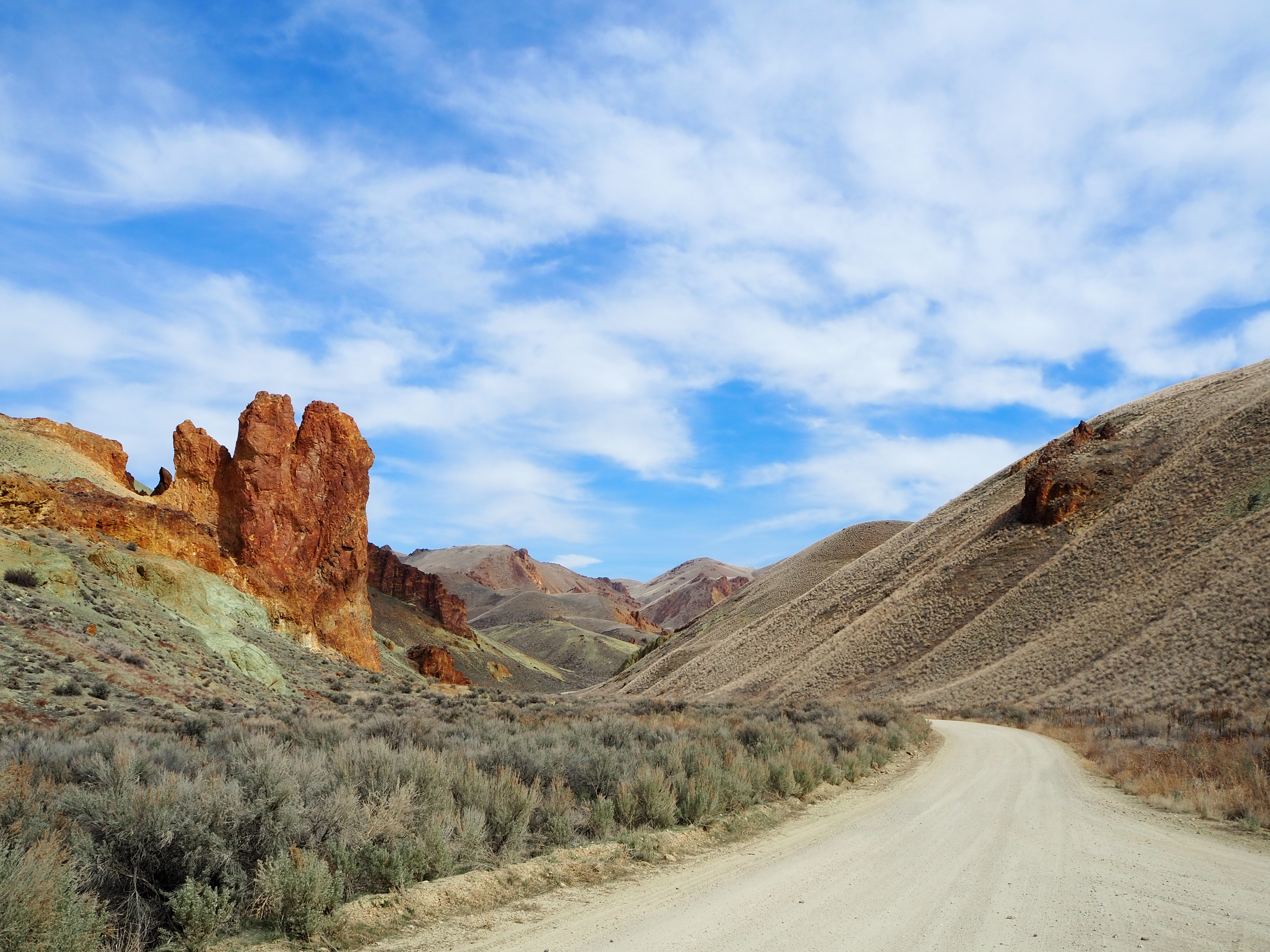
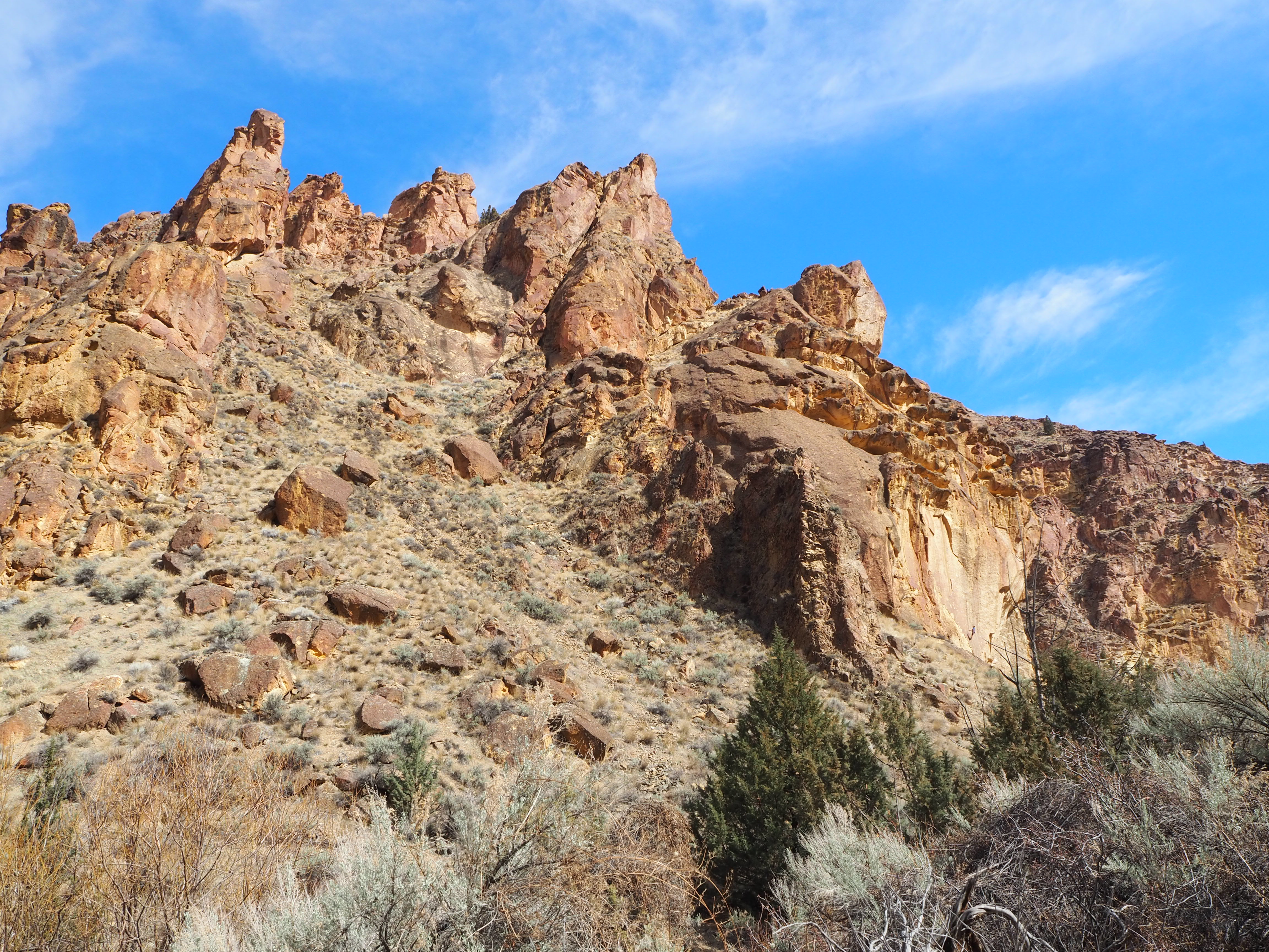
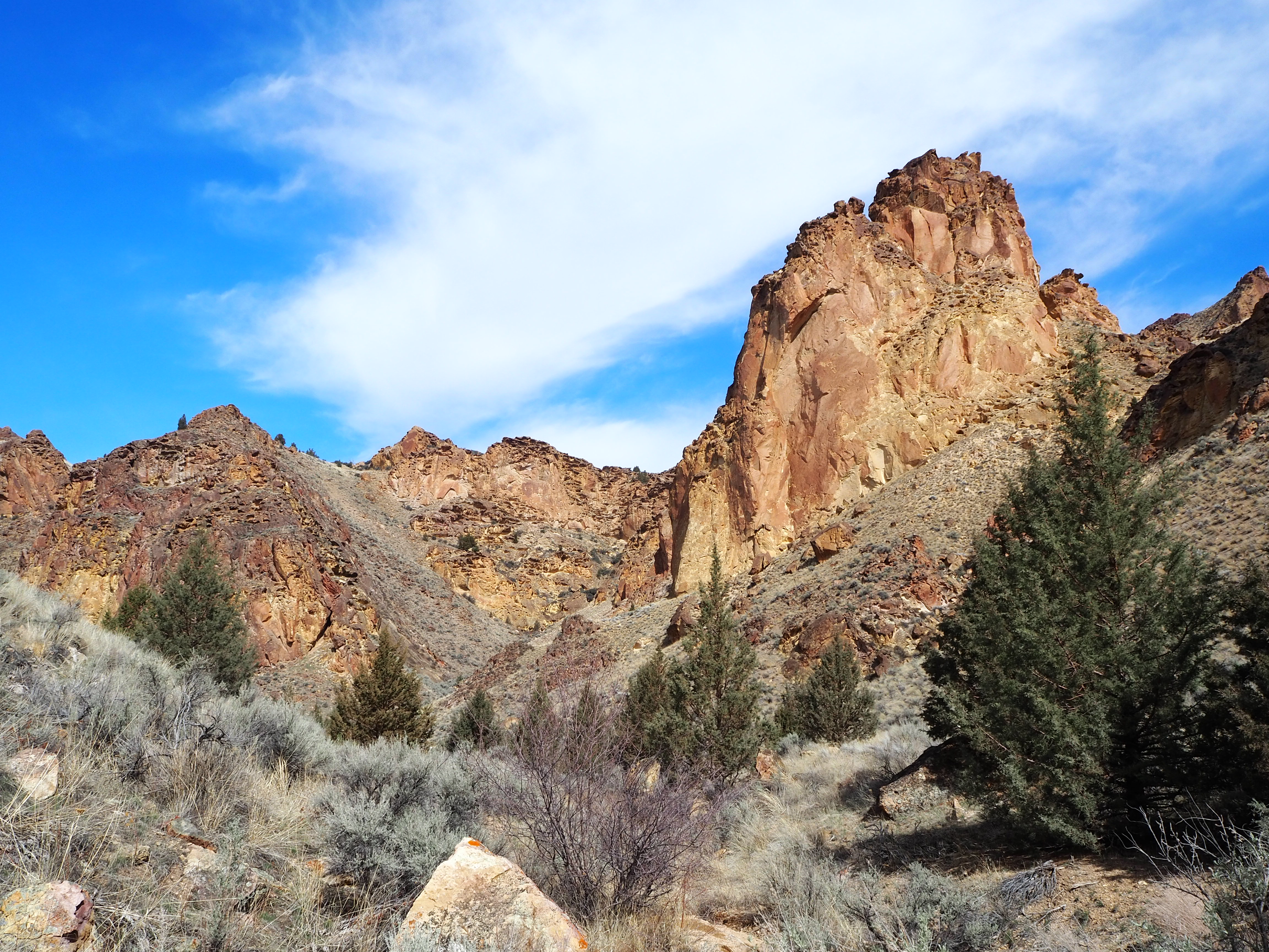
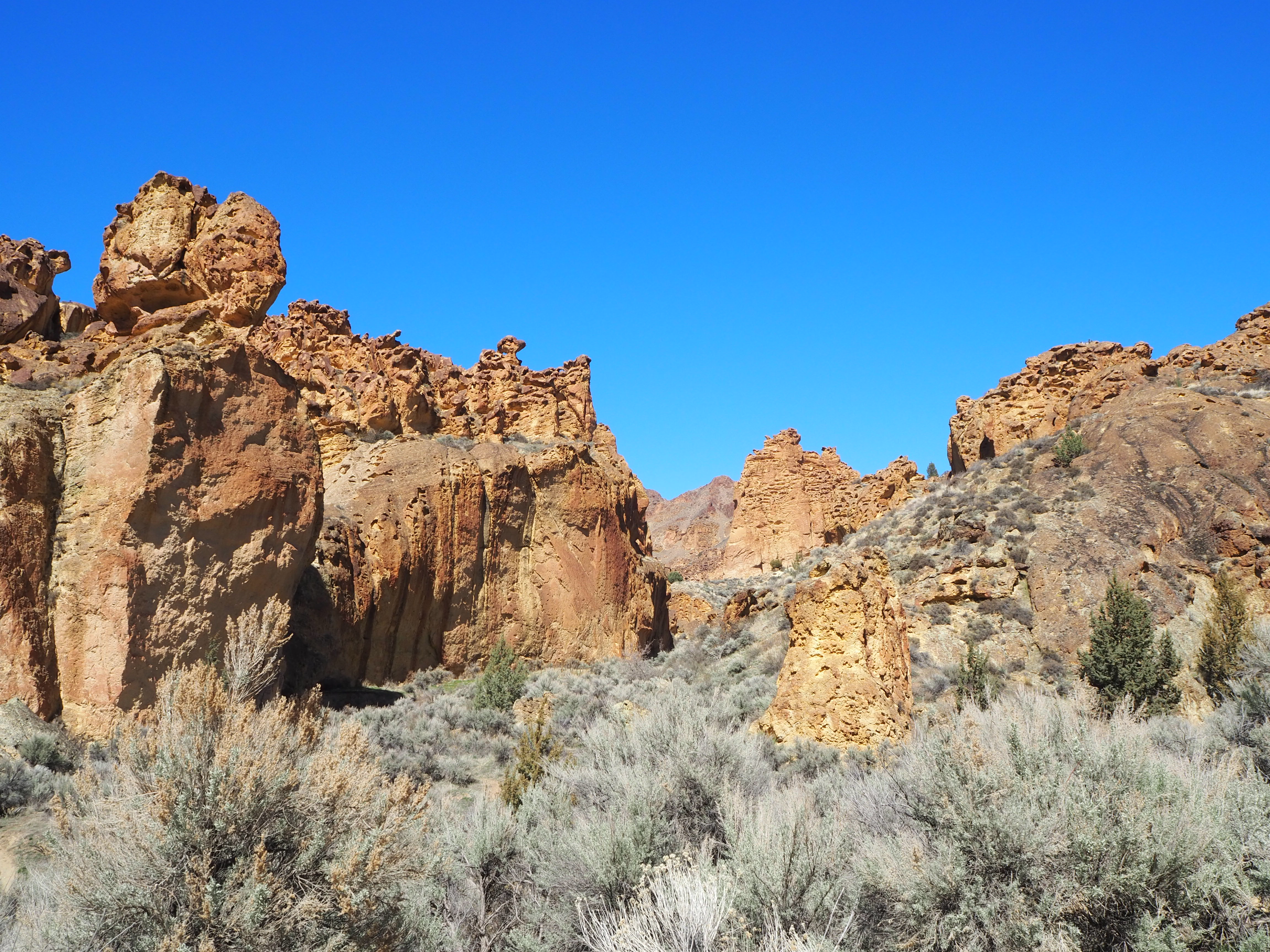
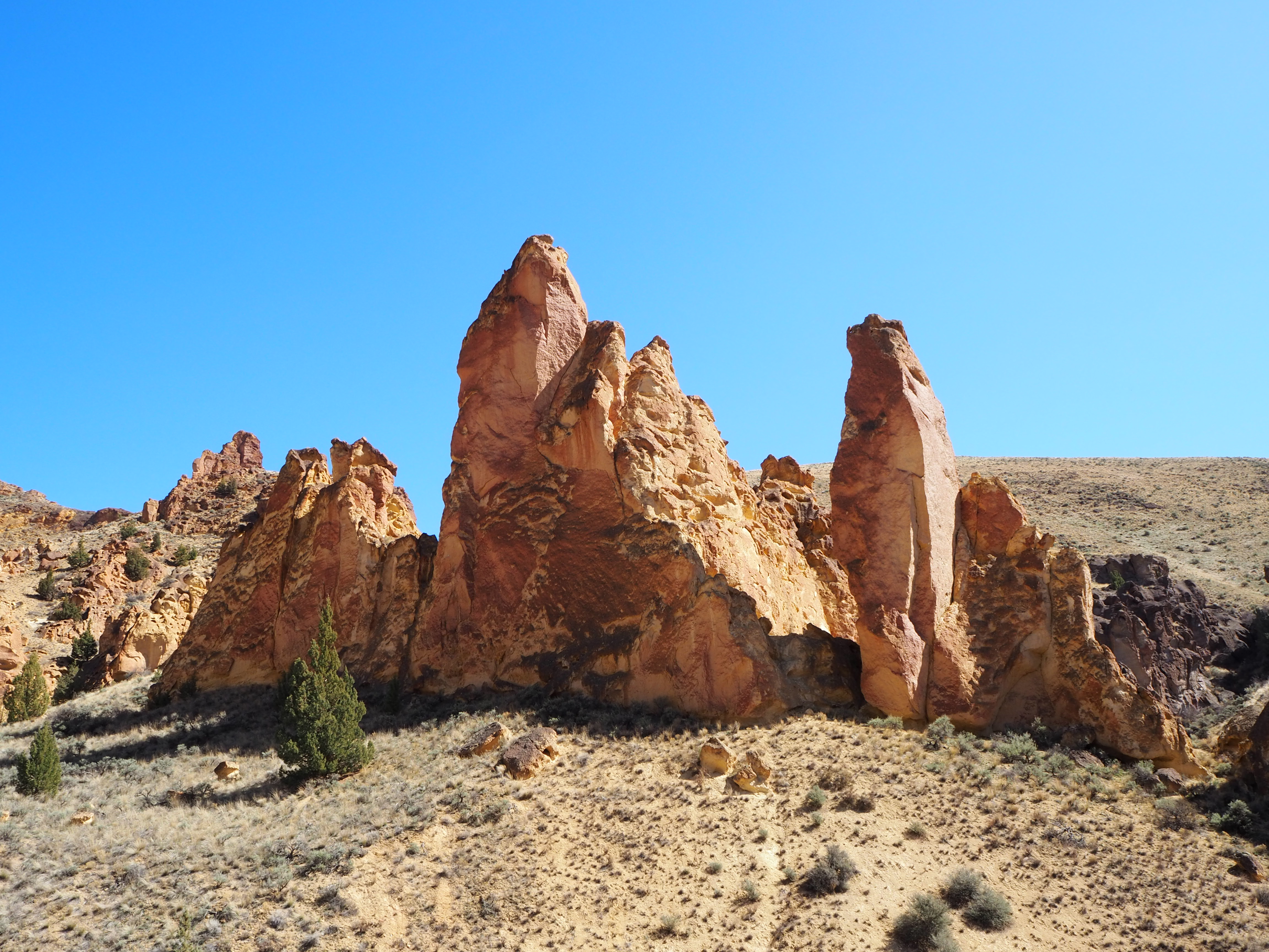
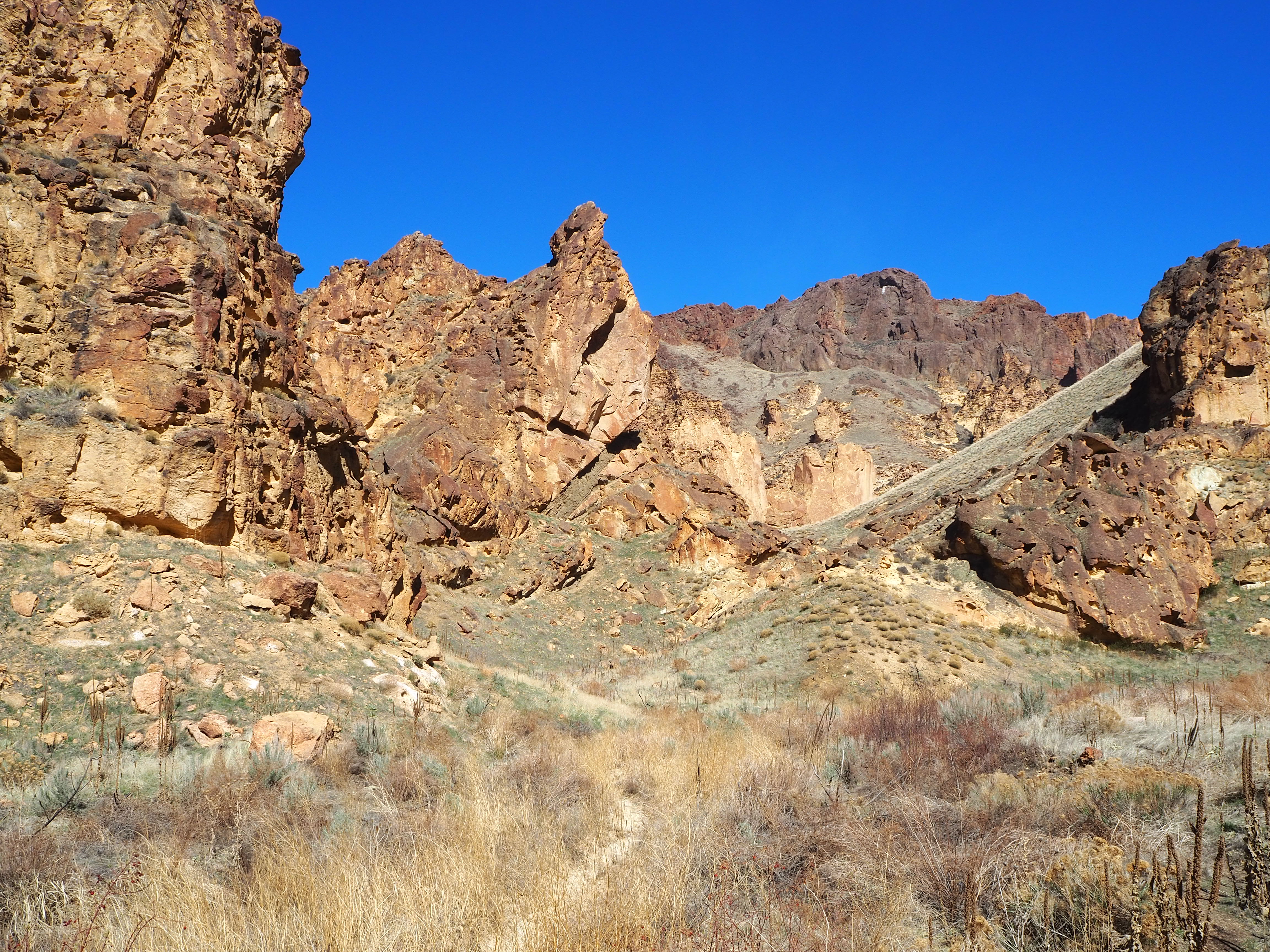
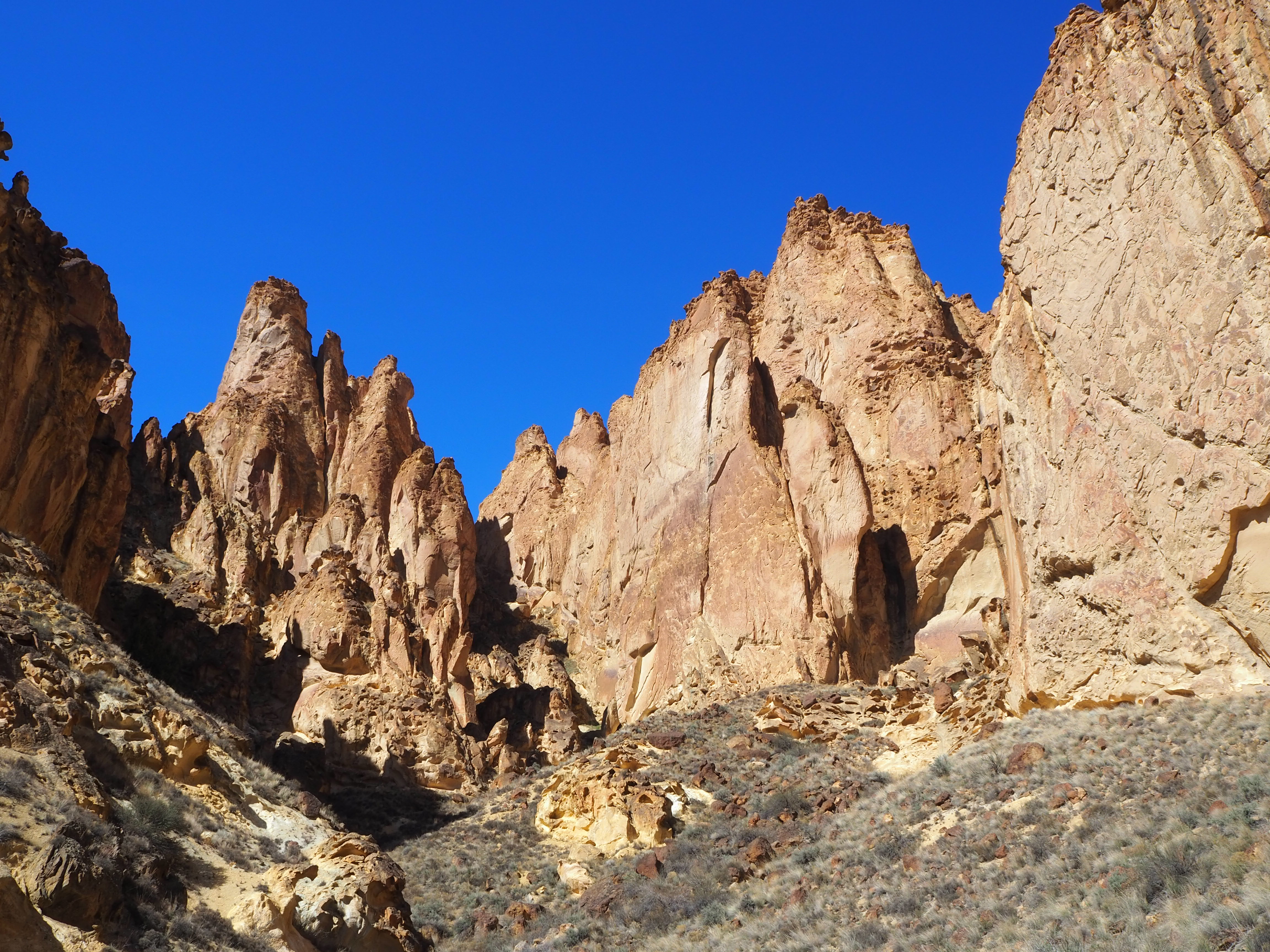
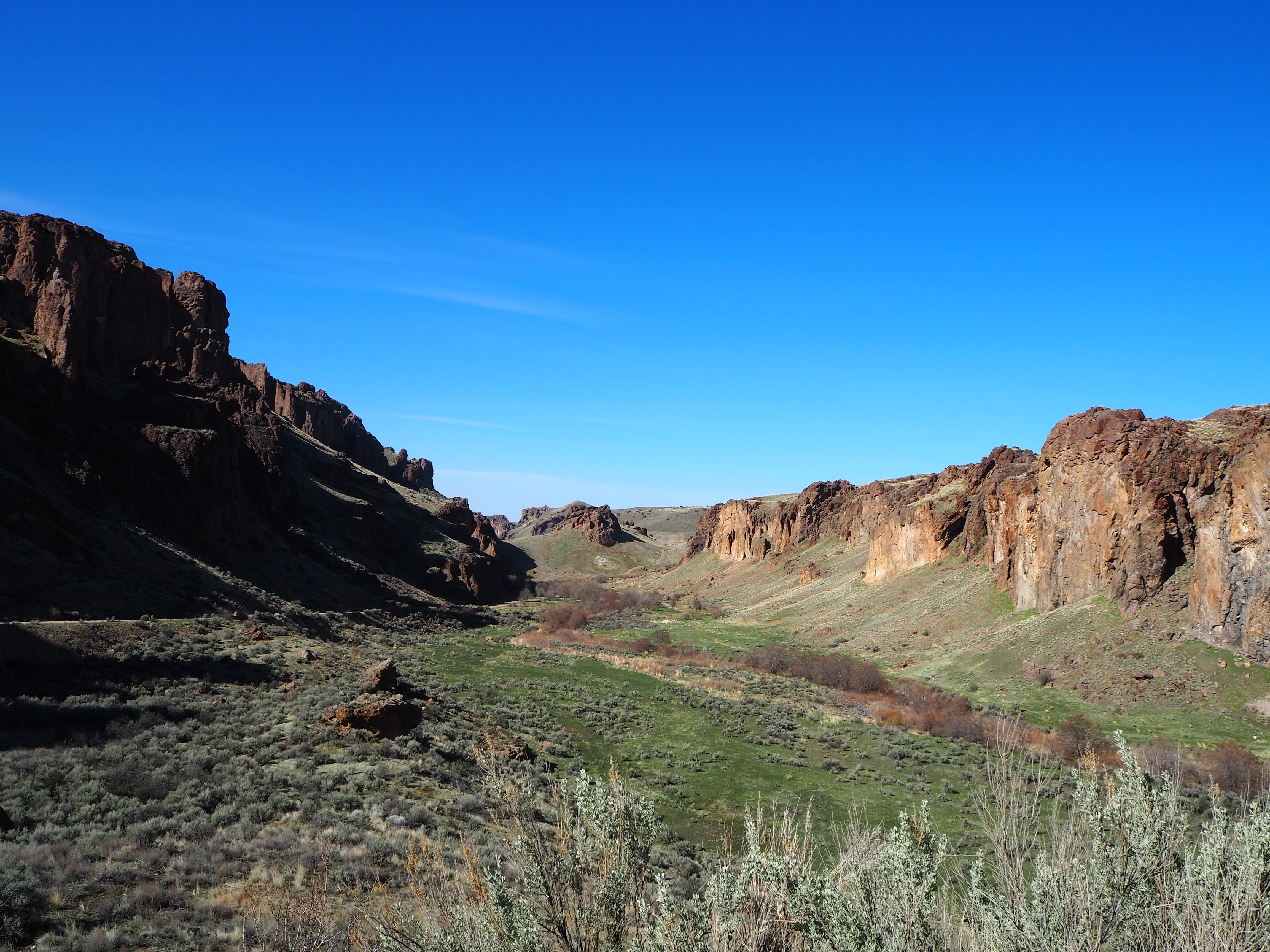
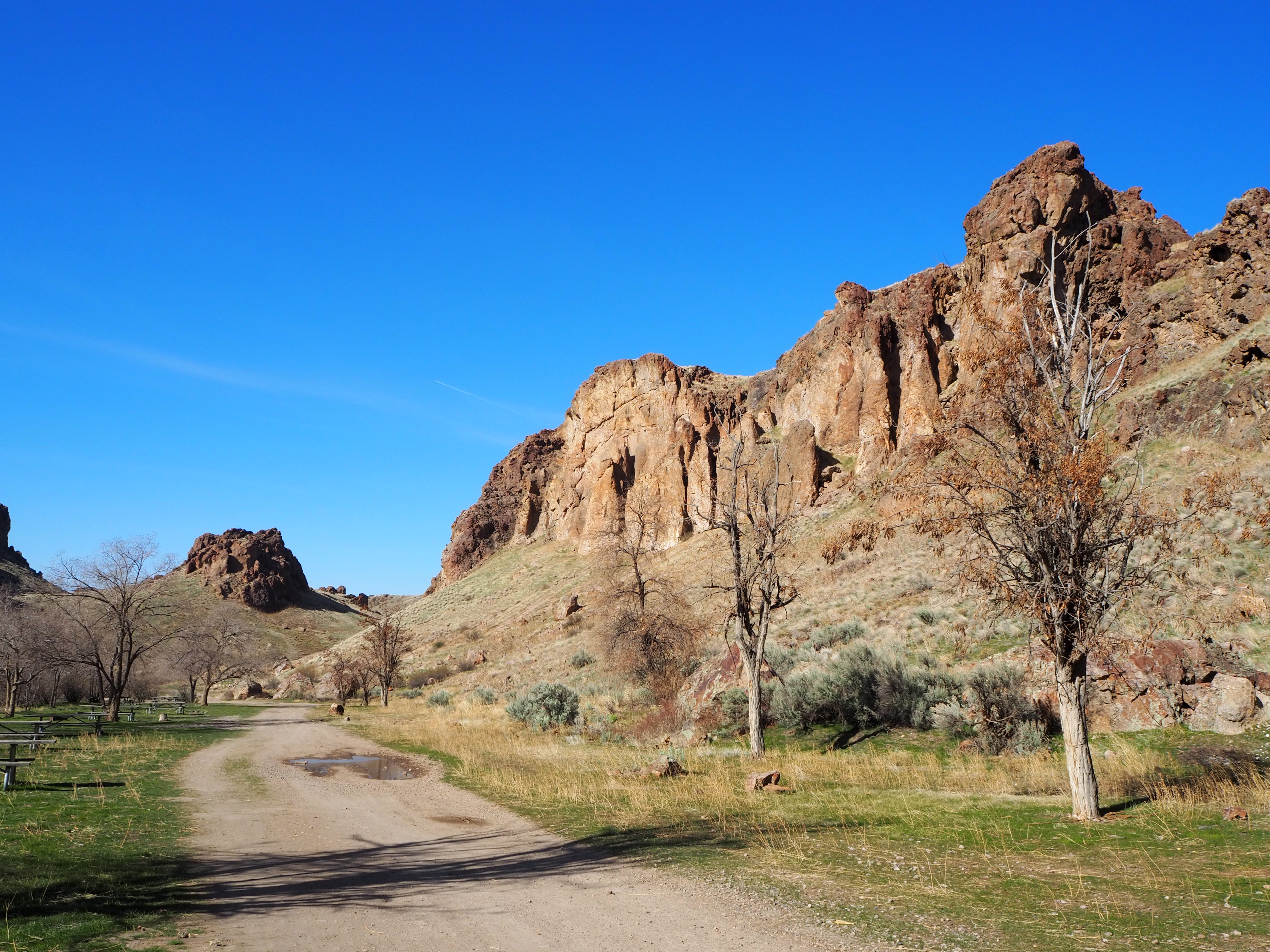
We both felt transported back to Southern Utah: tall red-rock monoliths and honeycombed cliffs towered over the road. Although similar in appearance, these red porous rocks are the product of millions of years of consolidated rhyolite ash from the Mahogany Mountain Caldera eruption. The area – over 11,000 acres – is protected as an Area of Critical Environmental Concern (ACEC) which means camping is only permitted in the 12-site Slocum Campground and no backpacking or horses are permitted. Mountain bikes and OHVs are confined to the road which makes hiking in one of the side canyons very enjoyable. There are four main side canyons branching off the main road (Upper Leslie, Dago, Juniper, and Timber) and a fifth (Slocum) next to the campground. We spread four hikes over two weekends, giving ourselves a weekend in between as a buffer.
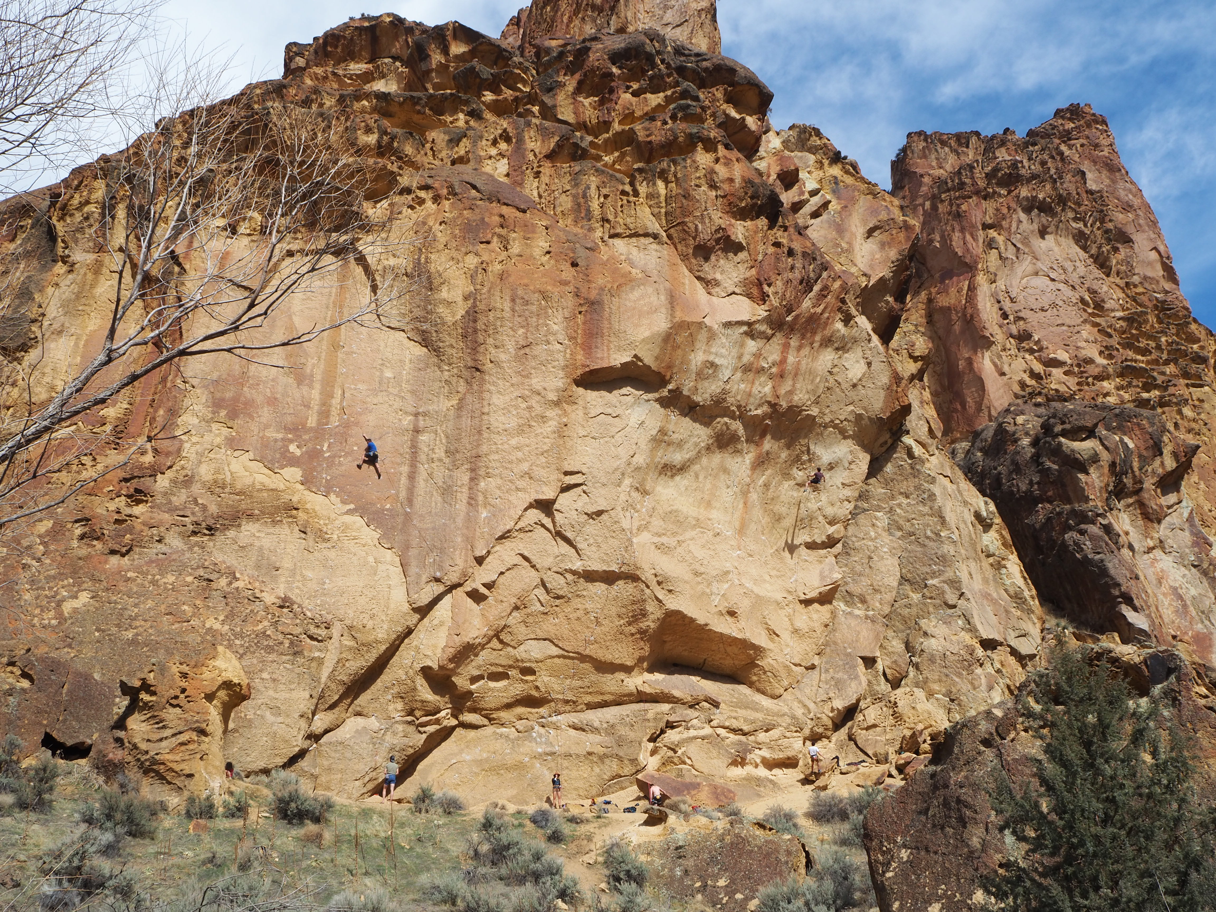
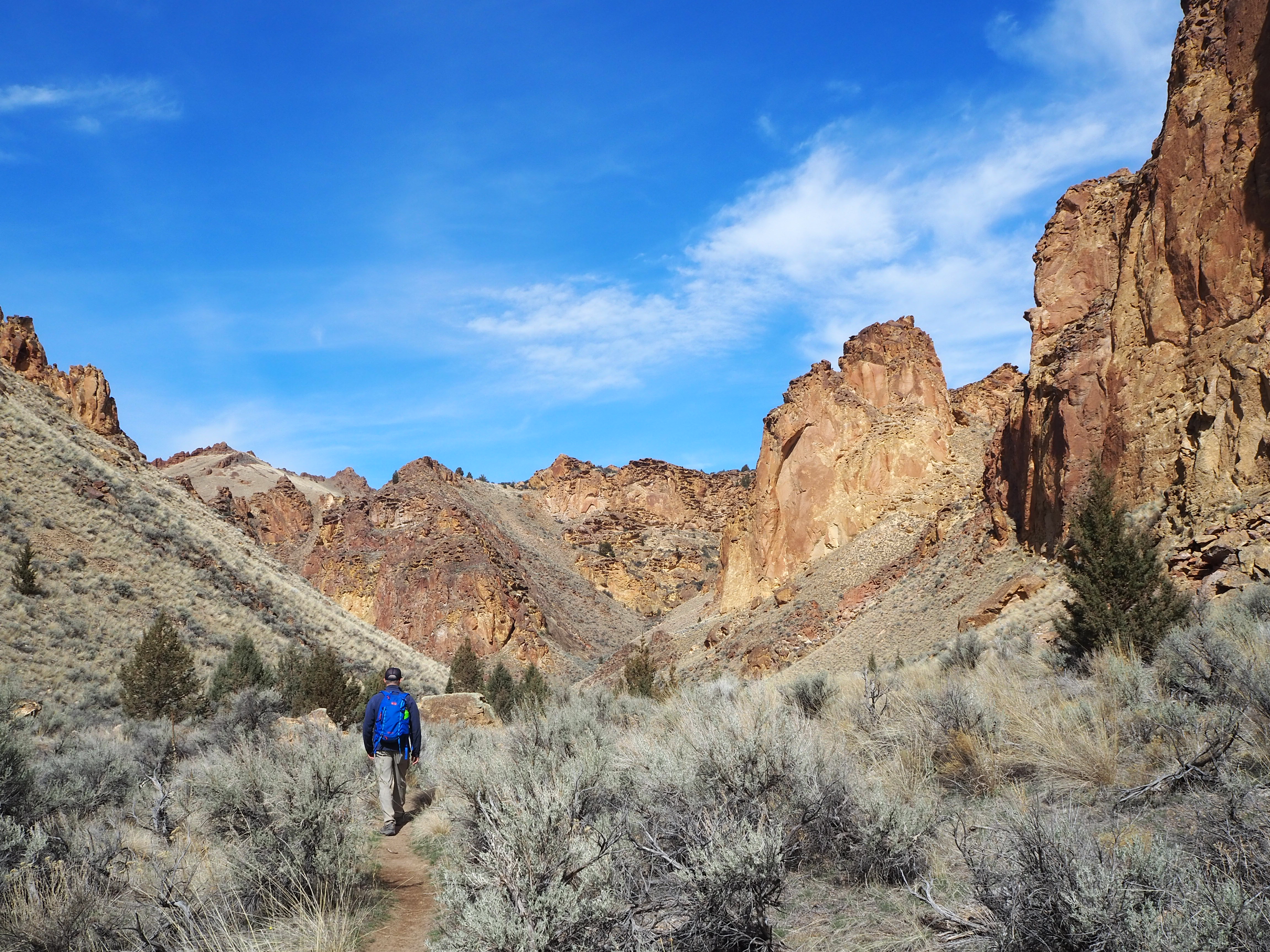
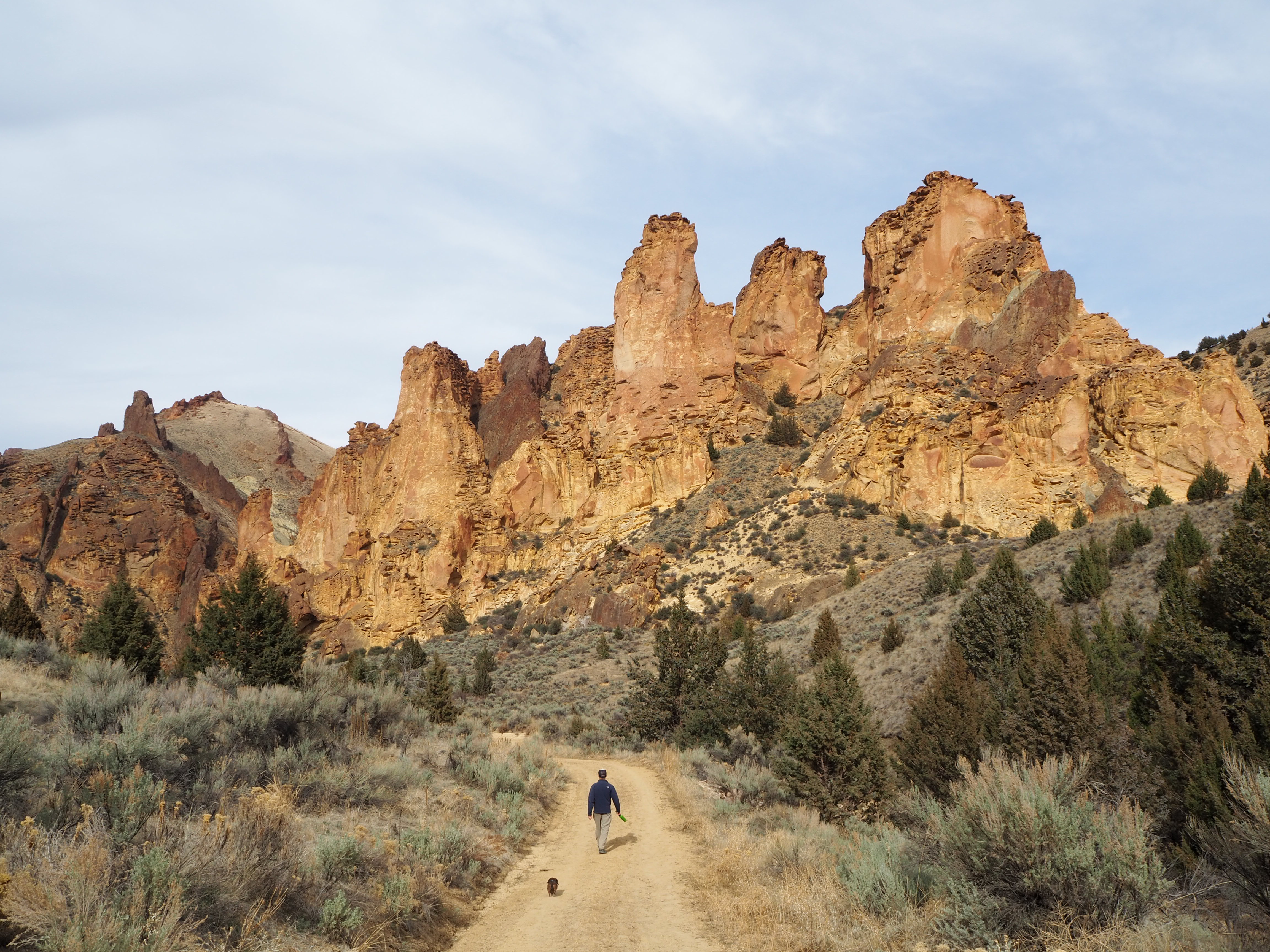
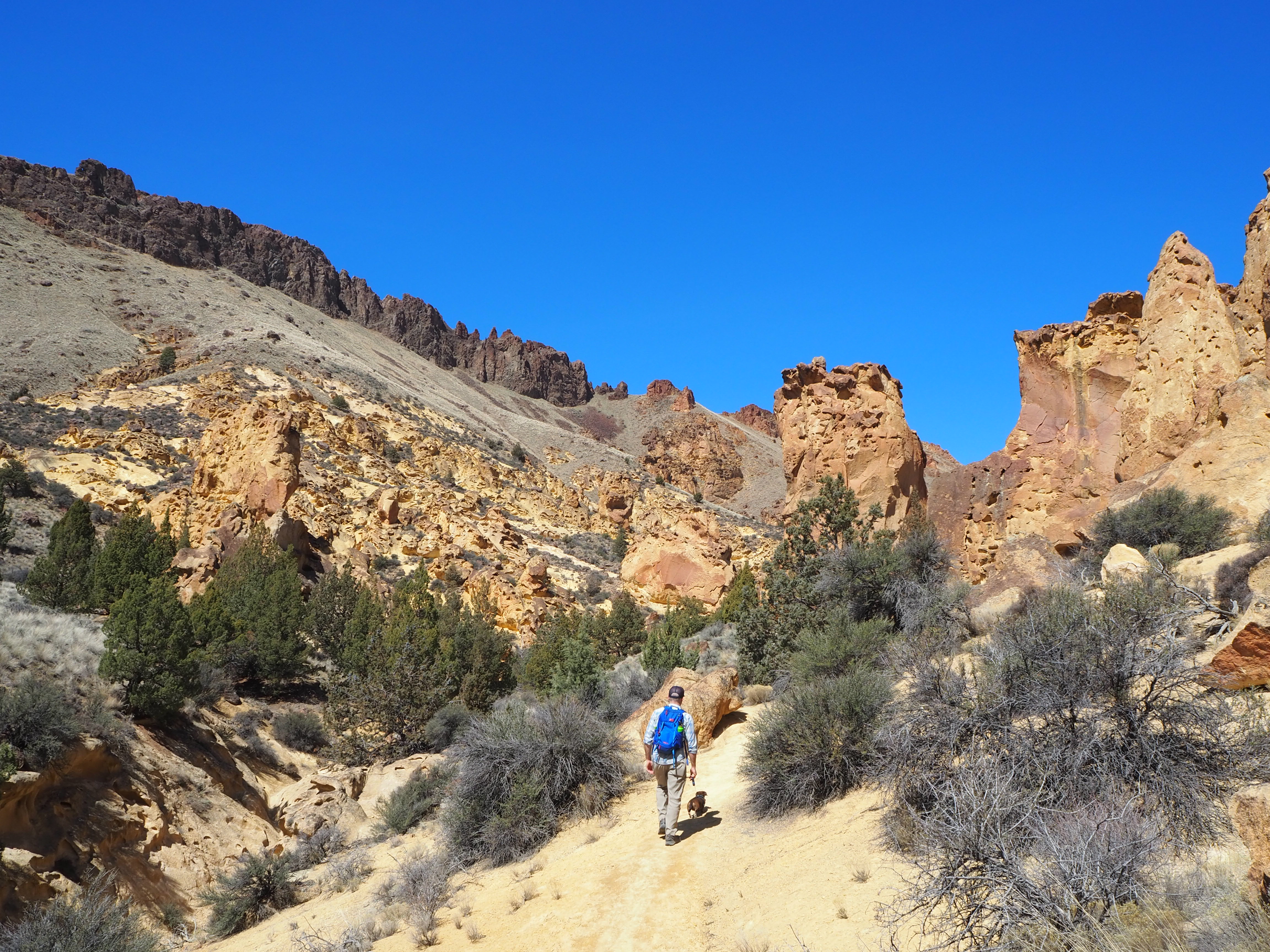
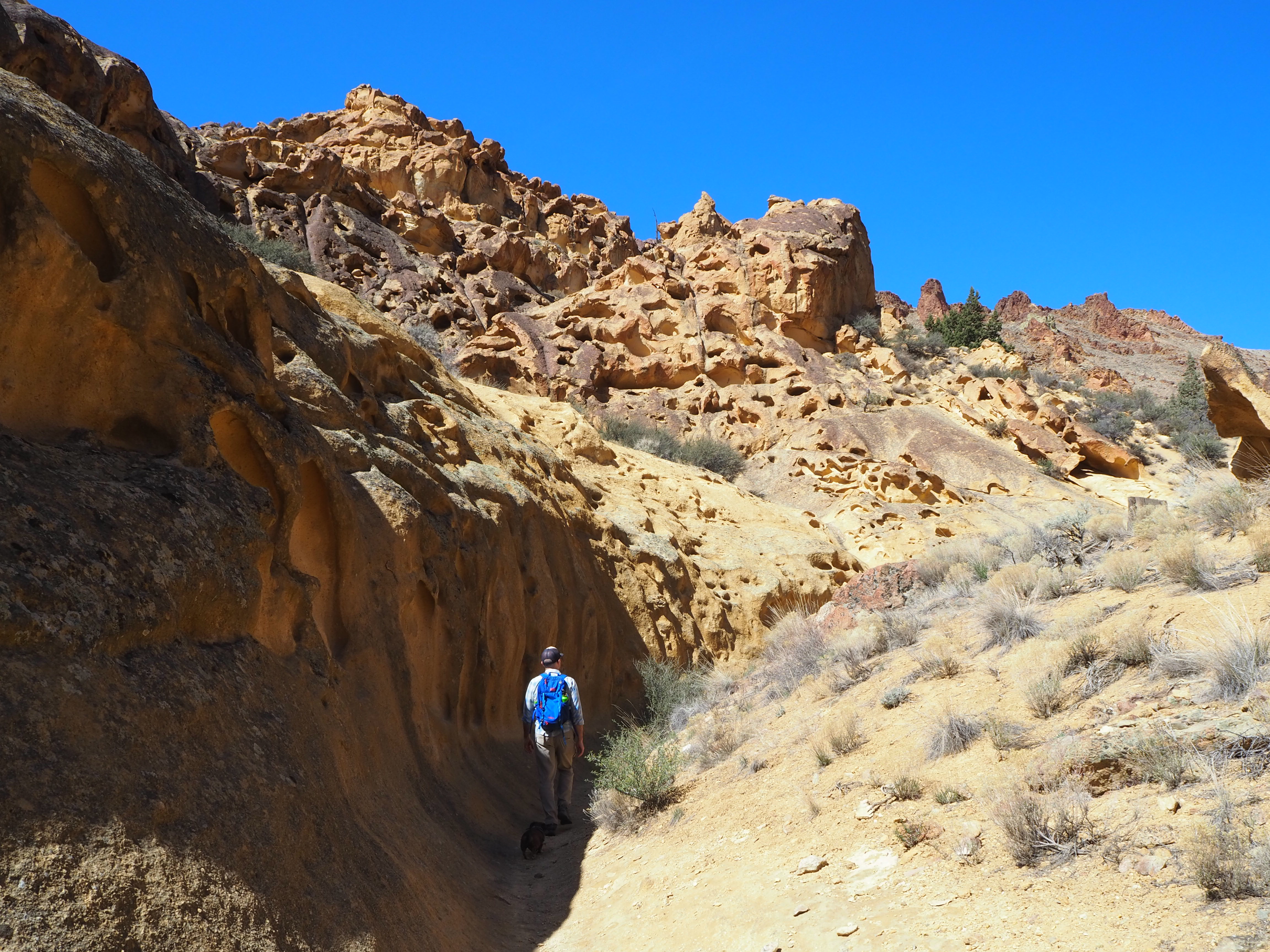
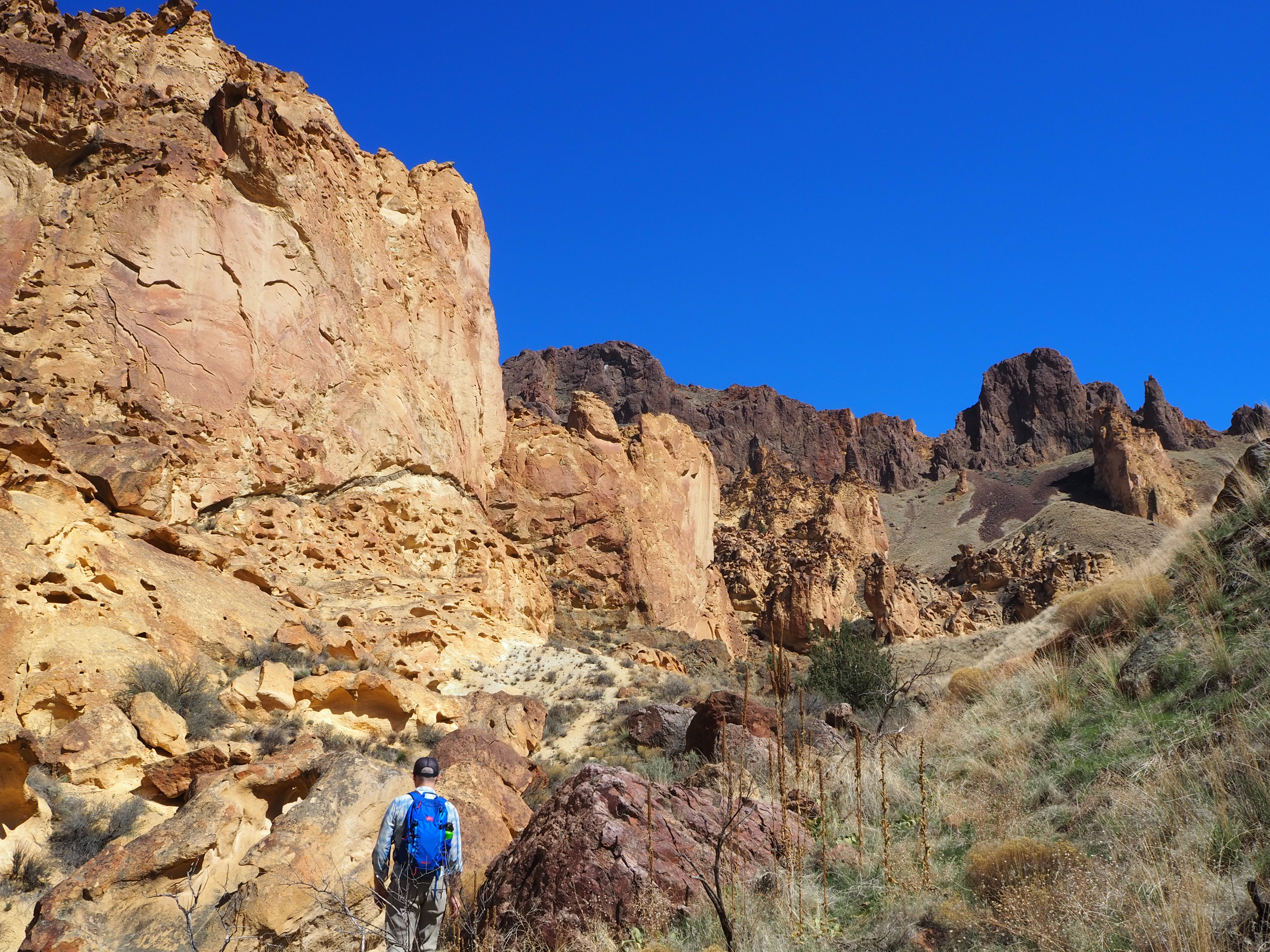
On our first outing, we stopped at the first trailhead: Upper Leslie Gulch. There’s a small parking area, and it was full (roughly 6 cars) when we arrived around noon. We parked a short distance down the road and hoofed it back up to the trailhead. Even from the parking area, the views of rock formations are stunning. As we began, I kept turning back to watch as the view shifted and deepened. All of the trails in Leslie Gulch are unmaintained. While the paths themselves are well worn, it’s the brush that makes this clear. We bushwhacked our way past juniper and gigantic clumps of sagebrush fairly often. I was glad I’d worn pants! About a quarter of a mile in, we came upon a group of rock climbers at the base of a large, flat cliff face. We stopped, transfixed, as we noticed two small figures high up on the wall. Truman, however, was unimpressed and urged us on.
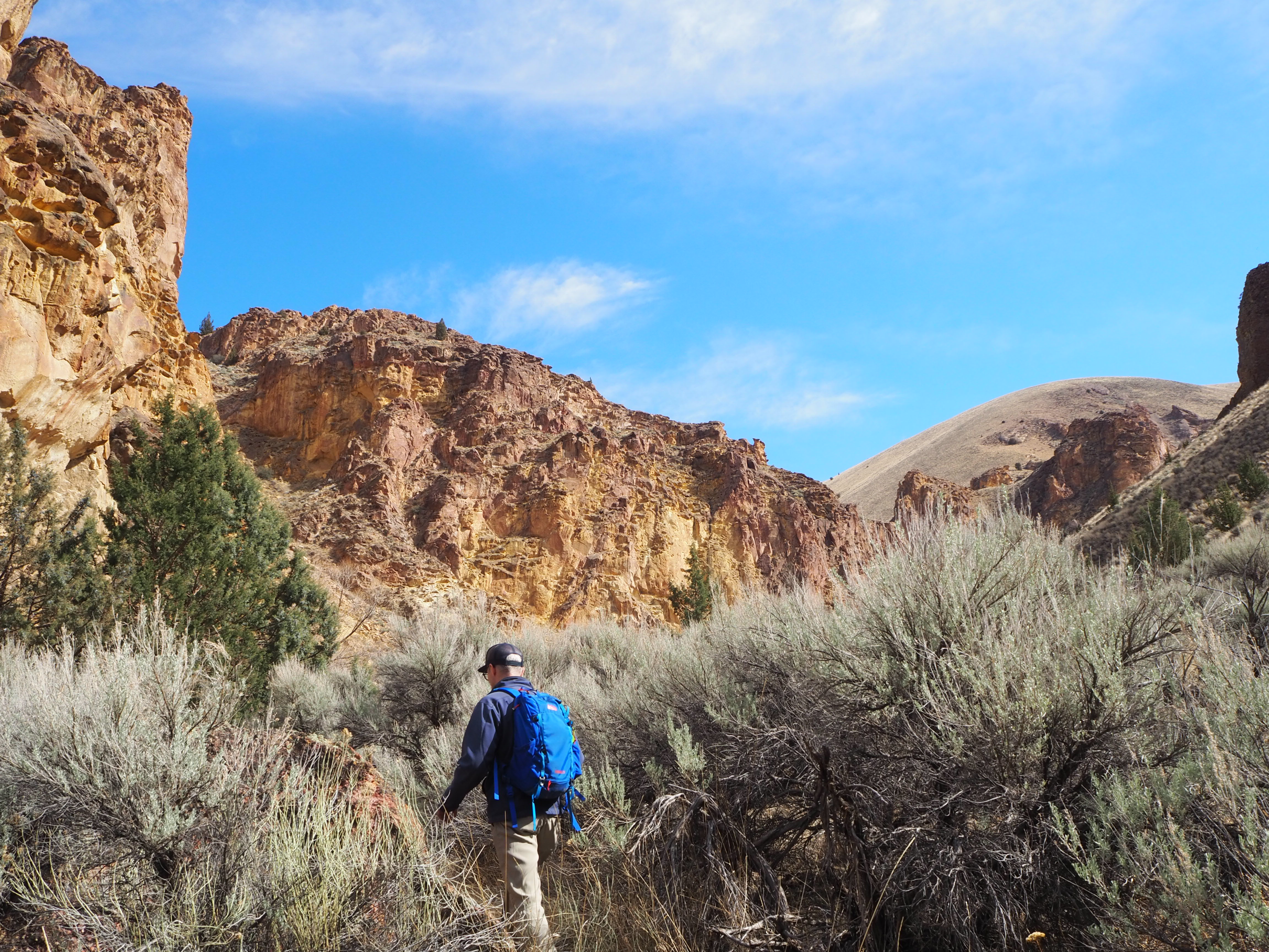
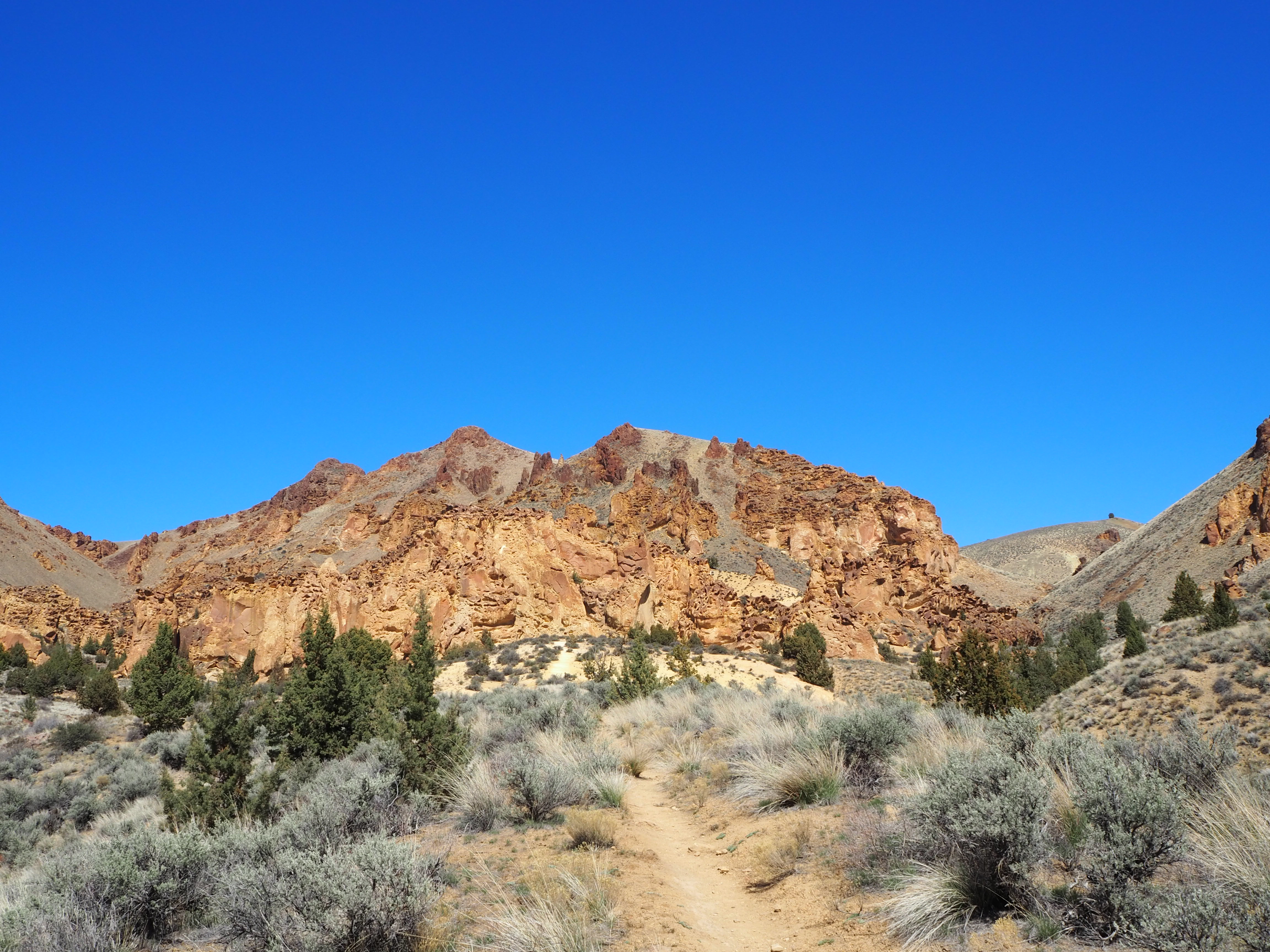
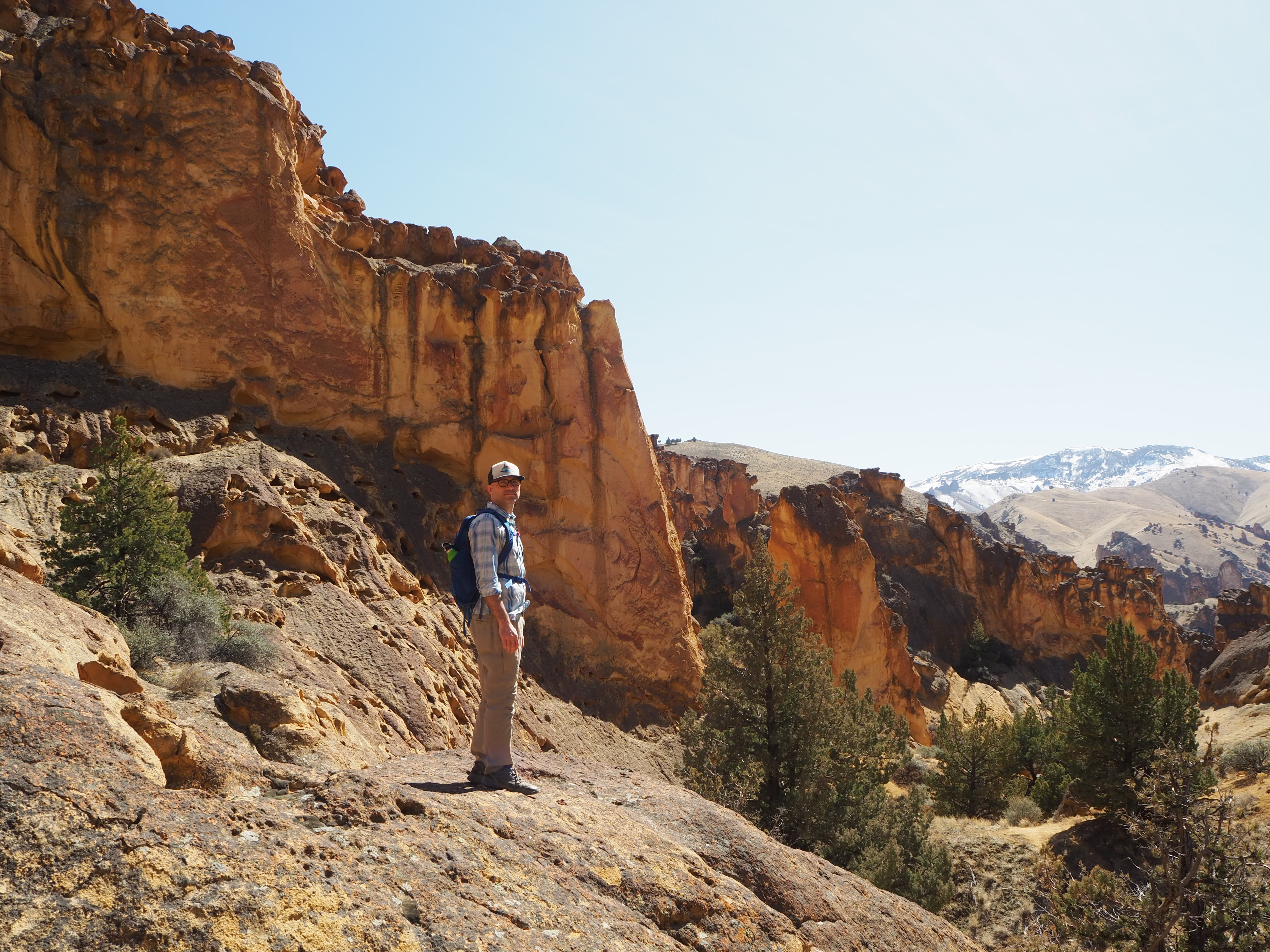
The trail kept up its moderate ascent, and we marvelled as our view opened up. The sheer rock walls fell farther to the side of the trail, and aside from a tall juniper tree here and there, we had a more expansive view of the gulch with Mahogany Mountain in the distance. We were surprised to pass so few, after the parking area gave us the opposite impression. After a mile, the trail dropped into a wash, and it was here that the real bushwhacking began. The wash was narrow and a few feet deep so that limbs and roots were a near constant impediment. I had to stay a short distance behind Zach to avoid getting thwacked. We continued this way for half a mile before we concluded that we could turn around and begin our return. I’ve never been too keen on hiking in washes, and this was no exception. The trail ended in another half mile and our hiking book described the option of bushwhacking farther to a slot canyon. We were okay missing out on that. Once out of the wash, we enjoyed our descent back to the parking area, shedding layers as the day warmed.

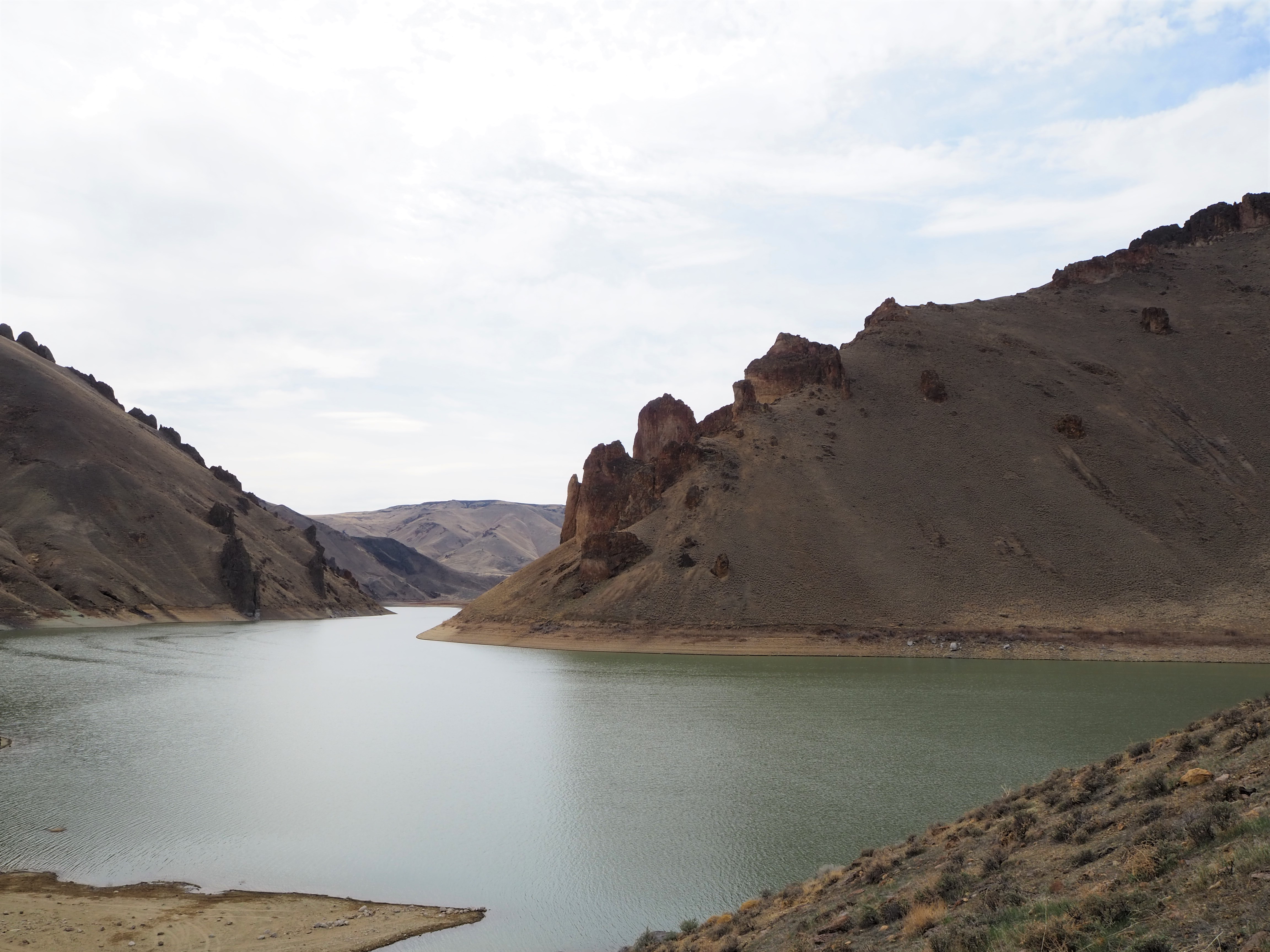
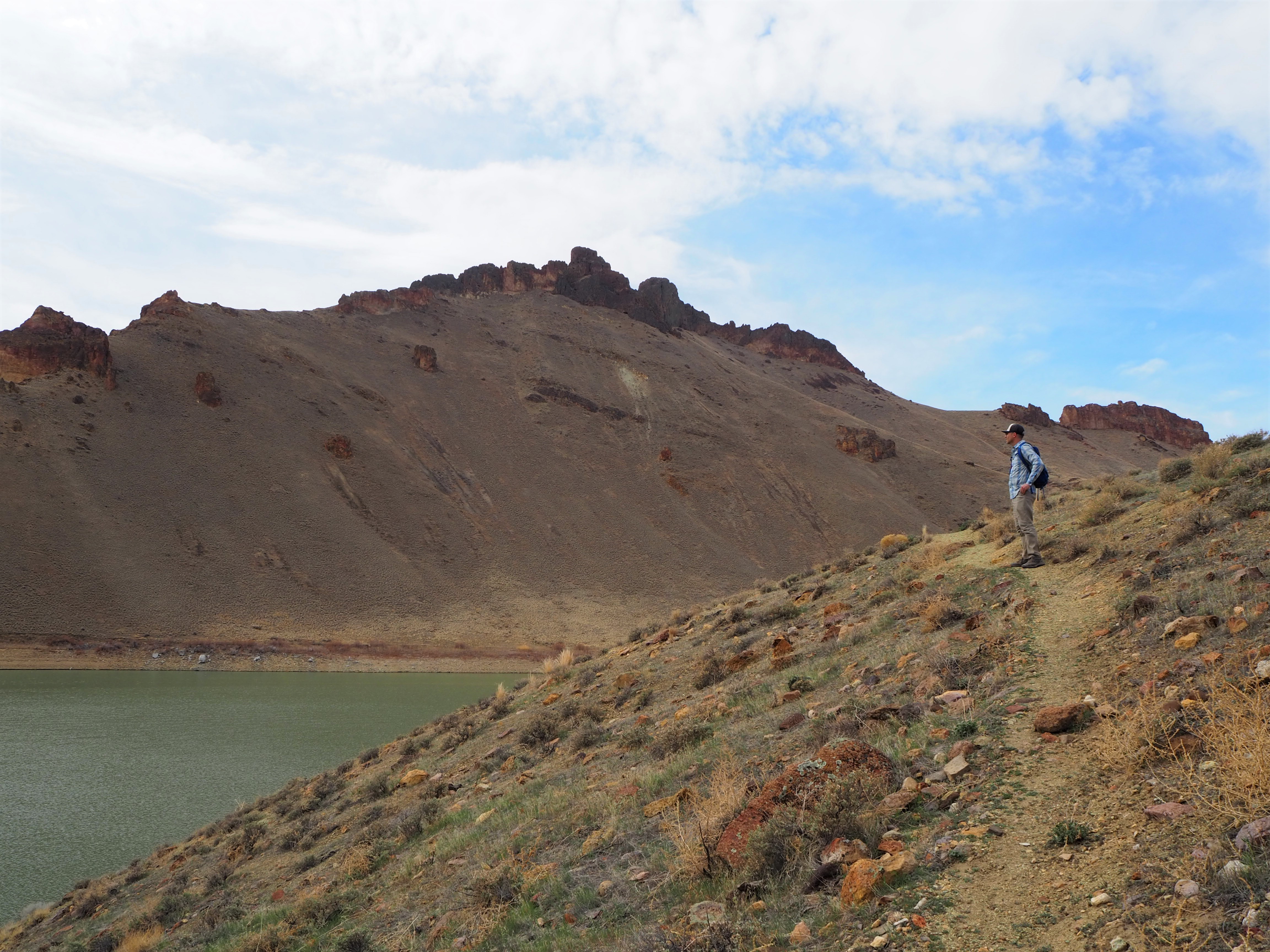
Back at the car, we decided to drive to the end and check out Owyhee Lake. The beauty and diversity of Leslie Gulch is stunning from the car, and it’s worth the trip even if you don’t hike. At the end of the road, instead of following the boat ramp to the water’s edge – which was littered with OHVs and their occupants – we parked and decided to follow a faint trail to gain a better overview of the reservoir. We scrambled up the steep slope and found a decent spot to sit and enjoy our sandwiches. The reservoir was still at its winter level, but a few boats cruised by enjoying the warmer day. We admired the bare scenery of the lake, but I was more enticed by the gulch behind us.
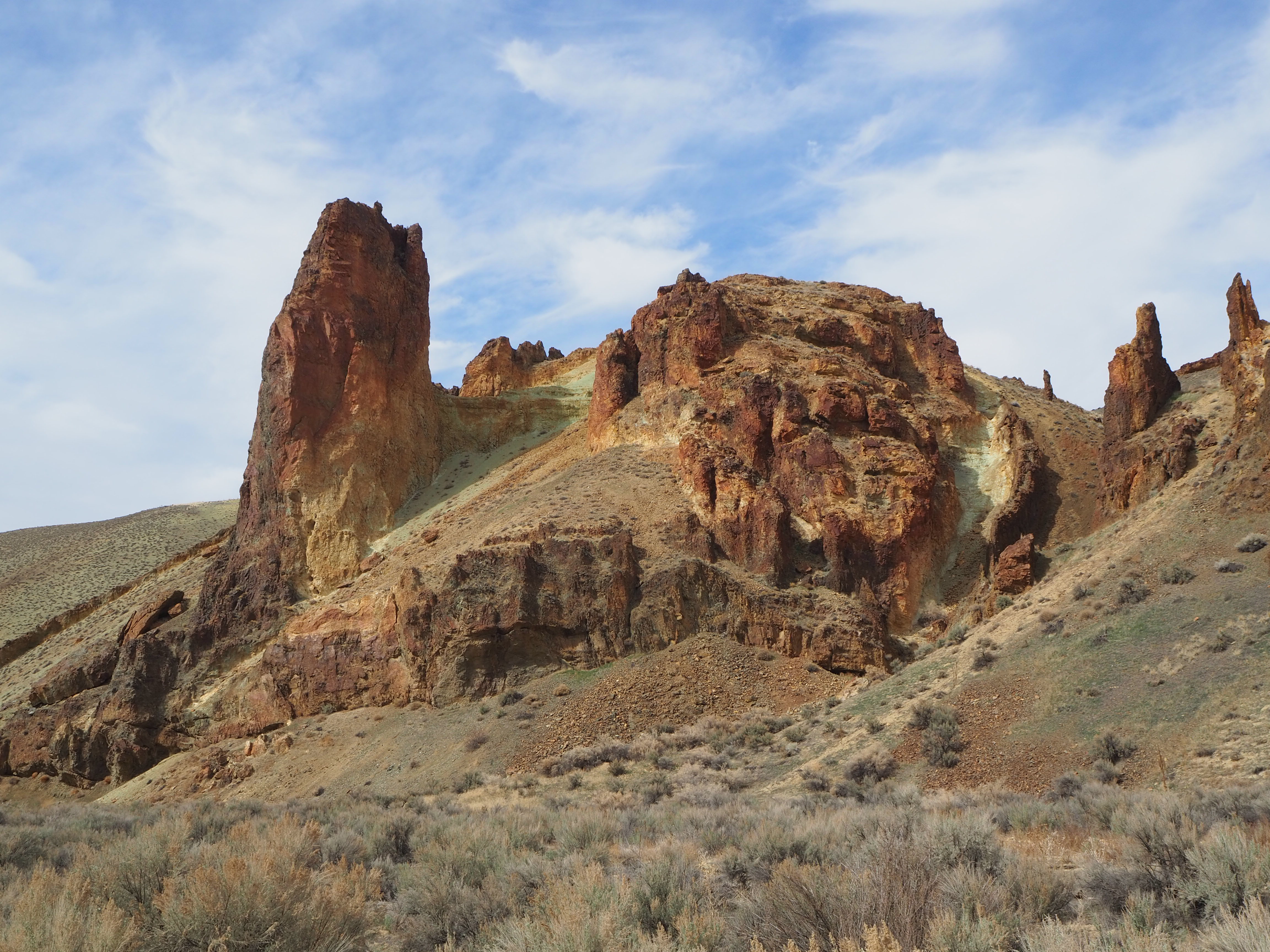
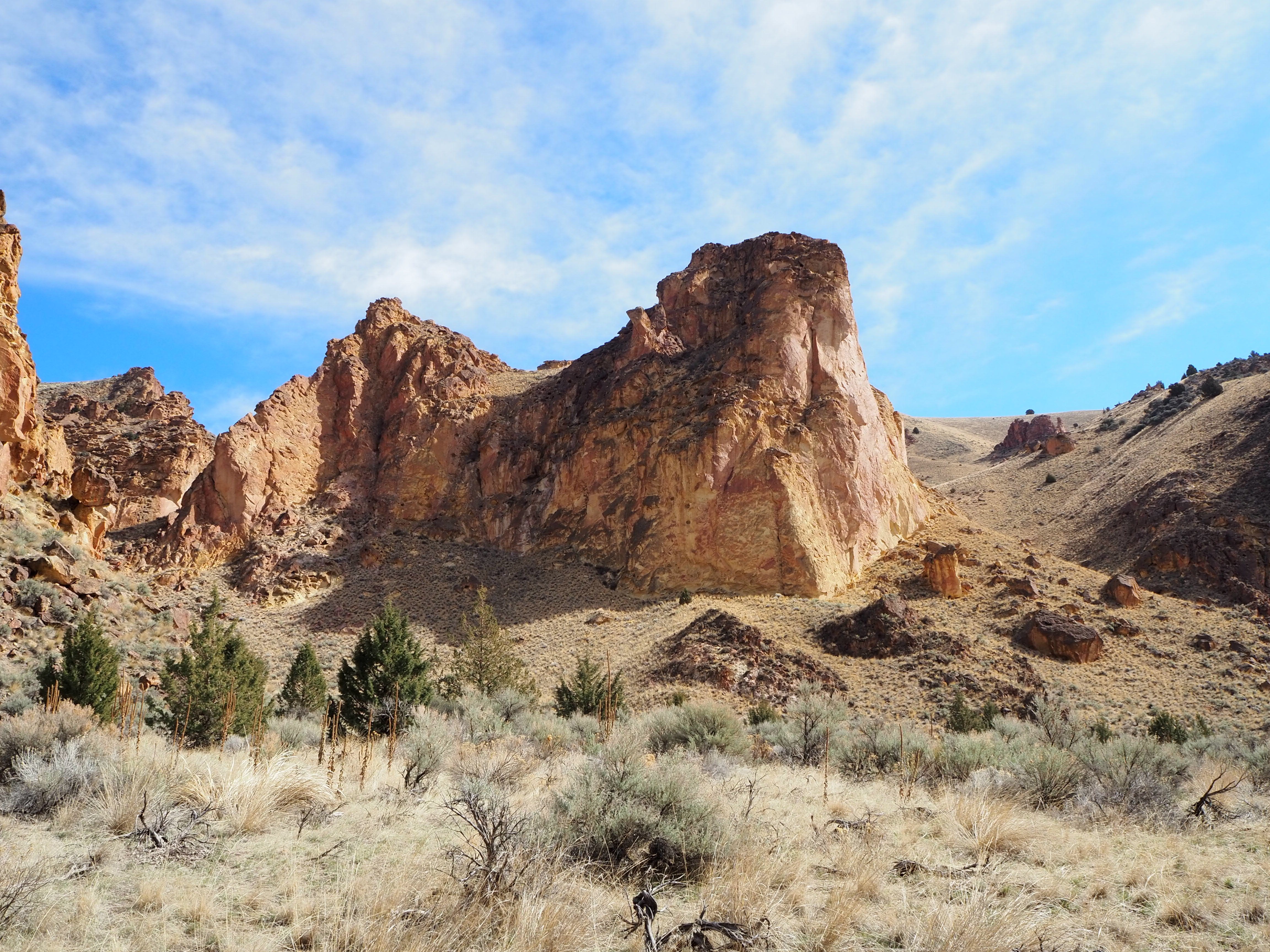
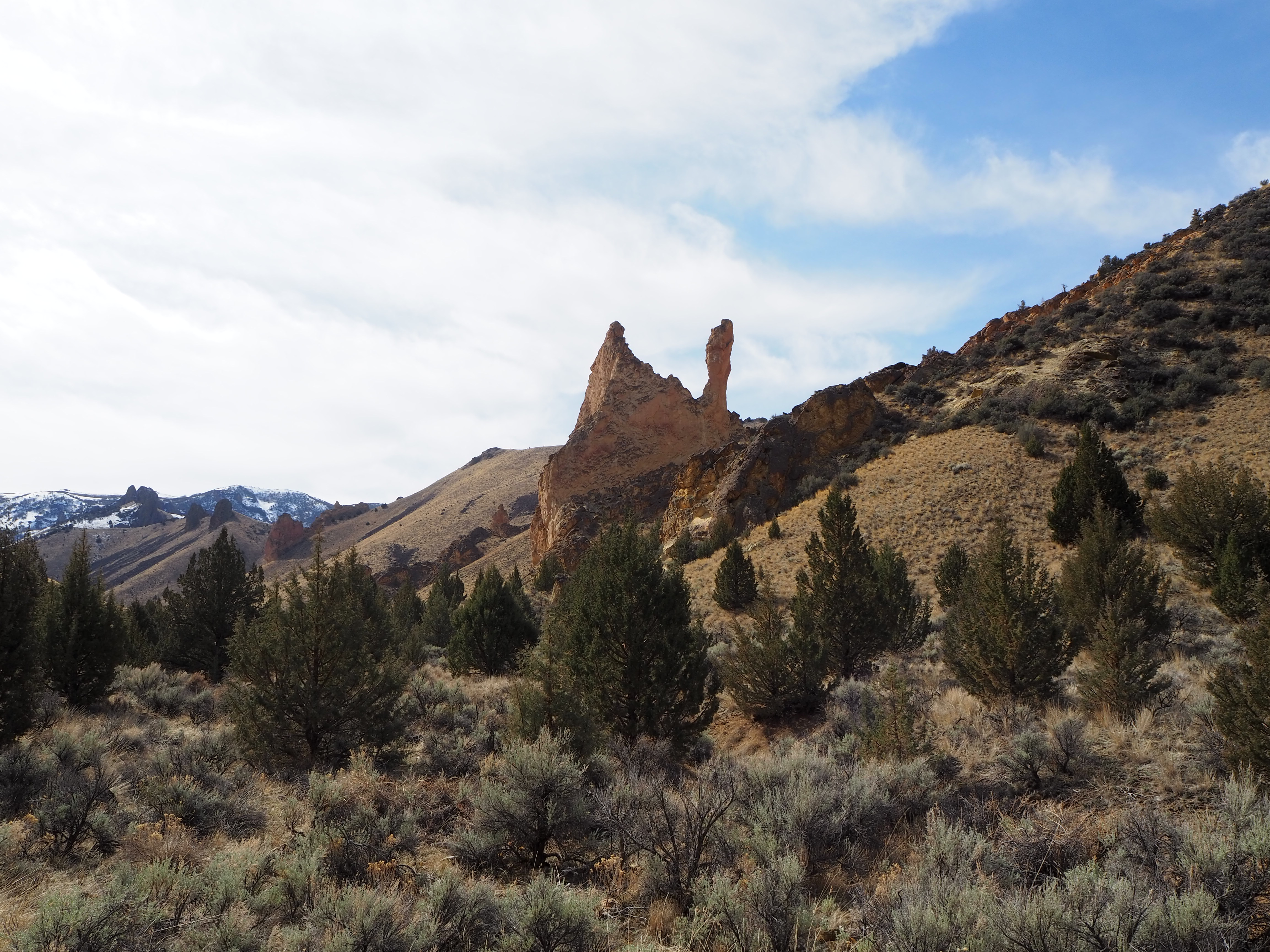
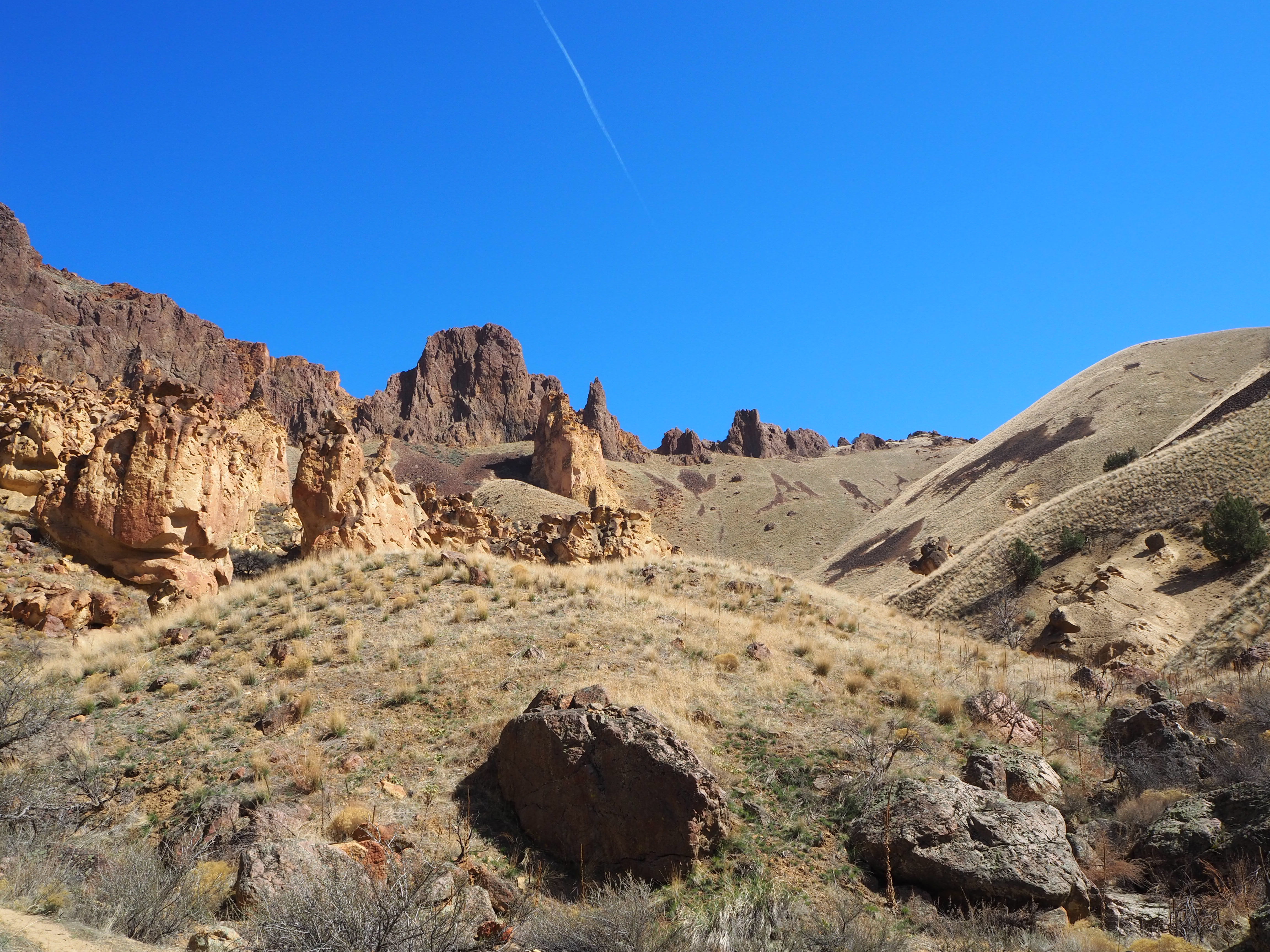
To close out the day, I thought we could hike up Dago Gulch. A relatively short hike up an old Jeep road, it’s the most tame of the four gulch hikes. The rock formations at the start of the hike are the showstoppers, but it was easy to admire the entire hike. Green ash slopes abut one side of the road, while the other is covered in rock and scraggly brush as it slowly rises above the wash. The hike ends at a private property gate, and we turned back for the full effect: the subtle elevation gain perfectly frames the road against the backdrop of the initial formations. It’s the reason to do this hike. We timed it well too, passing only two other hiking groups on their way down, we had the entire road to ourselves as the sun illuminated the red rocks with its warm 5 o’clock gaze. And with that, we ended our first trip to Leslie Gulch.
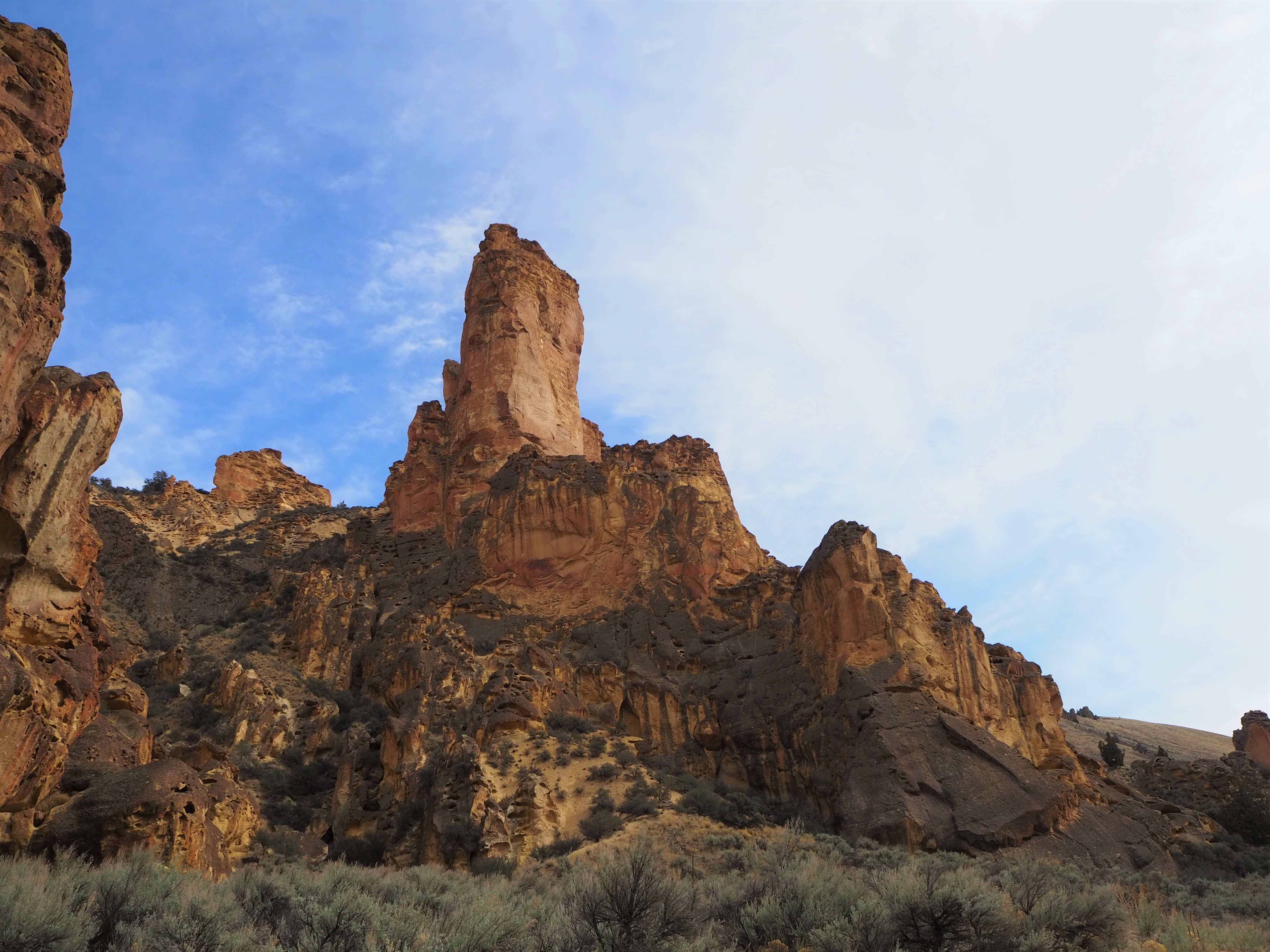

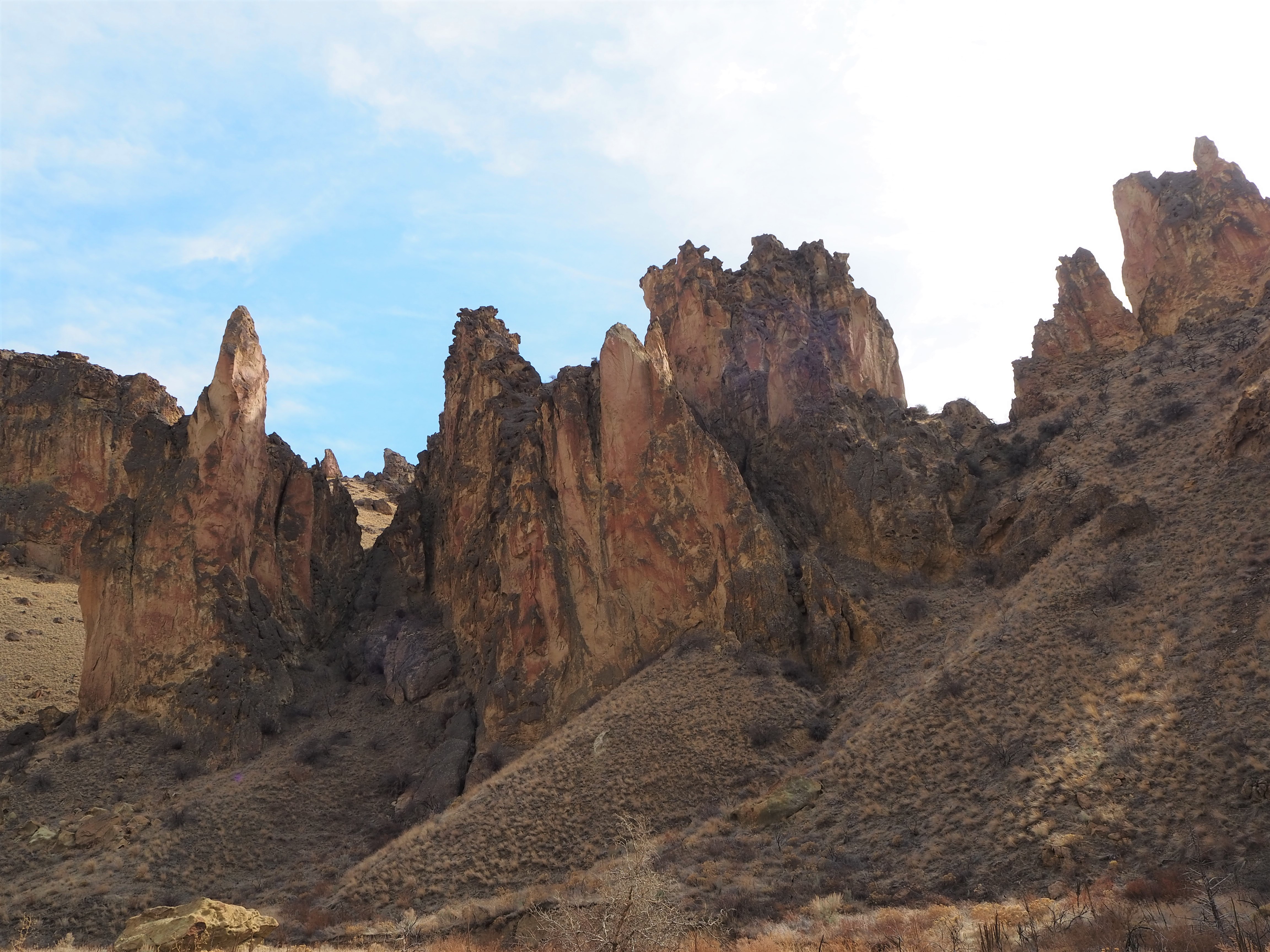
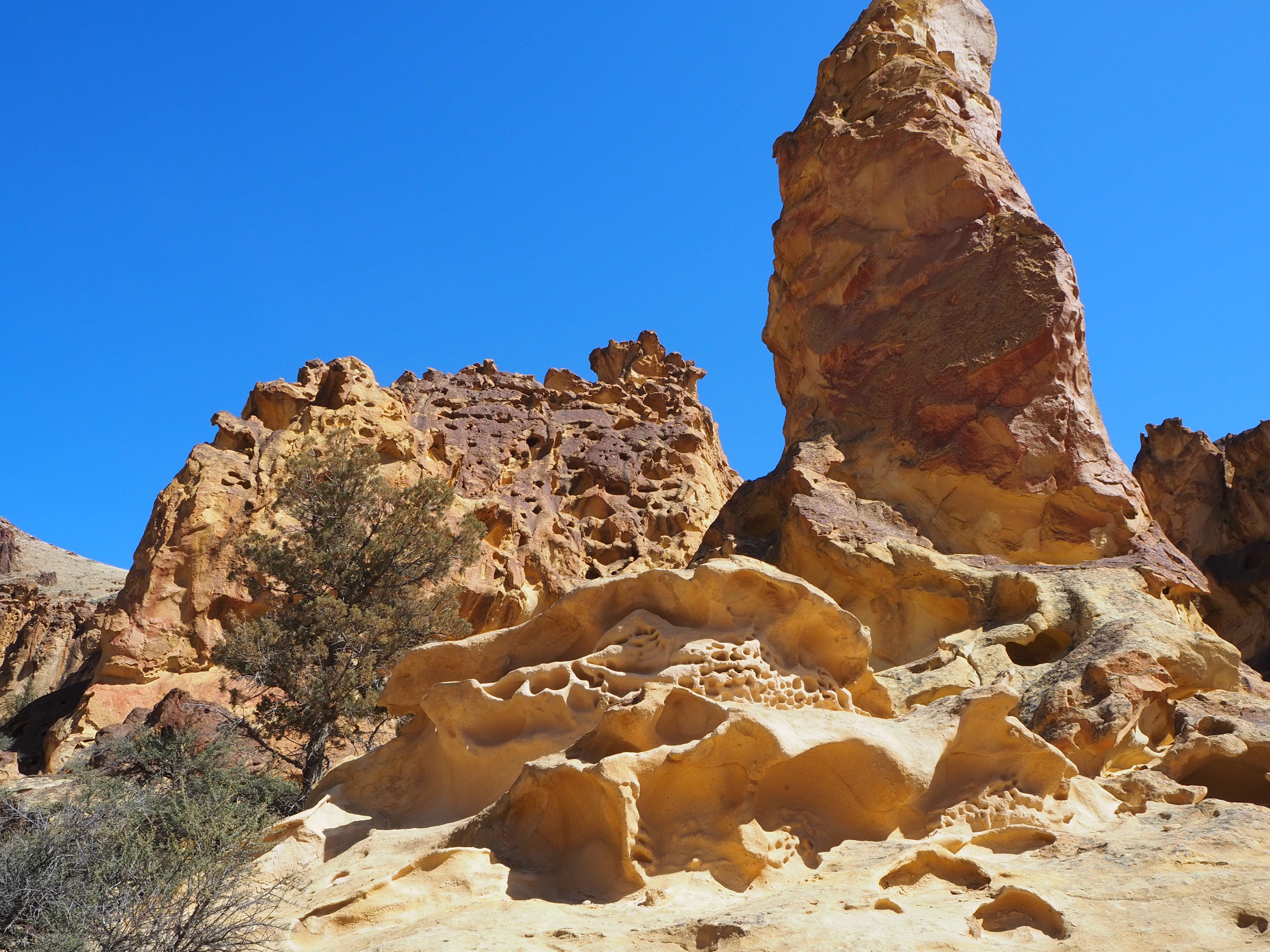
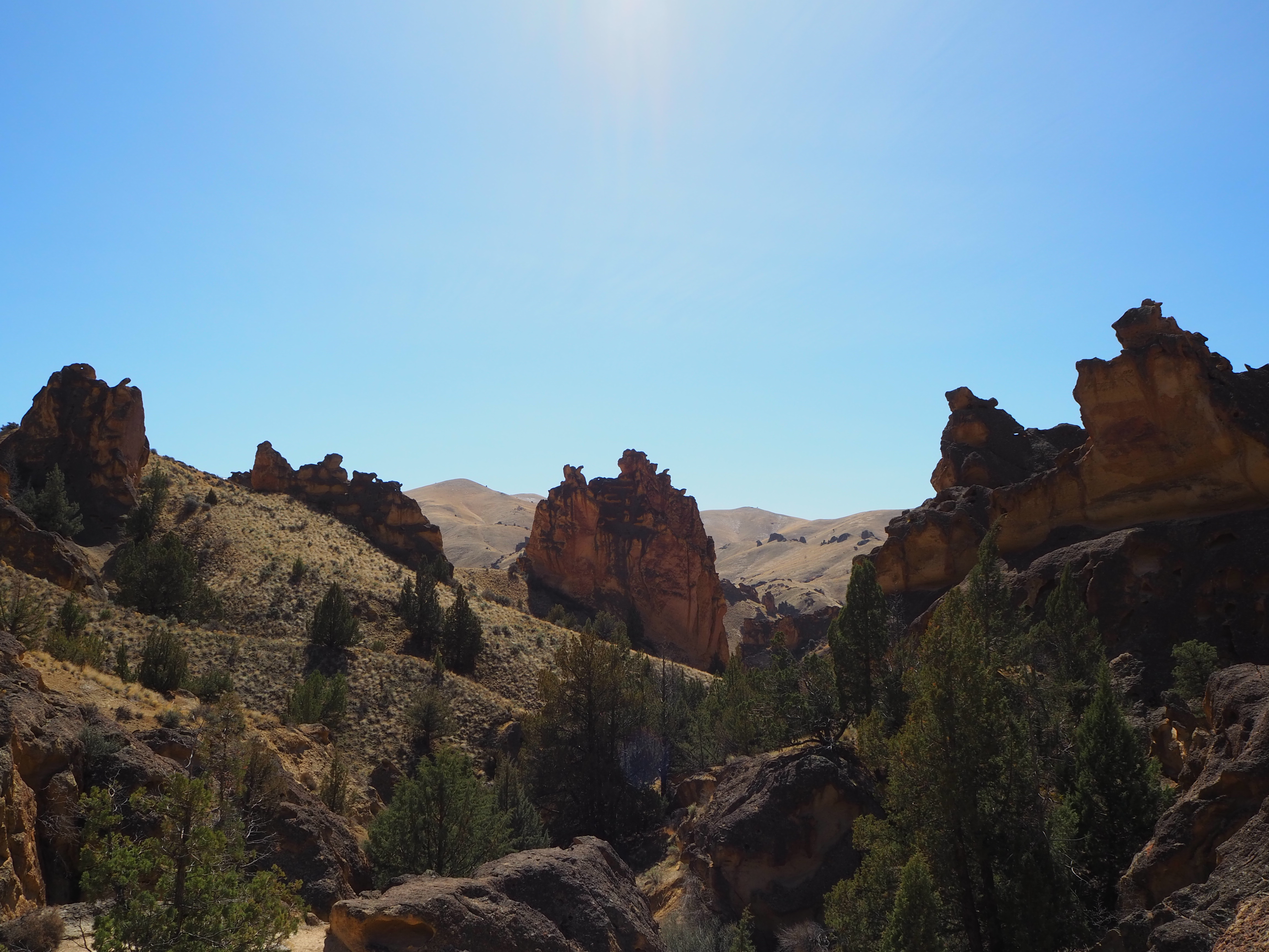
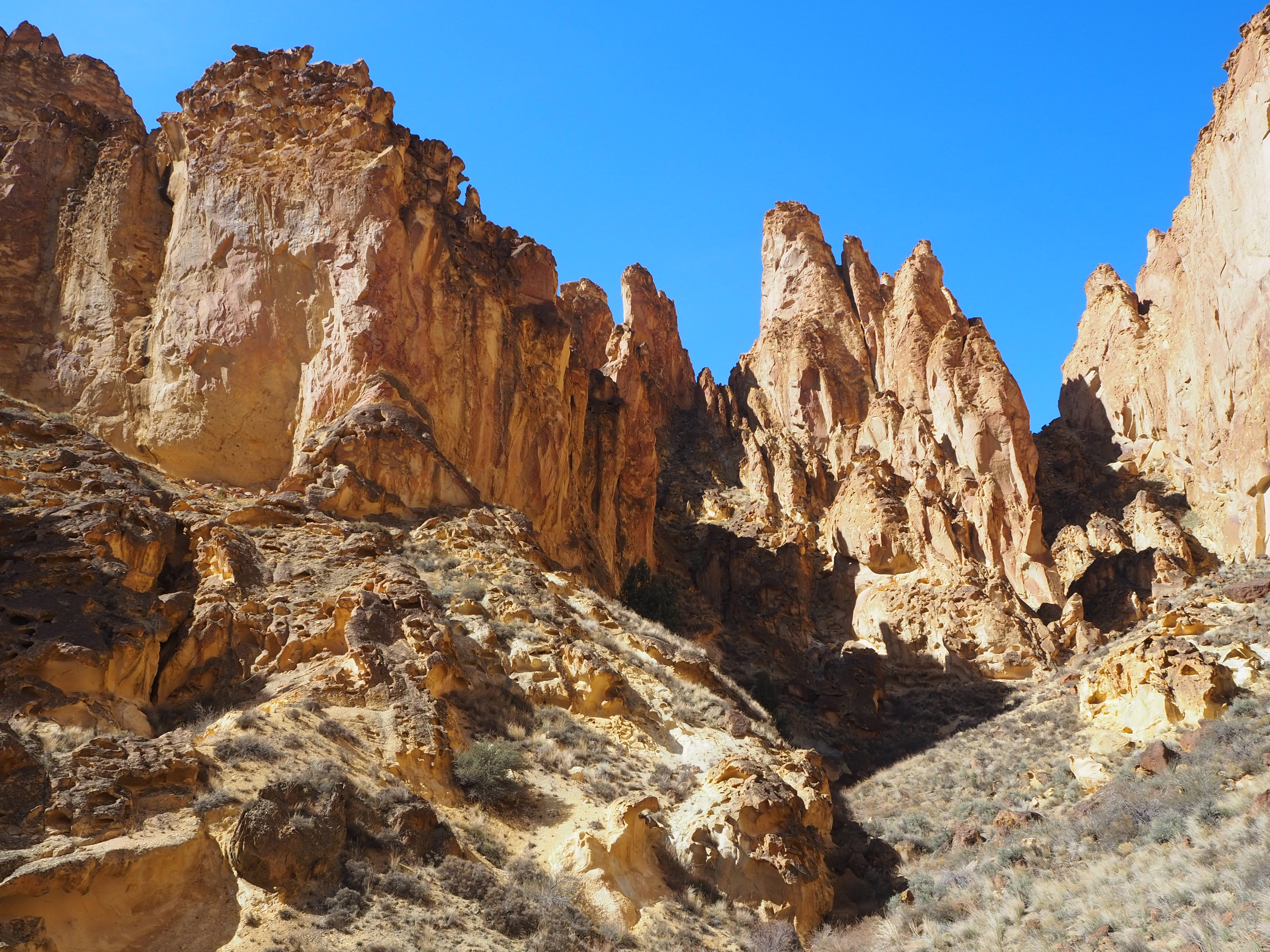
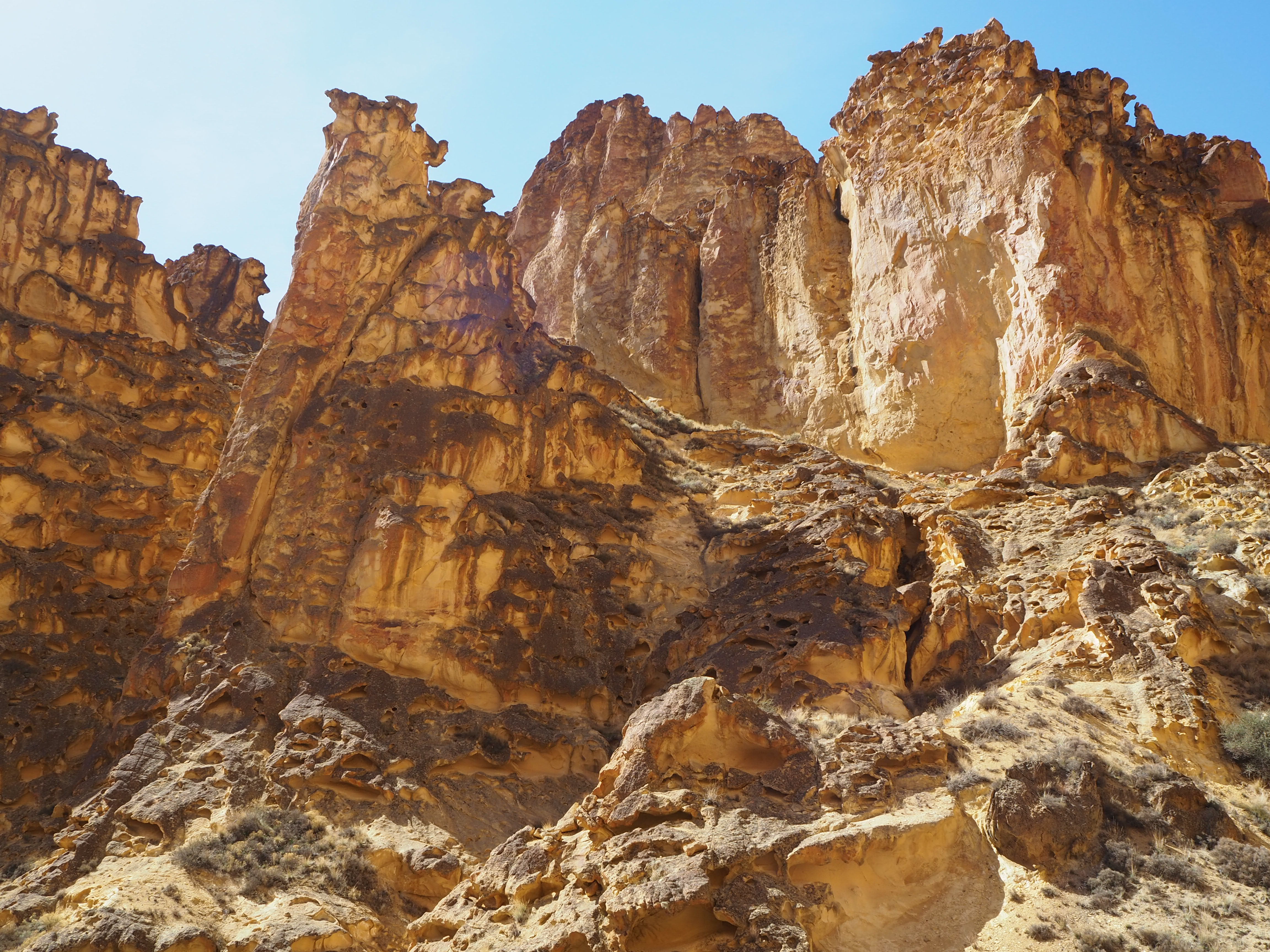
On our second trip, we passed Upper Leslie and Dago to begin at Juniper Gulch. Unlike the other two, the trail almost immediately drops into a wide wash and begins winding underneath hulking honeycombed rock, tapering into a tighter passageway. The wash brought us to a fork and we took the route up, emerging onto a wide plateau that enabled us to skirt the boulder-choked sections of the wash. The plateau was framed at its end by an imposing wall of rock. It looked like a glorious dead end, until we noted a trail leading back down to the wash. The wash can be followed north for another mile or so, weaving through large boulders and over water-carved pour-offs. Eventually departing from the wash, a faint trail ascends to the top of Yellow Jacket, the plateau separating Juniper and Timber Gulches. We decided to wander through the wash leisurely, enjoying our solitude and searching the rock formations. Many of them looked like they were topped by gargoyles; the rocks perched perilously atop a pinnacle seemed to have scowling faces and fangs.
It was the warmest day of the year yet, and even with occasional gusts of wind, we were all feeling the heat, especially Truman. Last year, after one of our first warm-weather hikes, he became so dehydrated it required a trip to the vet! We hoped to avoid a similar situation by turning back after a mile and a half. Truman, unaware of our concern, continued to bound up and over rocks scrambling to keep pace with Zach, overjoyed to be out hiking again.
Juniper Gulch was so much more immersive than the other two hikes we’d done, I could see it’s appeal. There were many more people – encouraged by a larger parking area – and at the beginning of the trail there was little room to step aside in the narrow wash. However, there were also more opportunities to break away from the trail and explore the impressive geology. It was worth the return trip.
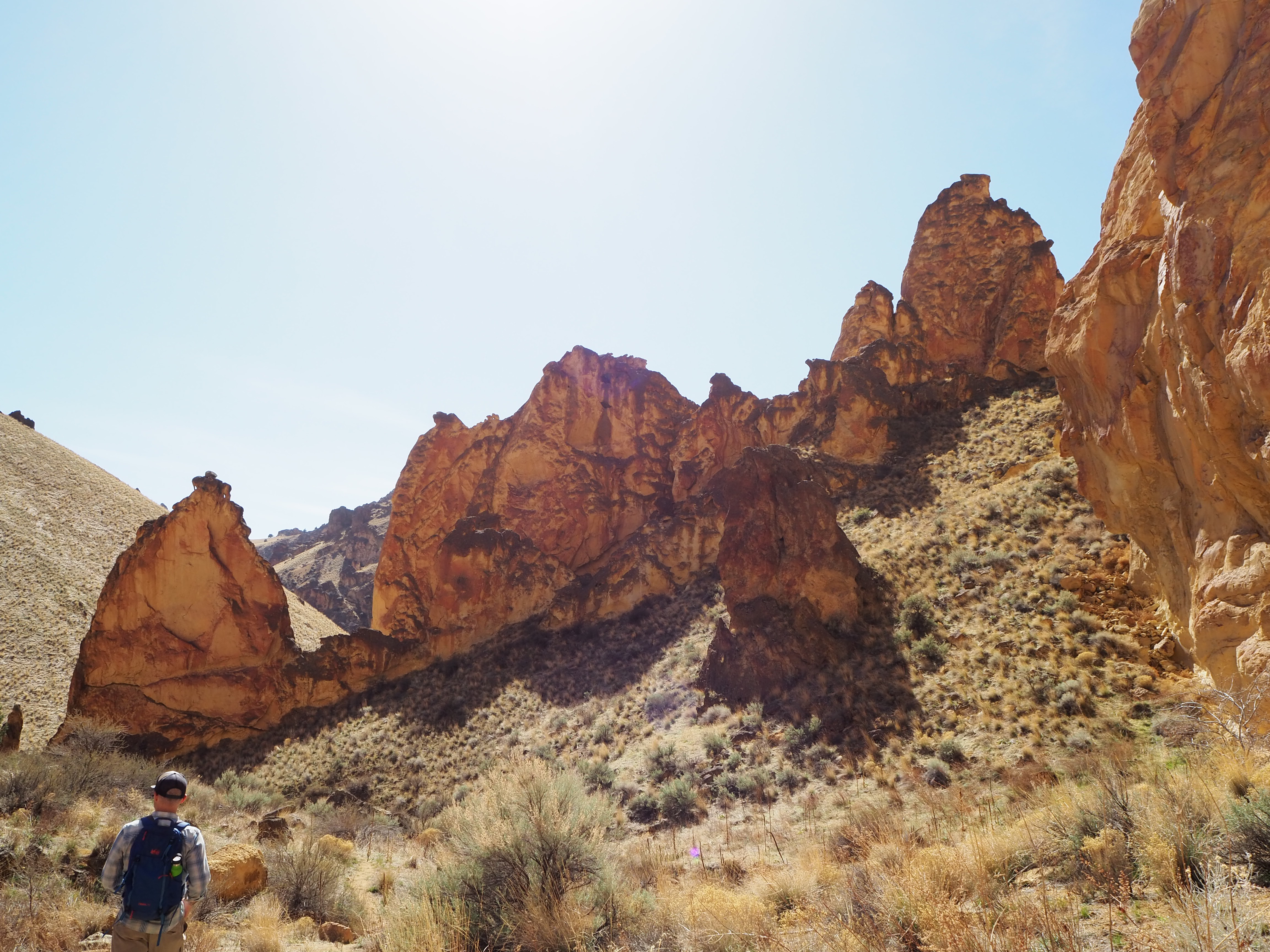
We drove the short distance to the fourth hike, Timber Gulch. It’s unsigned with only a pullout large enough for 2-3 cars. There was no one else at the pullout, so we began to gather our things, happy for the promised seclusion. Suddenly, we noticed a car backing in behind us. He came so close he was touching our bumper! Zach was able to catch his attention and he stopped, but moments later he was backing up again nearly grazing our bumper for a second time! He inched forward slightly and finally parked. He seemed intent on getting as close as possible which seemed absurd given our surroundings: wide, open space, a dirt pullout with no other cars in sight. Bewildered, we hustled off down the trail, hoping he wouldn’t follow.
This trail also followed a wash, so we dropped in and began our quest for a shade tree under which to eat our late lunch. Roughly halfway up, we found a decently sized juniper shading a large rock slab and perched ourselves atop it. Tru already had his tongue halfway to the ground, so we made sure to drench him with water before continuing. We didn’t have much farther to go – only four tenths of a mile – but as the trail left the wash it led us on a steady thigh-burning ascent/descent cycle, allowing us to bisect the curves of the wash. Truman’s tongue was practically on the ground. He was so eager to continue though, he jumped ahead of Zach to lead.
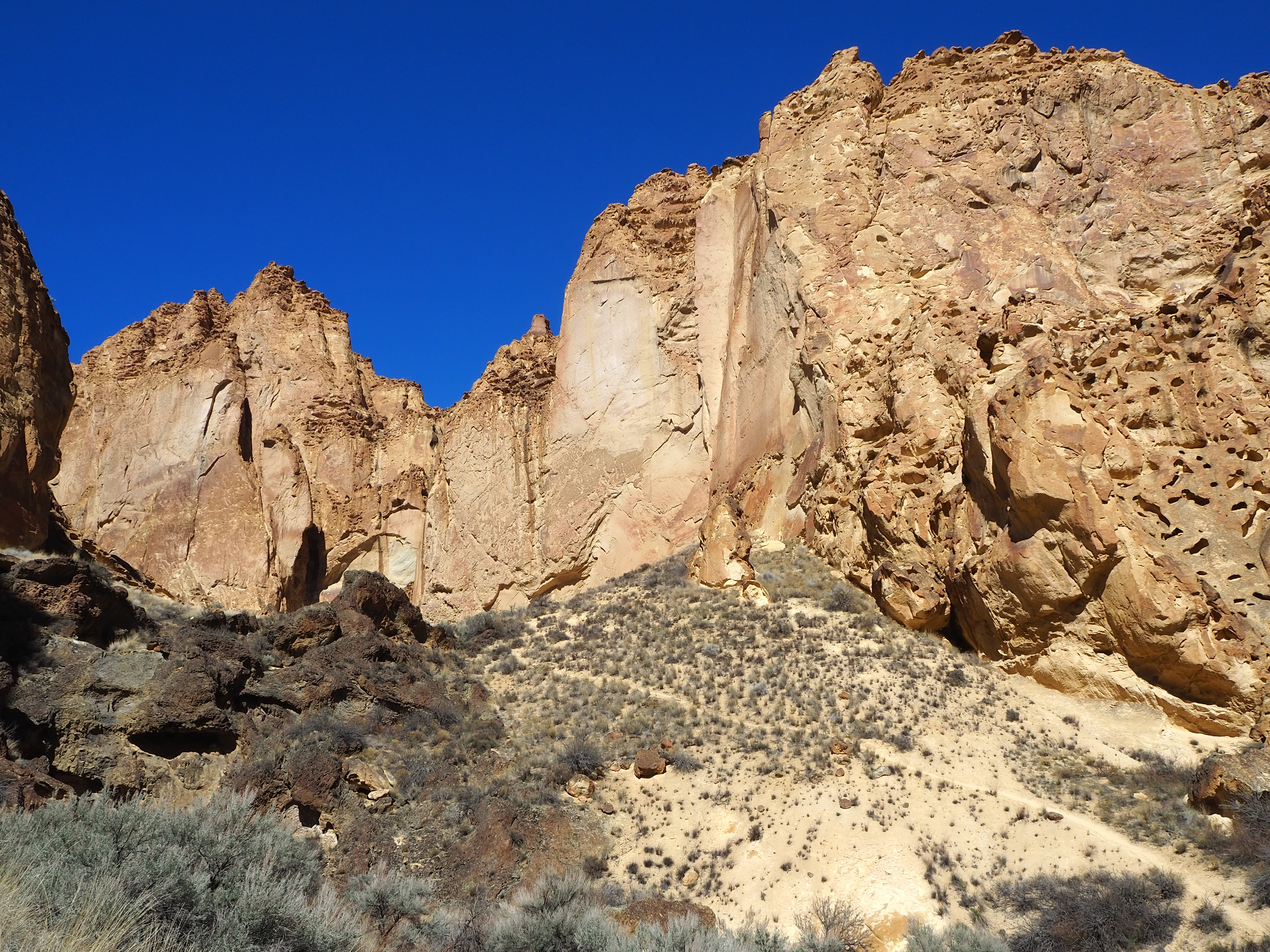
Near the trail’s end, we came upon a large boulder offering sufficient shade and decided to force Tru to suspend his journey there. Zach stayed behind while I travelled a little farther. The trail ultimately comes to a dead end, leaving you hemmed in on three sides by giant walls. I didn’t go quite to the terminus, but I climbed up to a good vantage point to capture the effect. It was quiet and still, only the cry of passing ravens punctured the silence. It was like standing in a gothic cathedral gazing at the chancel, admiring the deliberate construction of a space meant to humble you. To have the space alone, without other hikers passing by or children shouting, was reverential.
I rejoined Zach and Truman, and we began the brief descent to the car. (Our parking pal had since disappeared.) All four of the gulch hikes were incredibly different. It surprised me to find that degree of diversity in such a small area. They all offered varied scenery and new ways to experience the red-hued rock formations. We emerged from the deep cut of Leslie Gulch and made our way back to Succor Creek Road. As a detour, we turned north, opting to stop at Succor Creek State Park en route to Idaho.
The drive was scenic; more rolling hills with veins of volcanic basalt spilling out. To reach the canyon of the park, we teetered high above the creek on a narrow dirt road before greeting the canyon with an expansive view. We decided to pull into the sparse campground and drink the beers we’d brought along. The canyon, though wide, funneled the wind through in great gusts making our “picnic” a little comical. We dragged our chairs down by the creek and embraced the elements. There was no one camping in the park, but several others had stopped to use it as we had. Not as visually arresting as Leslie Gulch, it was a beautiful landscape that promised fewer people. As we drove away and left the canyon behind, I marvelled that such a varied environment existed in what looks like a drab desert from the highway.
Categories: North America, Oregon, USA
