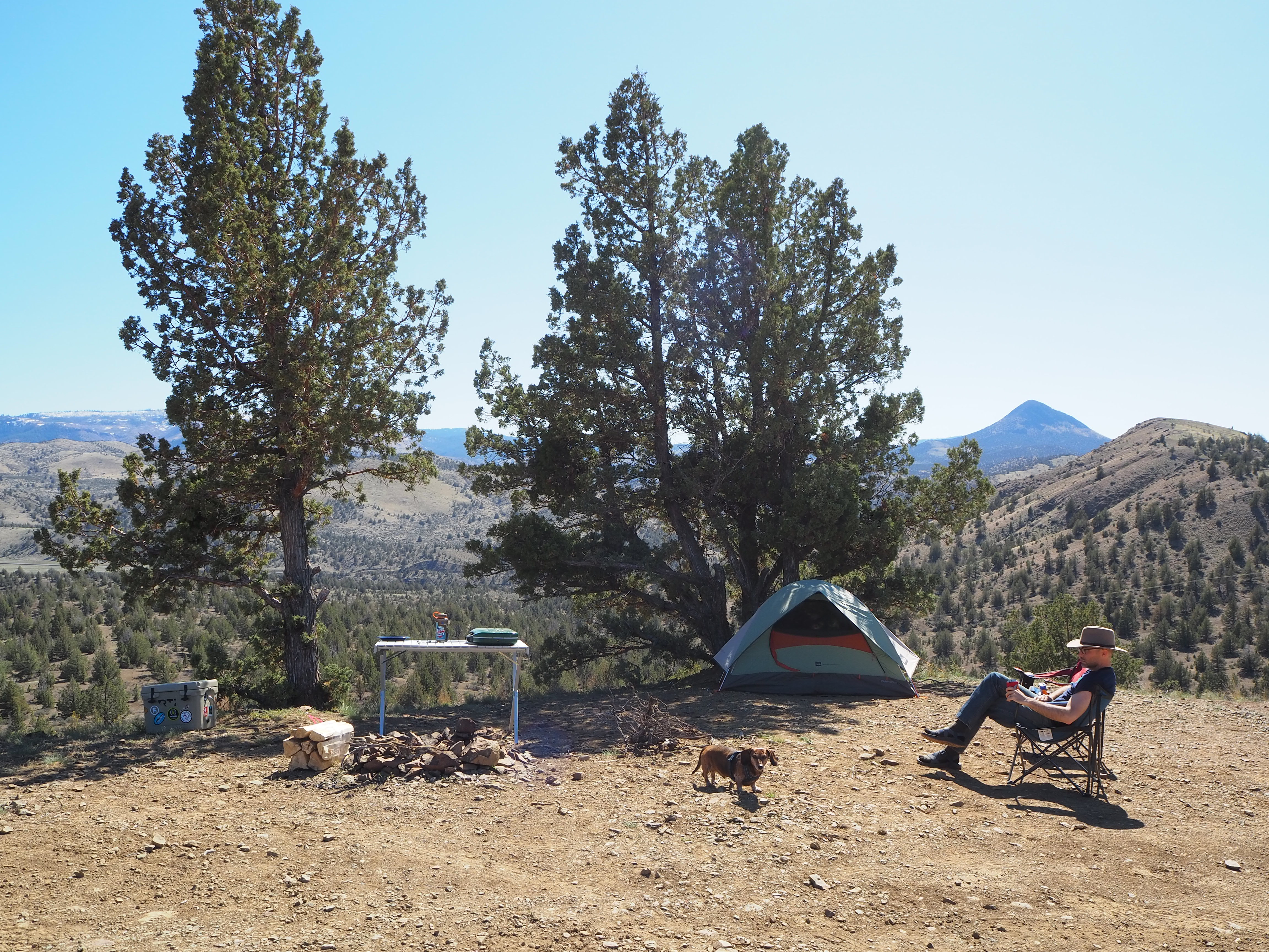
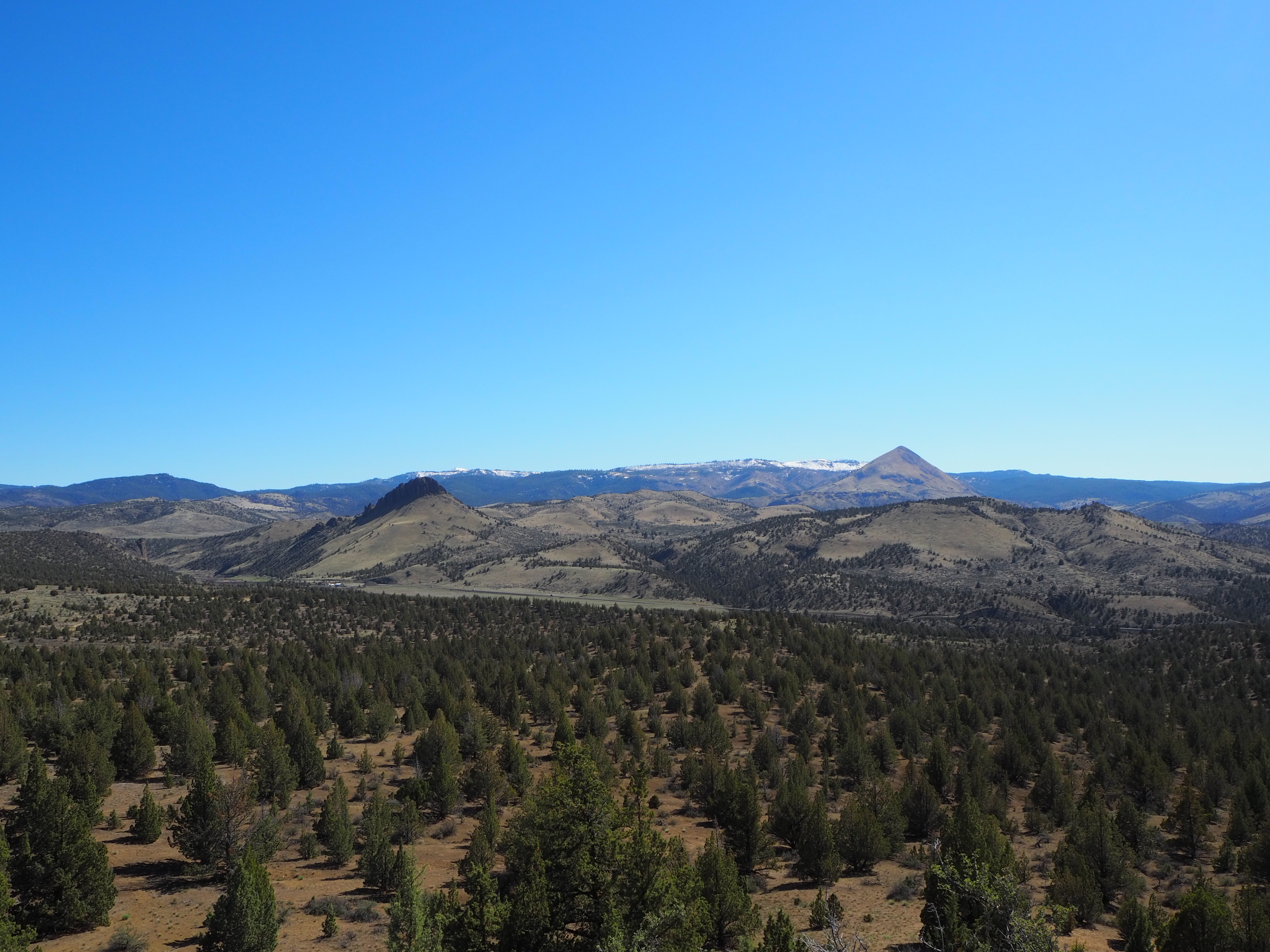
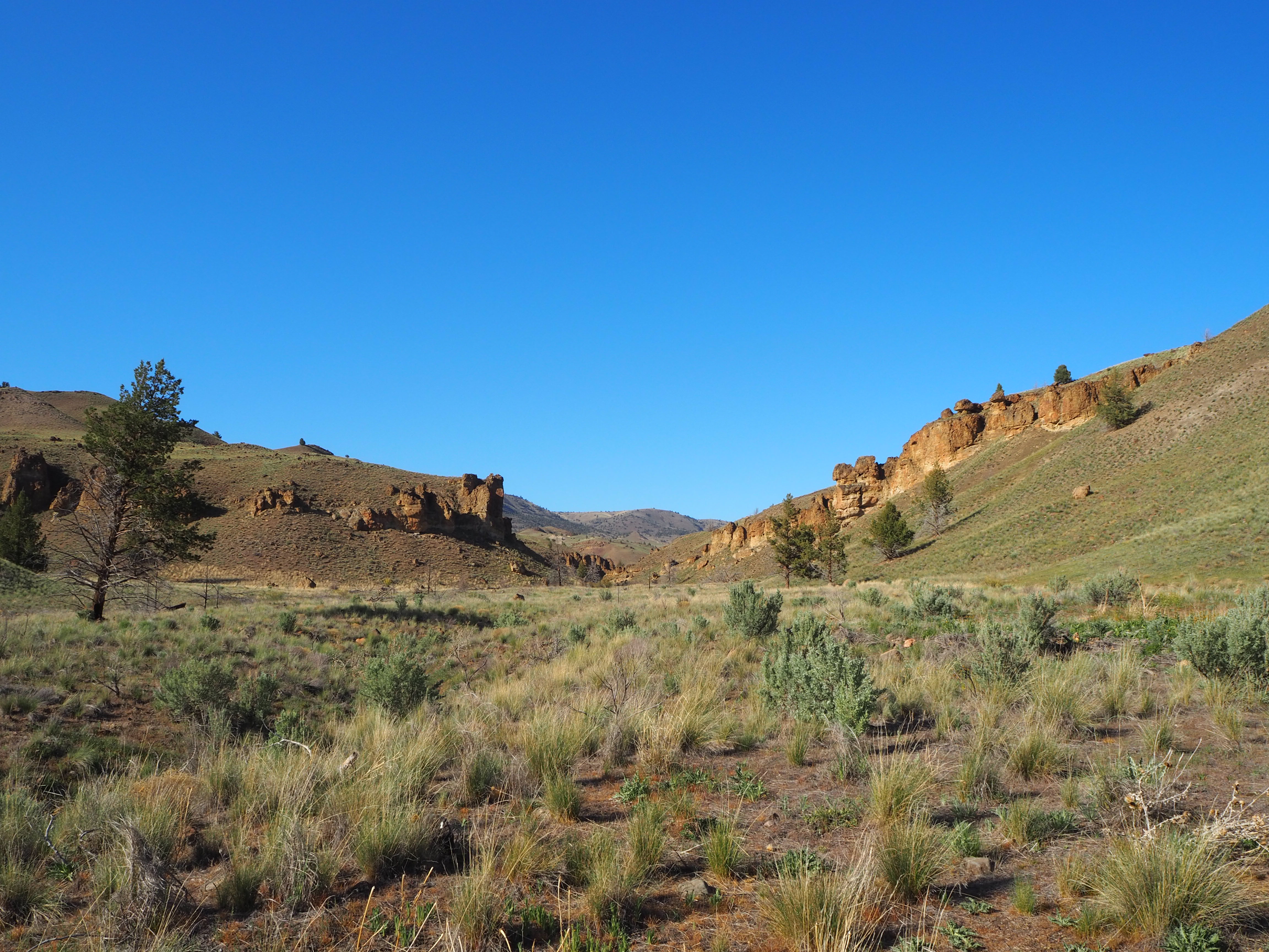
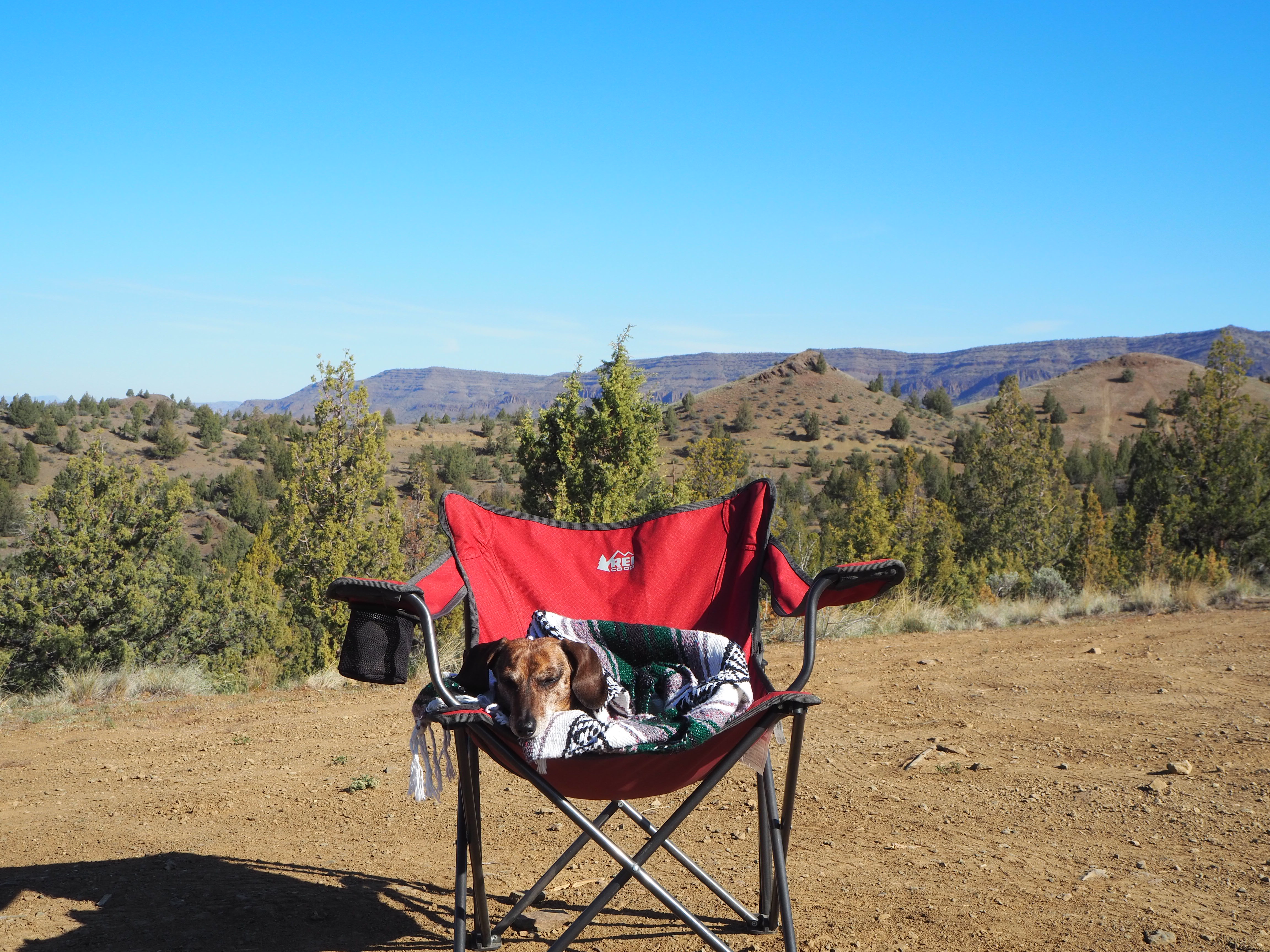
Last weekend we took our first camping trip of the year. Zach’s spring break was pushed into April this year, and the weather has been beautiful lately, and although we should be concerned about the lack of rain, it’s difficult to care as spring brings longer evenings and more opportunities to be outside. It’s still too early for mountain getaways, so we opted for a high desert escape to central Oregon, our first real foray into the state (other than Portland). The object of our trip was exploring the John Day Fossil Beds National Monument (a real mouthful of a name!). The Monument is divided into three units which are varying distances from one another. I thought we should make our camp near the Painted Hills, the most popular unit, allowing us to visit on Friday evening when it might be less visited. Although Ochoco National Forest is nearby, it’s a bit early to camp among the trees and melting snow. Instead, we looked for areas where we could disperse camp on BLM land allowing us to stay away from other weekenders. We were fortunate to find that our first spot was available and suitable. Sitting up on a bluff, overlooking Route 26 west of Mitchell and into the Ochoco National Forest beyond, we could place our tent and table in the shade cast by a large juniper and enjoy the spring sun.
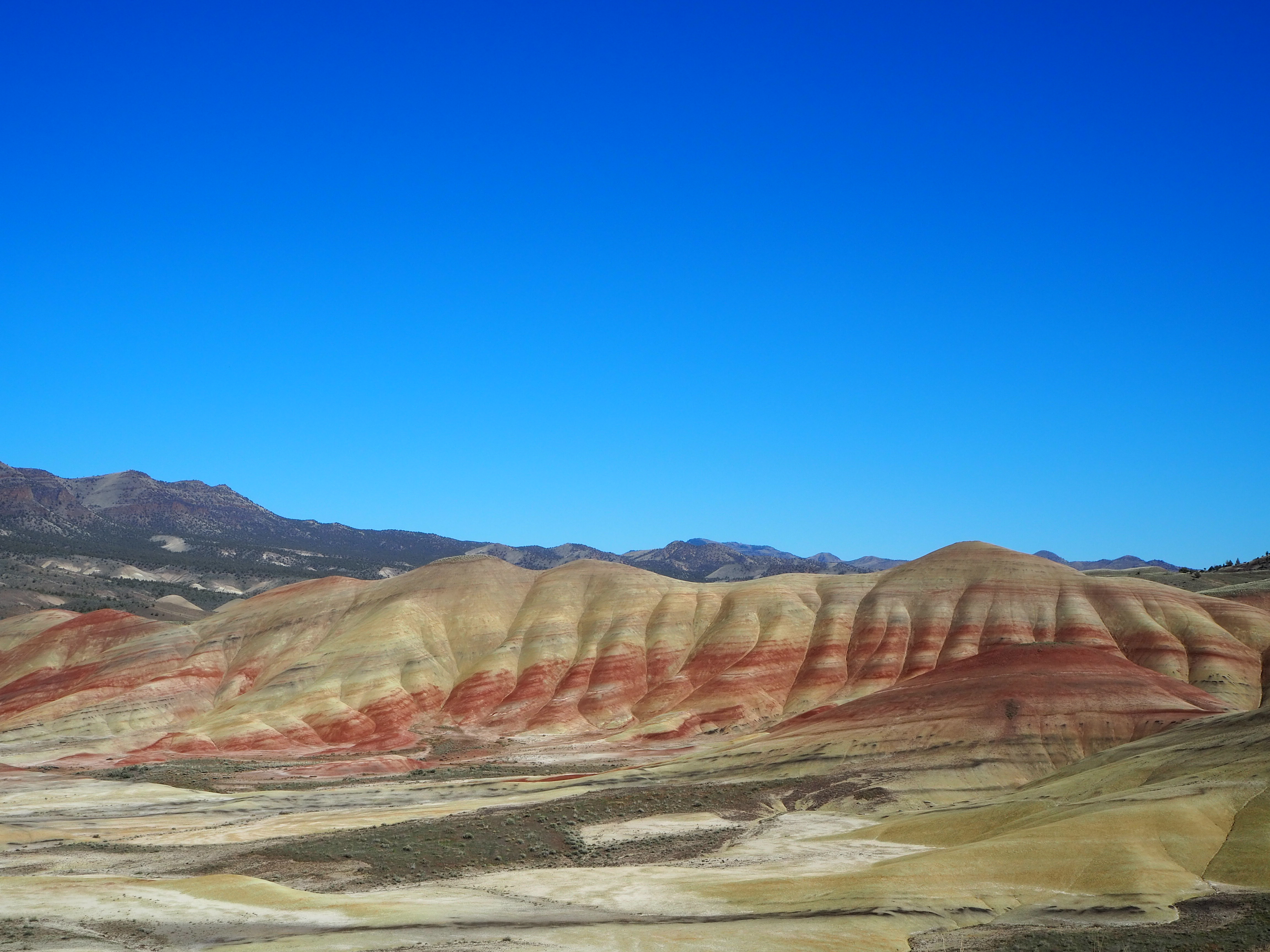
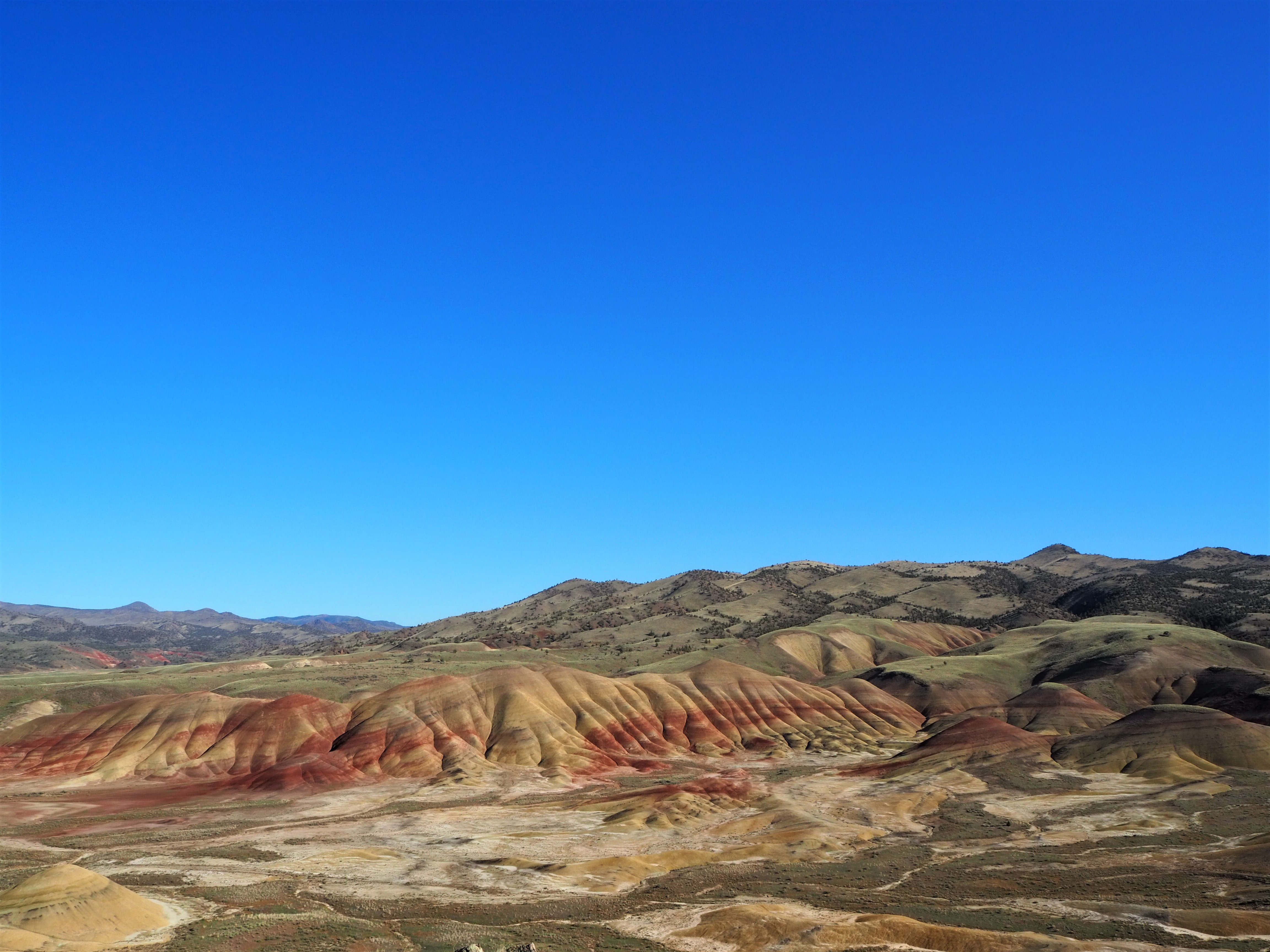
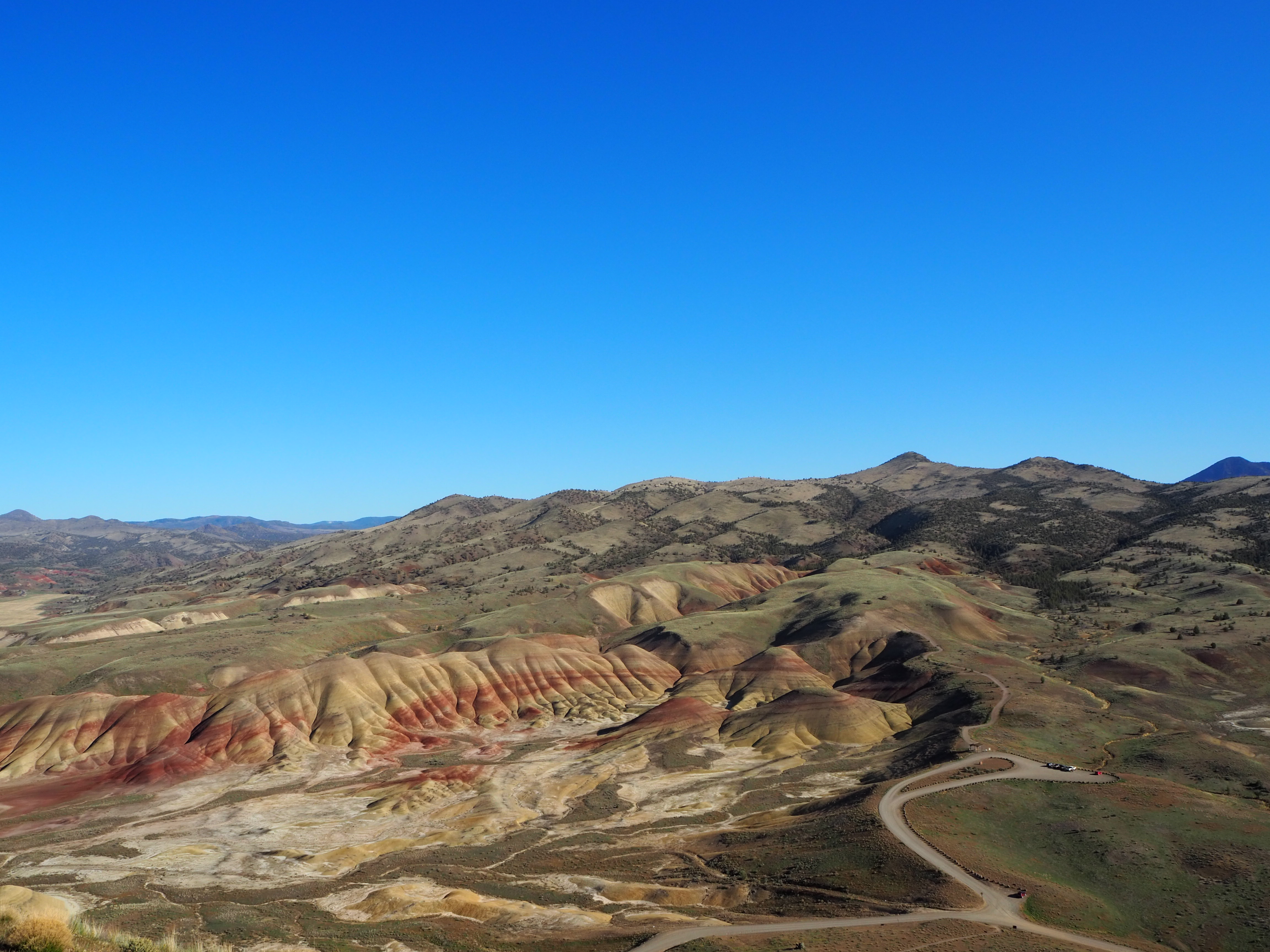
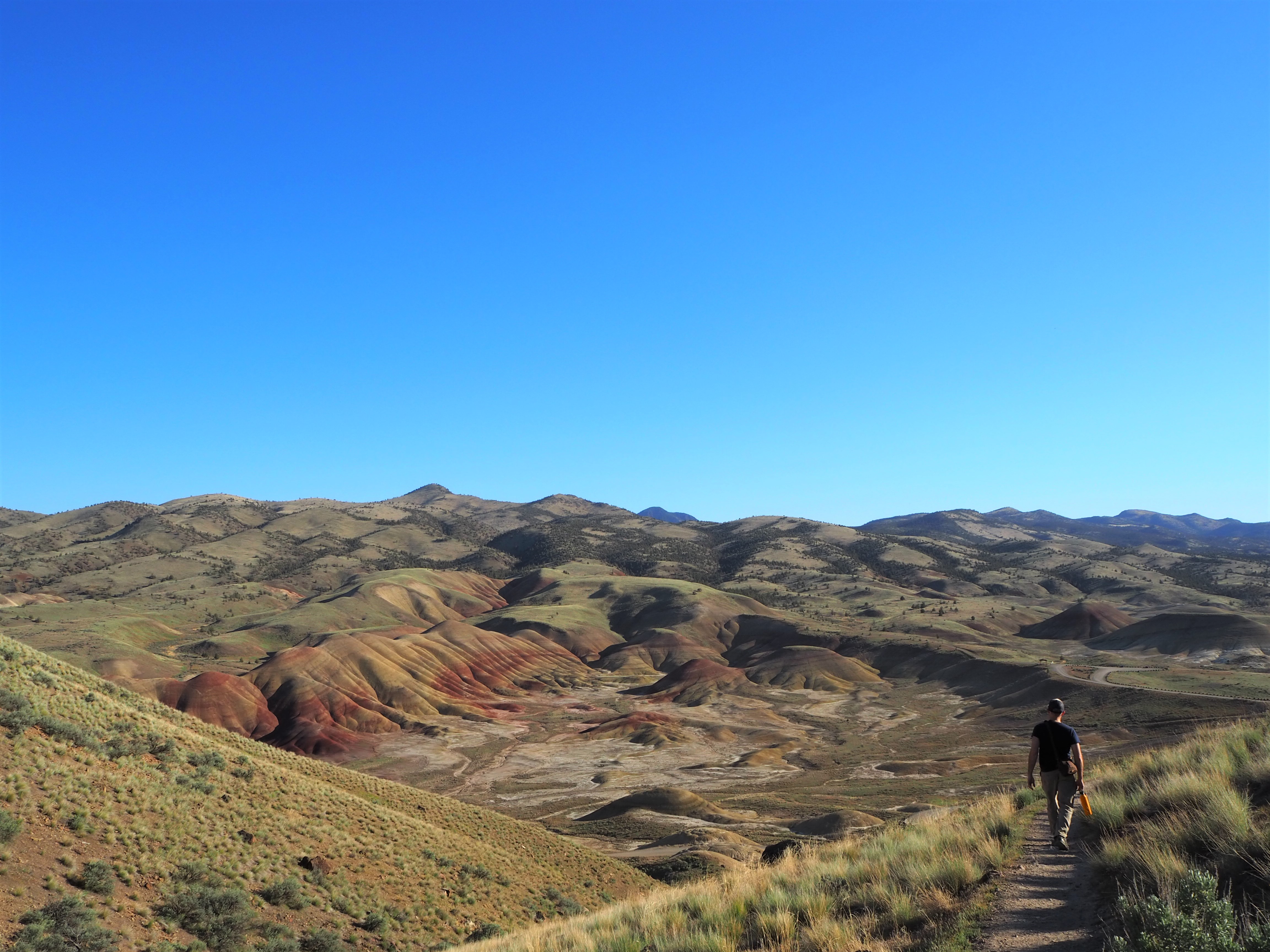
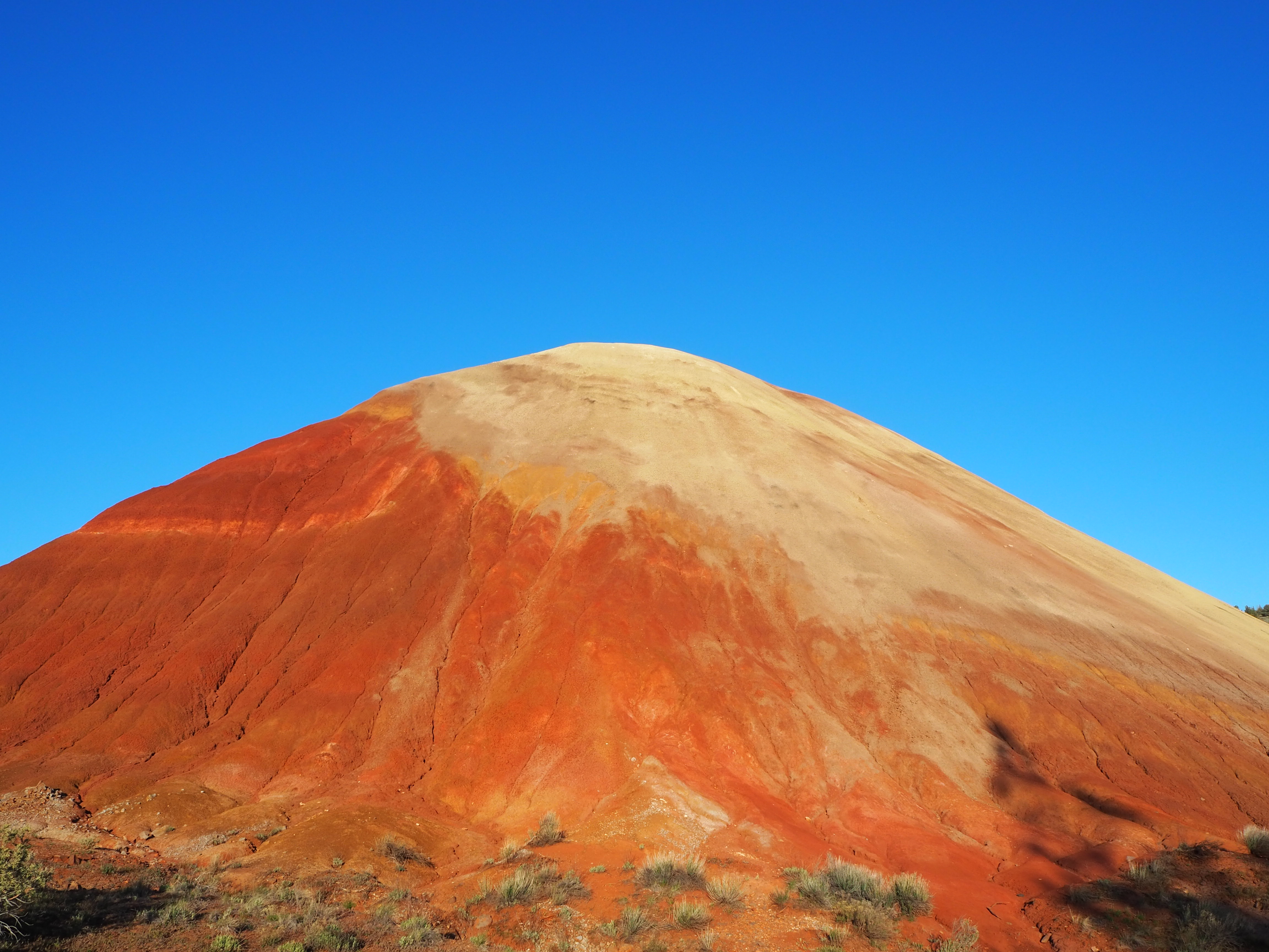
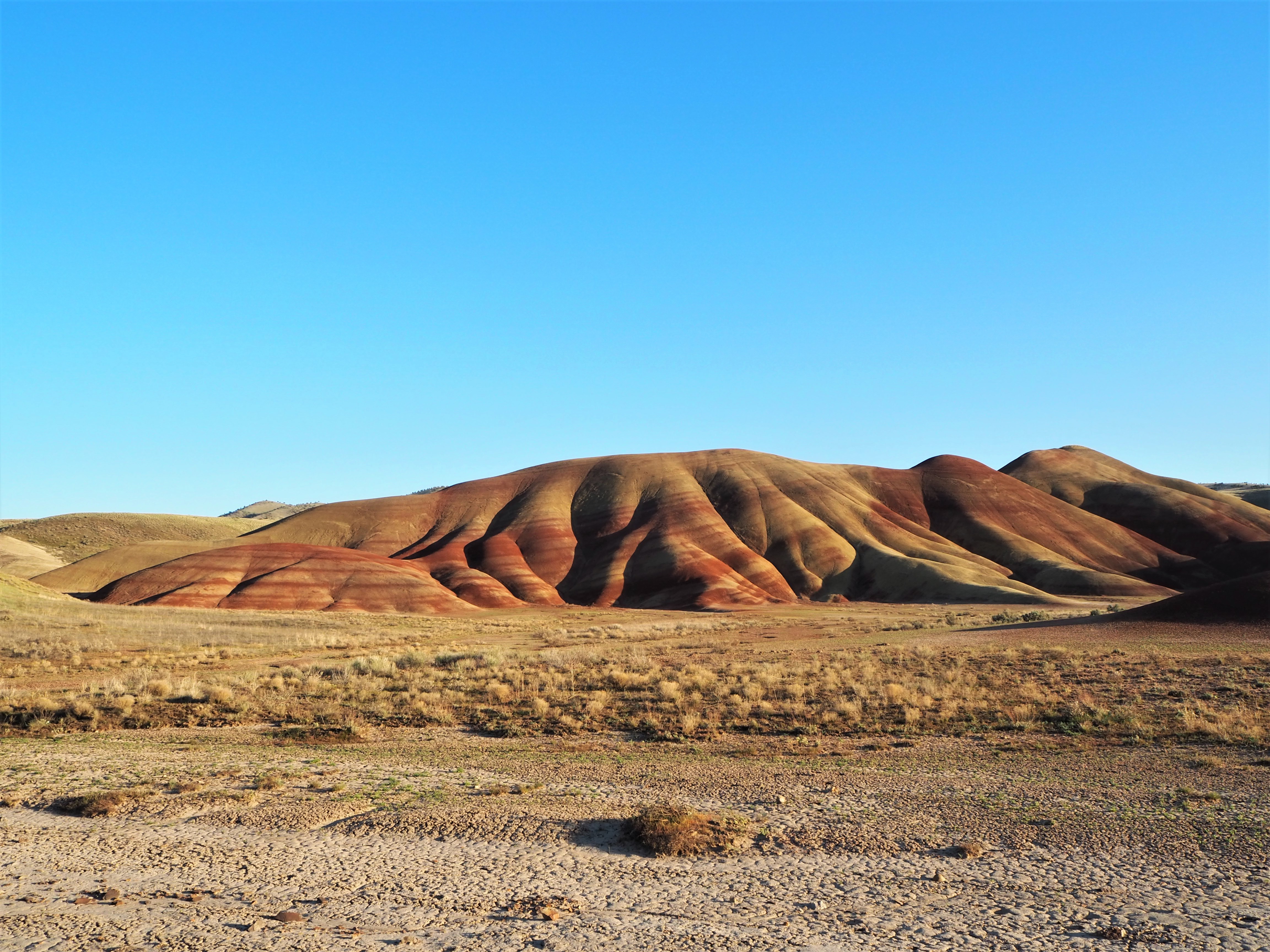
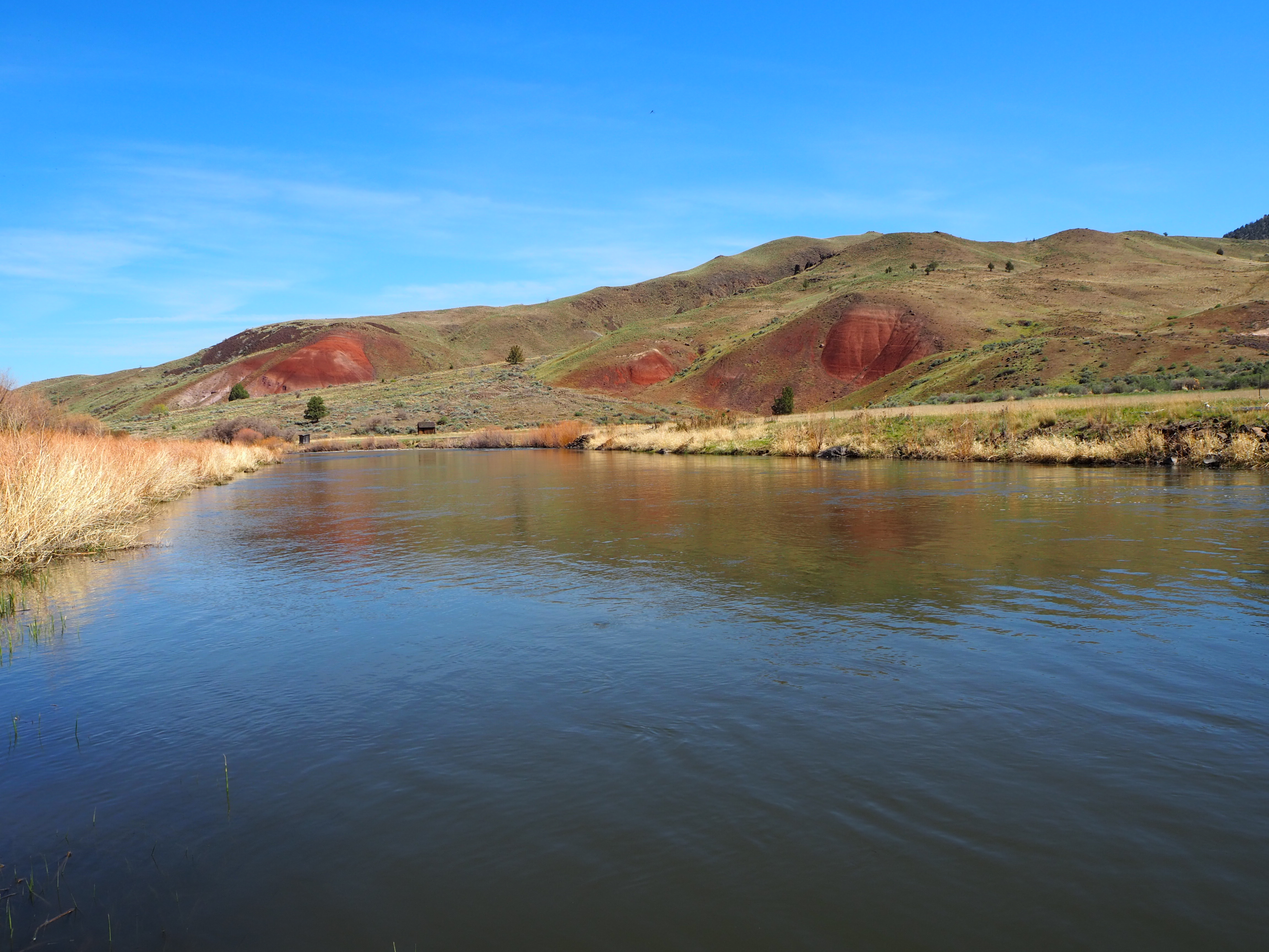
After we set up camp and made lunch, we began the brief drive to the Painted Hills. The unit is small, but has five sights of interest with accompanying trails. (Only one of the trails is of any length, the others remain at or below 0.5 mile.) It was late afternoon when we arrived at the first sight, the overlook of the Painted Hills. Lucky for us it also happened to be the best time of day for sunlight on the hills. Though there were several cars parked at the overlook, the trail to the viewpoint was nearly empty of people and we managed to have it to ourselves. The color of the hills are a large-scale representation of Earth’s changing climates. Each band of color highlights that period’s environment with red being a wet, swampy landscape and yellow/tan indicating a drying out. There have also been significant leaf fossil discoveries near the Painted HIlls, including the fossils of a Dawn Redwood, a tree that is only found in China today. Zach made a crack about how we’ll all be condensed into a band of color one day, so you could certainly get existential on your visit, but aesthetically the Painted Hills are very pleasing too.
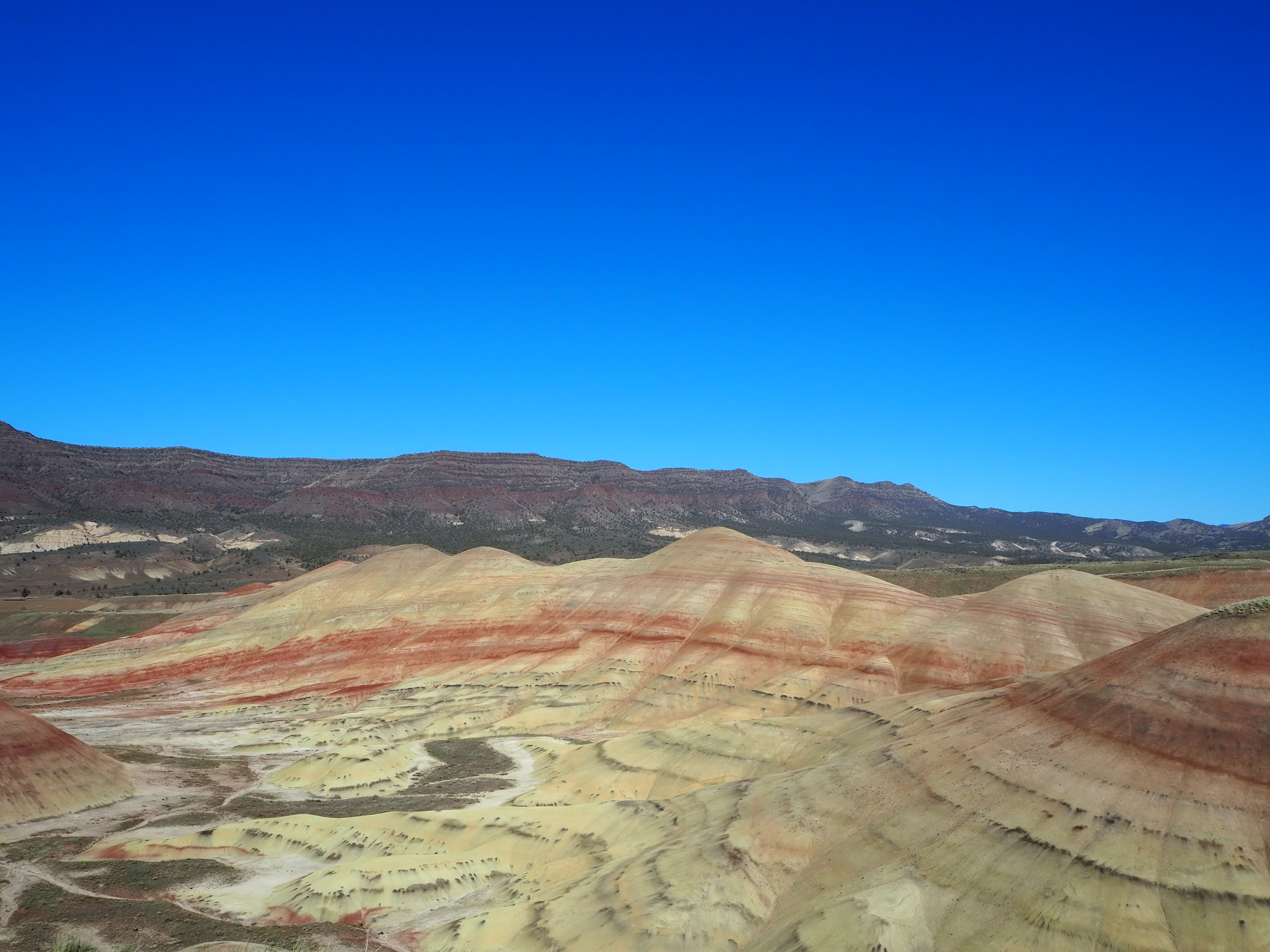
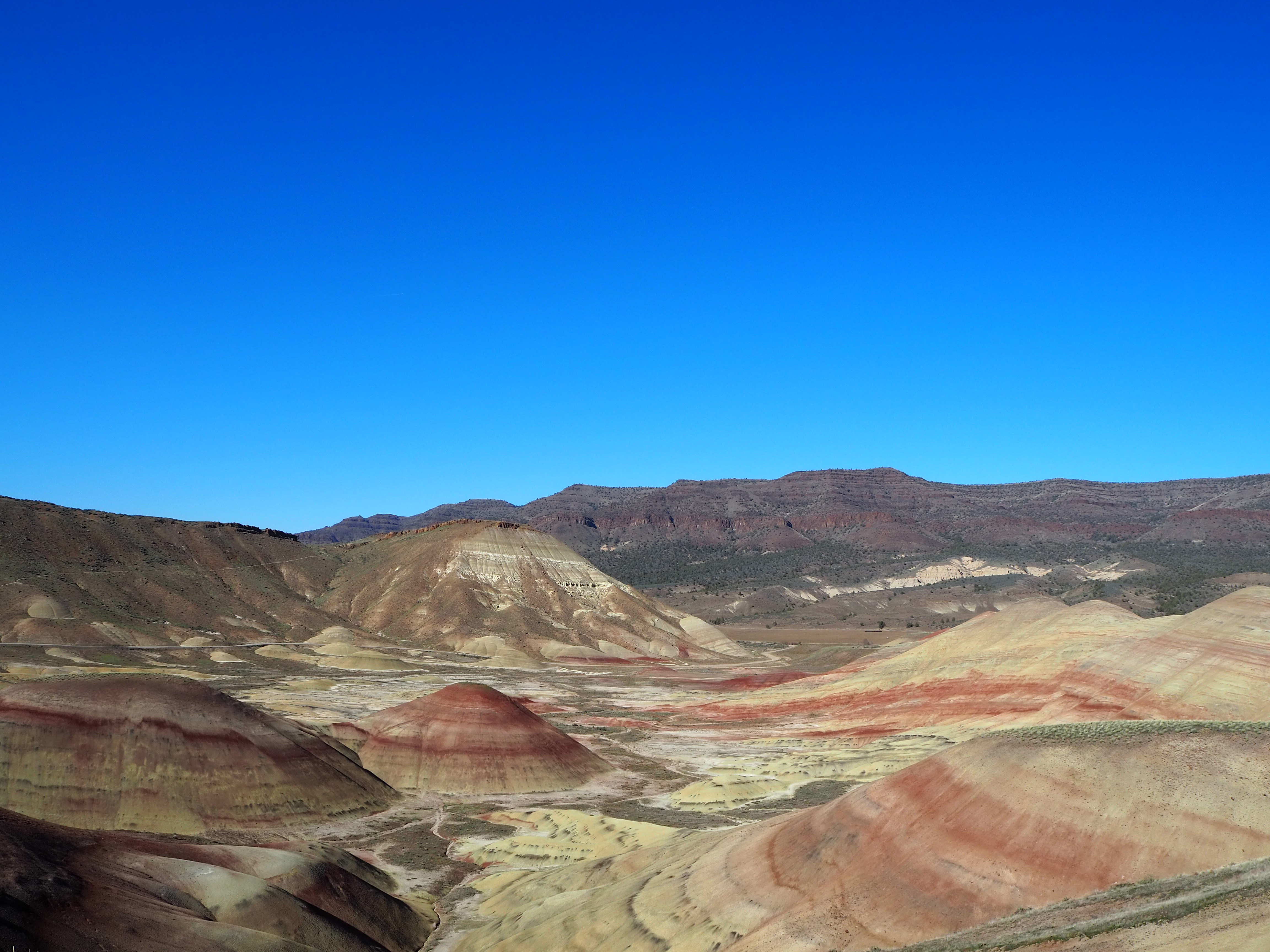
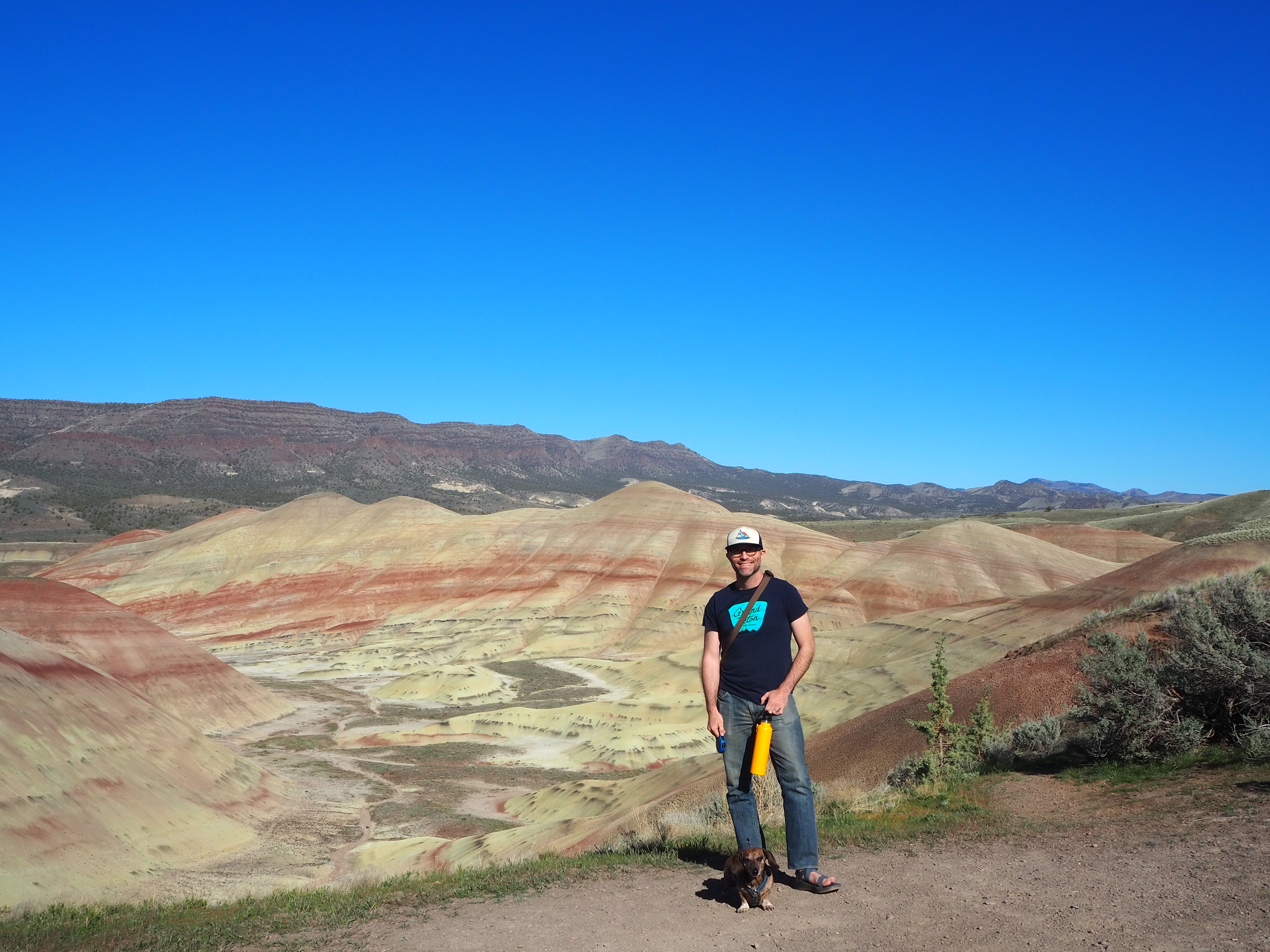
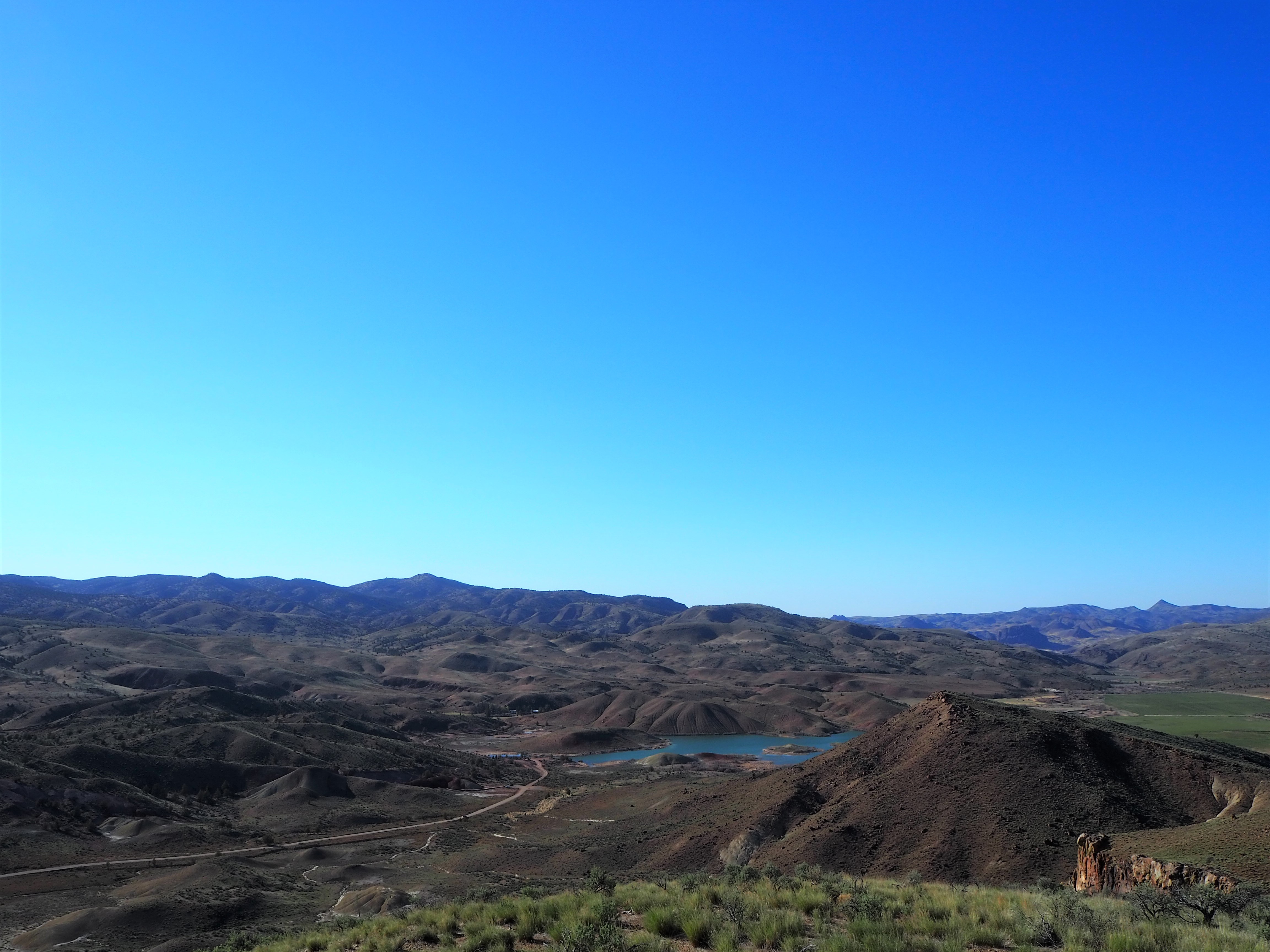
I figured we would do all of the trails in the unit since most were so short. After our walk up to the overlook, we decided to hike the Carroll Rim trail on the opposite side (and the only trail with any real length at 1.6 miles) to obtain a different perspective and burn some calories after the car ride. Very few of the visitors seem to do the hike, and we had it very nearly to ourselves with the exception of two hikers we encountered on our return. The trail climbs steadily up the ridge and then circles around the backside, leading to the top and providing a nice overview of the Painted Hills and the surroundings. The unit is encompassed by ranch lands swathed with cattle and even a small reservoir on private property. After Carroll Rim, we stopped at the remaining three paths, all 0.25 mile in length, and aside from what we termed the ” ‘gram spot,” we were the only visitors.

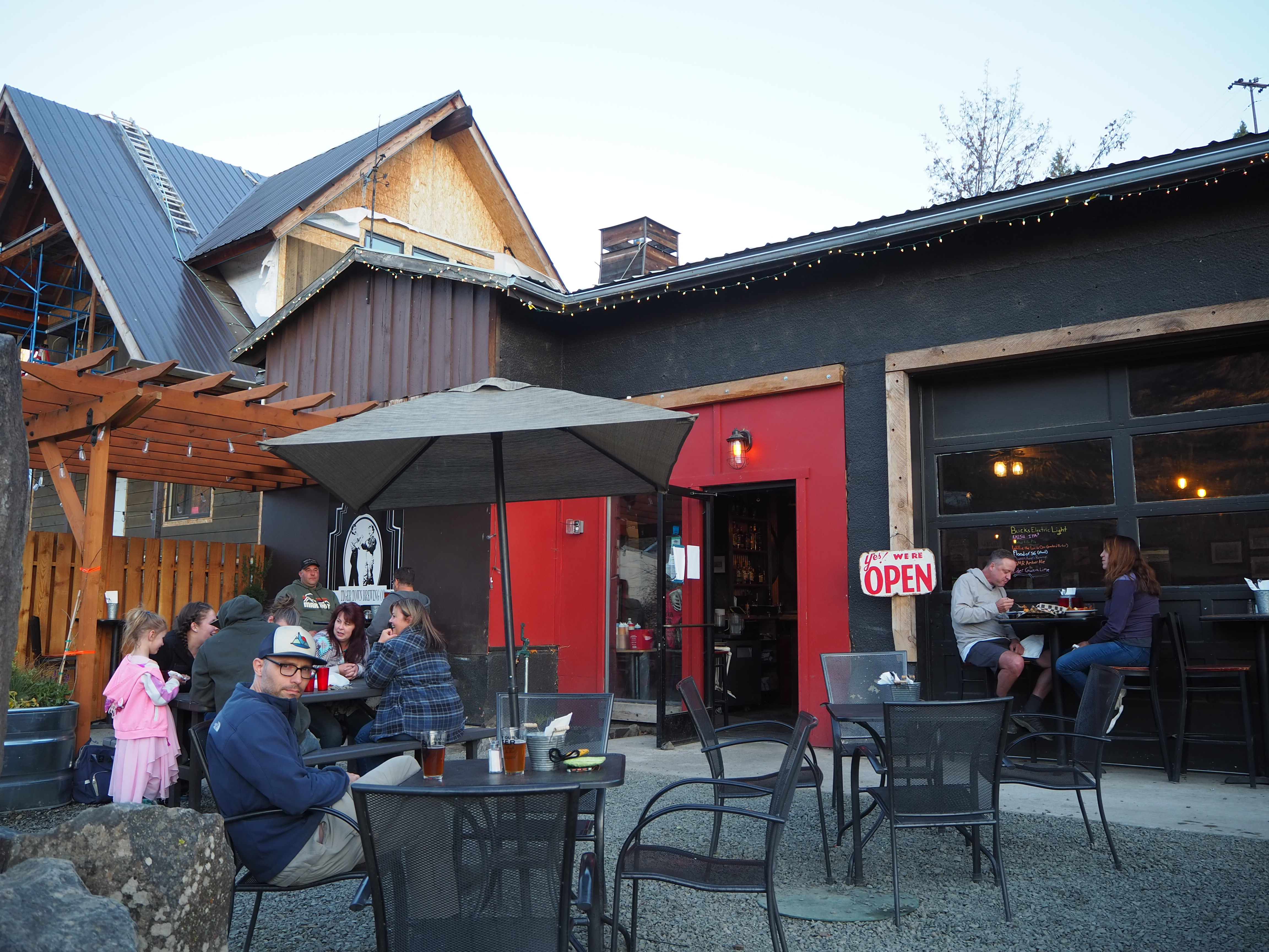
We left the Painted Hills with enough time to drive into Mitchell for dinner. Although being near the Painted Hills was the primary motivation for camping near Mitchell, the proximity to a local brewery was a close second. After driving through many small communities that weekend, Mitchell seems to be the most touristy. There is a hostel and a cute pastry shop, a couple of stores to peruse, and a hotel. Since the main street lies off the highway, Mitchell remains quiet and peaceful. Before stopping at the brewery, we wanted to fill up our gas tank for the following day’s drive. What we didn’t know is that Oregon has a strange relationship with pumping gas! Until this century, it has been illegal for people to pump their own gas. In 2017, a new law allowed stations in rural Oregon to offer self-service pumps, but it seems like a lot of stations still use an attendant. We arrived after hours (past 6pm), but thankfully, another motorist had already gone to the trouble of getting the attendant from the hotel. Our attendant told us he planned to install a self-serve pump soon, but for the time being, an attendant pumps your gas, takes your payment, hands out dog treats, and chats you up. (It was a more commercial experience on our way home, no conversation or dog treats.) We parked down the street after our gas adventure and ventured onto Tiger Town’s patio. It was the first time we visited a brewery in over a year! It was really wonderful to relax outside and feel something like a return to normal. Plus, the food and the beer was excellent.

The following morning, we prepared breakfast and drove an hour east to the Sheep Rock Unit. It’s the largest unit and the headquarters of the Monument. We lucked out as the Thomas Condon Paleontology Center had reopened to the public the day before. Both a visitor center and a place for scientific study, the Center has over 500 fossils on display and murals on the wall show how the regional environment has changed over time, including accurate depictions of extinct flora and fauna. The space was nicely laid out and although you could get a little bogged down by some of the information (if you, like me, are less scientifically inclined), it was fascinating to see so many fossils from the region. The Center even has a large viewing window that allows visitors a peek into a paleontology lab; it’s too bad it was empty during our visit.
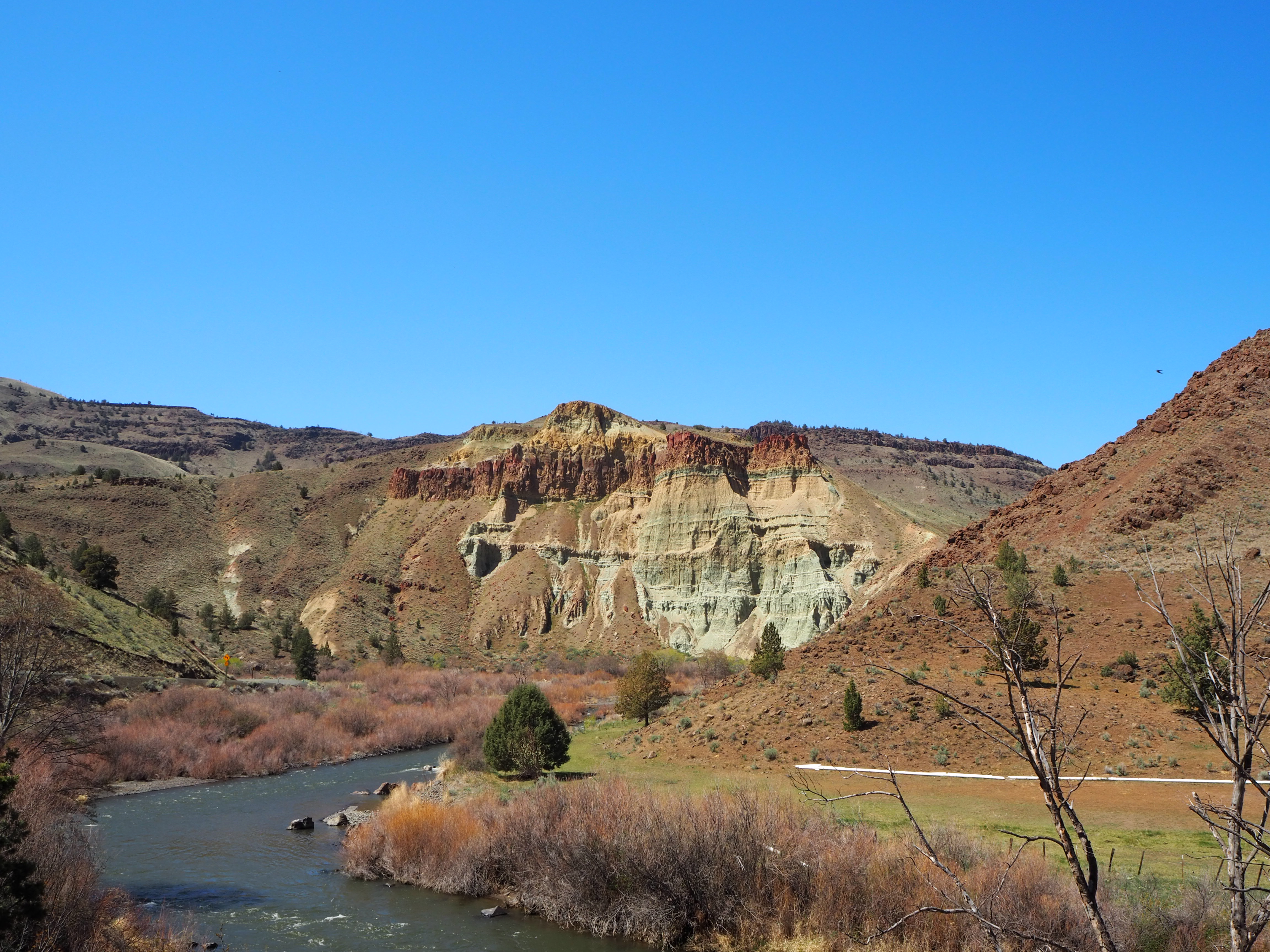
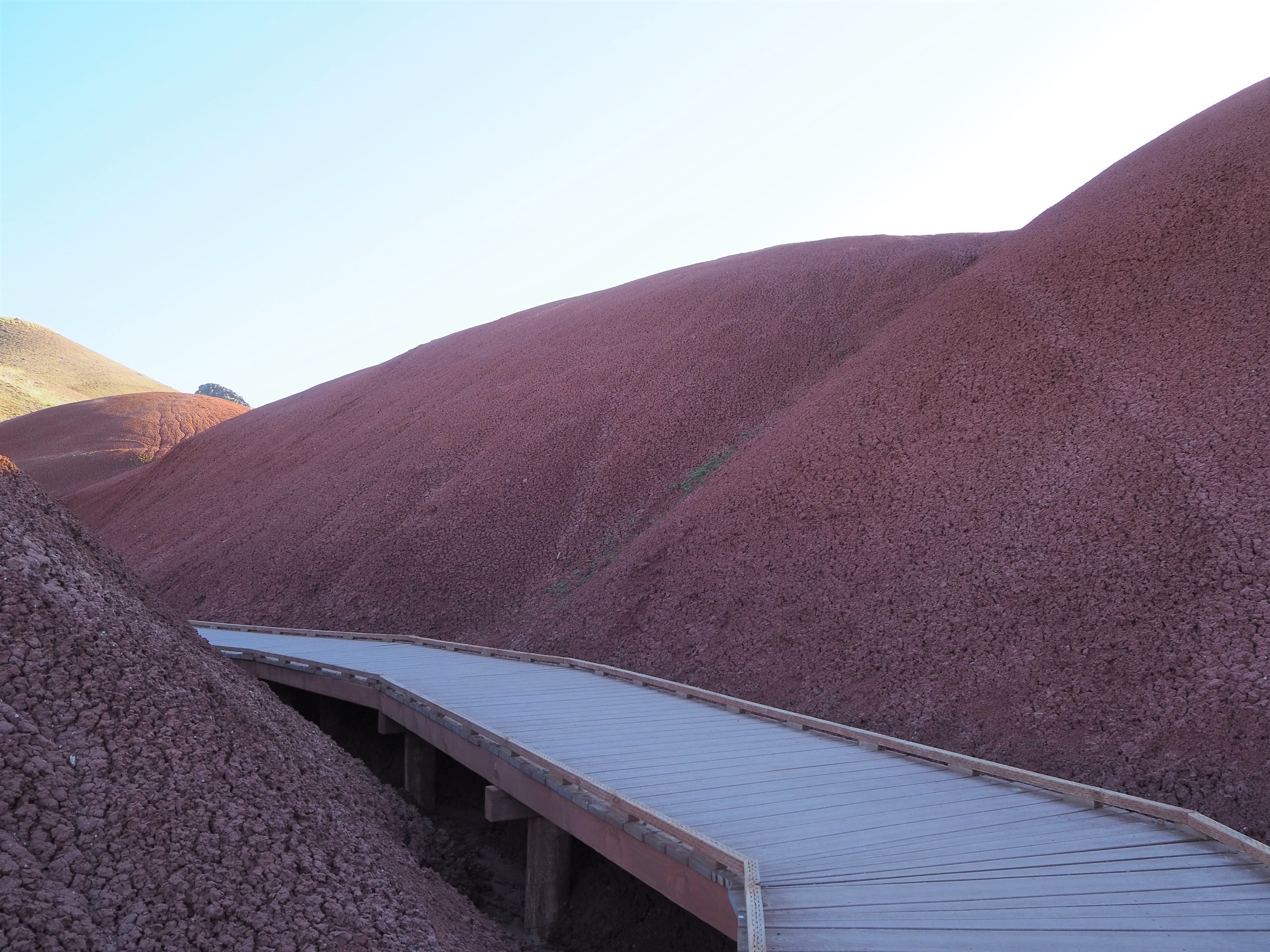
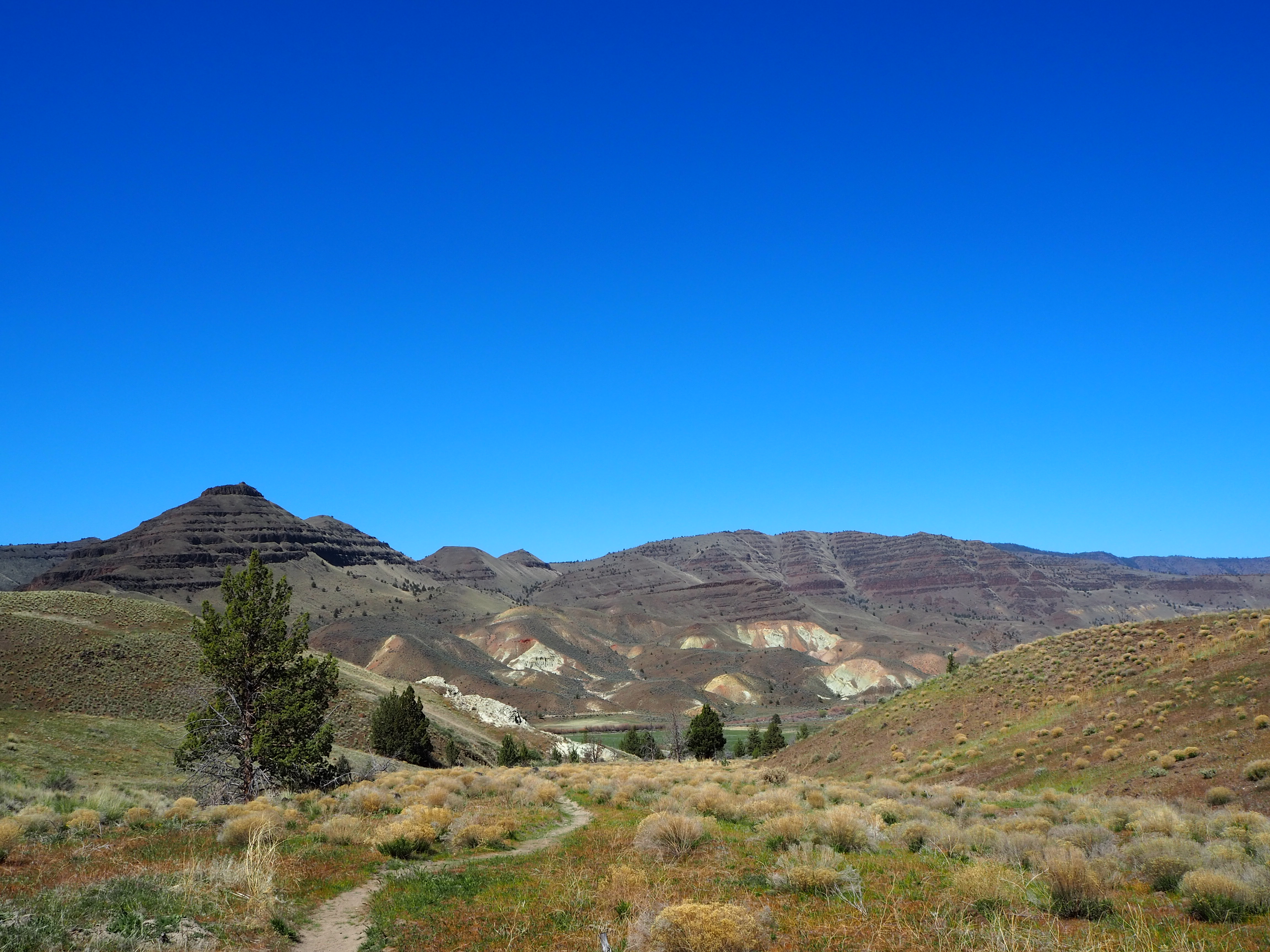
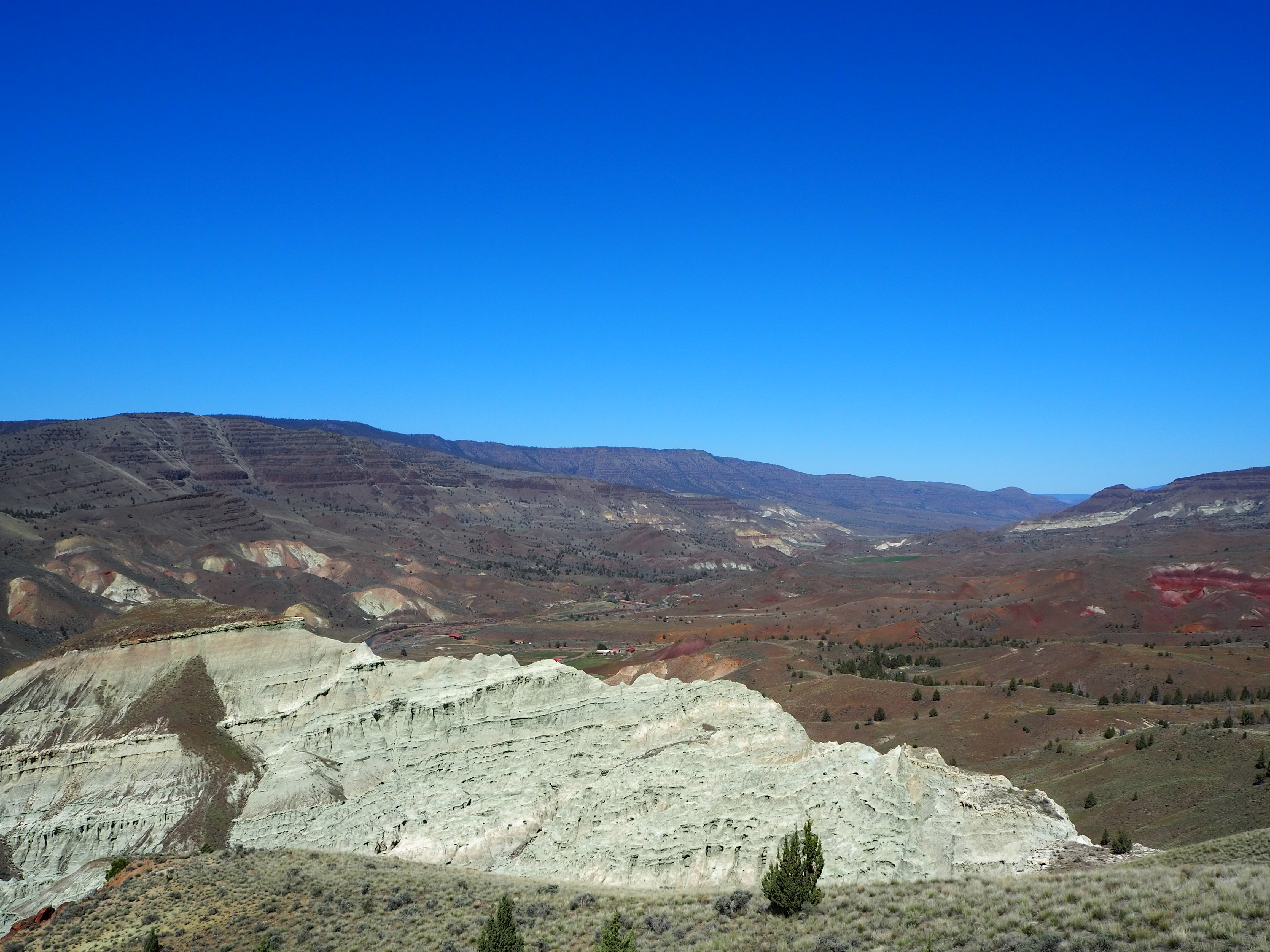
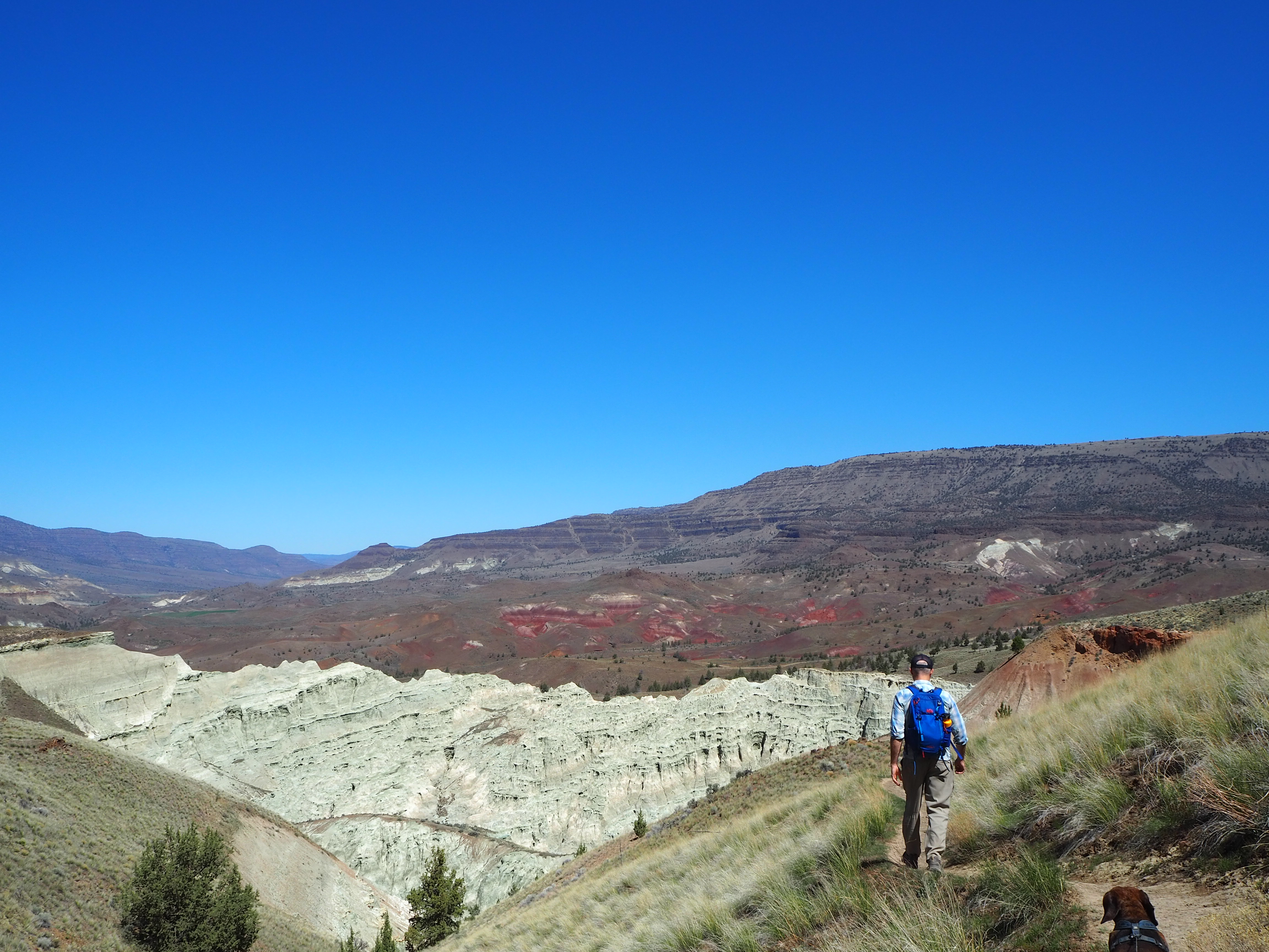
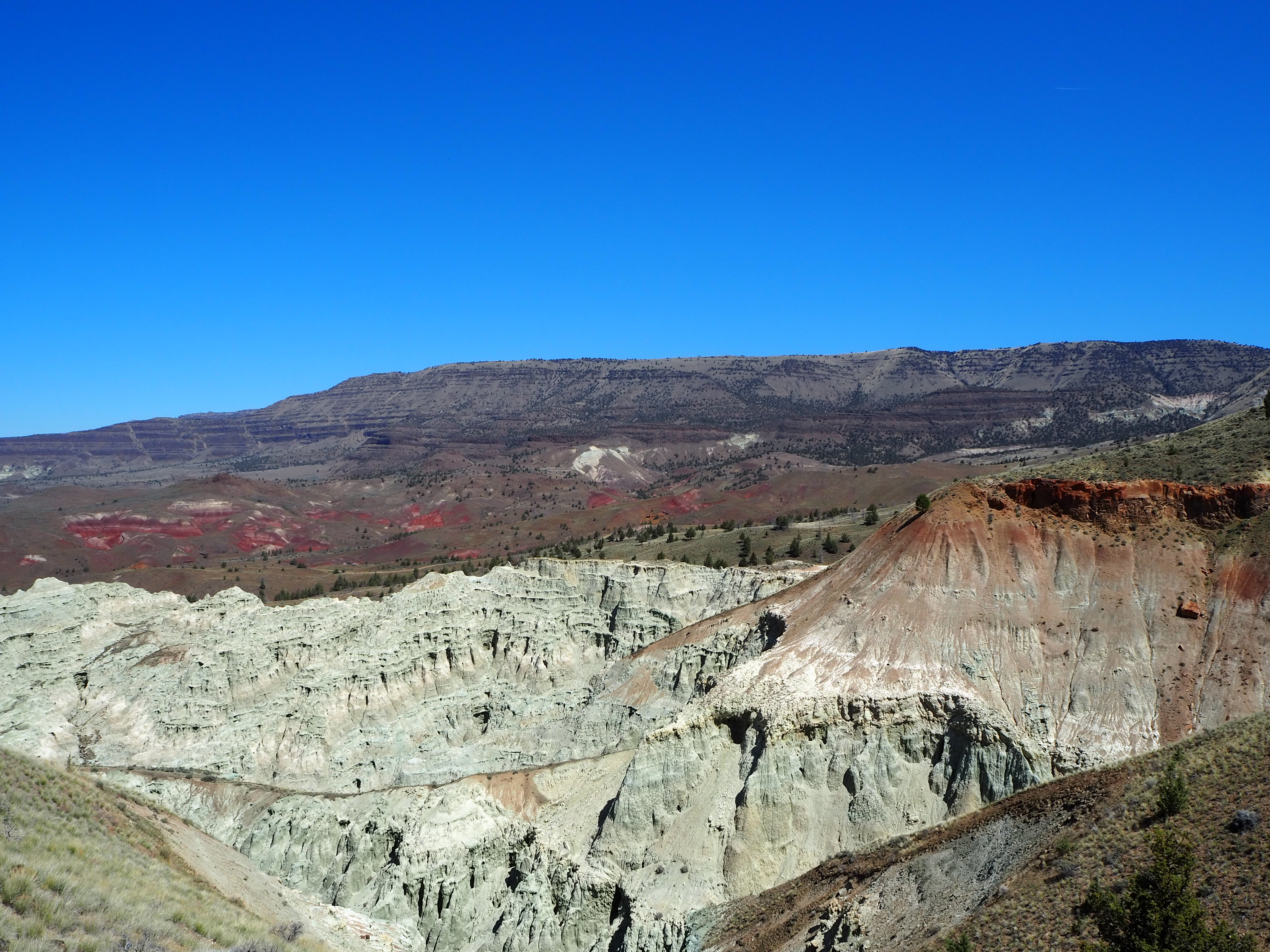
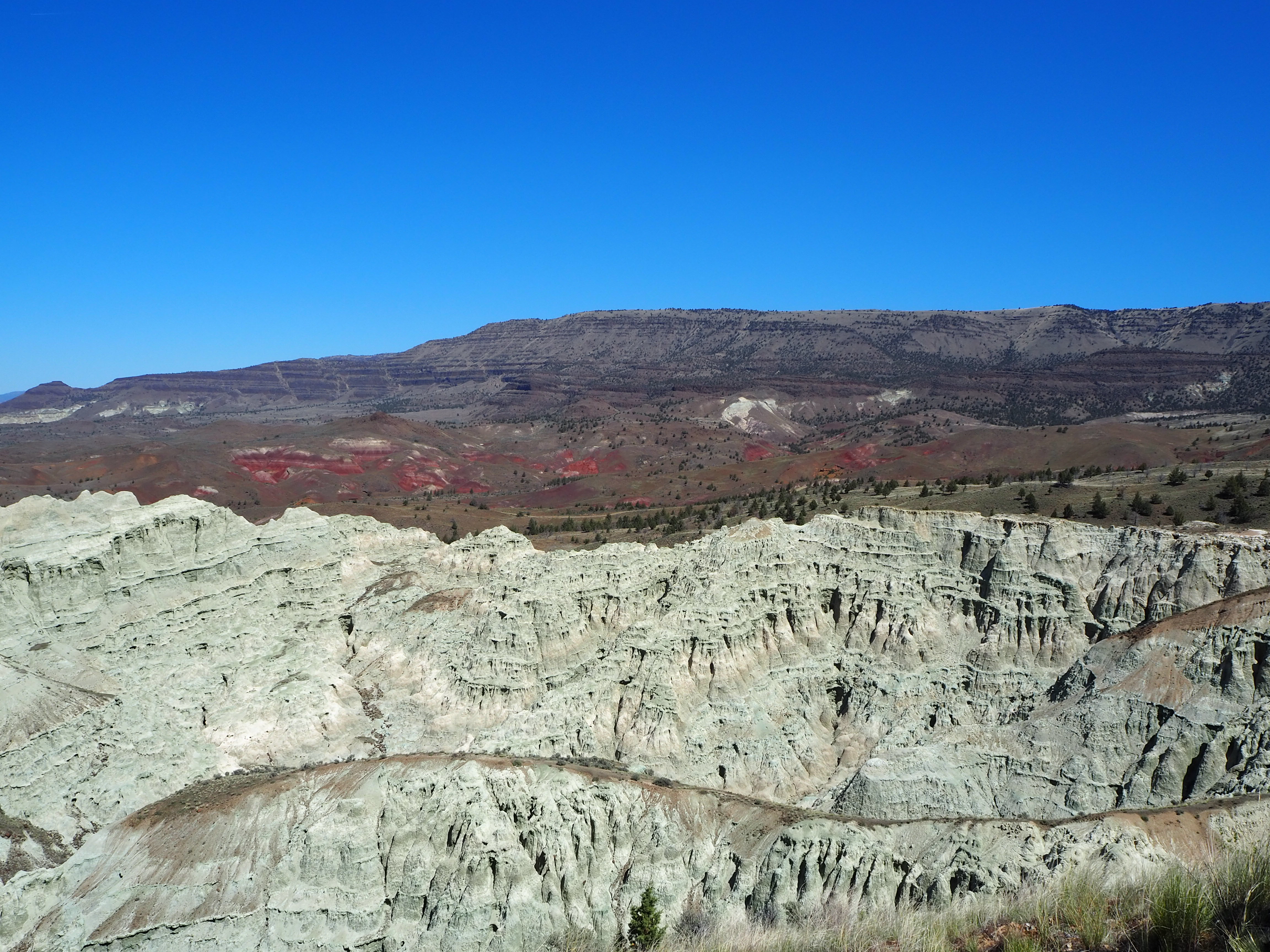
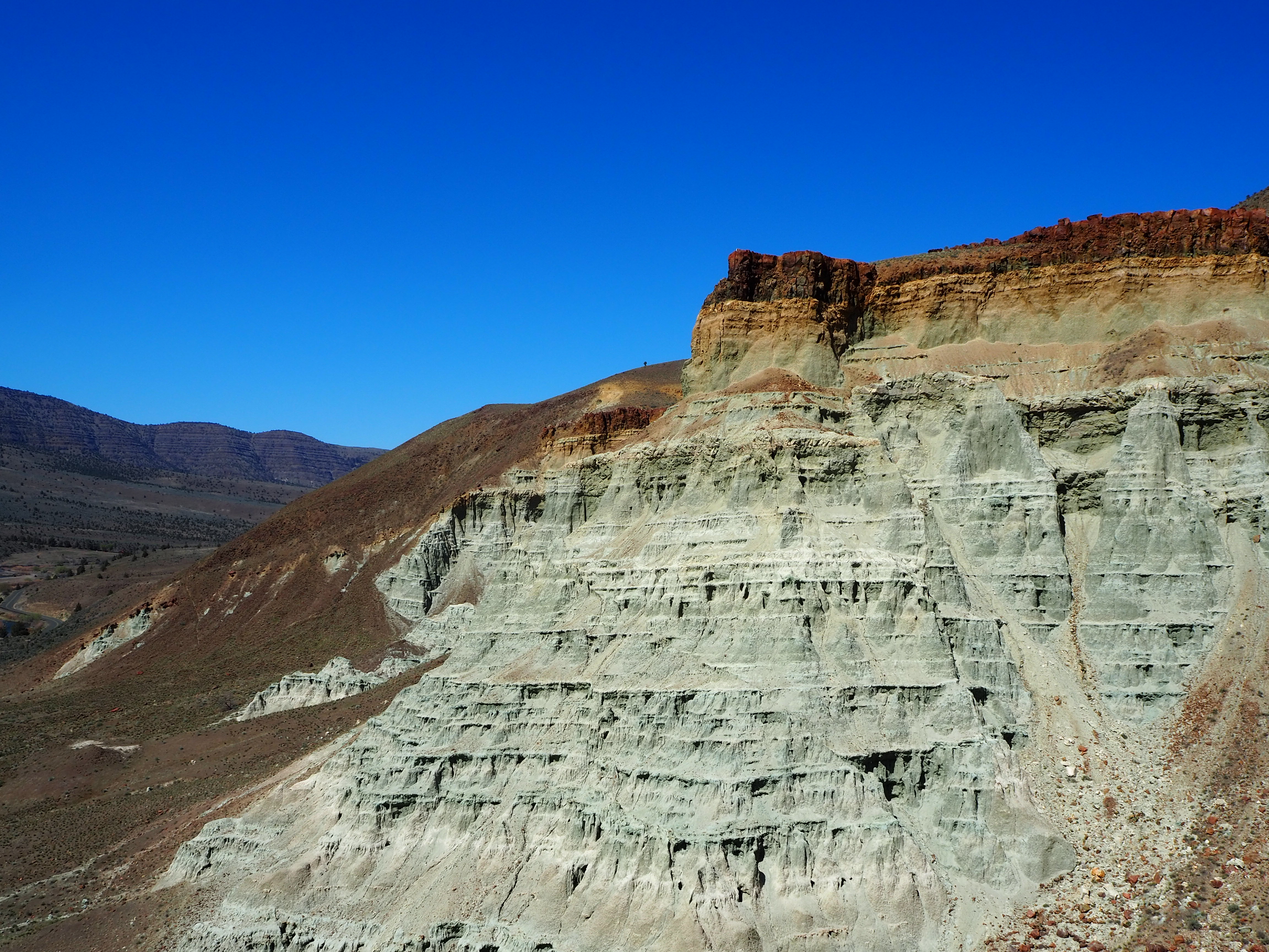
After our visit, we continued to our main hike for the day – Blue Basin. The longest hike in the Monument, Blue Basin is a 3.25 mile loop that circumnavigates an immense basin of blue-green claystones. When we got started just before noon, the weather was still cool and pleasant. We didn’t know anything about the trail, so when we came to the first small outcropping of claystones, we stopped to admire them for quite a while, thinking it might be one of the trail highlights. As the trail climbed, we had beautiful views at our backs of the lush ranching fields that straddle the John Day River. We skirted along cliff sides of exposed claystones admiring the beauty in their erosion. We steadily scaled to the top of the ridge, gaining sweeping views of the rolling hillsides across from us.
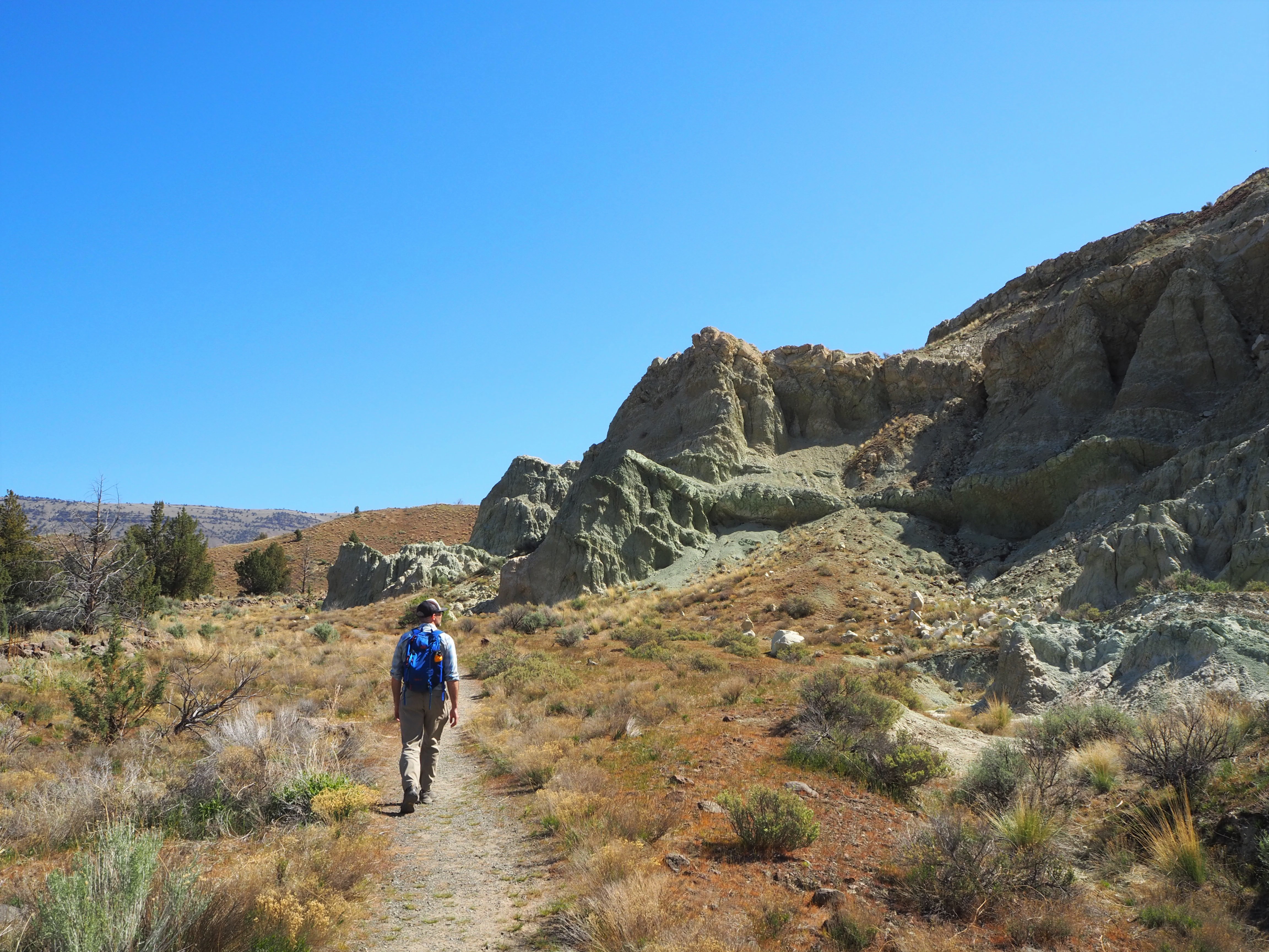
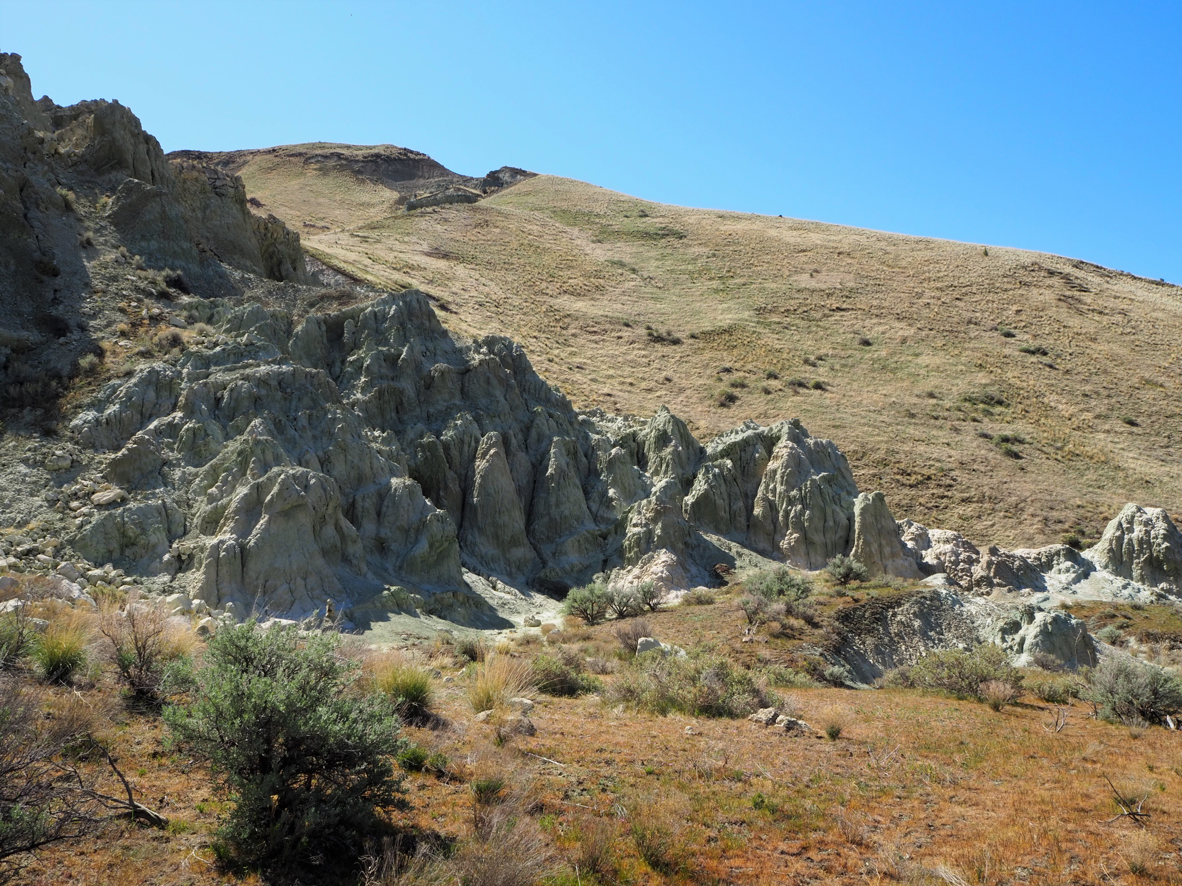
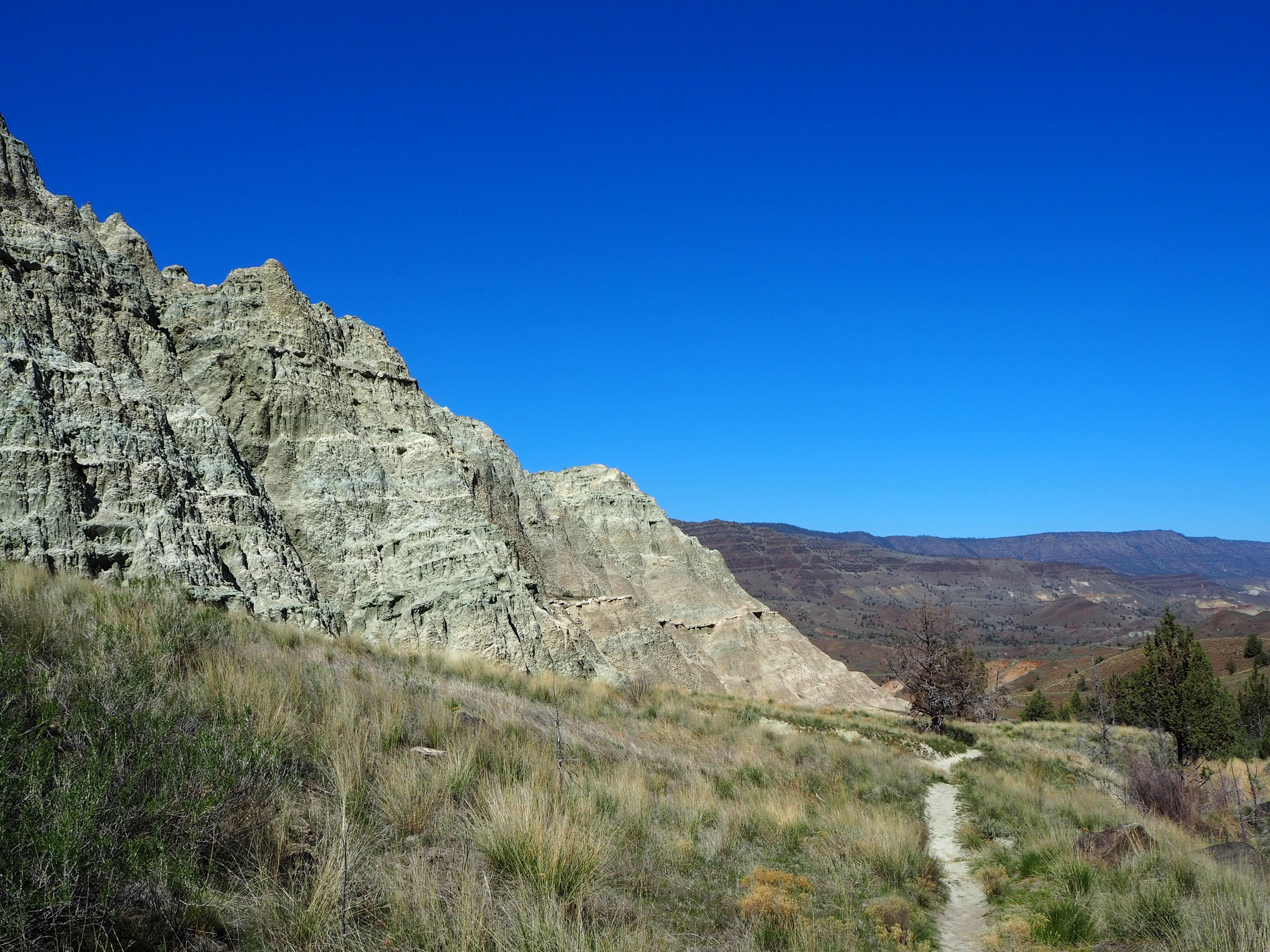
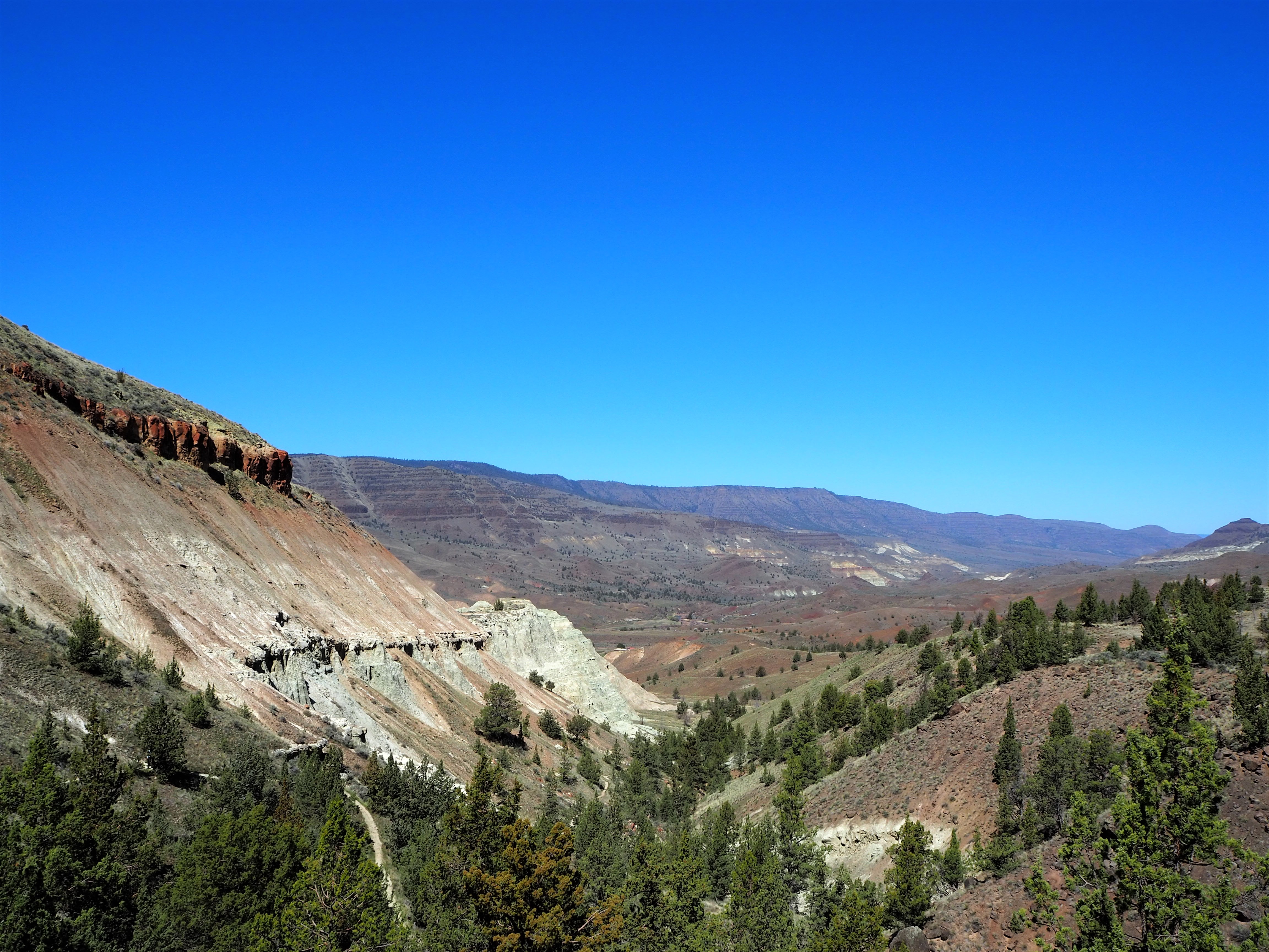
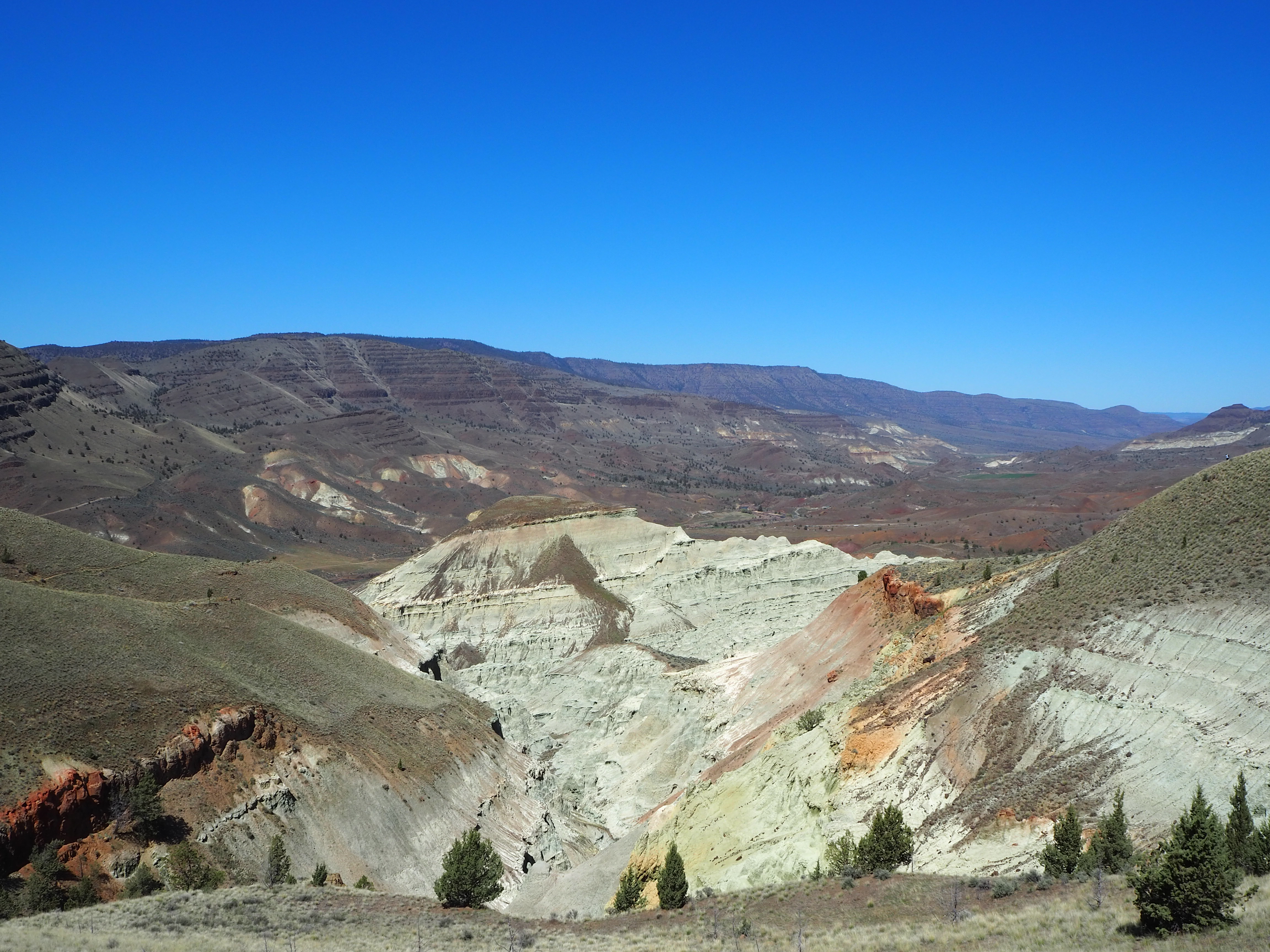
On top of the ridge, we made a short detour on a spur trail to an overlook. Still uncertain about what the view might be, we were stunned to find an amphitheater of blue-green claystones arrayed below us. It was gorgeous; the sun shone on the amphitheater, highlighting the complexities of the stone as we delighted in our reward. Surprisingly, the overlook wasn’t the only spectacular view. As we returned to the main trail to complete the loop, the trail retained expansive views of the basin, showing us varying angles and depth. It was a stellar loop hike, and one of the peaks of our visit.


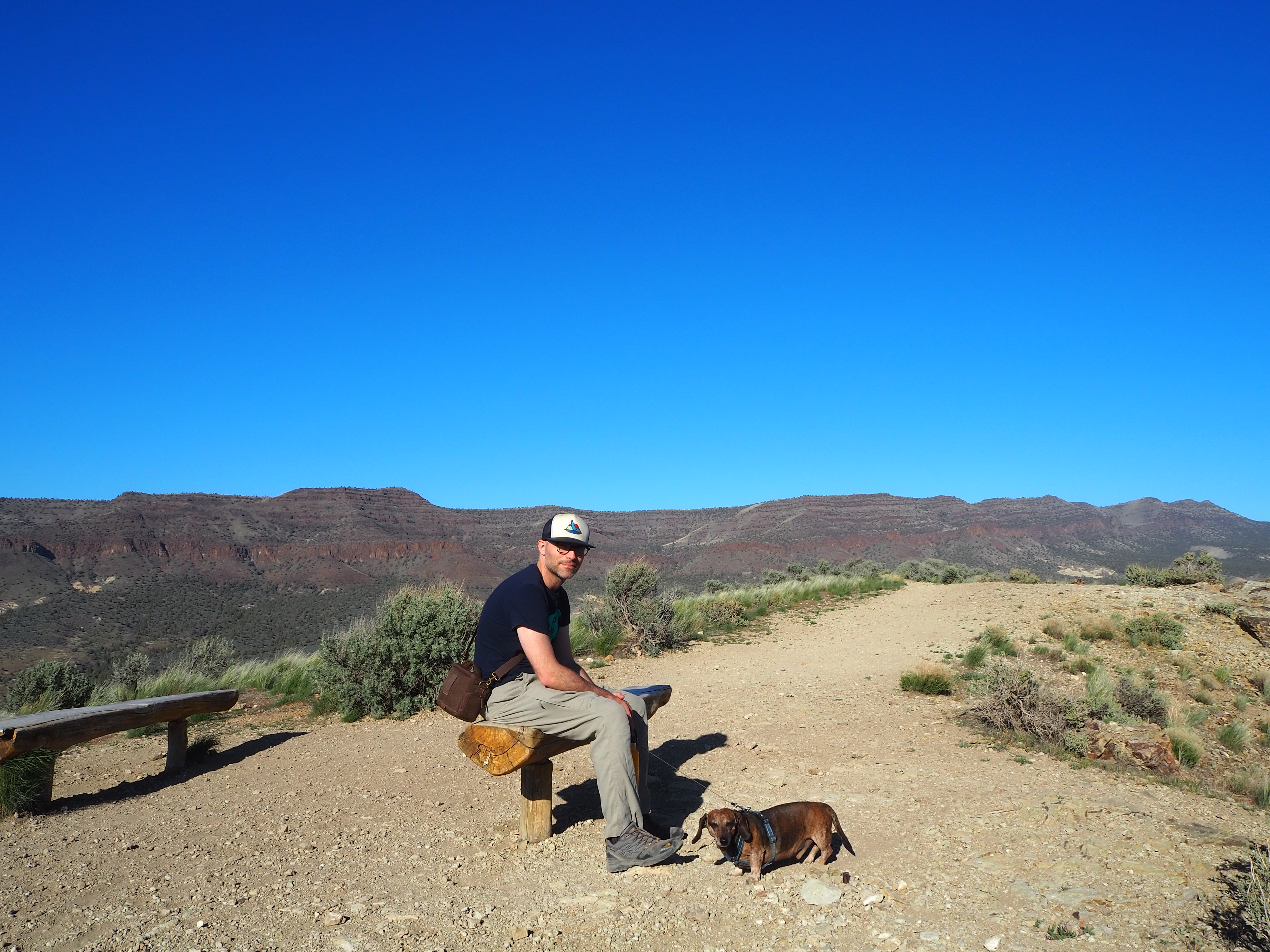
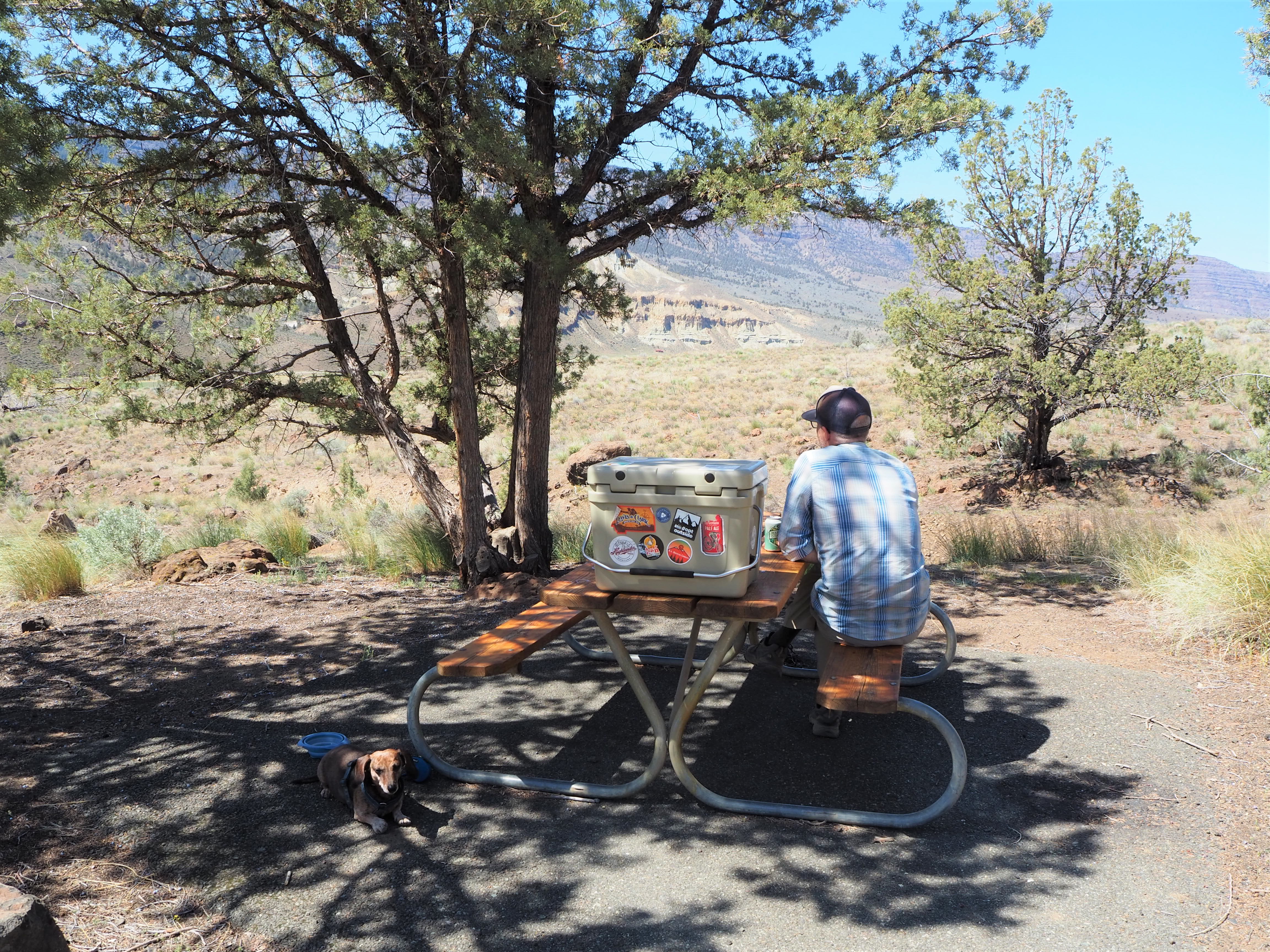
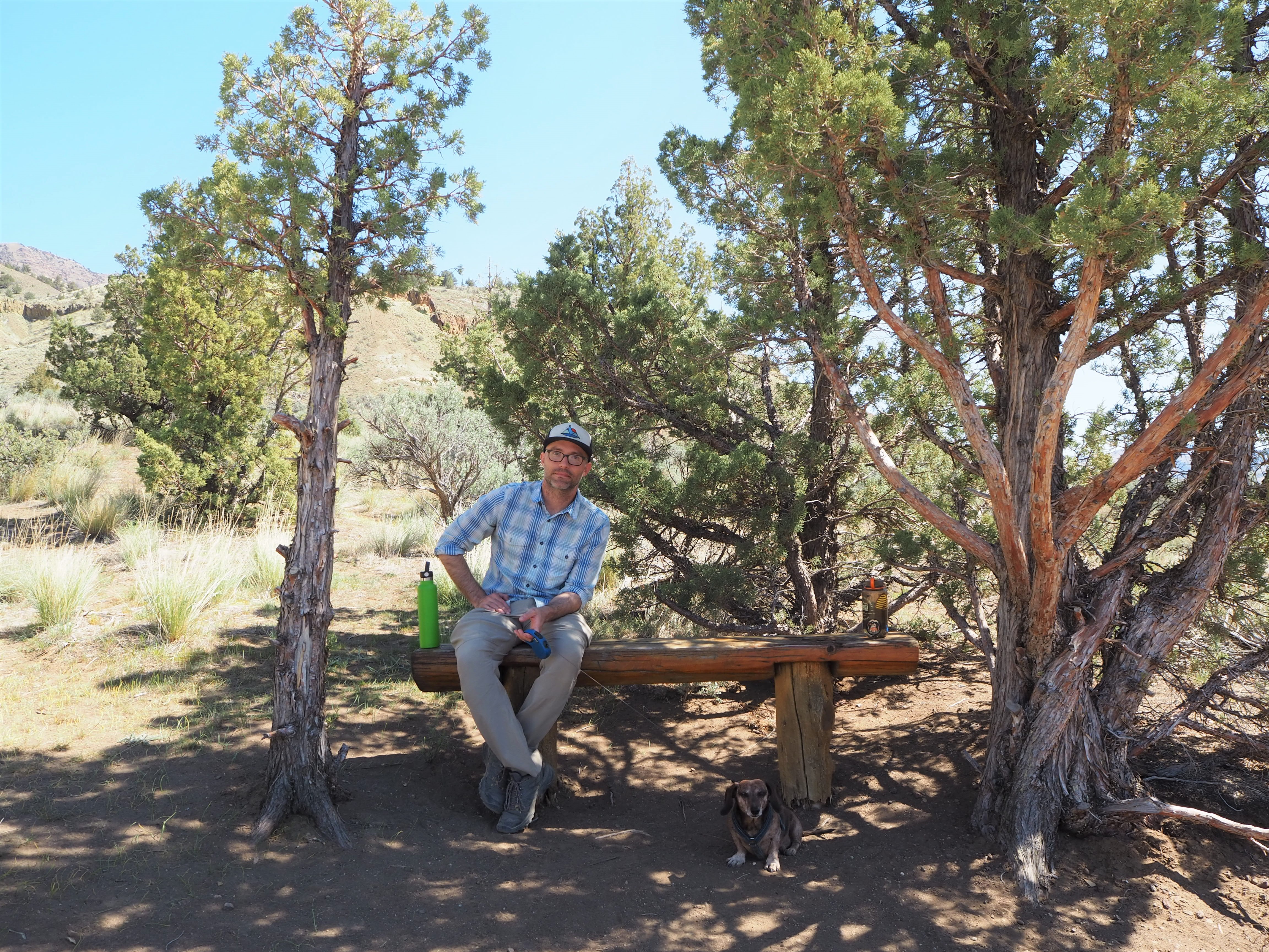
Hot and tired after our Blue Basin hike, we drove to the final piece of the Sheep Rock Unit, the Foree Trailhead. There were far fewer people there, only a couple of cars, so we were able to snag one of the well-shaded picnic tables for our lunch. Set back from the parking lot, it was nicely sequestered from anyone who arrived to hike. We enjoyed the solitude and the chance to cool off, as the temperatures reached toward the low 80s. The two trails here were brief (under 0.5 mile), and since one led to a view of blue-green claystones similar to Blue Basin, we chose to do Flood of Fire for a post-lunch walk. Tru, we quickly learned, was exhausted and uninterested in doing much more hiking. We carried him a bit to speed things along. It was a simple walk to a pretty overlook of the John Day River Valley and some colorful rock formations with a bench flanked by junipers. We surveyed the view and then turned back before the next flurry of hikers arrived.

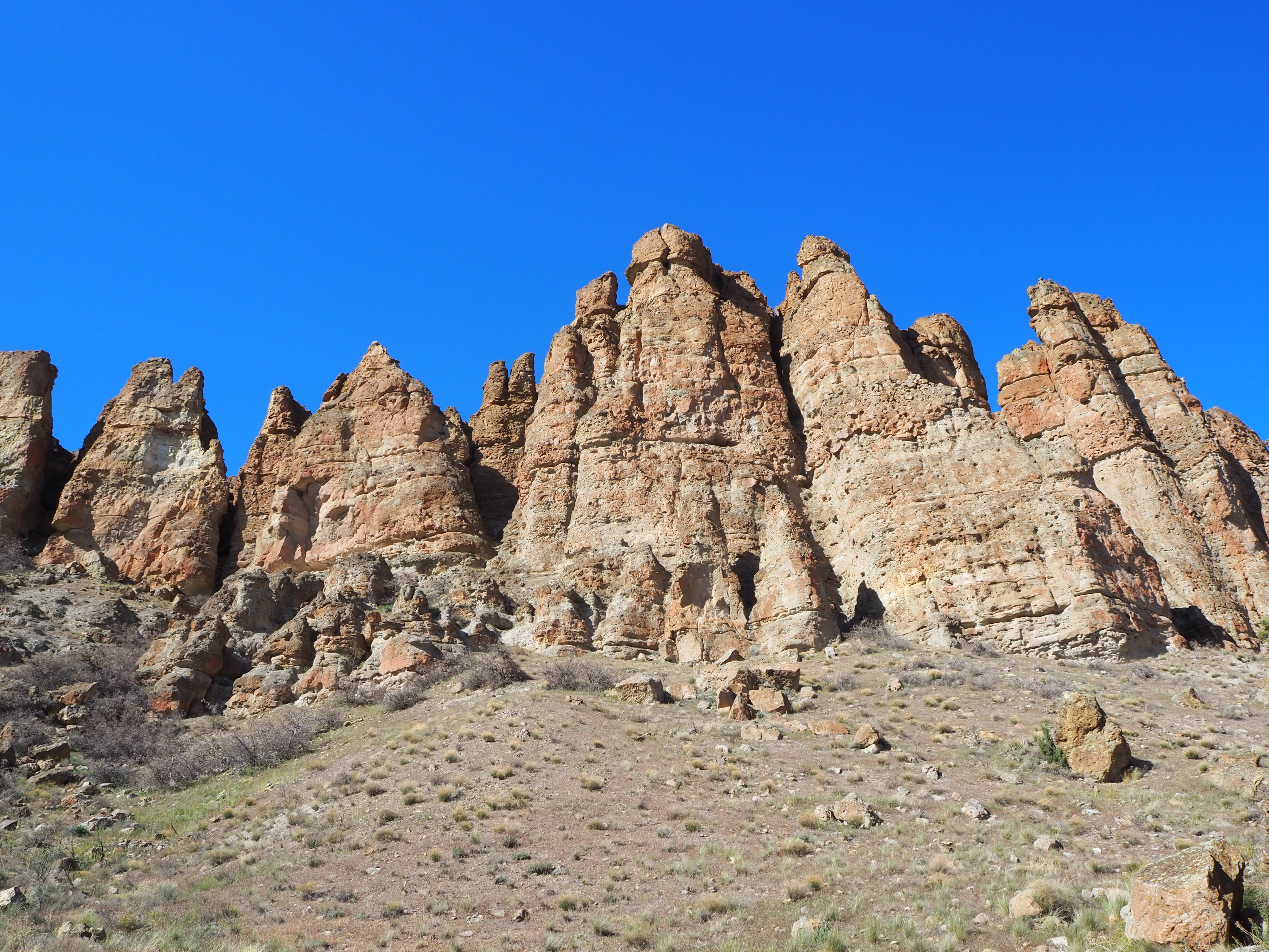
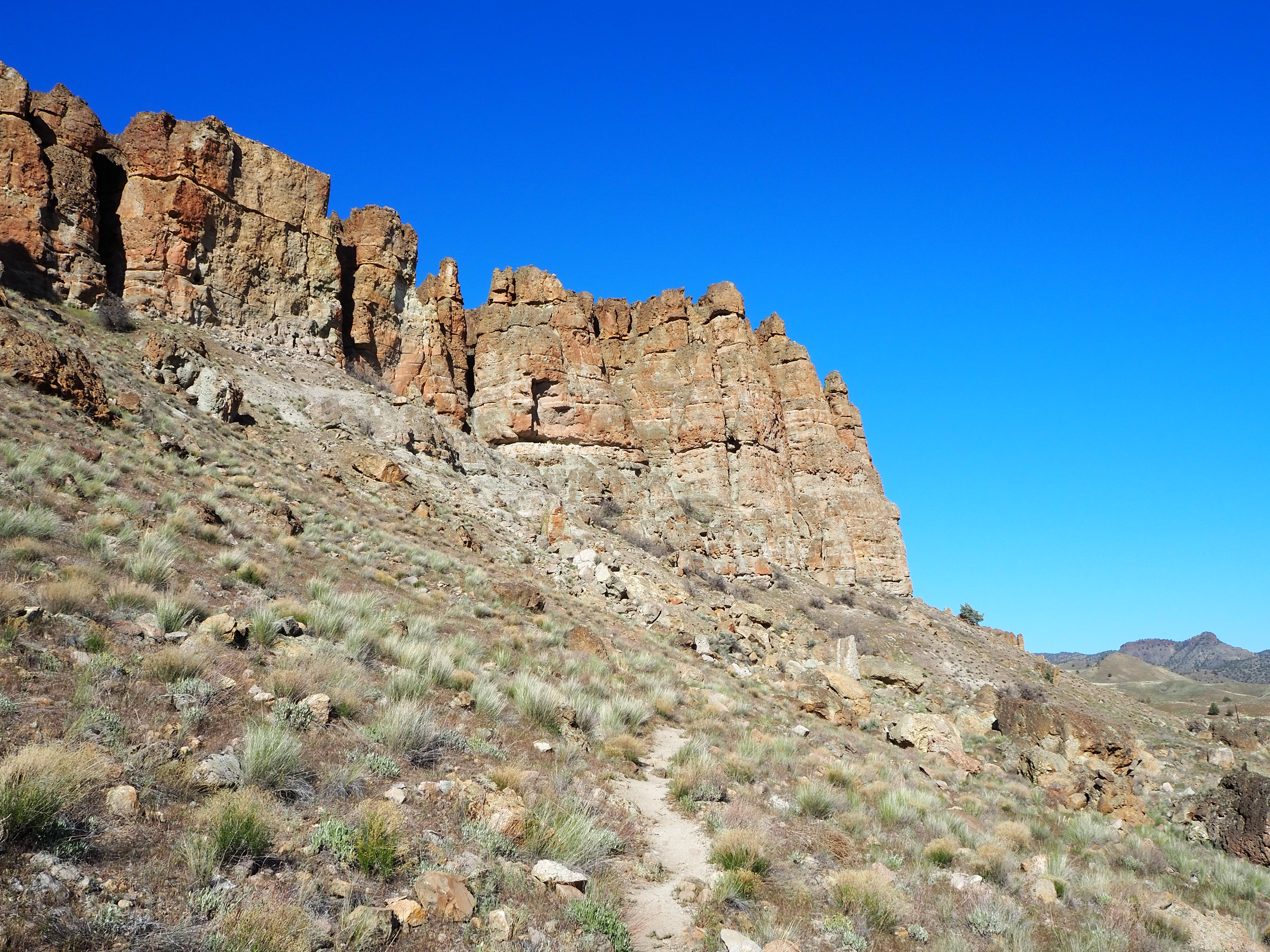
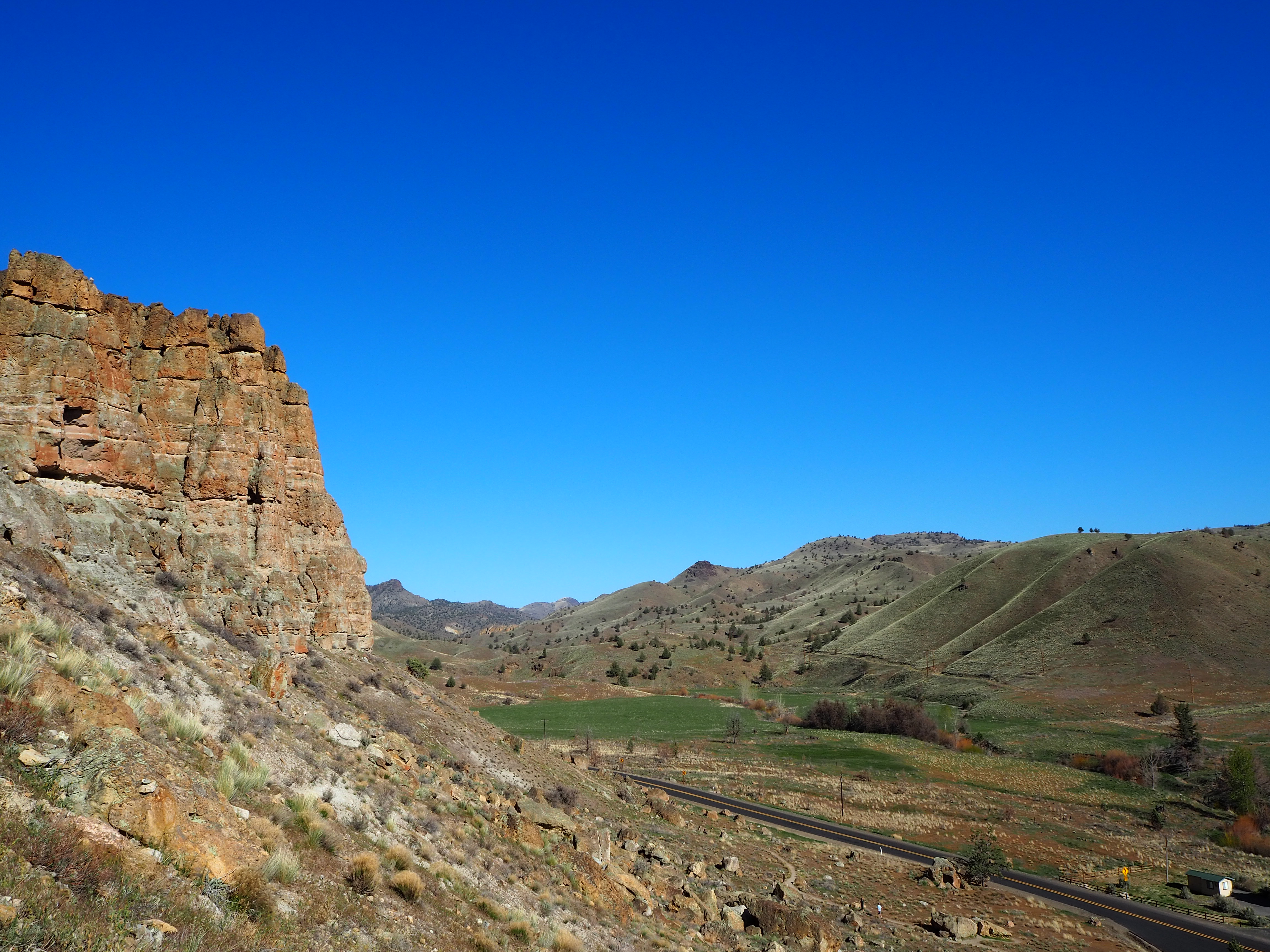
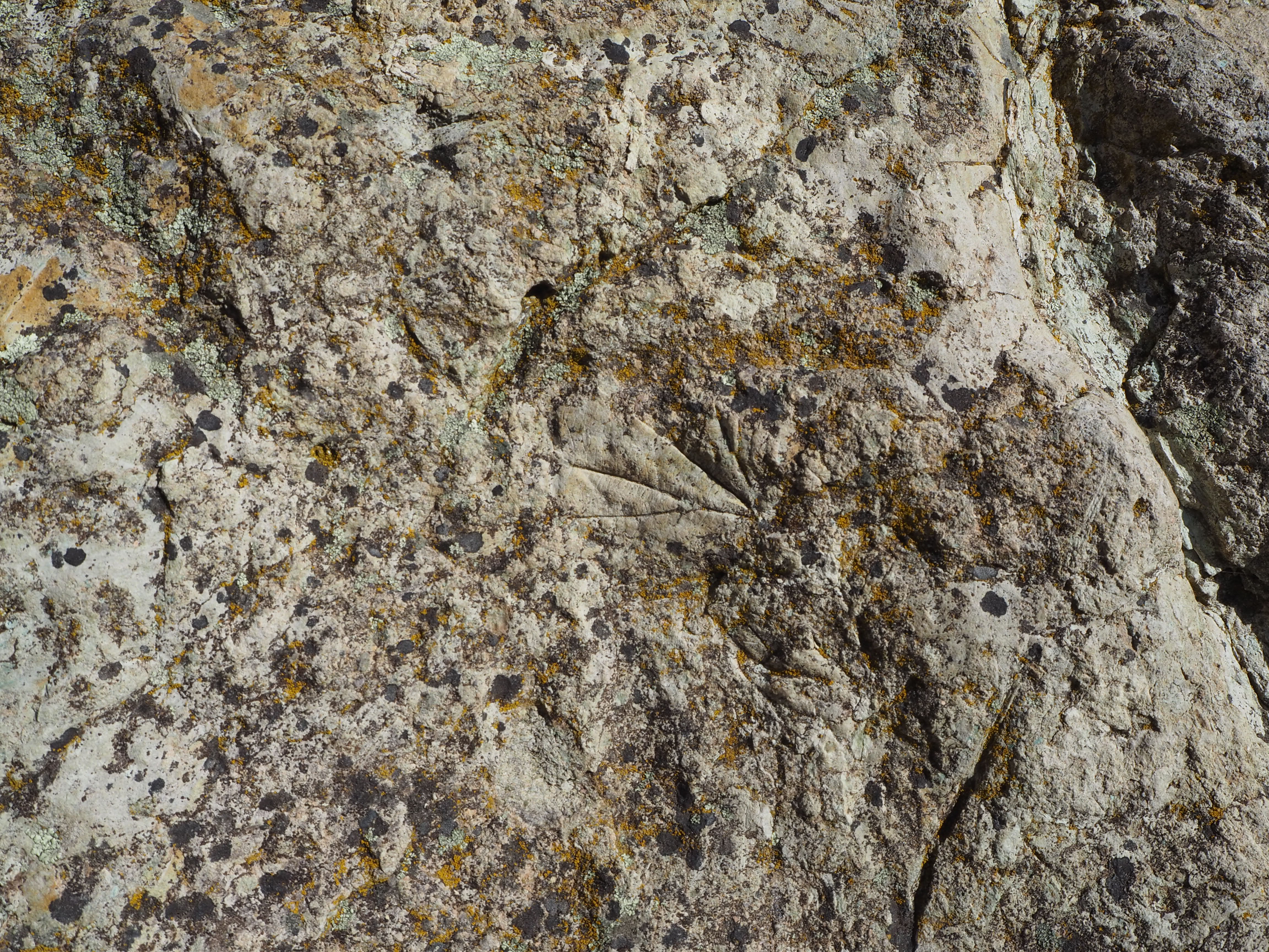
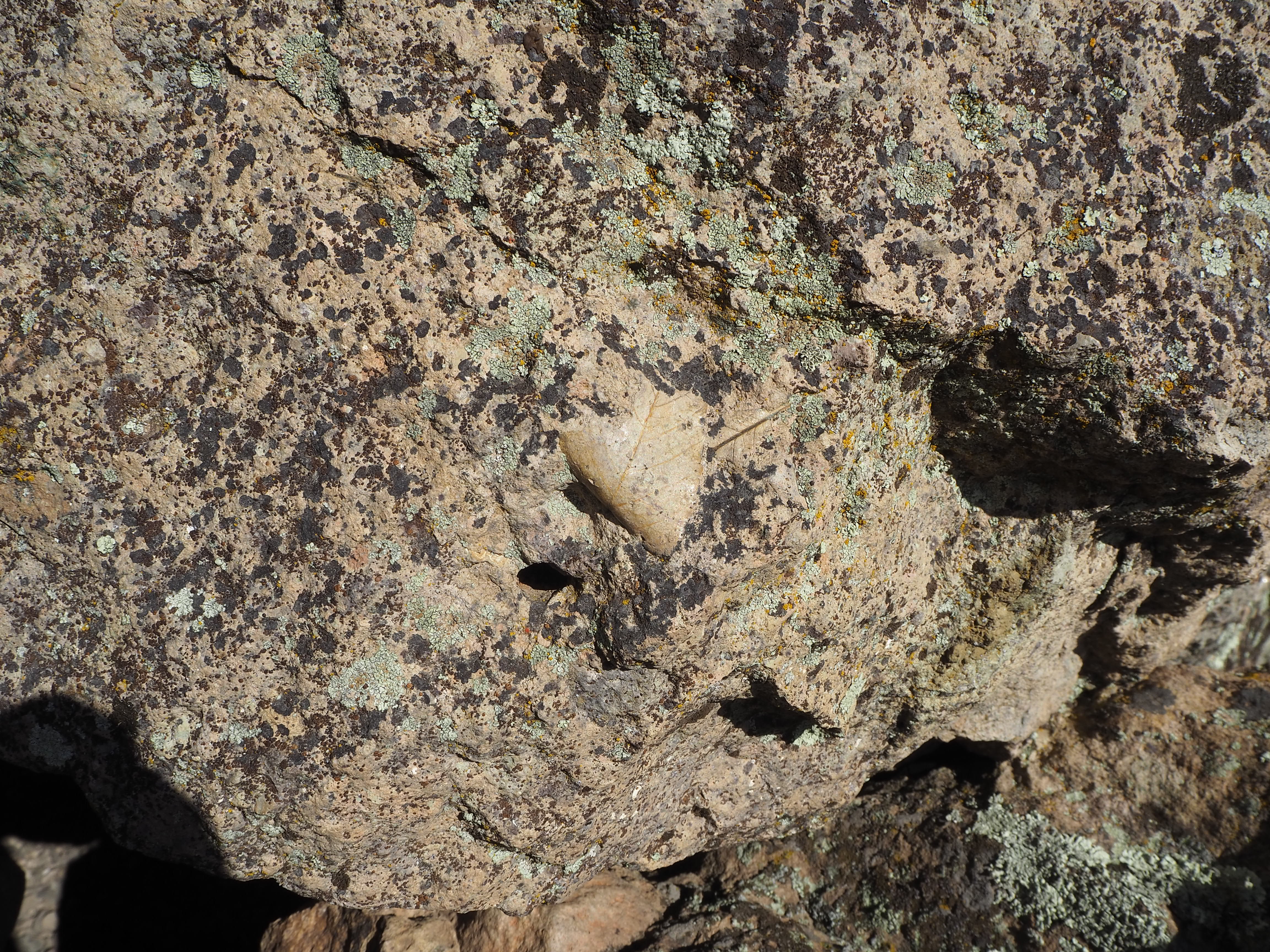
Back in the car, it was time to go to the final unit – Clarno. The least visited, Clarno is the smallest and fairly far from the other two units (2 hours from Sheep Rock and 1.5 hours from Painted Hills). It’s tucked in a canyon alongside a quiet two-lane road that doesn’t seem to see much traffic other than motorcyclists and cyclists out for a ride. The drive from Sheep Rock was beautiful as we followed the John Day River on its journey north to the confluence with its North Fork until we parted ways at Service Creek, then we travelled on quiet tree-lined roads connecting rural communities. By the time we arrived, it was late afternoon and the temperature was at its peak. I had hoped that the car ride would give Truman the rest he needed and then he might be willing to do one of the short trails at the Clarno Unit. As we took the trail that connected the parking lot and rest area to the other two trails, it became clear that Truman was done. Really, we were all done. What remaining zest we’d had was quickly zapped by the heat and sun. The main sight at Clarno are the Palisades, gigantic eroded cliff sides that are leftover from an ancient volcanic mudslide. They were imposing and shone brightly in the afternoon sun. Zach found a shaded bench to sit on with Tru, while I ran up the arch trail to get a better vantage of the Palisades, then perused part of the other path, searching for fossilized leaves embossed in the rock face. Like the other units, the trails here were all less than 0.5 mile in length, but even that couldn’t persuade me to complete one. Tired, but accomplished, we drove back to our campsite.
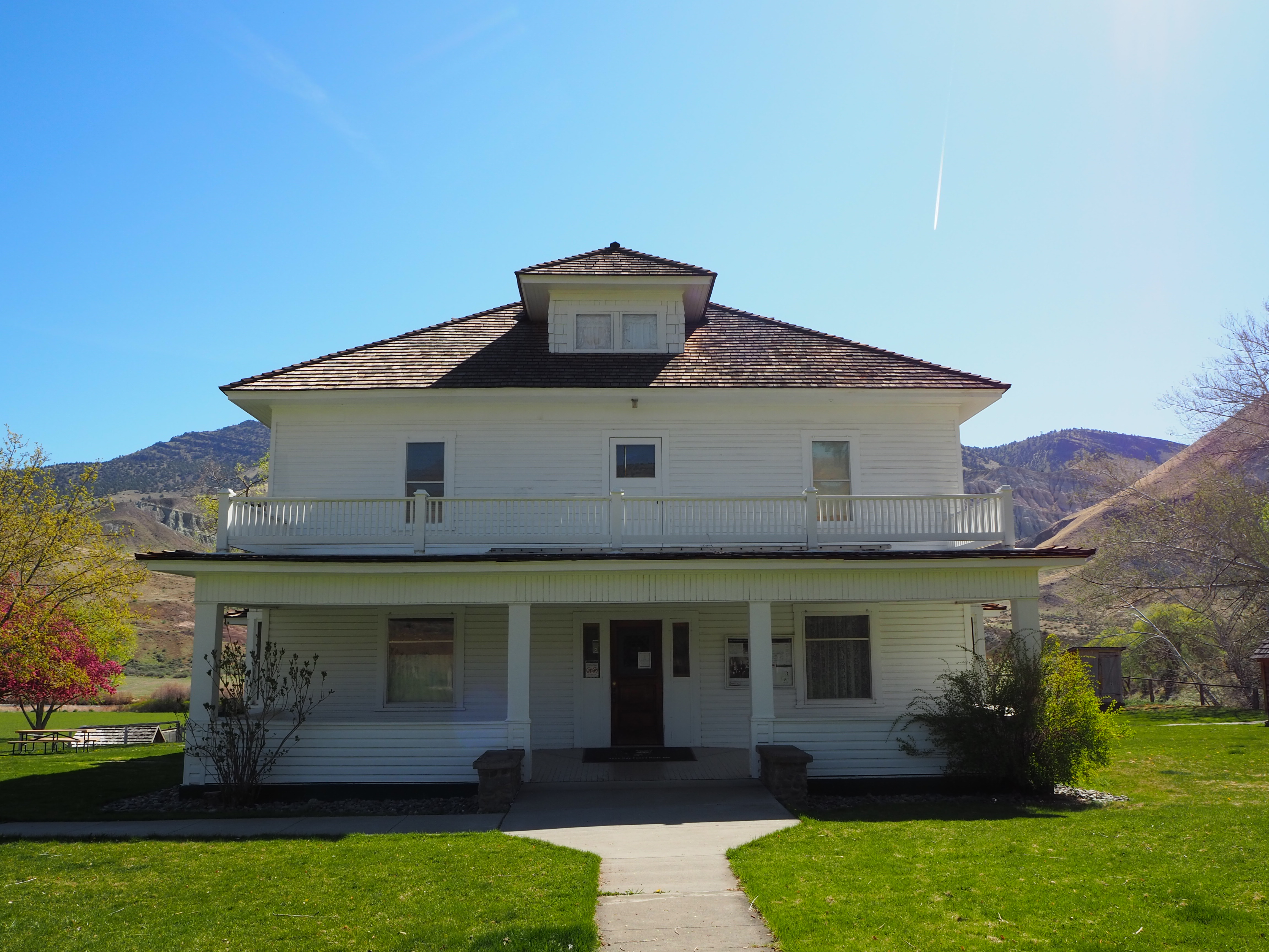
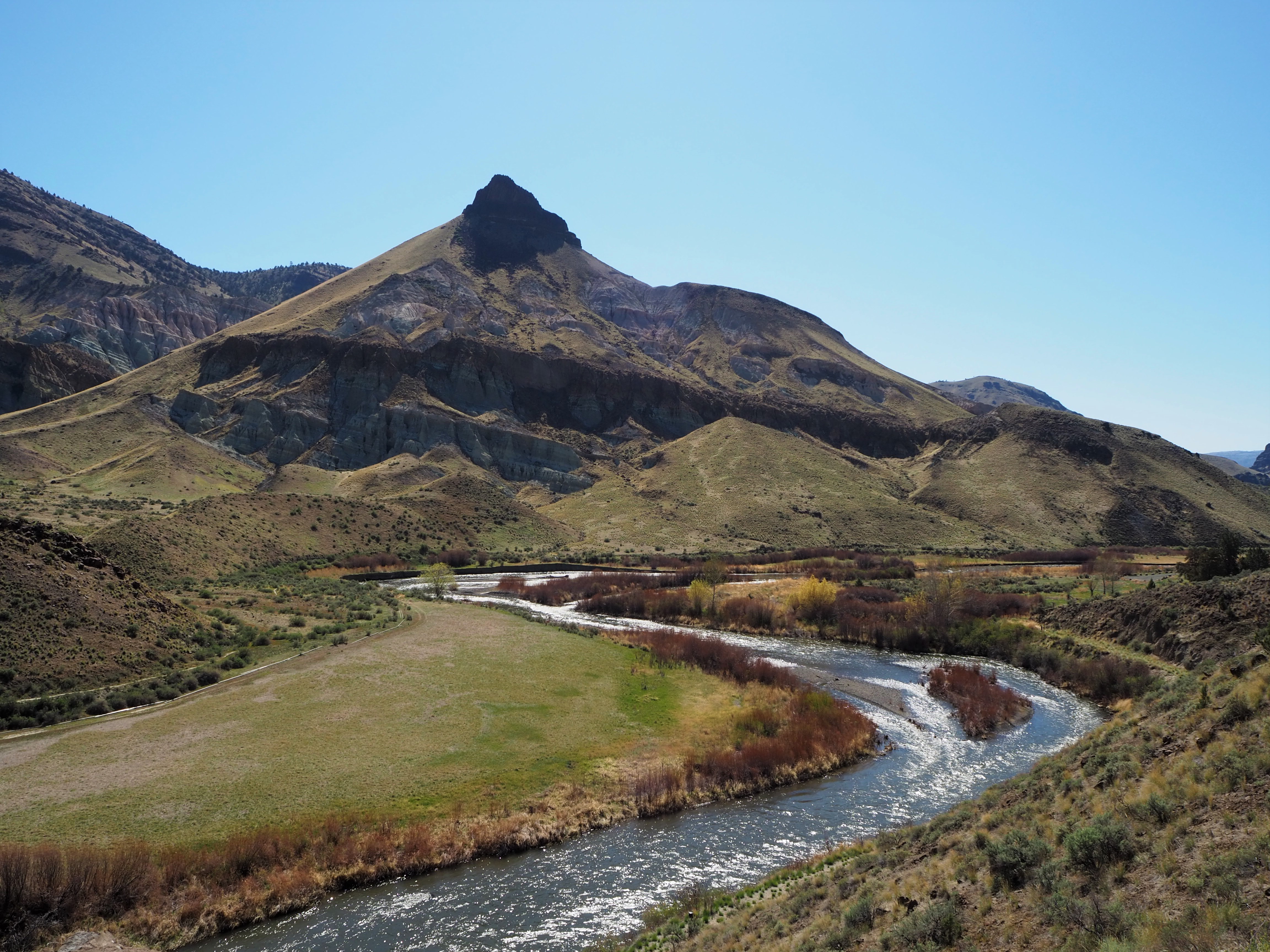
On Sunday morning, we took our time making breakfast and lounging around before breaking down camp. Zach even hiked up a nearby hill with his trumpet (cue eye roll). We stopped by the drive-thru coffee stand outside of Mitchell for a caffeine fix, and then began the somewhat familiar drive east toward Sheep Rock again. I wanted to stop to check out the one area we had skipped the day before – the James Cant Ranch. This area is reminiscent of the Gifford House at Capitol Reef NP, minus the fruit pies and jams. The Cant Ranch was established as a sheep ranch in 1910 by Scottish immigrants. Today, it serves as the Monument headquarters and operates as a working hay farm. It sits alongside the John Day River and has several nicely shaded picnic tables, a trail leading to the river and another to an overlook, a small orchard, and tours of the historical Cant home. While Zach and Tru hung back in the shade, I ventured up the short overlook trail for a really great view of Sheep Rock rising above a large bend in the John Day River.
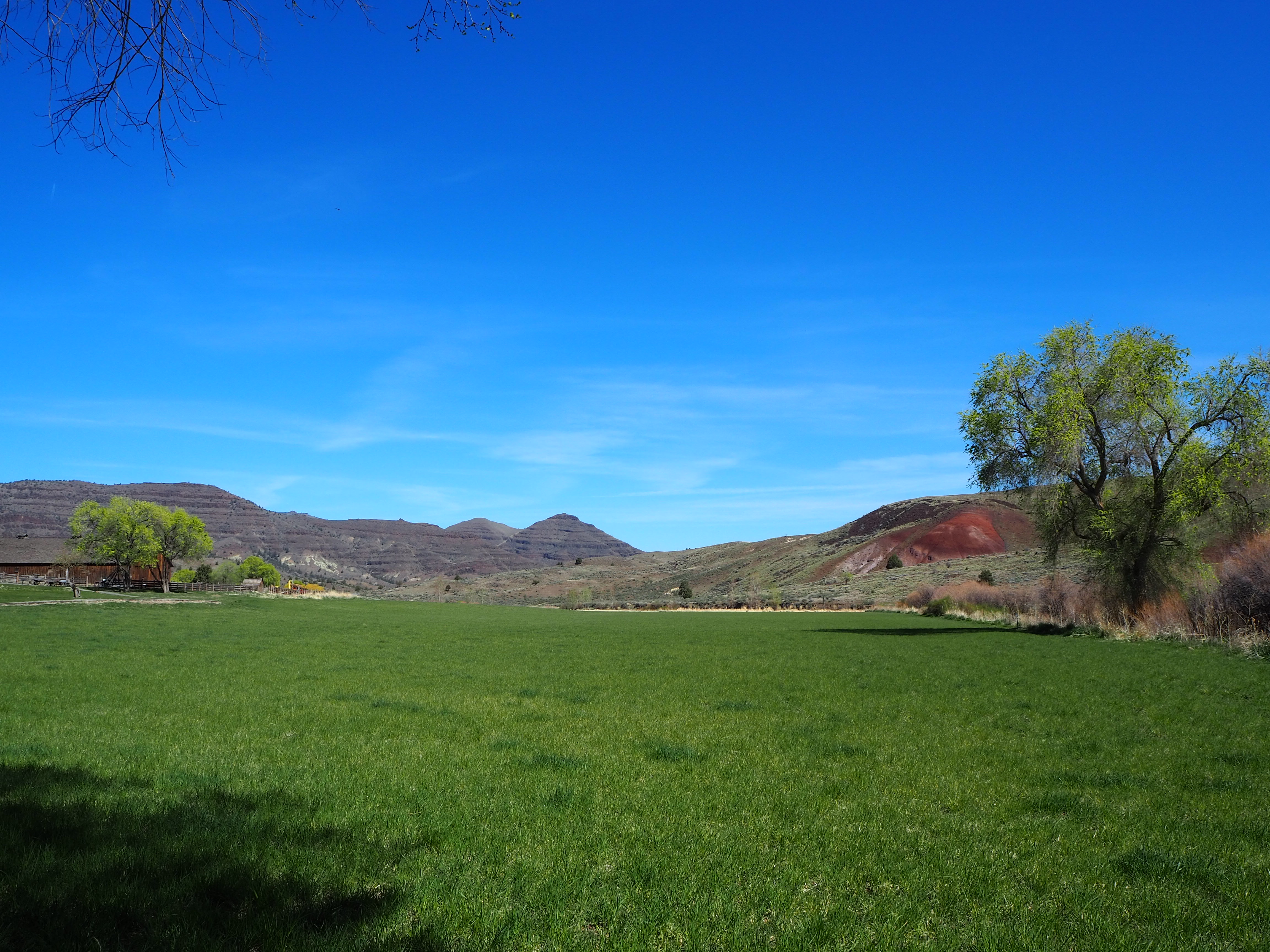
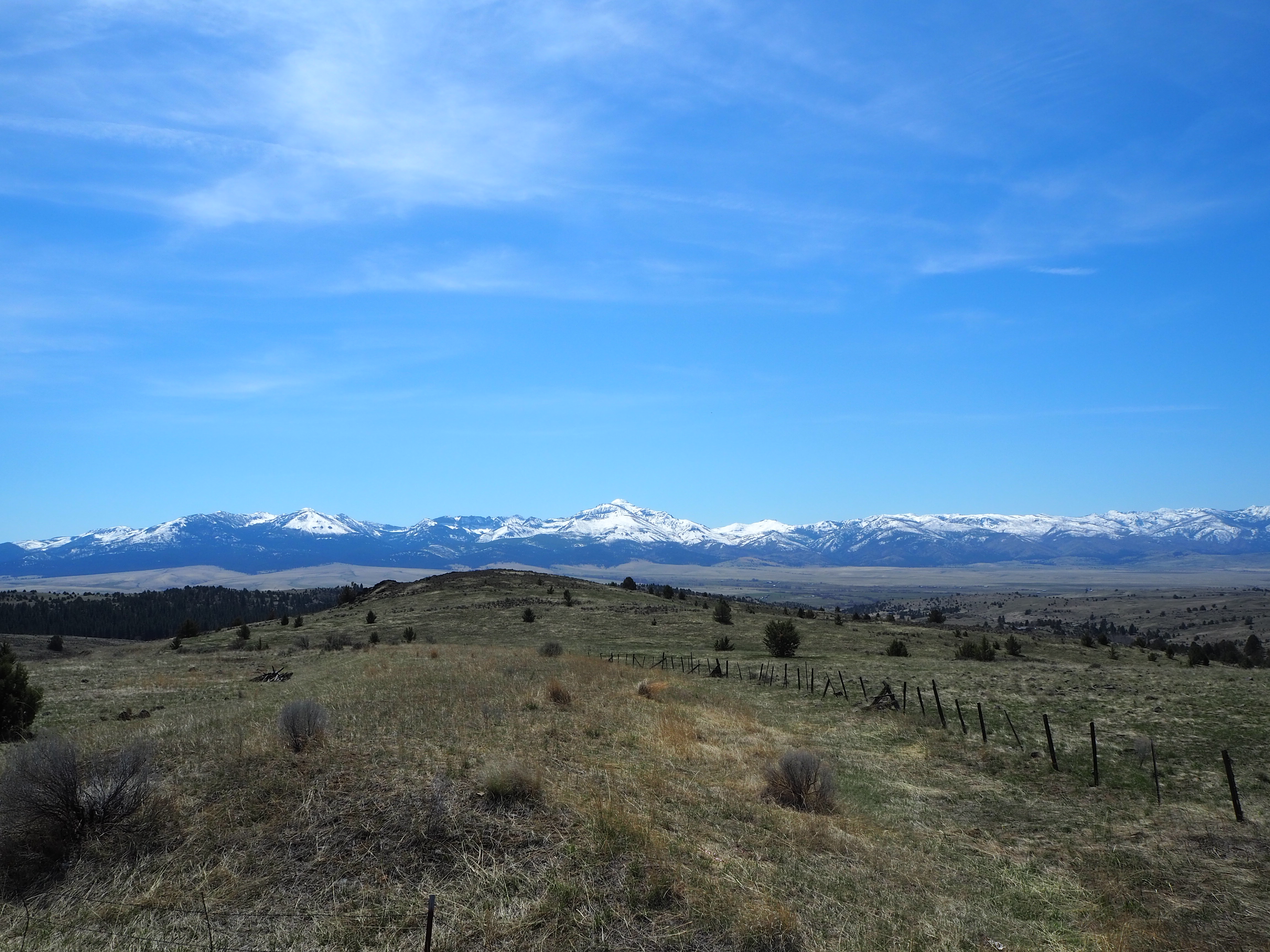
Back in the shade, Truman decided he wanted to do the short trail to the riverside, so we willingly obliged and ambled down the wide path to the river’s edge. The entire time we were there only one other elderly couple was out, making our time there serene and peaceful. Then it was back in the car, driving past modern day farms and ranches, before a brief lunch stop at a pull out overlooking the Strawberry mountains, then back along the highway as forests melted into dry, sagebrush plains, then bright green irrigated fields, and finally home.
Categories: North America, Oregon, USA
