Following a summer unlike any other – in which we were incredibly fortunate to be able to escape into Idaho’s wild places – fall and winter loomed large on the horizon. Although the pandemic certainly impacted our summer, I was anxious about what it would mean for winter especially. Without the ability to retreat outside as easily or as often, I was dreading the change in seasons. With that pressing on our minds, we decided to plan a Thanksgiving trip to Kanab in southern Utah, a place we have visited during the Thanksgiving holiday twice before. A familiarity with the region made me feel comfortable with the idea that we would have places to retreat outside where we wouldn’t be surrounded by many, if any, other people. In years past, we rented an attached casita outside of town. This time, I found a detached casita in town that would be a better (and cheaper) basecamp for our adventures. I also planned to bring all of the food we would need for the entire week, something I typically don’t do. I wanted to make our footprint as faint as possible.
In the early weeks of November, we had our first (knock-on-wood, only) Covid scare. One of Zach’s students tested positive the day after a private lesson. Although they were 12 feet apart and used bell covers for their trumpets, it was the closest we had (knowingly) come to Covid. Thankfully, Zach’s test came back negative. After a week-long quarantine – that included my birthday! – we were able to resume our lives. It made our trip to Kanab feel that much more critical to our mental health.
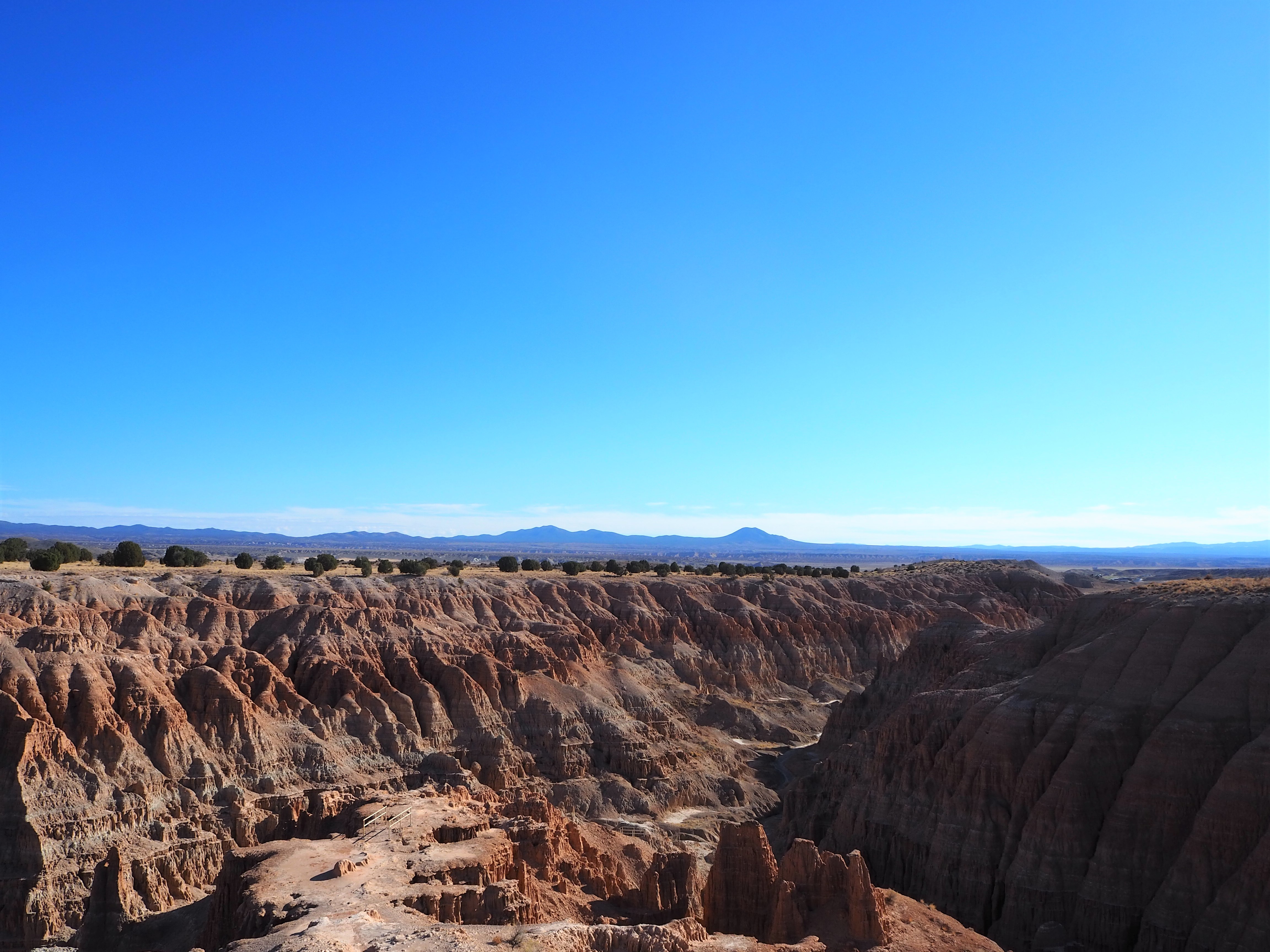
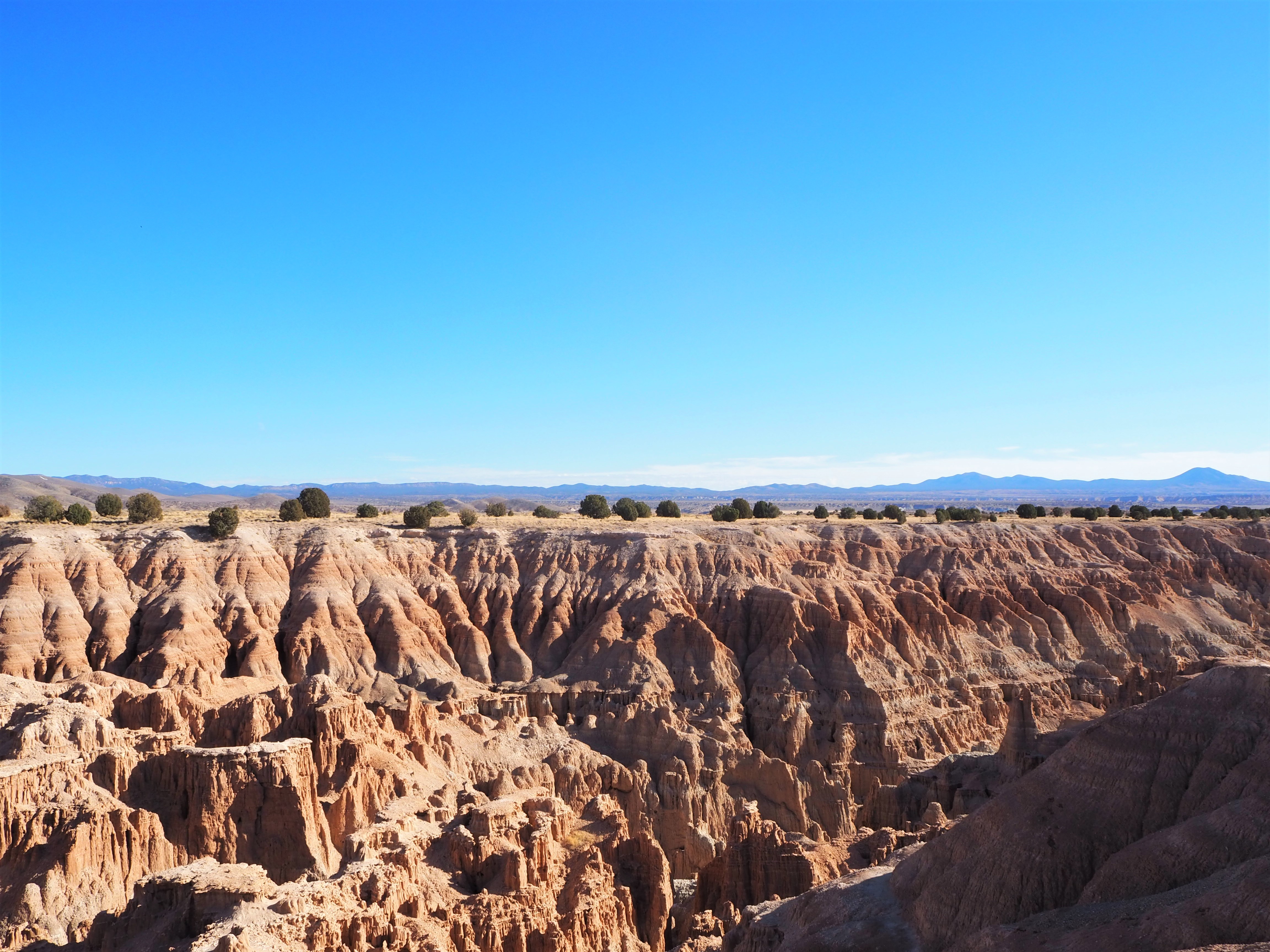
When we lived in Salt Lake, the trip to Kanab only took 4.5 hours. Now, it was going to be an 11 hour drive. We loaded everything up the night before so we could get an early start on Sunday morning. Zach wanted to drive through Nevada, which is a slightly longer journey, albeit more scenic and less populated. It was a gorgeous drive sprinkled with a rest area bathroom stop along US Hwy. 93, a driving tour of Ely’s main drag, and a stop at the overlook of Cathedral Gorge State Park. We arrived in Kanab just as the sun was sinking, feeling all 11 hours of being in the car.
JOHNSON CANYON & LICK WASH
The forecast during our stay was exactly as we’d hoped: mostly sunny with the kind of cool desert temperatures that make hiking in the fall so wonderful; just enough chill to wear a fleece. On Monday, I thought we’d take it easy with a drive up Johnson Canyon to Skutumpah Road where we could stop at Lick Wash and hike as far as we wanted. Johnson Canyon is a paved, scenic drive through a wide canyon of pastures that was once used as the backdrop for several old Hollywood films – most notably, Gunsmoke, (both the movie and some of the tv series). Most of the sites of interest sit on private property, so it felt a little anticlimactic to me, but it was a beautiful drive nonetheless. The road crosses the boundary into Grand Staircase-Escalante National Monument (GSENM) – where it gets a little more scenic – before the pavement runs out. We turned onto Skutumpah (like “Scoot ’em pah”) to follow it another 15 miles before the trailhead for Lick Wash came into view. We encountered Skutumpah Road on a previous trip, starting at its northern terminus and ending at the trailhead for Wilson Creek, a similar wash hike. That section of Skutumpah was a bit more adventurous, taking us up a steep hill and around sharper curves, on a narrow road softened by recent rain. This section was much more tame. It was fairly flat and wide, with lots of room to let faster vehicles pass us while we meandered along.


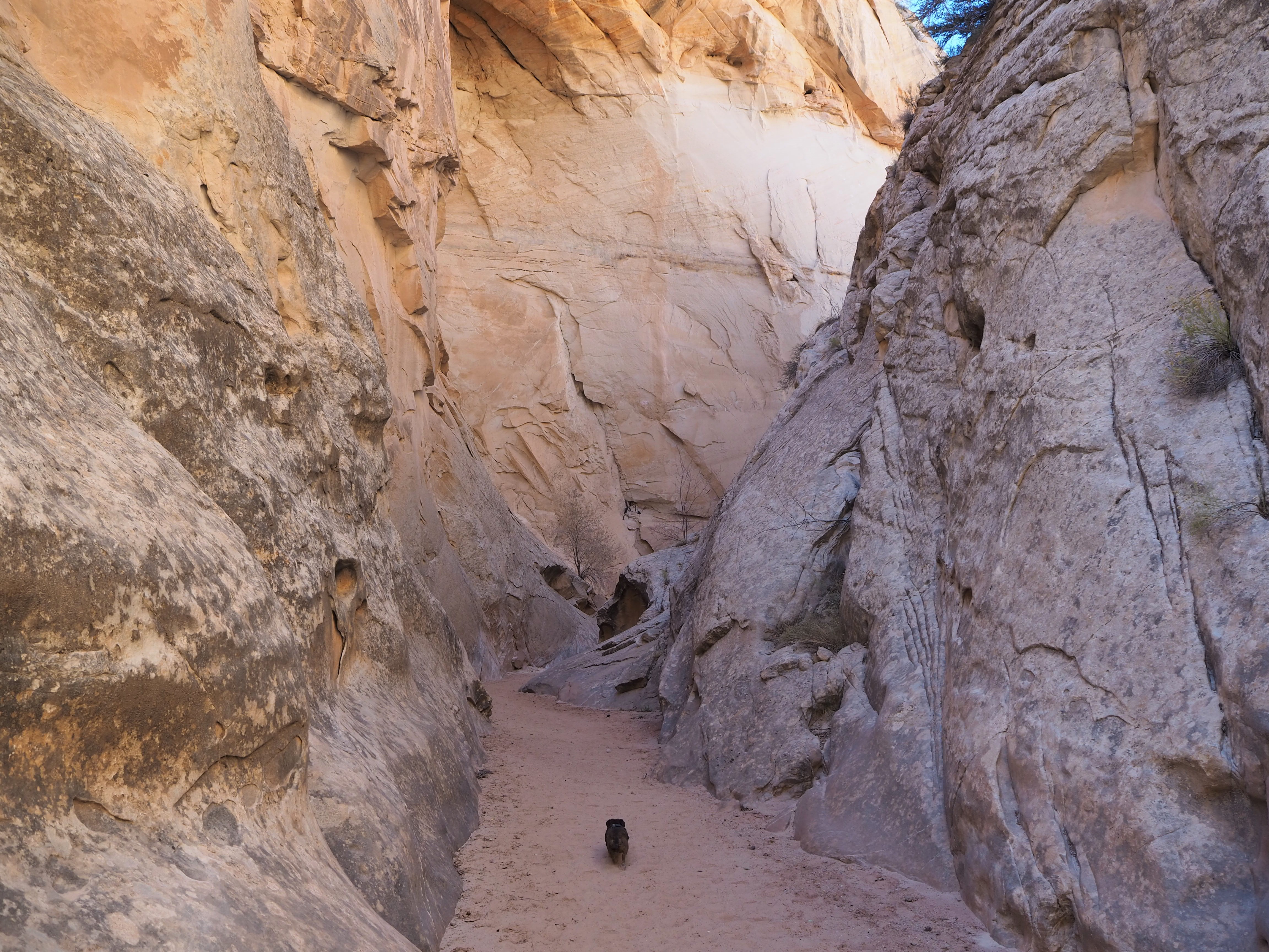
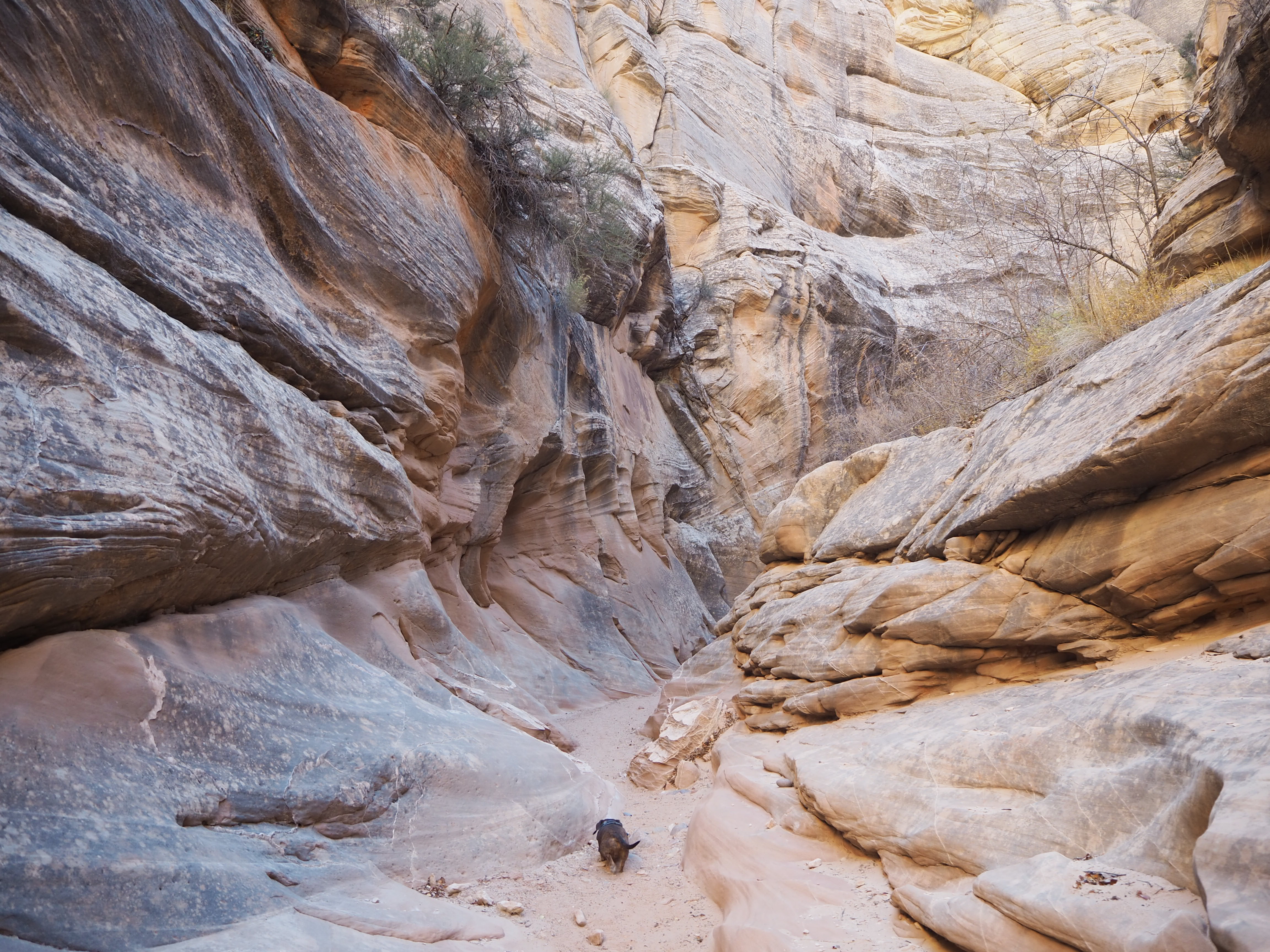
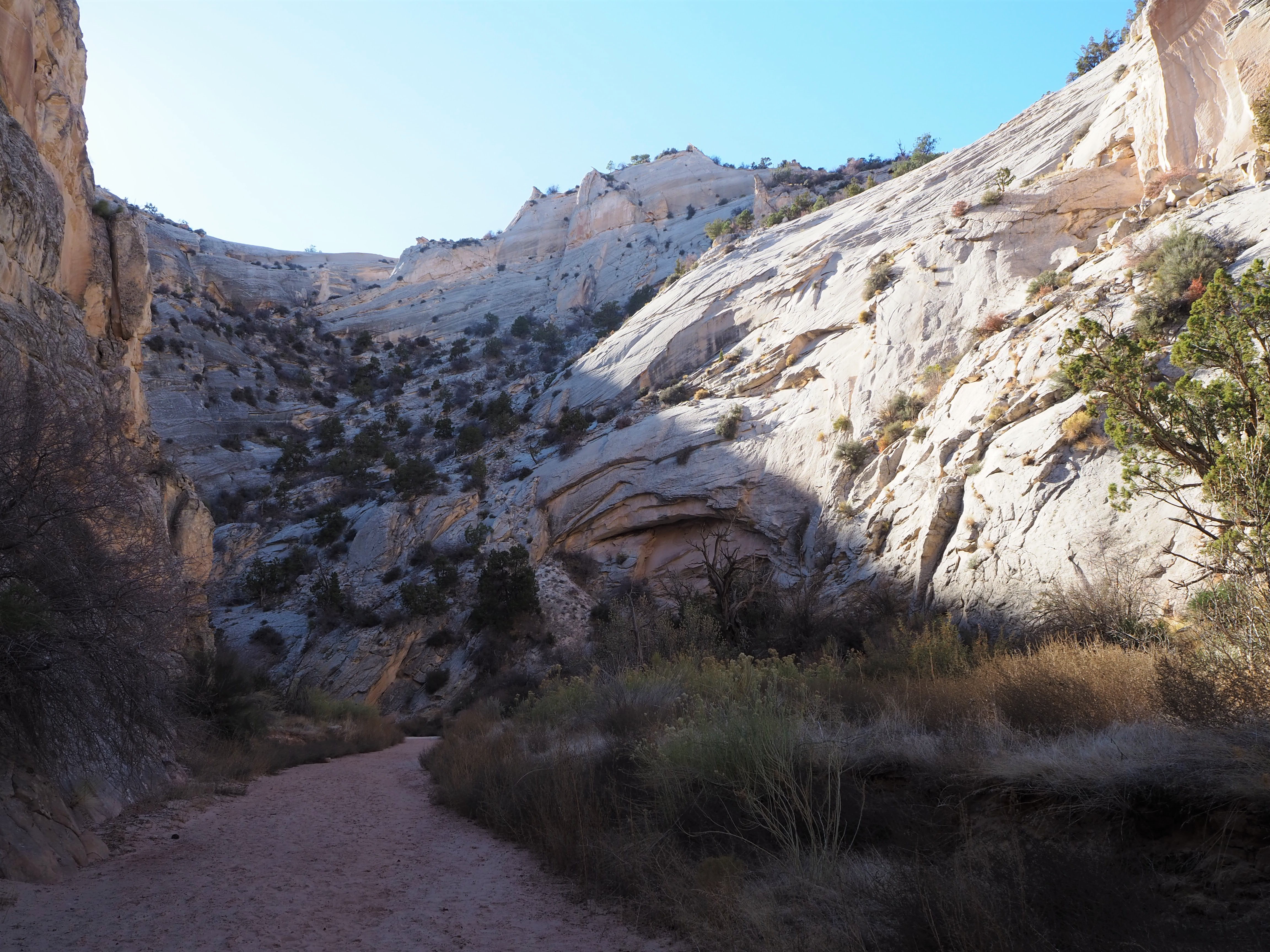
Like Wilson Creek, Lick Wash is a trail that traverses a creek bed as it cuts through the White Cliffs of GSENM. Although it was slightly overcast, there was no threat of rain for the day, making it an ideal time for a wash hike. Lick Wash is an out-and-back, giving hikers the opportunity to explore as much as they want before turning back to enjoy the scenery one more time. We bisected the serpentine curves of the dry wash bed to arrive at the entrance of the canyon. Never a true slot, (except one itty-bitty spot) Lick Wash has many nice sections of narrows in the first mile or so of the hike. We followed the worn curves of the sandstone walls as they contracted and expanded, towering 600-800 ft. above us.
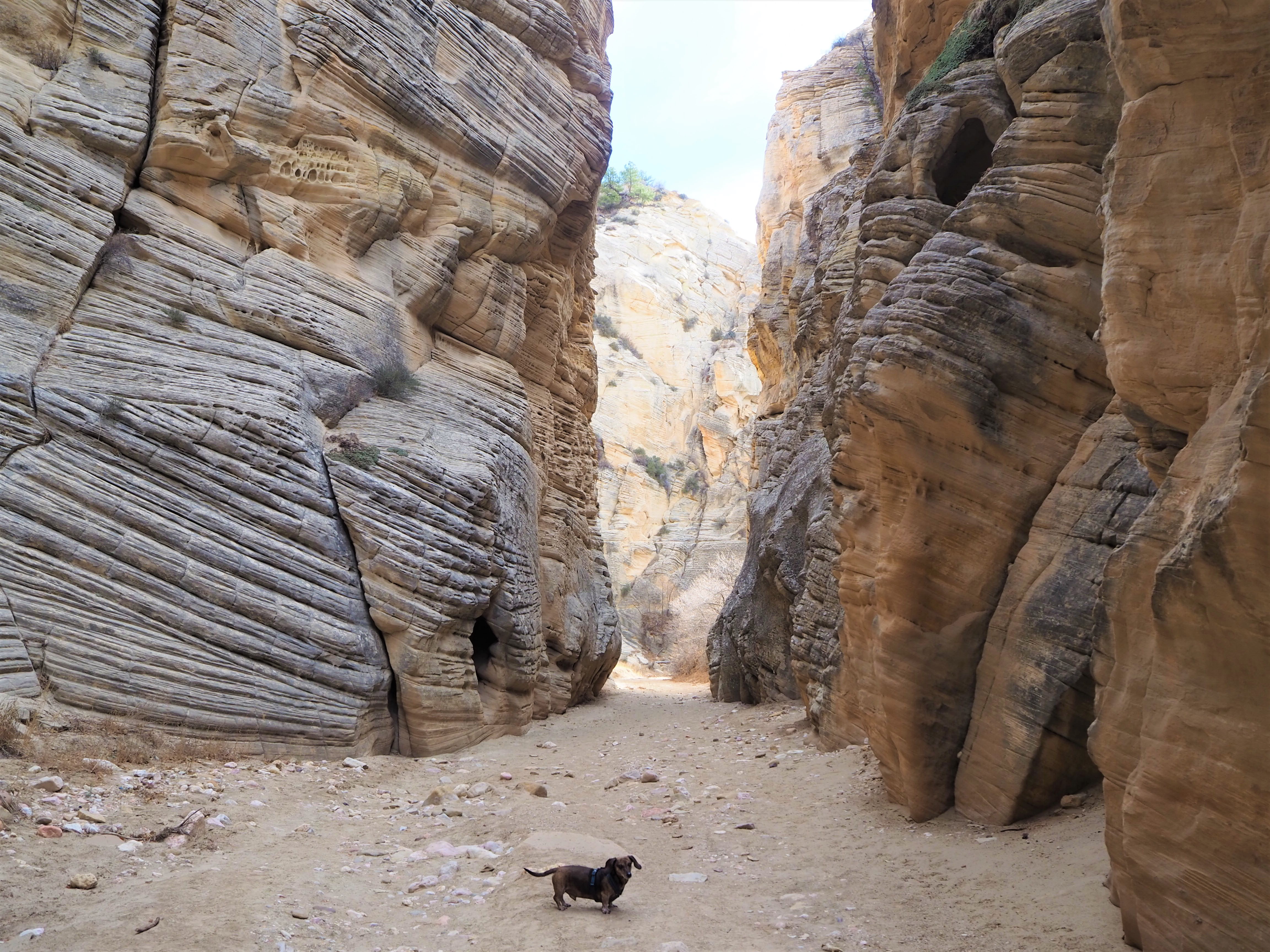
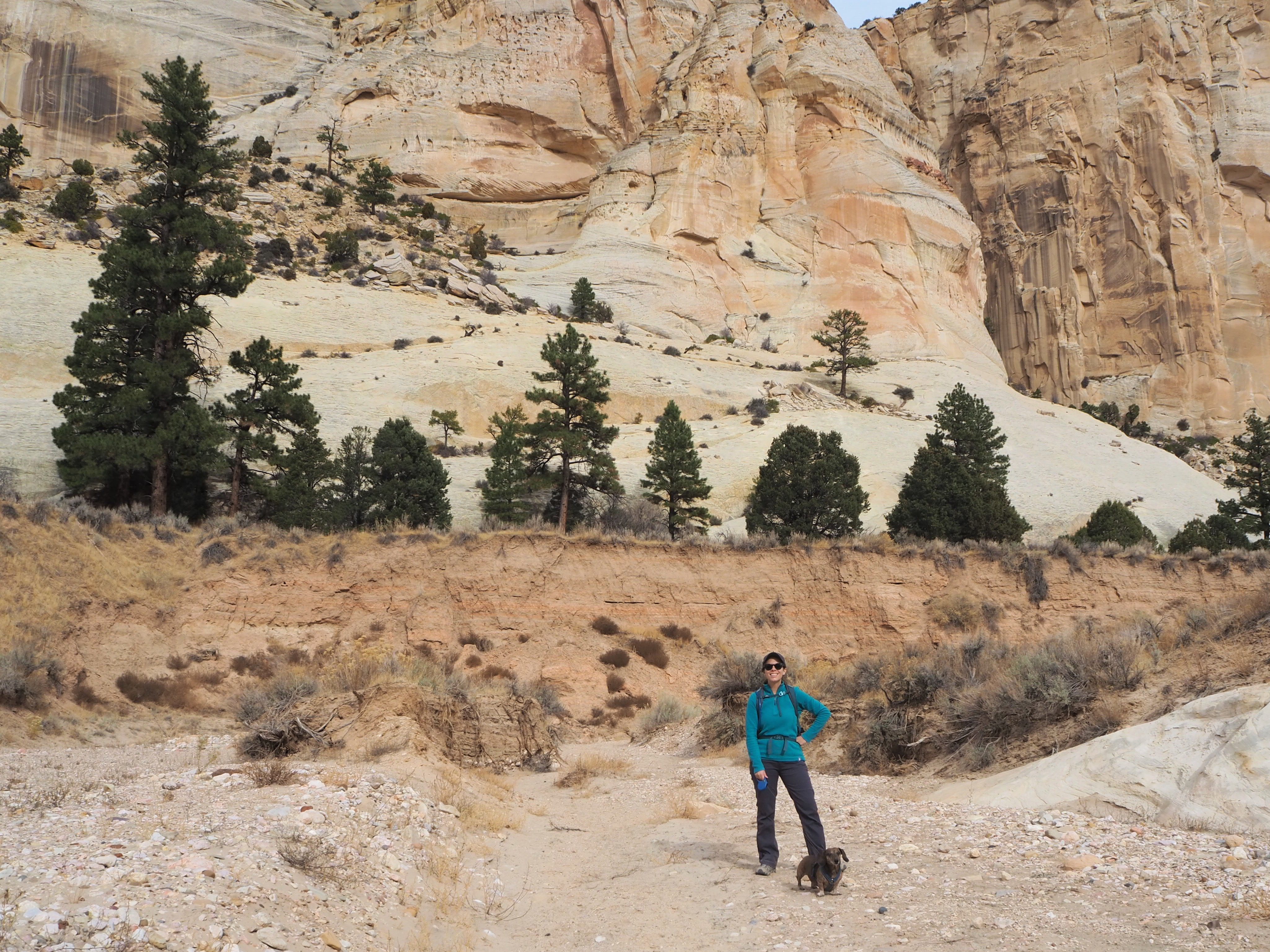
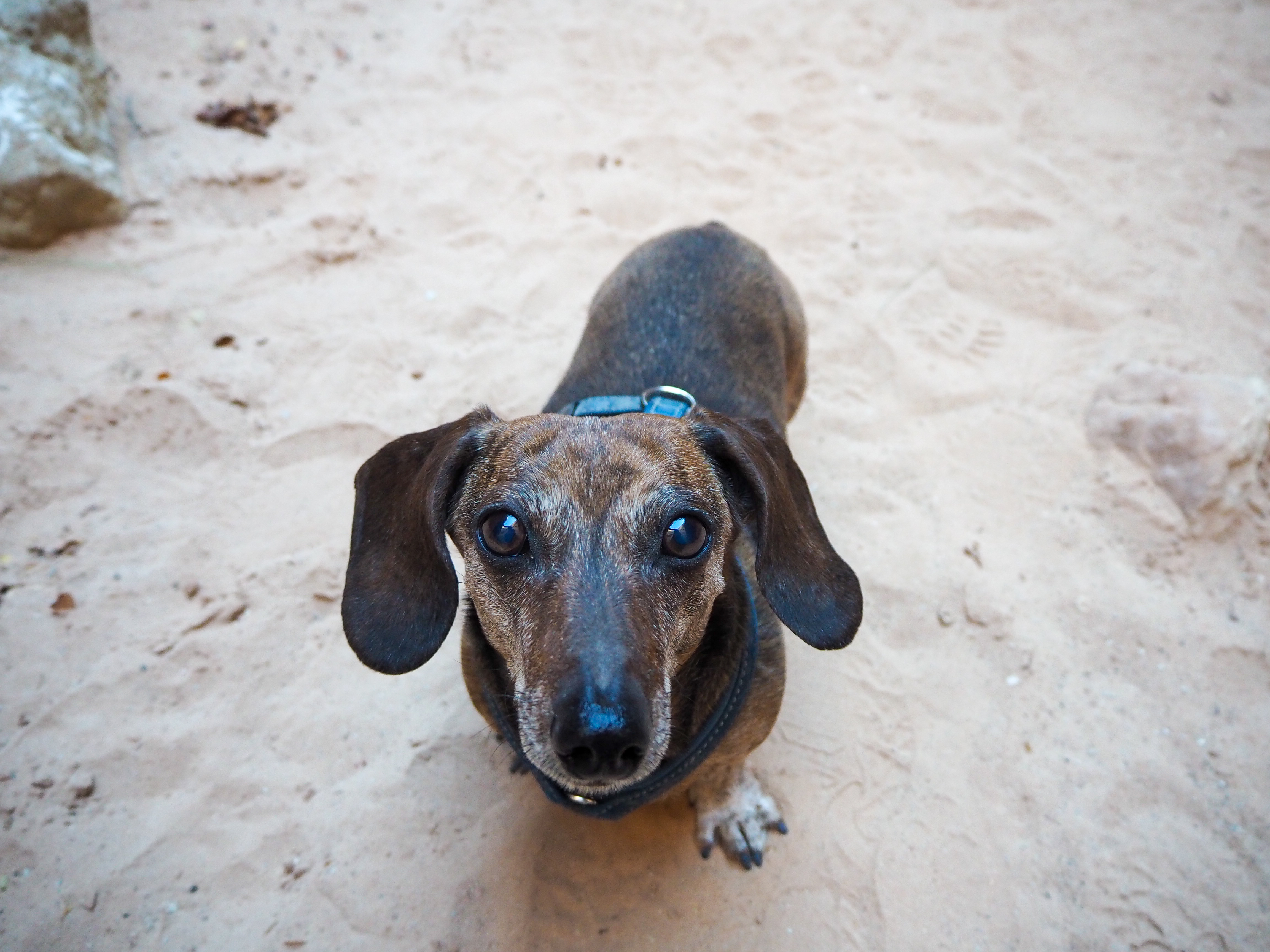
Once we left the embrace of the canyon walls, we were flushed into a wider canyon with swirling, colorful sandstone formations rising on the walls on our right. We stopped to have our lunch in the shade, enjoying the open views across from us. 5.5 miles ended up being the right (round-trip) length for us, as Truman began to slow once we reached the exposed reaches of the wider canyon. There were more hikers than I expected, but there was still more than enough space for social distancing. In all, we passed maybe 5 people.


Our tire light had come on earlier in the drive, and Zach let out some air once we turned on Skutumpah. We made it without any issues to the trailhead but drove slower than usual, just in case. Once we returned to Kanab, we stopped at a gas station to check the tire pressure. Zach discovered that one of our tires was grossly overinflated! For our entire trip so far, including an 11 hour drive from Boise on Nevada roads where we were easily driving 90mph, we had been on top of a potential hazard! We were grateful and relieved that we hadn’t had a greater mishap!
COTTONWOOD CANYON ROAD
On Tuesday, we were finally going to drive Cottonwood Canyon Road! The weather was perfect, there hadn’t been any rain recently, and the forecast was blue skies and sunshine. I have wanted to do this drive since 2018. Although the weather was perfect, we didn’t have time on that Thanksgiving trip. When we planned to do it on our farewell tour of southern Utah, the rains prevented us. So, it felt like the culmination of several years’ desire when we set off that morning.
Cottonwood Canyon Road is a 46-mile long dirt road connecting Hwy. 89 (between Kanab and Big Water) with Scenic Byway 12 in Cannonville. The drive itself is worth doing for the scenery alone (provided you are prepared to be in the backcountry without cell service!), but there are also several spots to hike. I knew the drive plus a hike and any other stops would make for a full day, so we got an early start and headed east on Hwy. 89 from Kanab.

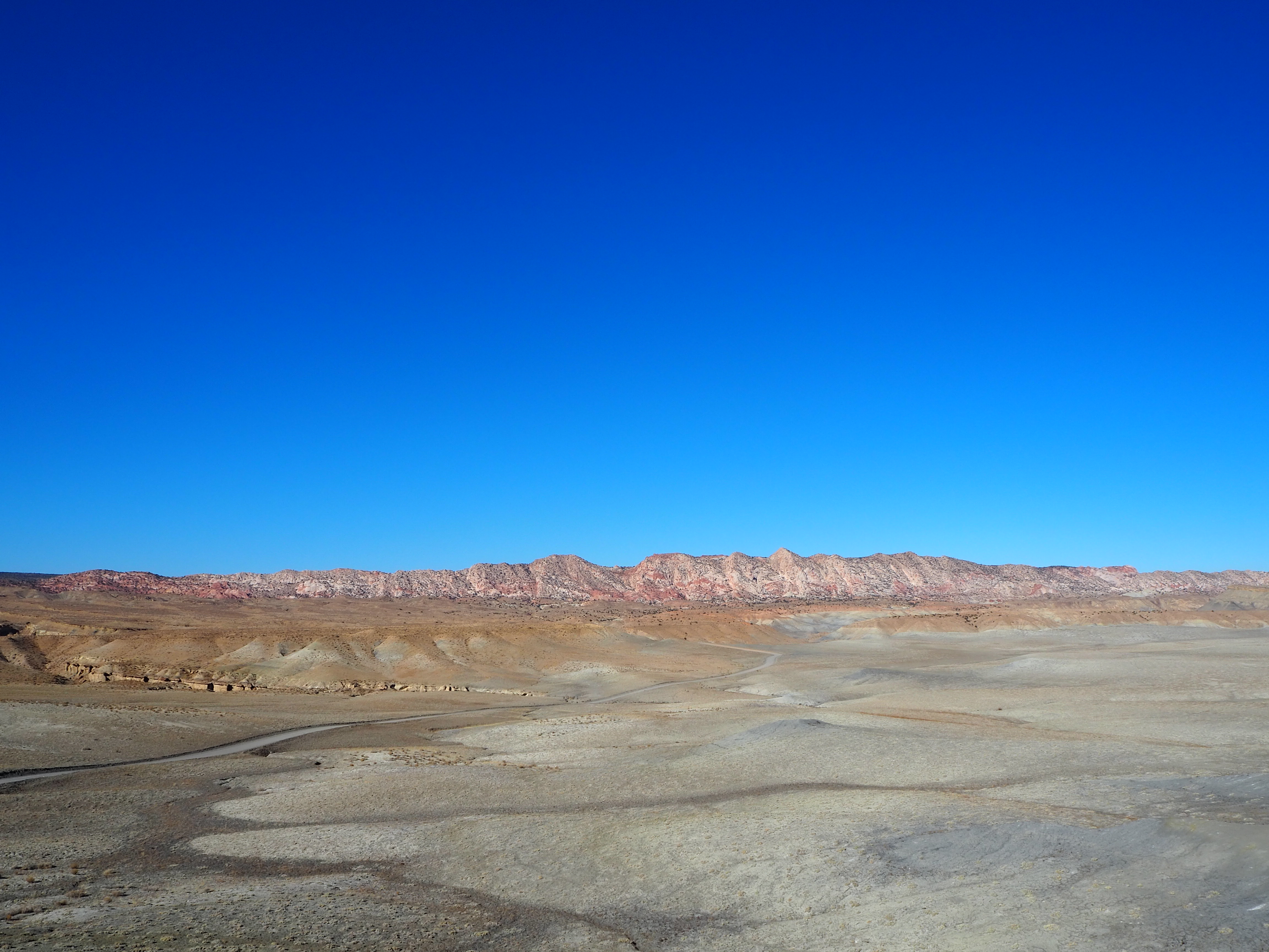
The road begins in a rather unassuming spot between two mile markers. We pulled off the highway and set off across a high plateau with grey badlands rising in the distance. We passed one car parked to the side of the road with several of its occupants peeing – I guess they thought they would be alone! – and continued winding our way toward the Paria River Valley in the distance. Before the road dipped down into the valley, we pulled onto a spur which led to the top of a hill and surveyed the magnificent view of the badlands, river valley, and the immensity of the landscape. The wind was ferocious, whipping around us, but it was the view that was breathtaking. As we continued, we made several stops to admire rock formations and the general scenery. It reminded us a bit of the drive along the Waterpocket Fold, with colorful swirling sandstone creations bordering one side of the road, and the Cockscomb (a ridge of steeply tilted and eroded teeth) on the other. Although I had researched and written down several hikes along the road, we decided we had time for only one. I chose what I imagine is the most popular hike along this route, the Cottonwood Wash Narrows.


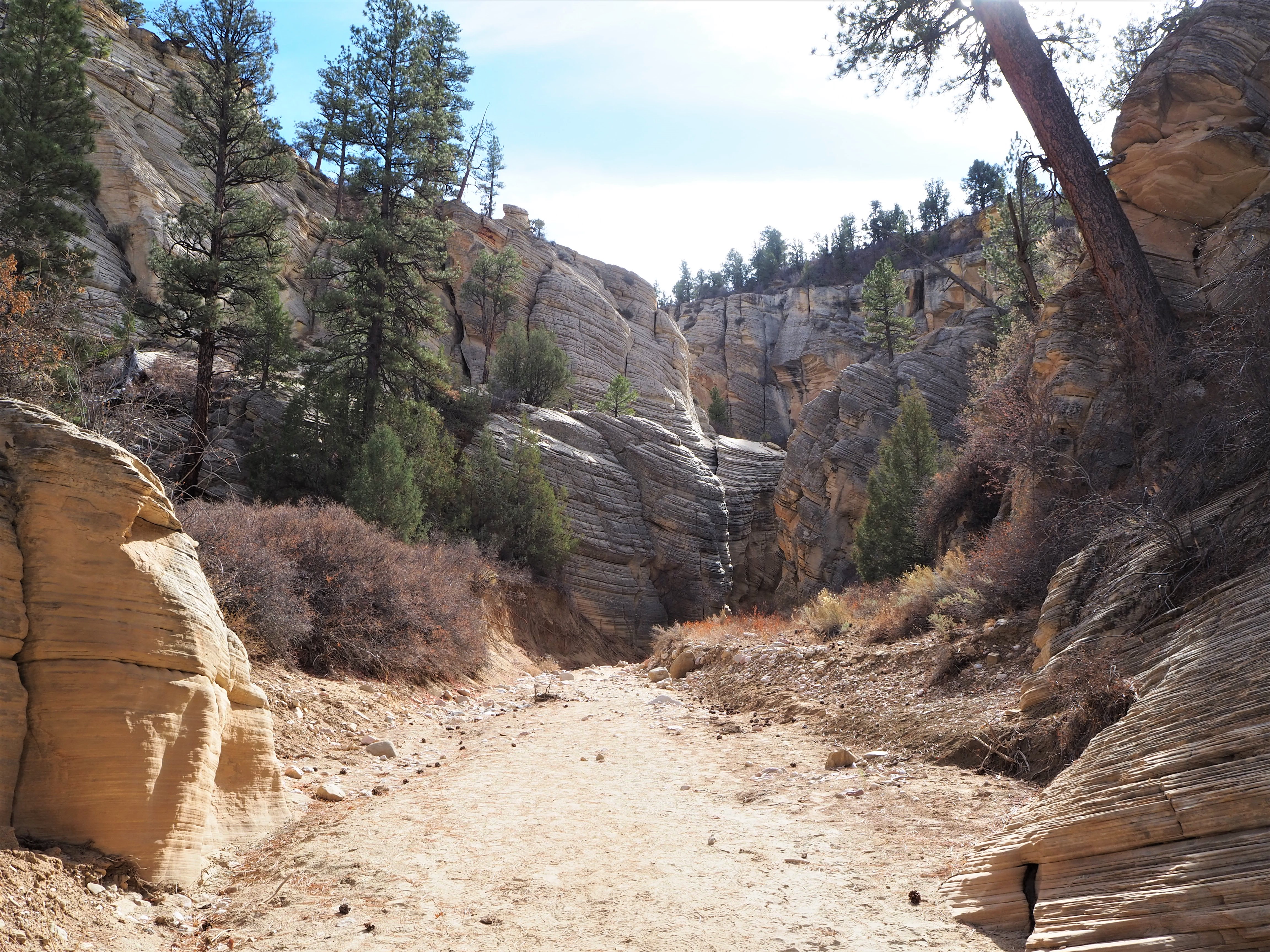
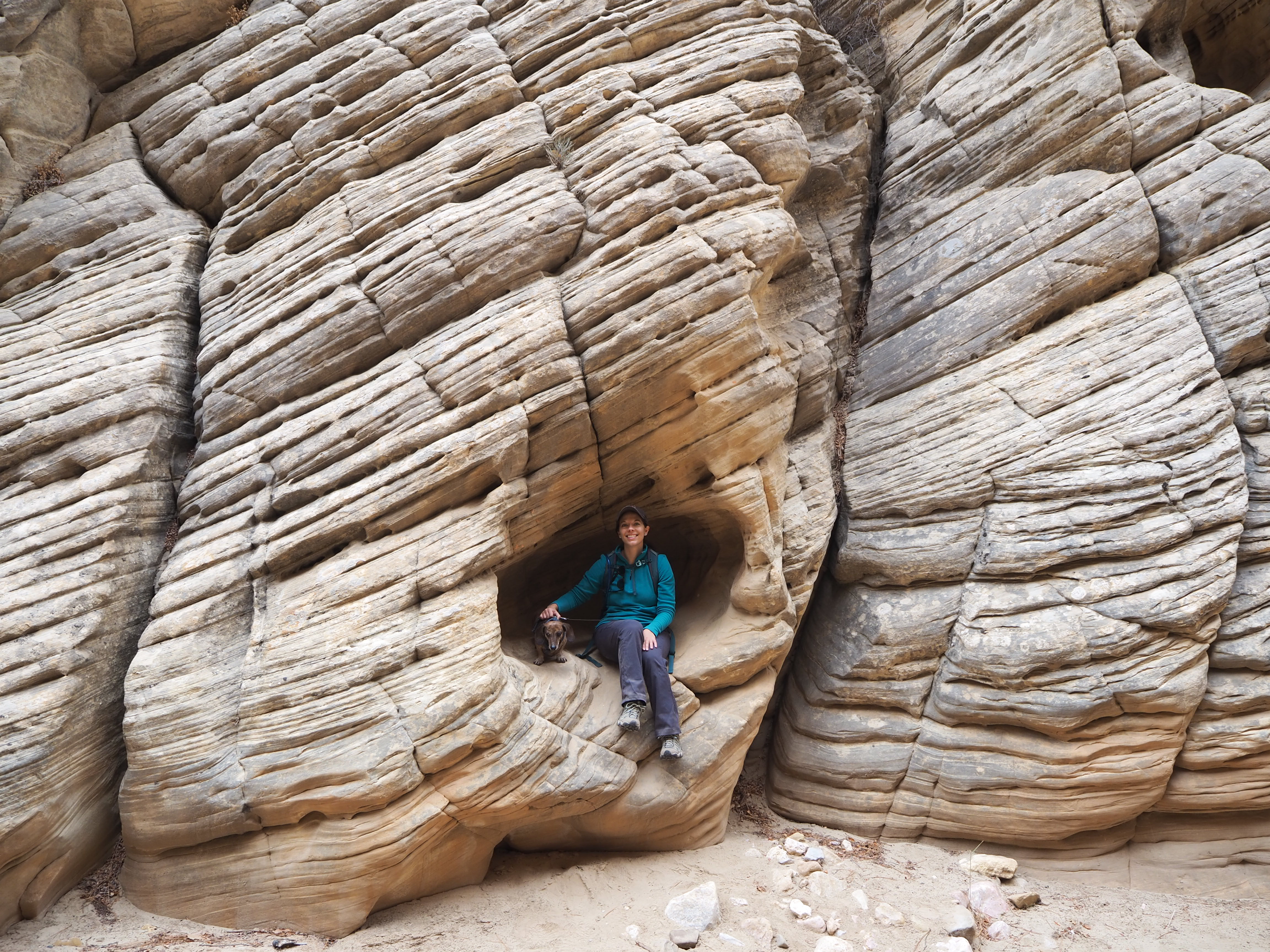
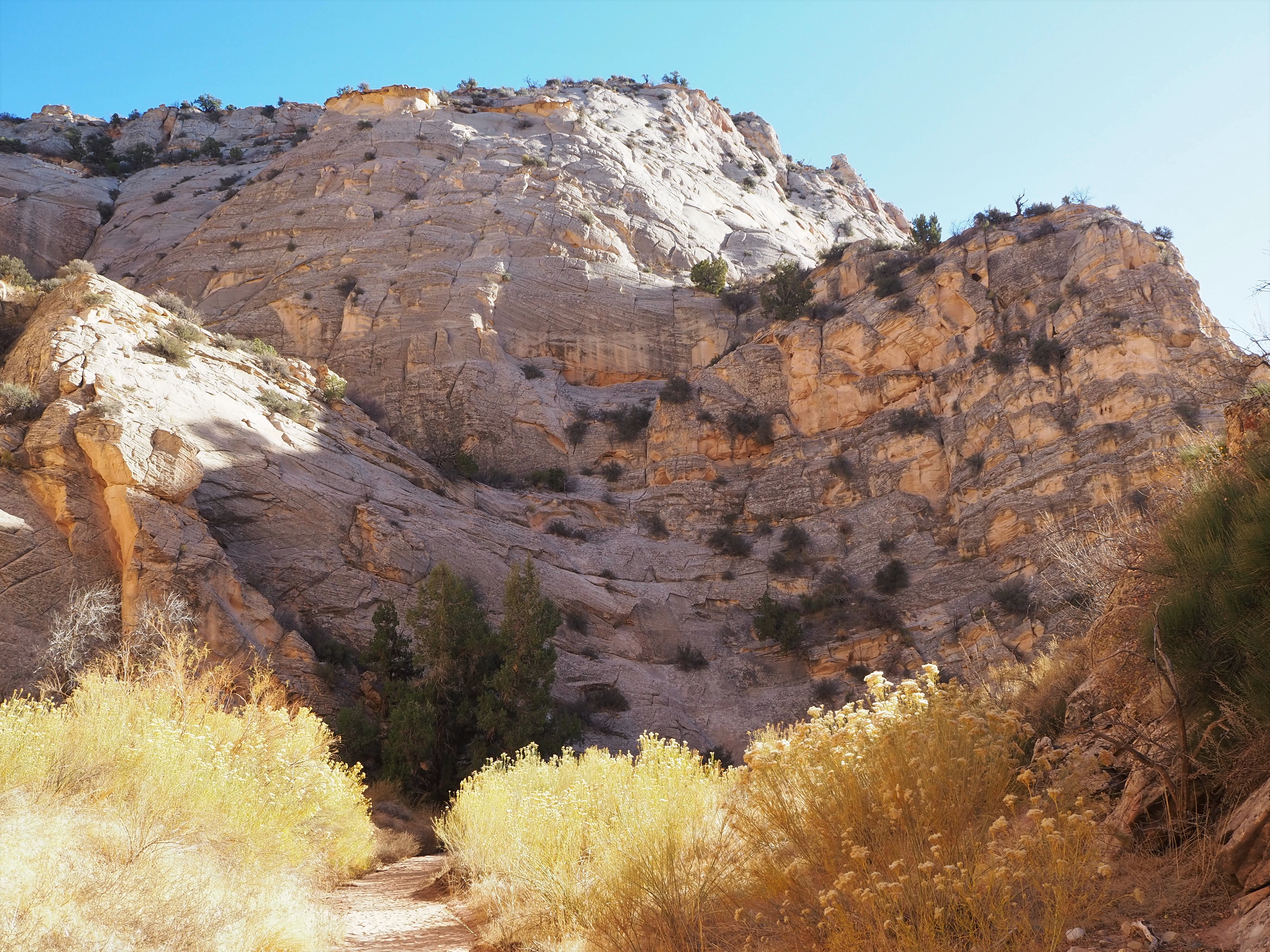
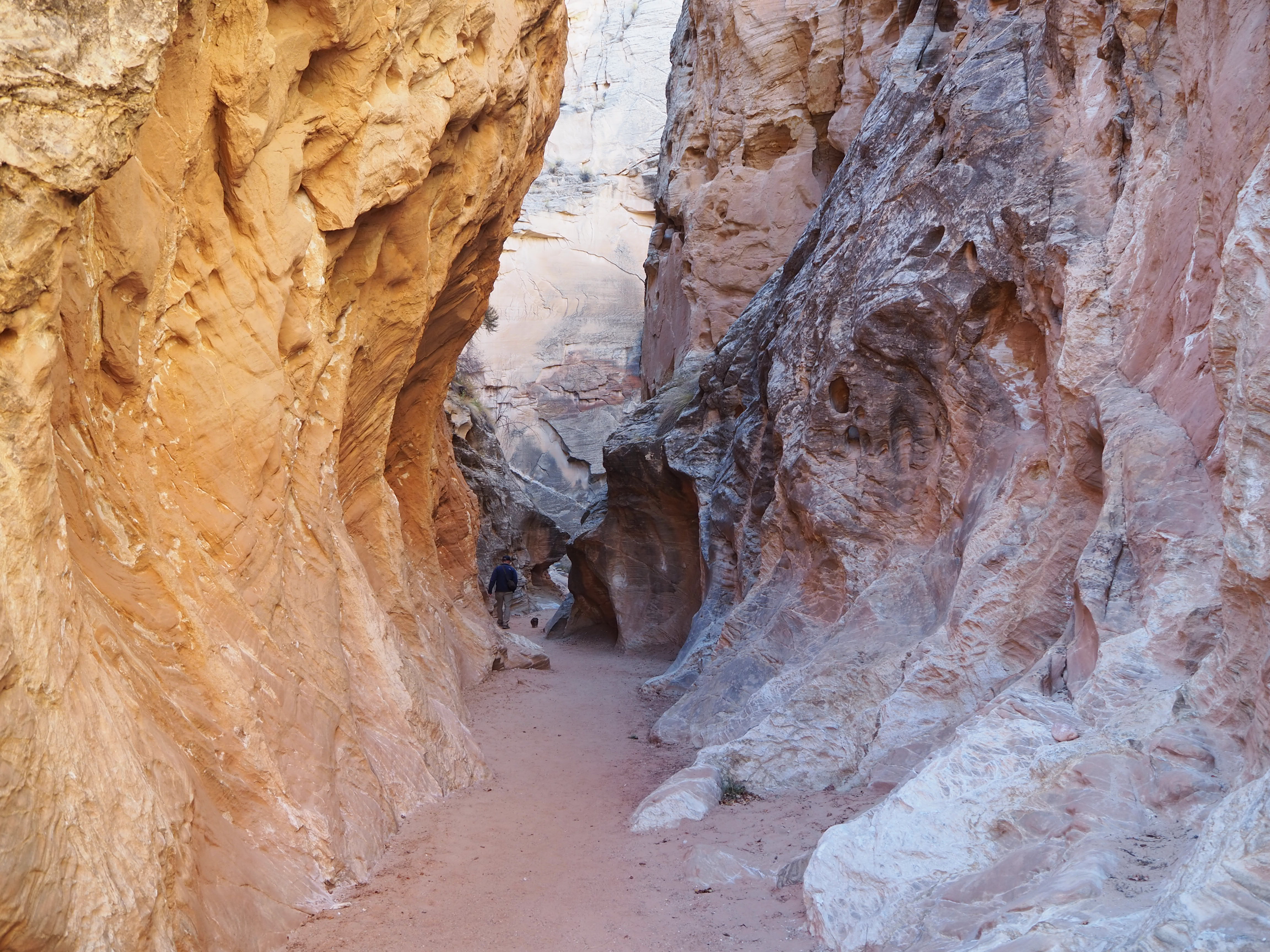
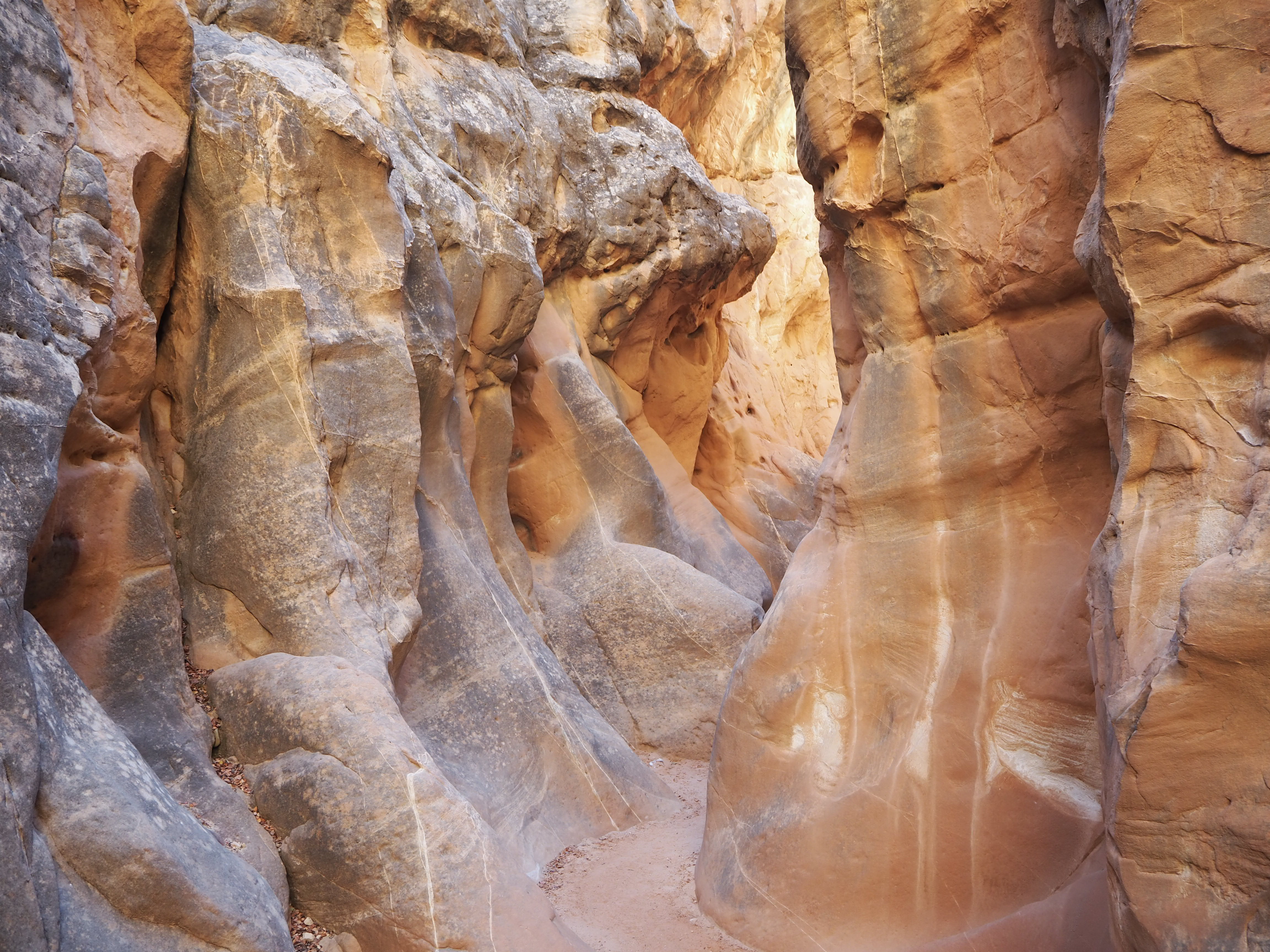
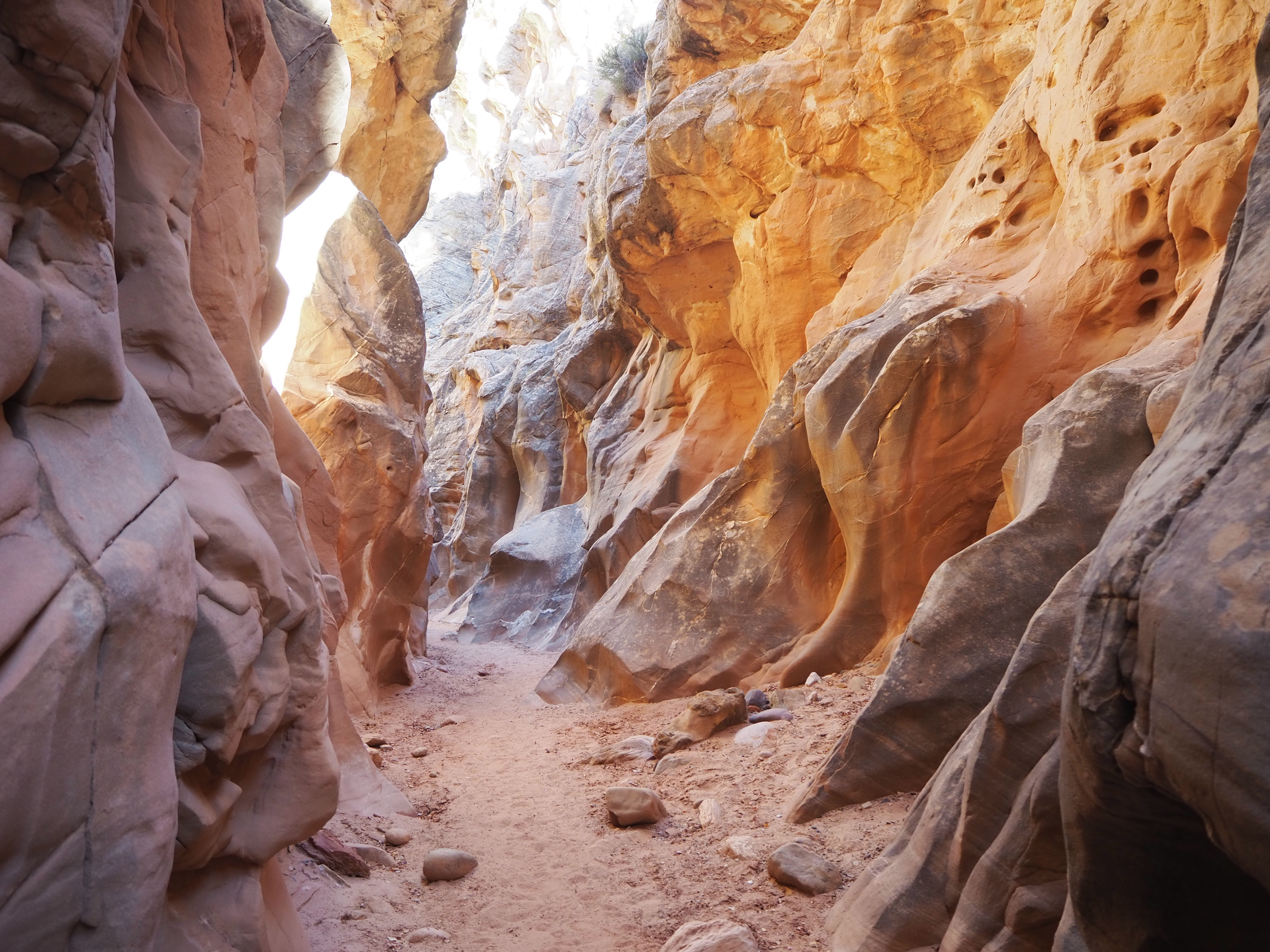
There are two trailheads, a north and south, one at each end of the canyon. Since we were driving the road south to north, we stopped at the southern trailhead to begin the hike. I signed us into the trailhead register, and we set off down the trail to the entrance of the canyon. Not far in we realized there wasn’t a clear path into the canyon due to a collection of flash flood/rockfall debris. However, a quick evaluation showed us an easy way to climb up and over some boulders that would put us on the path above. From there, it was easy walking down the sandy wash hemmed in by towering canyon walls. Warm in the sun on a cool fall day, it could easily become a furnace in the summer. Soon, we reached the first of many narrows, the walls closing in tighter and providing a shady respite from the sun. We let the canyon usher us in and out of its undulating curves, enjoying the spectrum of colors reflected on the sandstone.


Just beyond the northern entrance/exit to the canyon, there’s a small slot section. We saw our first group of the day in this section, and later when driving by the northern trailhead, there were more cars and people than we’d seen the entire day. I think our decision to start at the southern end and do the entire hike meant we had greater solitude. We only passed one other hiker on our way up the canyon. I assume a lot of people may only do the little slot section. Anyhow, even after encountering that group, we had the slot section to ourselves. While we could have hiked out to the northern trailhead and looped back to our car via the road, we decided to stay in the canyon and return the way we’d come. Again, we had the place to ourselves and could simply enjoy the peace and beauty.

We took some time after our hike to eat our packed lunch back at the car, then continued our tour of Cottonwood Canyon Road. We passed through a particularly cool section of the Cockscomb, jagged teeth of red and orange, lined the roadside. Soon thereafter, the road began to emerge back into familiar scenery: a large open sagebrush plain, bordered in the distance by cliffs and alcoves of red Navajo sandstone. We had one final stop before hitting the pavement: Grosvenor Arch. The arch is the most developed of any stop along Cottonwood Canyon Road. A vault toilet, picnic tables, and an accessible concrete path to the arch invite more than hardy backcountry visitors. Grosvenor Arch is a towering white sandstone formation, striking from a distance and imposing up close. There are several social trails that litter the sagebrush once the paved sidewalk runs out, and we followed a few to get closer to the arch. Again, we were alone to drink in the spectacular scenery before us.


Grosvenor Arch was essentially the end of our Cottonwood Canyon adventure. We wound our way to Kodachrome Basin State Park – which would be an excellent base to explore the road – and hit pavement. To complete the loop back to Kanab, rather than turn around, we continued to Scenic Byway 12, stopping briefly in Red Canyon at sunset, and then connecting with Hwy. 89 to get to Kanab. It was a full day of adventure, and it was perfect. The weather was glorious, there were even fewer people than I expected, and we checked off one of my Utah bucket list items.


NORTH RIM OF THE GRAND CANYON
On Wednesday, we decided to visit the Grand Canyon.
MANSARD TRAIL & ZION NATIONAL PARK
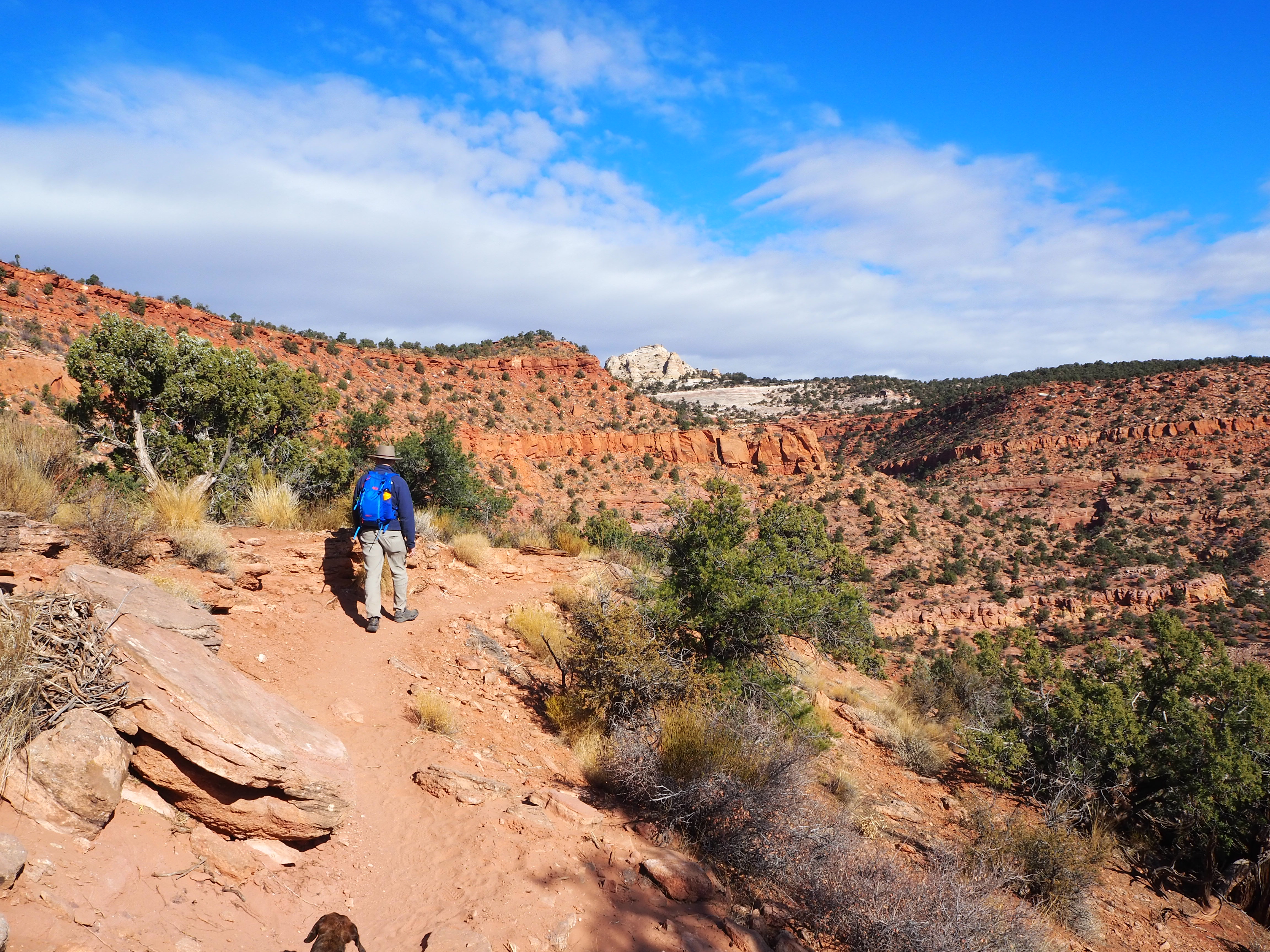
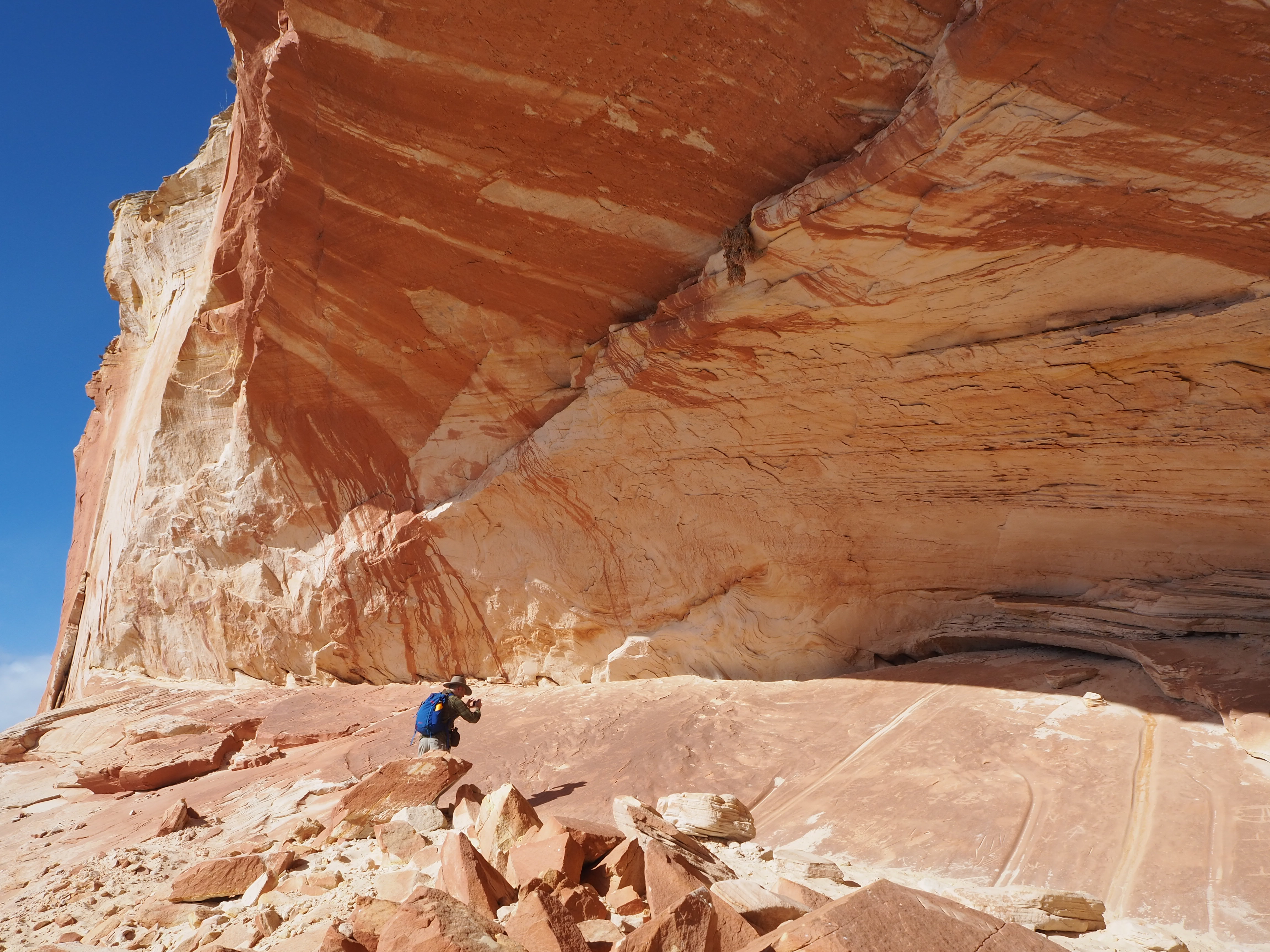
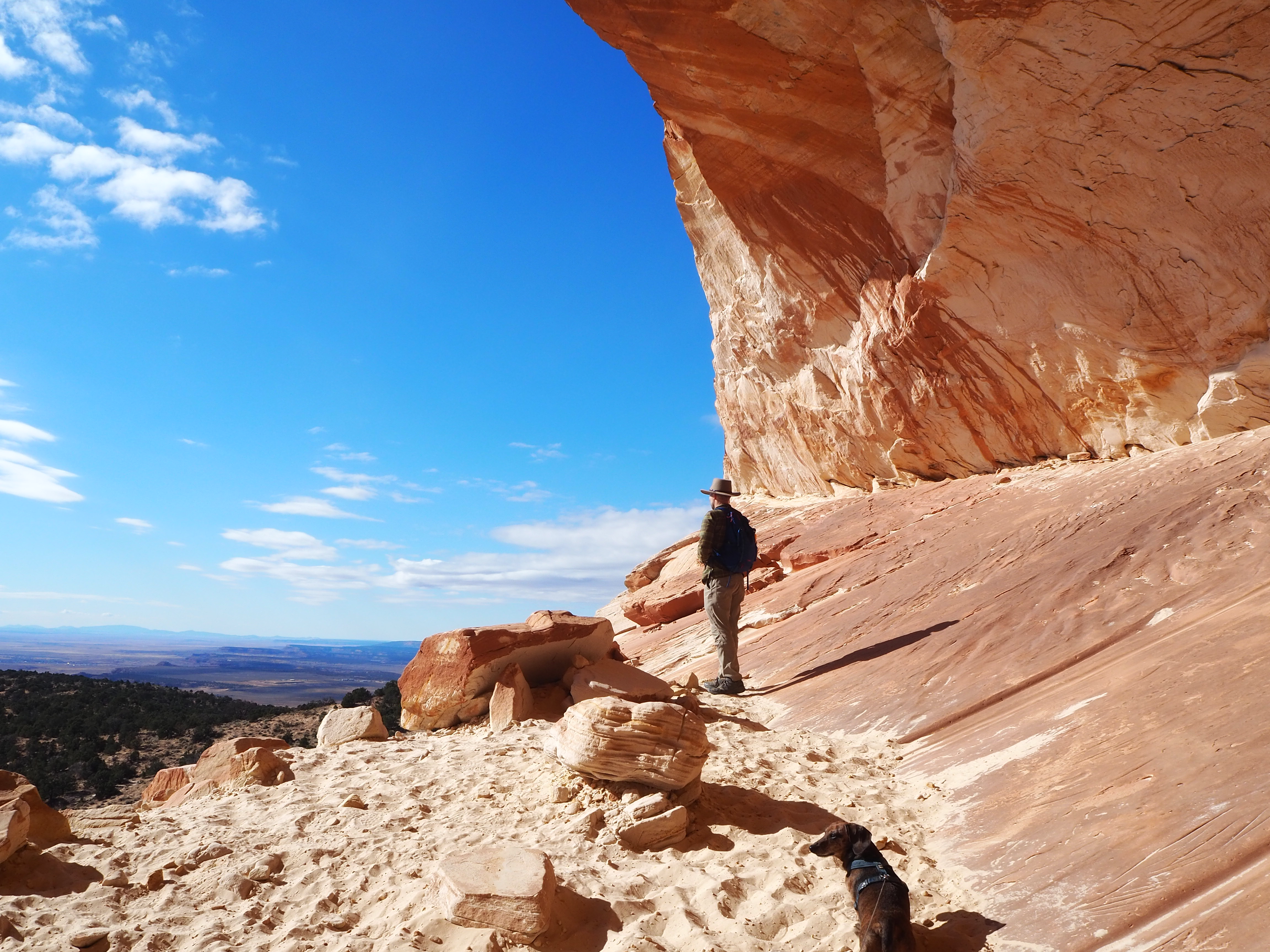
For our final day (also Thanksgiving Day) in Kanab, I wanted to do a local hike. Every time we spend Thanksgiving in Kanab, we make an enchilada casserole as our Thanksgiving meal. With that in mind, we wanted a nice, strenuous hike that would account for the calorie-rich casserole I would make later in the day. I chose Mansard Trail, a 4.5 mile hike with slightly less than 1,000 feet of elevation gain located east of town.

We wanted to get a relatively early start since the hike would be fully exposed. Knowing this is a popular local hike, we weren’t surprised to spot several cars in the lot when we arrived at the trailhead before 10:30am. We made sure we had sufficient water, along with treats for Tru and got started. The initial part of the hike is a series of long ascending switchbacks cut into the red sandstone, stretching to the top of the plateau. This is where most of the elevation gain is found. At times the trail is fairly narrow, but as we climbed I was more focused on the expansive vista we gained with each new level. We could see far south toward the Vermillion Cliffs (where we hiked Wire Pass) and the Kaibab Plateau (which extends to the North Rim).

As we neared the top, I could see the first of two small obstacles we had to climb in order to reach the next level of the trail. Both were entirely manageable, just made slightly more difficult by carrying Truman. At the top of the second scramble, we had reached the top of the plateau! From there, the hike was a breeze. We passed two small family groups, as we wove through scrubby juniper trees and sagebrush. Since we spotted the alcove when we reached the top of the plateau, we knew that the trail was curving in a large arc toward it. The final stretch to the alcove was my least favorite hiking surface, deep sand. Getting through that alone felt like the victory.

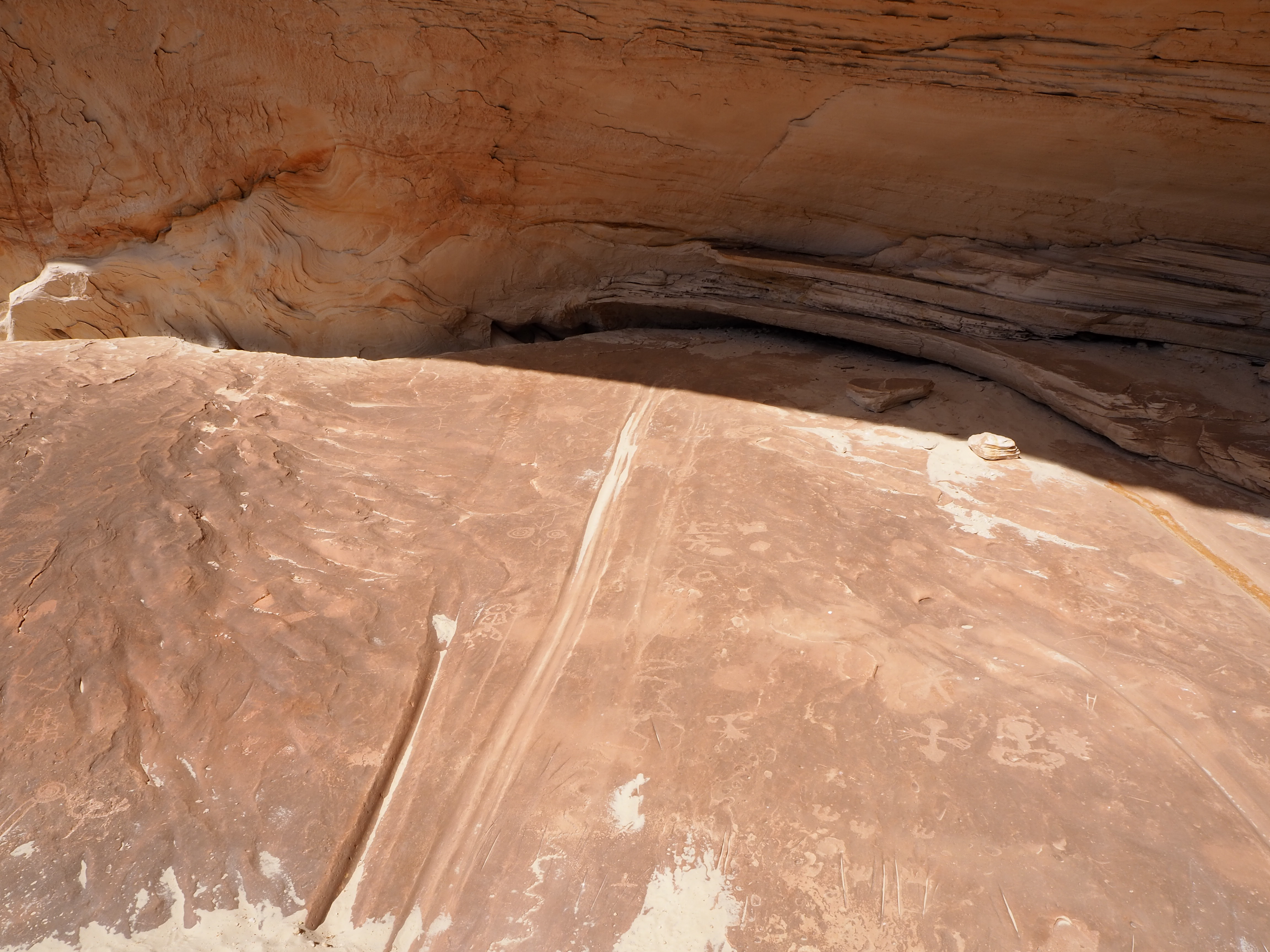
We were delighted to find that we had the alcove to ourselves, though it took us a little time to ascertain the best route to it. In the Kanab tourism description of the hike, they mentioned that the the site was unusual. Thought to date to the Anasazi period, there are deep grooves in addition to the petroglyphs that cover the floor of the alcove. The grooves have not been seen at any other site so far. We took our time surveying the markings, taking care not to step on any as we crossed the cave. In addition to the rock art, the view from the alcove was spectacular. When another couple entered the alcove, we ceded our time and retreated to the shade of a juniper for our lunch. The return was even more pleasant as we scaled back down the plateau to the car, grateful we had the fortune to do most of the trek in solitude.


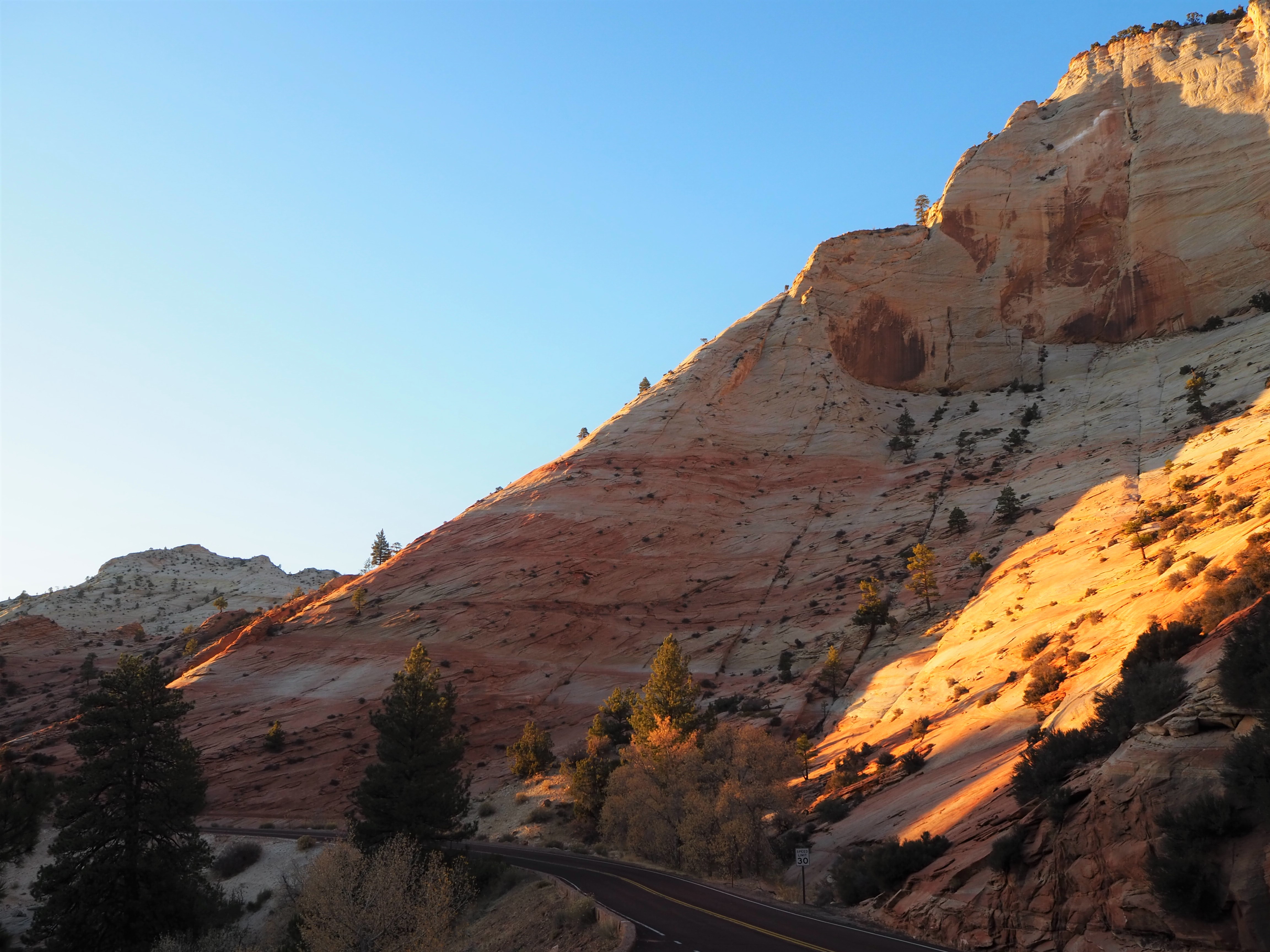
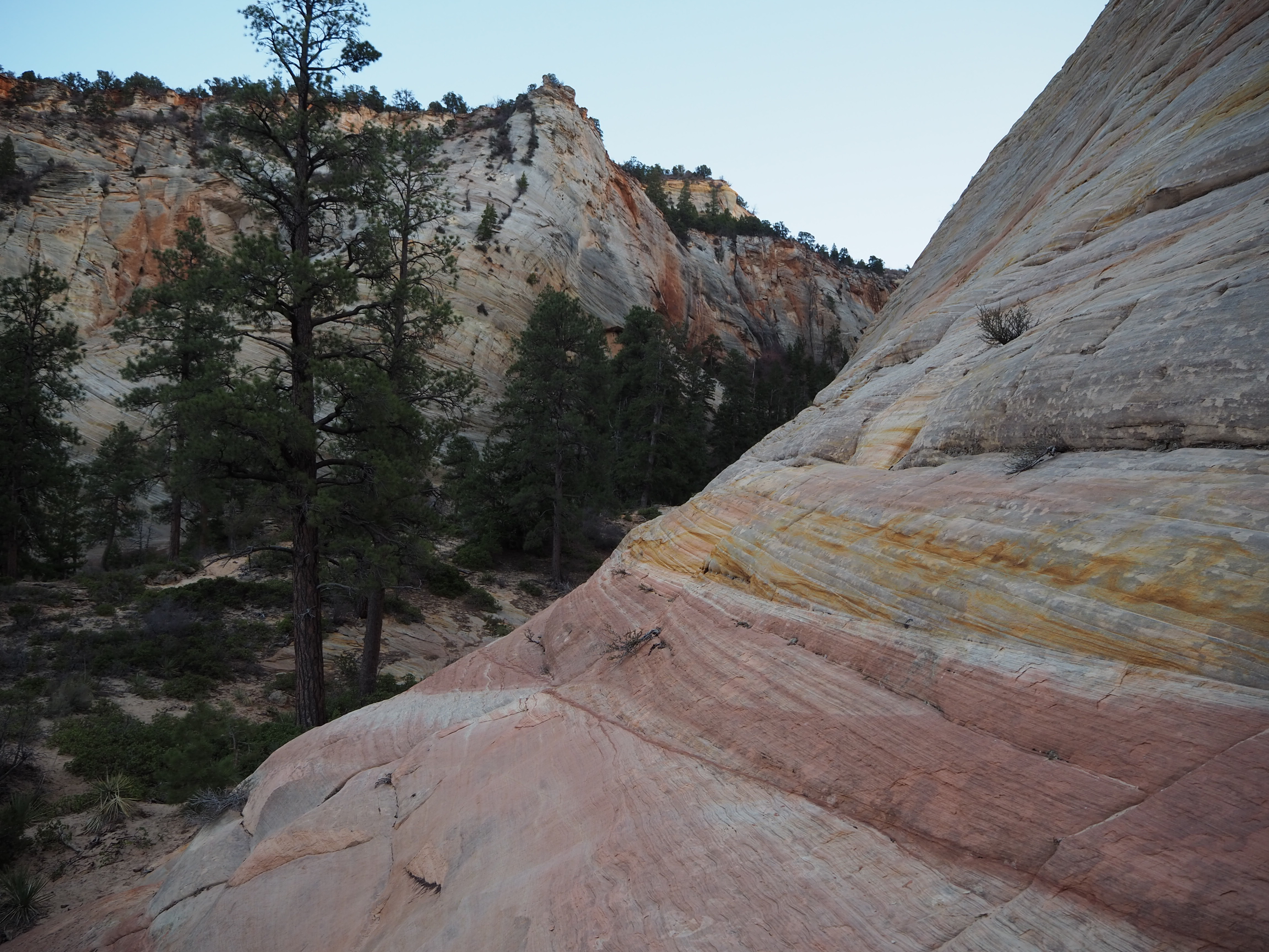
Because we started early, we were back at our casita with more daylight to burn. I was itching to do one more thing to ensure we got our fill of southern Utah before returning to Idaho. Zach suggested making the drive to Zion’s east entrance. Typically less crowded than the main canyon, we thought we might catch it at a quiet time, just before sunset, when day trippers were headed back for the evening. We weren’t entirely wrong, but it certainly wasn’t quiet. I thought we might do a short hike, but upon entering the park that notion was quickly dispelled. Instead we pulled off where we could to climb around the sandstone playground of Zion’s East Canyon. (Before and after a mistaken trip through the tunnel – whoops!) It ended up being the perfect close to the day. The longer we were there, clamoring around, the more people left, until it really was quiet. We even had Checkerboard Mesa all to ourselves! We left after dusk, and arrived at our casita fulfilled and ready to return home the next day.


On Friday, we were up early to load the car and clear out. We stopped in St. George for a couple of hours to have a morning backyard hang and Christmas gift exchange with our Utah pals, Ryan and Lisa. Then we returned the way we’d come, leaving St. George through the sweeping vistas of the Dammeron Valley and back into Nevada, admiring the same sites we’d passed not even a week before. We saw the sun set before we reached the state line, pulling off the highway to snap a photo of the the pastel colors as they melted into the horizon. We sped through the few bright lights of Jackpot before entering the darkness once more, wondering if there was in fact a town on the other side. For once, the Interstate was a blessing, and we glided home to await winter.


1 reply »