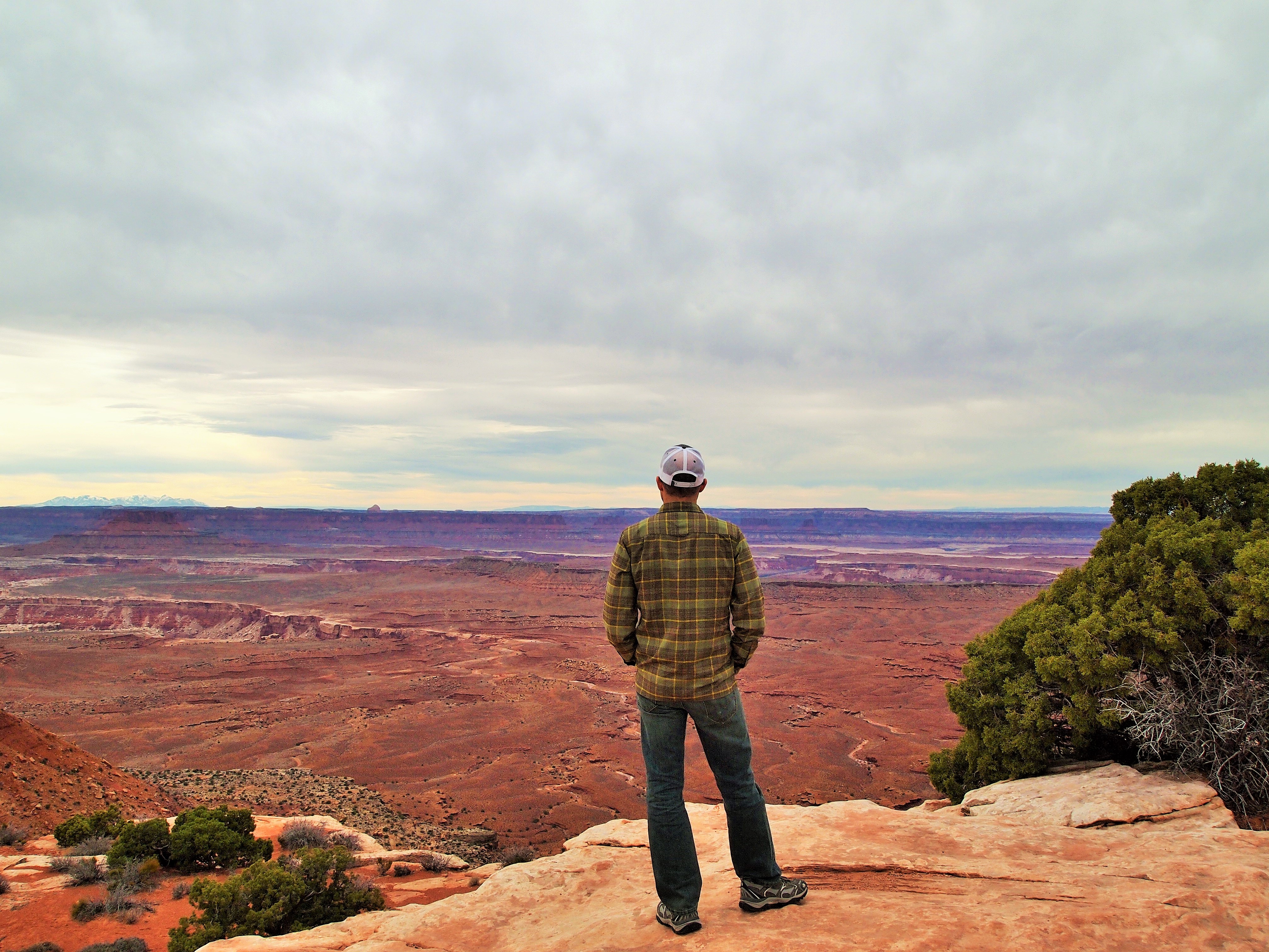
For Spring Break we went back to Utah to visit our friends in Salt Lake City and scout a possible move. This time we were travelling with Truman so we couldn’t do any extensive hiking but we were able to stop at Canyonlands National Park for a scenic drive. Unlike Arches NP, which I found to be pretty accessible from the car in the span of a couple hours, Canyonlands is definitely better enjoyed when you can fully immerse yourself in the park. But since we were on our way back to Texas and with dachshund, we made do with the driving tour.

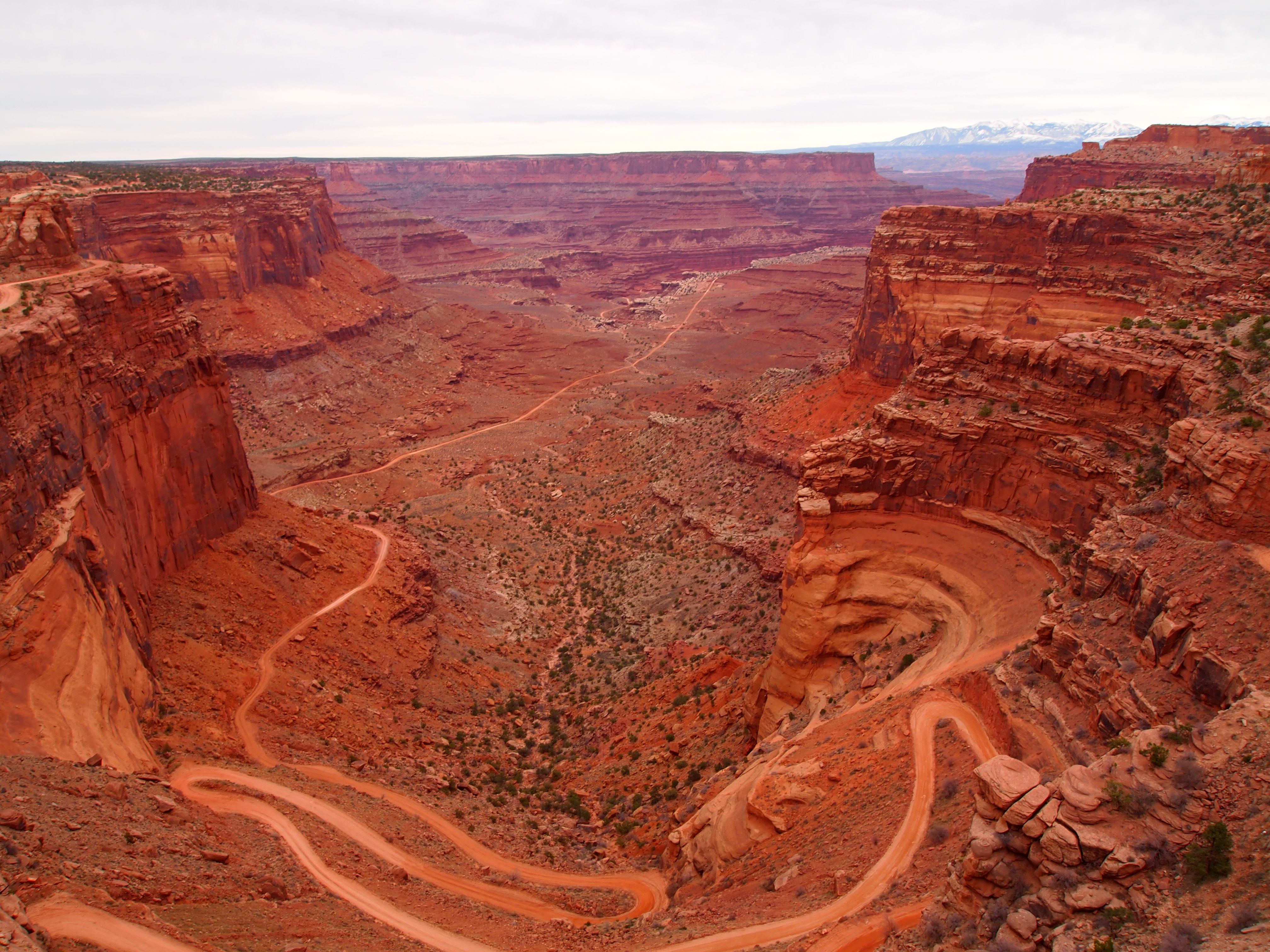
The park is 32 miles from Moab so it’s not just off the highway like Arches. However, the drive is striking and scenic in its own right. The park is split into four districts and we only visited one – Island in the Sky. Island in the Sky is the easiest district to visit since it’s the mesa above all the canyons. Once we arrived at the visitor’s center, we grabbed a map and were immediately afforded a scenic overlook of Shafer Canyon. Unfortunately my awe was subdued when I returned to the car for my camera and found that Truman had consumed the rest of my latte! Although I was alarmed (and utterly fuming!) at first, the caffeine didn’t seem to have an effect and he was better behaved for the duration of our drive. Well… until he ate my quesadilla, but that’s another story.

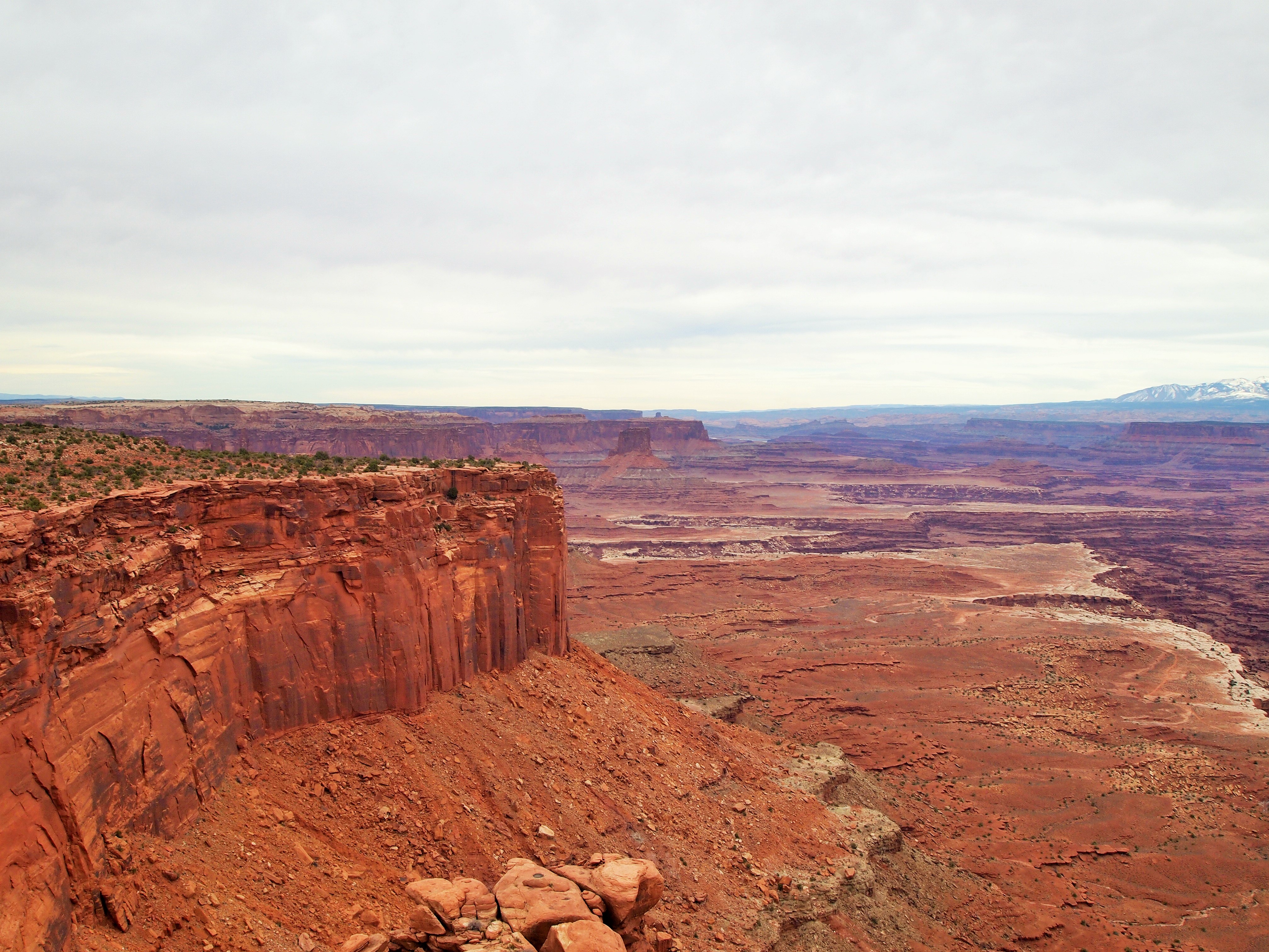
Shafer Canyon with La Sal Mountains in the distance
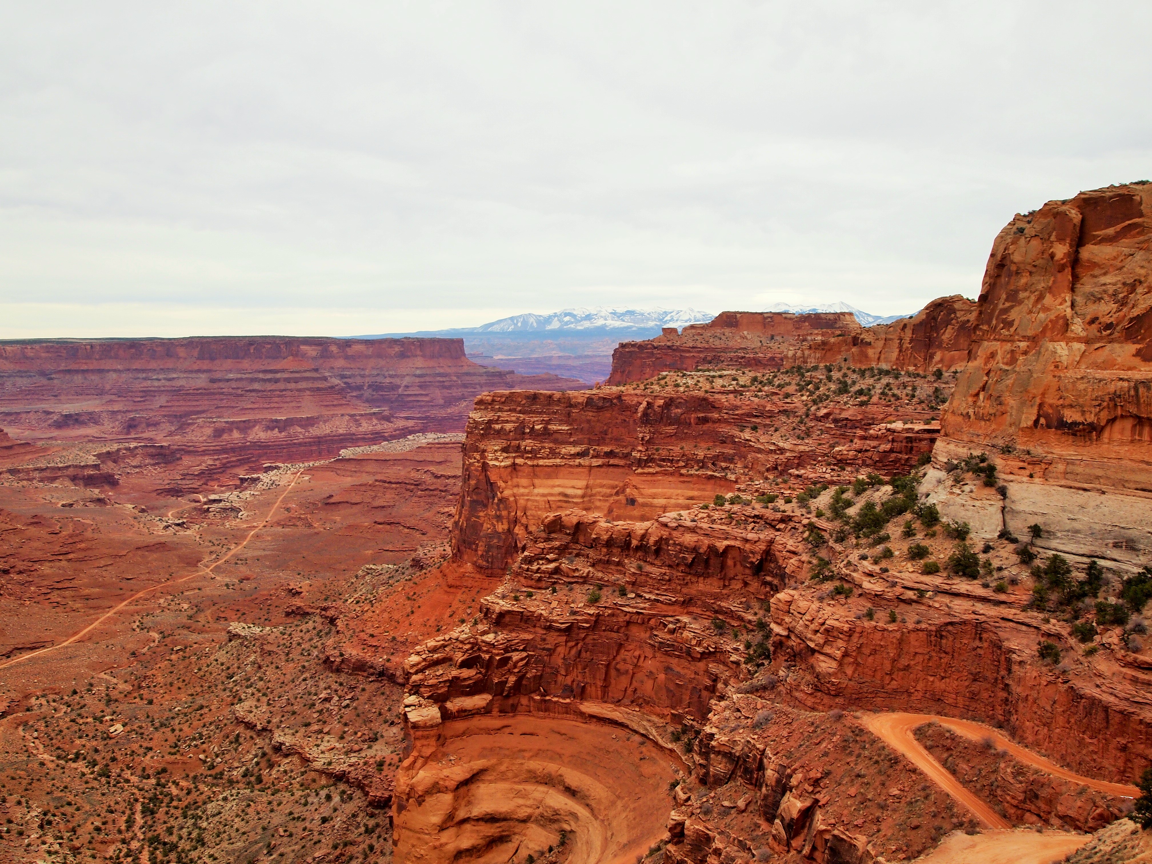
Another view of Shafer Canyon

What?! I’m perfect!
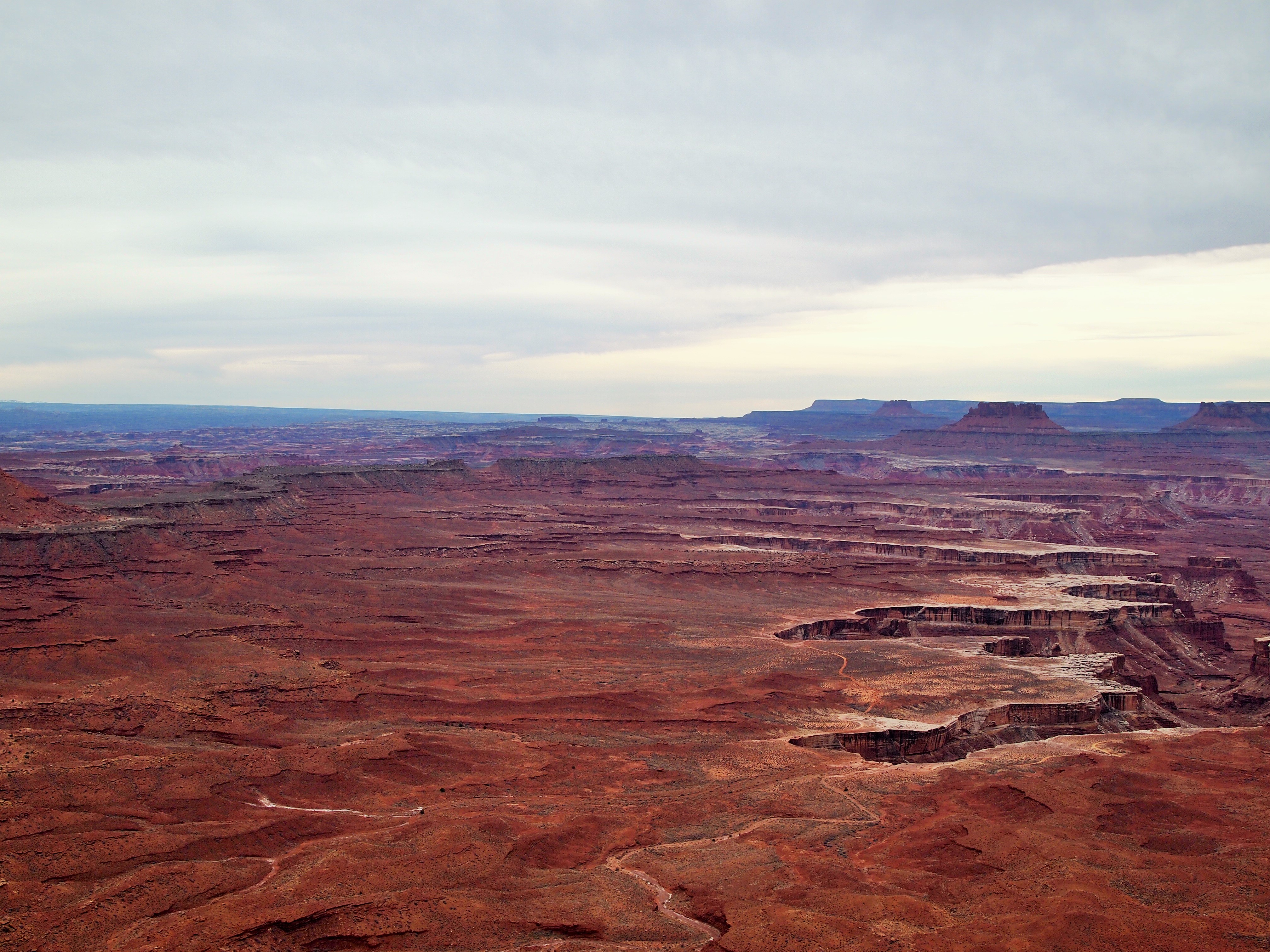
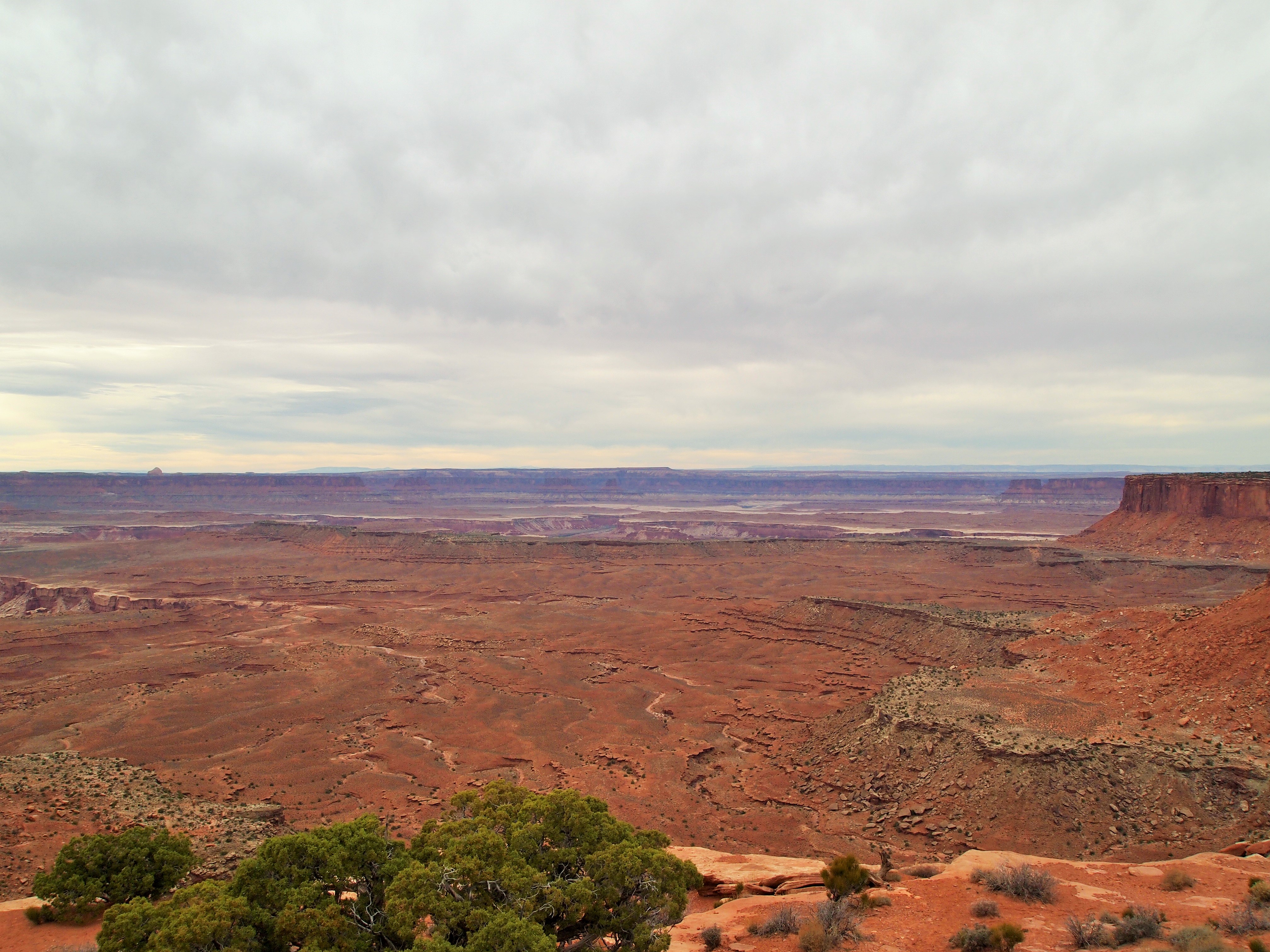
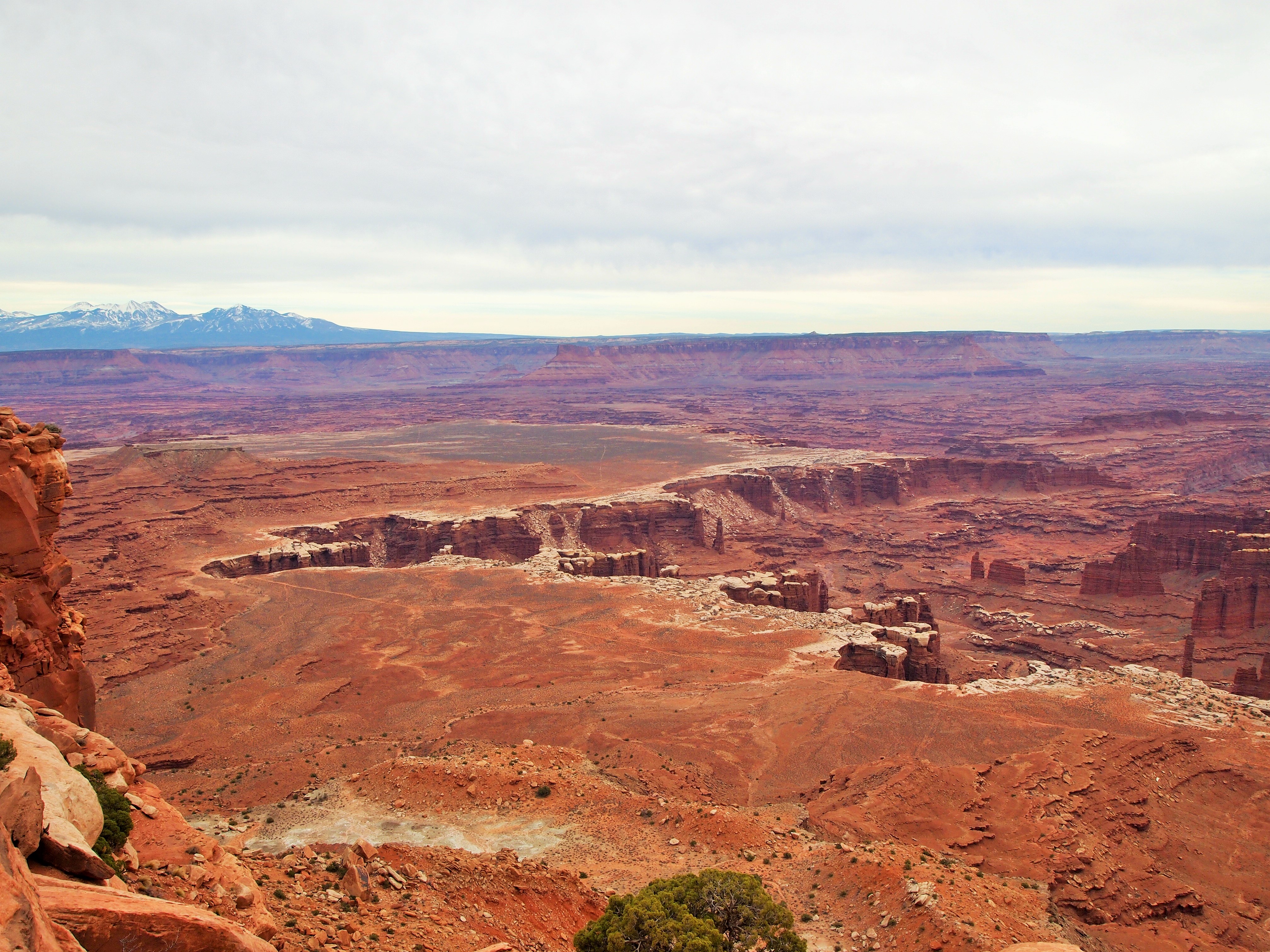
The scenic drive is only 34 miles round trip but there are several overlooks and pullouts along the way. We skipped one overlook which was an additional 10 miles round trip since we were low on gas. (Until next time, Upheaval Dome.) Our first stop was the Green River Overlook. Wow. Wow. Wow. Of all the overlooks that day, nothing compares to my complete astonishment at that first sight. The most striking feature is the Soda Springs Basin. From the overlook, the Basin is a gigantic crevice in the landscape, opening up and swallowing the red earth. Inside its clutches, the Green River winds into Stillwater Canyon on its way to the Colorado.

Green River Overlook

Soda Springs Basin
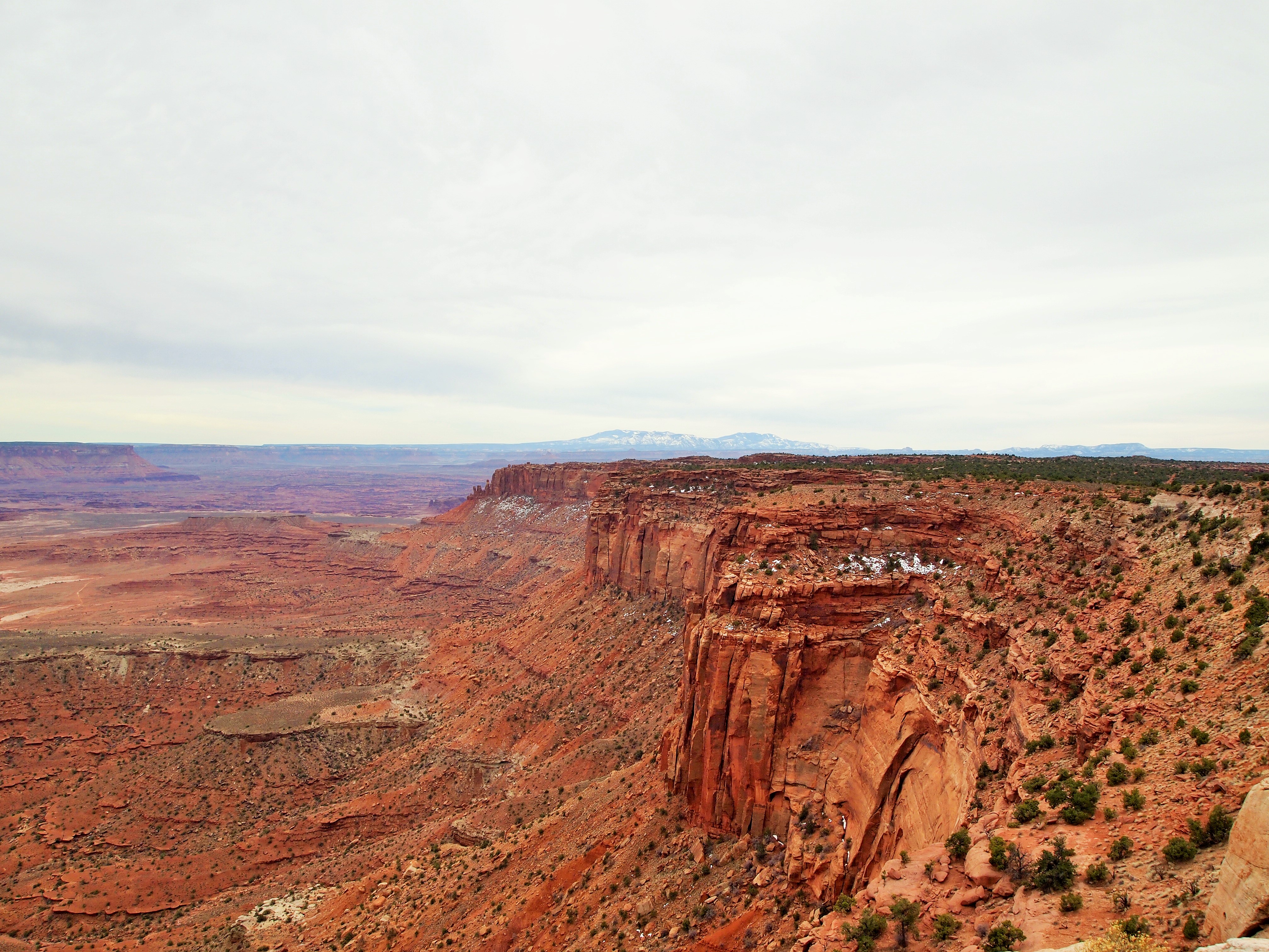
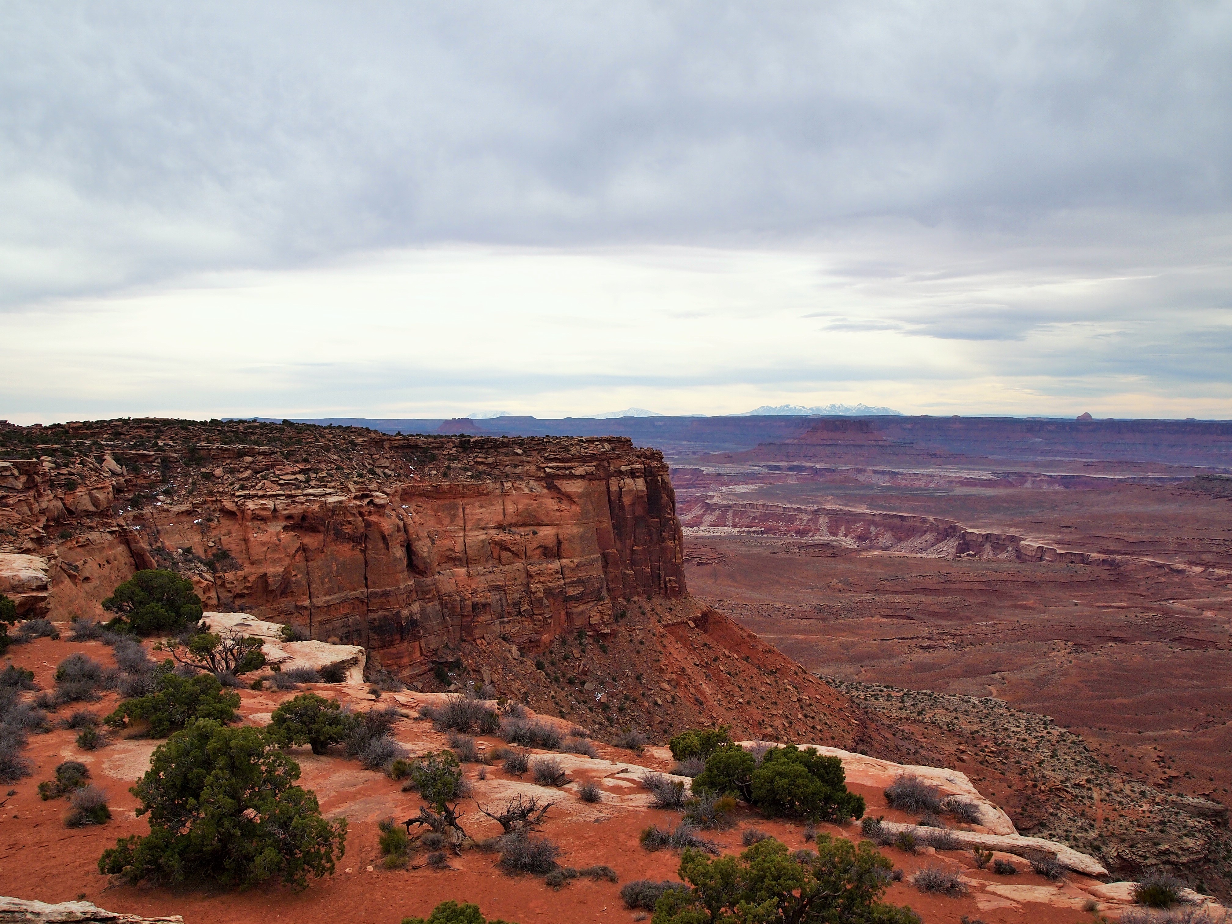
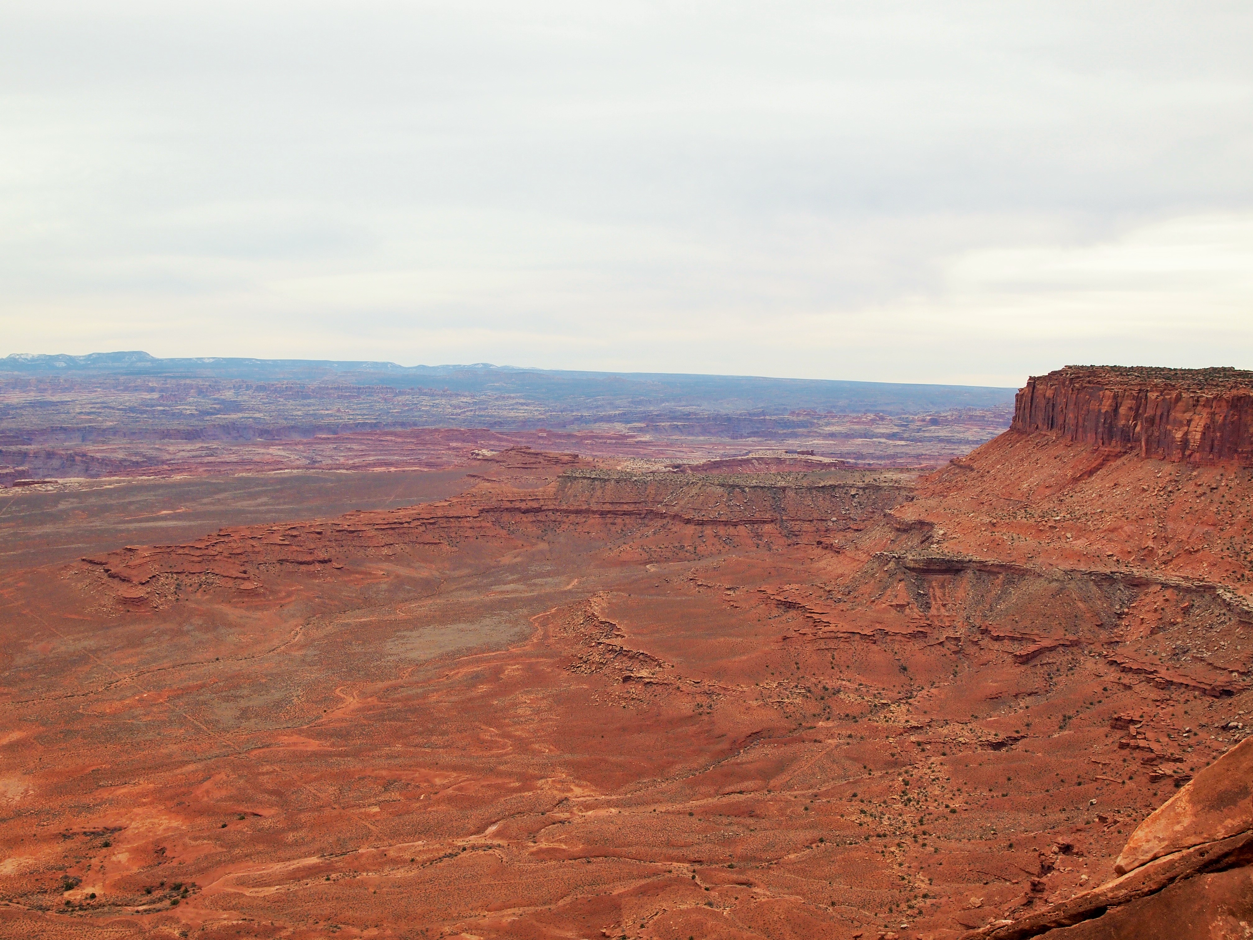
Our next stop was Buck Canyon Overlook. Again, spectacular. It offered a completely different view from the west side of the mesa. Buck Canyon appears to be slowly opening its jaws as it approaches the cliff-side, silently consuming the red dirt until it’s had its fill. It’s difficult to put into words the sheer magnificence of this view.
From several of the overlooks White Rim Road is visible. Aptly named for the white rims which skirt the basins and canyons, White Rim Road is a 100 mile loop around Island in the Sky. It’s open to vehicles with four-wheel drive and mountain bikes and typically takes between two to four days. I would love to drive it sometime!

Buck Canyon Overlook & La Sal Mountains
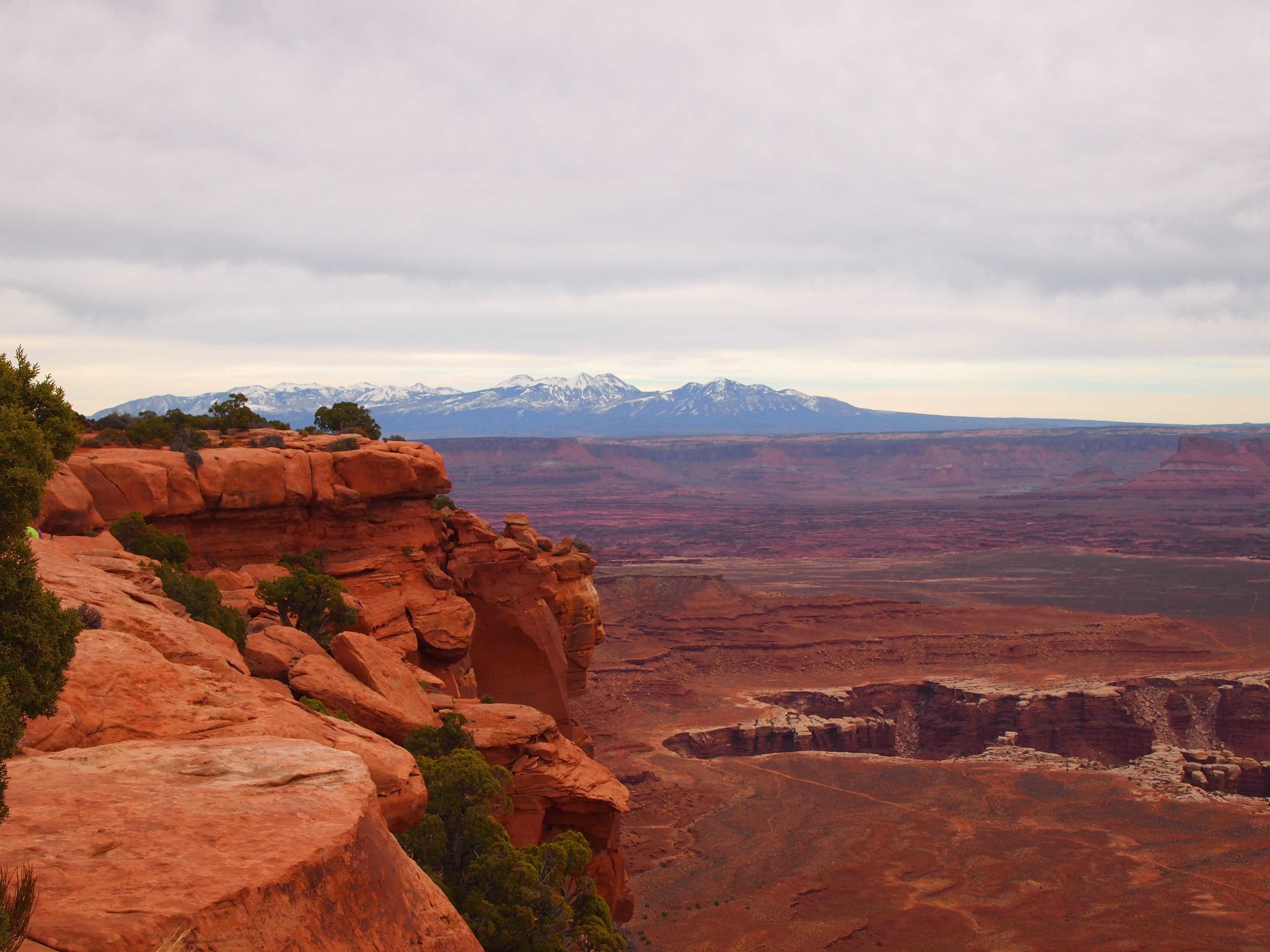
The last two overlooks were very close together- Orange Cliffs and Grand View Point. Orange Cliffs reinforced the vast expanse of the park beyond Island in the Sky. There is truly so much more to explore. Orange Cliffs overlooks the Maze district of the park in addition to the eastern part of Glen Canyon National Recreation Area. This district is the most remote in the park and offers backpacking opportunities for the hardiest hikers.
Orange Cliffs Overlook
Looking toward Grand View Point
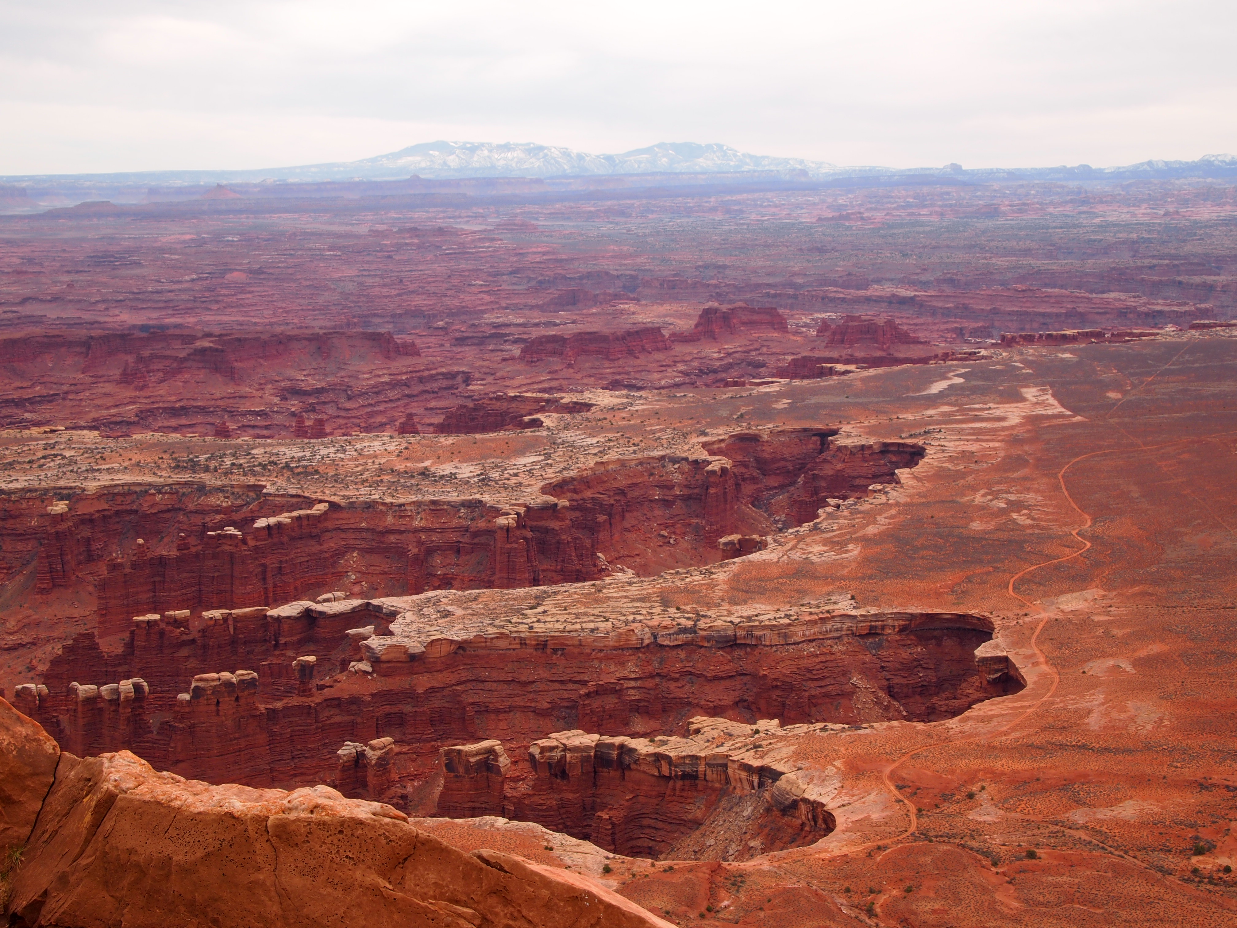
Grand View Point Overlook is at the end of the road. It’s the southern-most point on Island in the Sky and overlooks the vast Needles and Maze districts of the park. We could see White Rim Road below hugging the perimeter of the canyon, the La Sal Mountains looming in the periphery, and the seemingly delicate formations of rocks teetering hundreds of feet into the air. I could hardly grasp the magnitude.
Grand View Point Overlook

I see the footprint of a gigantic T Rex… too much Jurassic Park?
To the West
On our way back north we stopped at Mesa Arch. It’s a quick hike from the parking lot – only a half mile round trip. It’s a simple hike. There isn’t much of an incline so it’s great for families, casual hikers, and older folks. Luckily, there weren’t many people on the trail, and we were able to edge out a family with three children. The arch is low slung and perched on the edge of a cliff, offering a lovely frame for the scenery below.
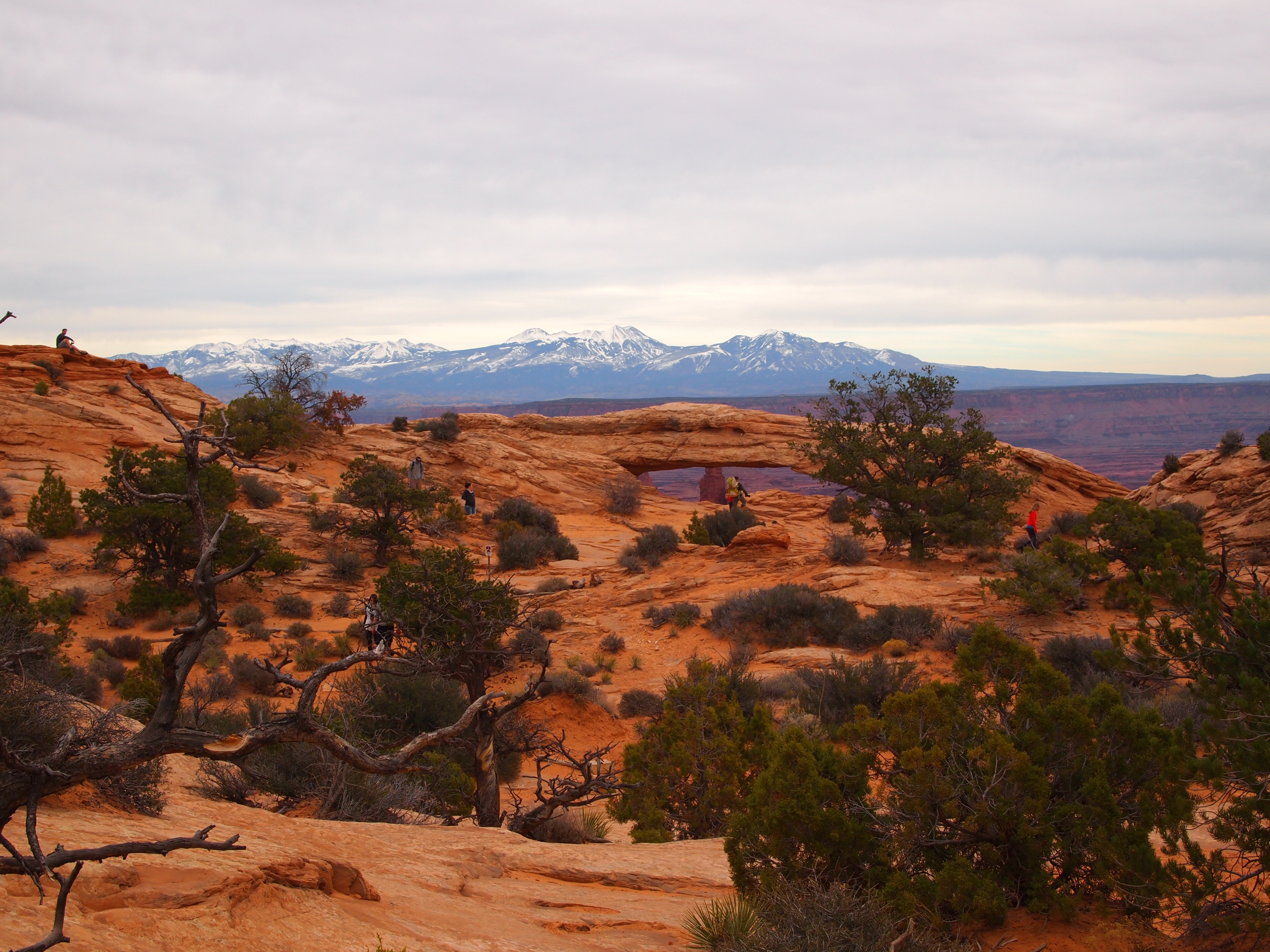
Mesa Arch in the distance
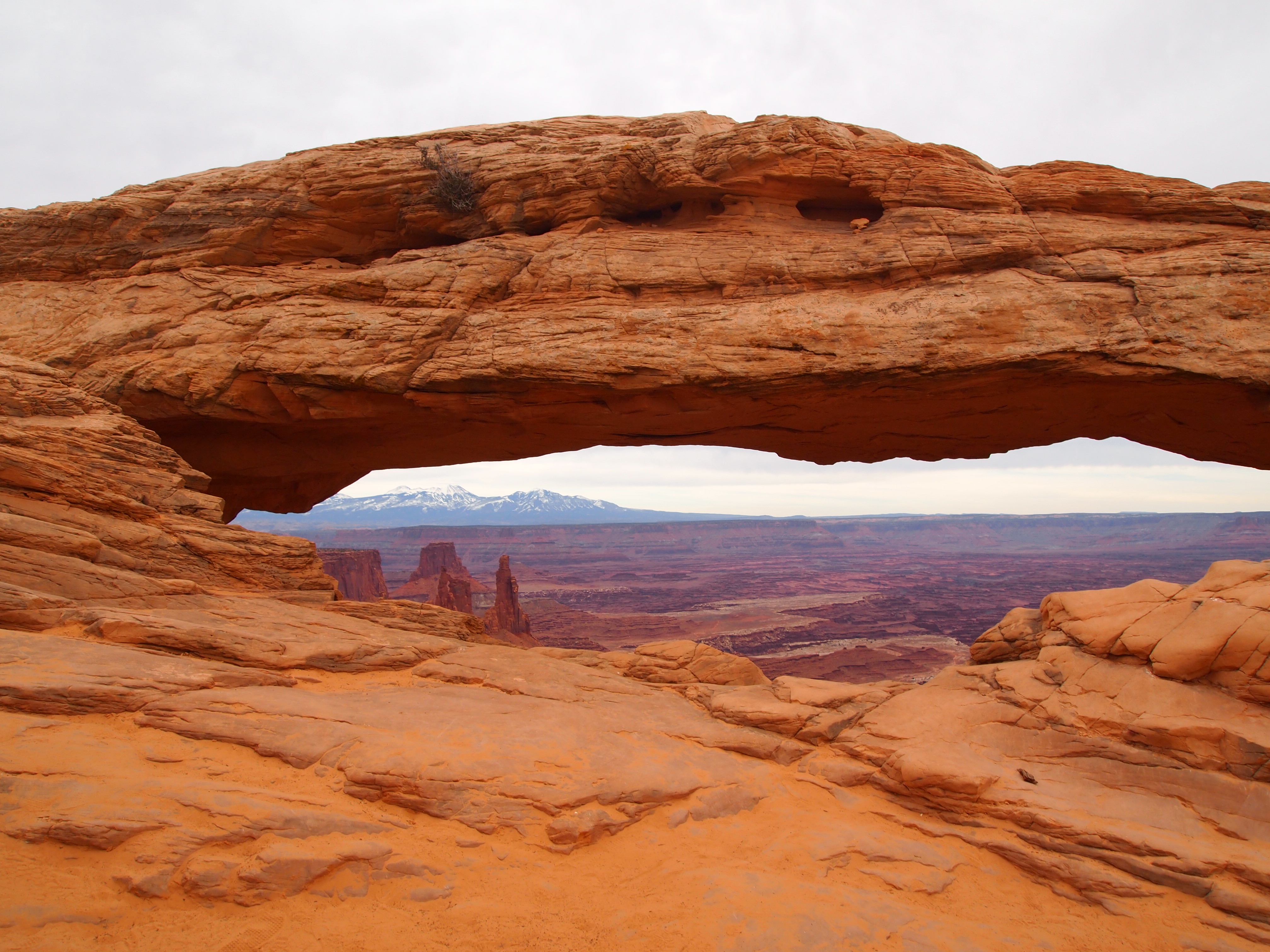
Up close it provides a nice frame
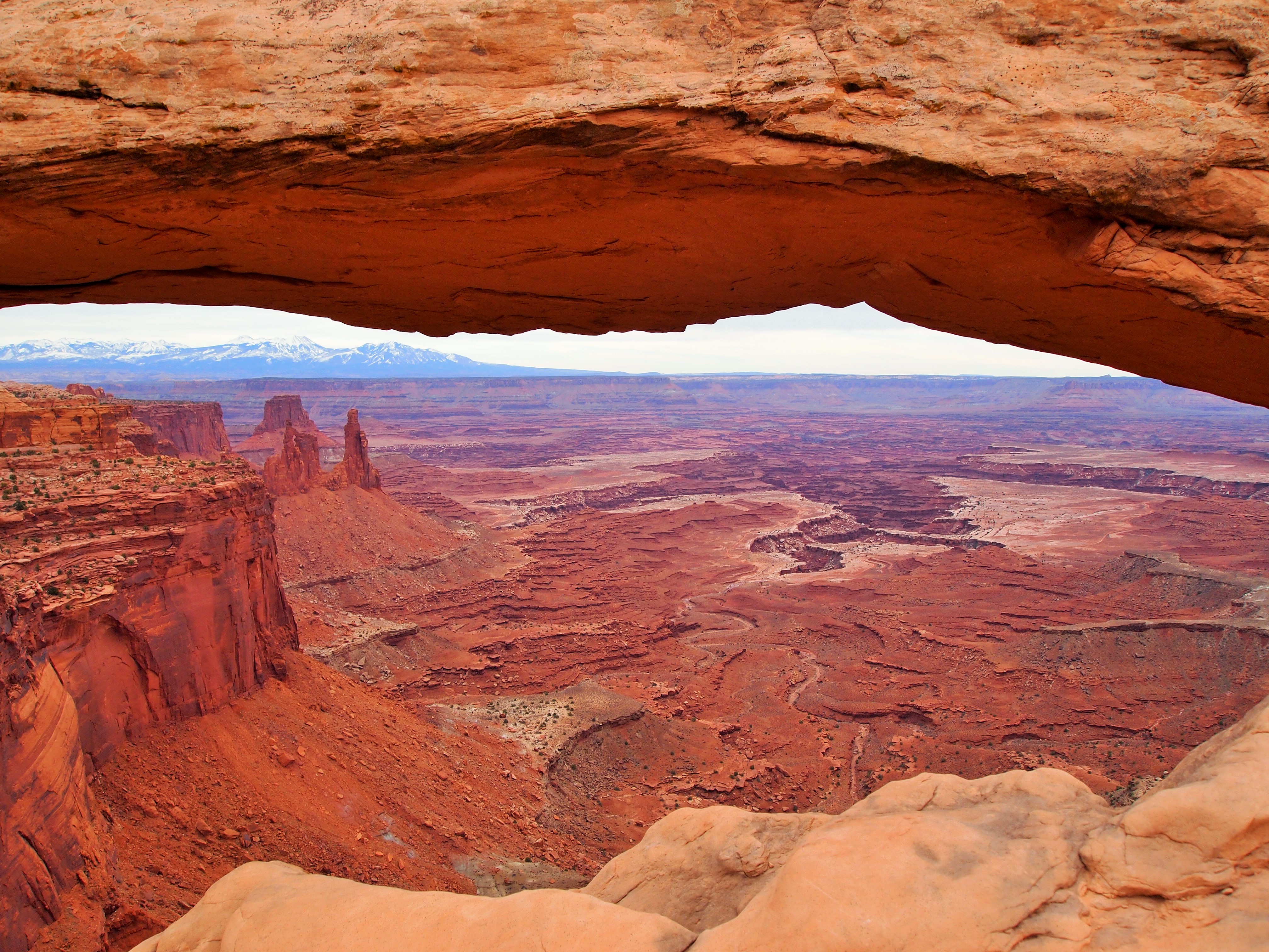
The view through the arch – stunning
All in all, our drive was a nice introduction to Canyonlands and left me craving future adventures. The scenery was striking in an utterly different way from Arches despite their proximity. It’s an amazing landscape – one I can’t wait to revisit.

This is how Truman toured the park

La Sal Mountains
Categories: North America, USA, Utah

2 replies »